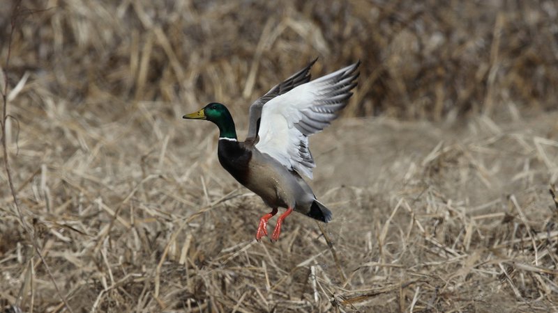
Arkansas Wildlife Waterfowl Report
BY Jim Harris
ON 12-08-2021
Dec. 8, 2021
Jim Harris
Managing Editor Arkansas Wildlife Magazine
Dry Conditions Still Prevail With Saturday’s Restart of Duck Season
LITTLE ROCK – Duck season restarts for waterfowl hunters on Saturday, Dec. 11, and those hunters maybe facing worse conditions than when the 60-day season officially opened Nov. 20.
“It’s doing nothing but getting drier on the landscape,” Luke Naylor, the Arkansas Game and Fish Commission waterfowl program coordinator, said Wednesday. “Conditions may be declining, and certainly not getting better in a lot of places. We need a substantial rain soon, but there isn’t one in the forecast.”
By “substantial” rain, Naylor means something more than was left by the storm line that passed quickly through Arkansas Sunday night and early Monday morning. What the state needs, he said, is something in the 4- to 6-inch level of rainfall, “a massive rain that lasts a couple of days and sits over the state. The little half-inch or three-quarters inches of rainfall isn’t going to do anything at this point.”
The AGFC’s waterfowl aerial survey team is in the skies over most of the state this week trying to spot what ducks have encamped in Arkansas. The flying was to be completed Wednesday (Dec. 8), with a report to be released by early next week. “I wouldn’t be shocked if it is one of the lower December counts we’ve had, because habitat availability is so poor,” Naylor said.
Naylor said he hasn’t heard much anecdotally from hunters since the season opened. The first break of the season came Nov. 30, with the only waterfowl hunting over the past two weeks coming on Saturday, Dec. 4, with the youth, veterans and active military special statewide hunt. Otherwise, ducks have been able to rest from pursuit for 11 days before the second split opens Saturday 30 minutes before sunrise.
“I assume places that have some water have some ducks. Places that have permanent water on hand in East Arkansas, our people surveying this week have noticed geese and numbers of ducks there, but nothing remarkalbe,” Naylor said. “There’s water and there’s some ducks, but nothing fantastic.
“Private clubs that are carefully managing hunting pressure and that have some water have some ducks.”
There are also geese available, but Naylor said he hasn’t heard many reports on that front. “I heard some snow geese flying overhead this morning. I’m sure we have got the typical numbers of snows and specks. They have more options in terms of habitat than what ducks do.”
Missouri’s Department of Conservation, meanwhile, put out its annual pre-Thanksgiving report on ducks, Naylor noted. “They usually have peak numbers then and that was true in this report, they were close to peak numbers with a little lower percentage of mallards. They had average overall duck numbers for that period. I don’t know anything about the hunting success there, but ducks were around. I don’t know if they are as dry as we are.”
* * *
Remember that to participate or land a permit for either the AGFC’s managed waterfowl areas that offer permit hunting, or to enter the drawing for an Arkansas WRICE program field for the weekend of Dec. 18-19, you’ll need to apply this week between Thursday at 3 p.m. and Sunday at midnight. Permit hunts are offered on Steve N. Wilson Raft Creek Bottoms WMA, the Red Cut Slough tract at Cypress Bayou WMA (though, without water, those permits are suspended until there is huntable water), the Conway George tract at Sheffield Nelson Dagmar WMA and Freddie Black Choctaw Island West Unit WMA. And AGFC has up to 45 privately owned flooded rice fields available to hunt by permit through its special duck hunting application process. Again, with the dry conditions around the state, some leased fields are still not available, though most owners are attempting to flood their fields this year and many have upgraded their blinds for a better hunting experience. Visit https://www.agfc.com/en/hunting/migratory-birds/waterfowl/special-waterfowl-permit-hunts to learn more about these special duck-hunting opportunities and to apply.
* * *
Where pumping is possible, the AGFC is getting more water onto its hunt areas.
“We’re still needing a significant rainfall evenl,” said Eley Talley, assistant regional supervisori in Hope over the southwest region. “We’ve begun putting water in the GTR at Dr. Lester Sitzes Bois D’Arc WMA. It will have some walk-in hunting available. Seeing a few more ducks around on ponds and sloughs so that’s promising.”
Red Cut Slough in Cypress Bayou was dry during the first split of duck season, but now there is huntable water in three of the six units and a little water in a fourth. Hunting on Red Cut Slough is available via online draw. The AGFC’s Jacob Booker said, “We were able to get some from the bayou and some from a new screw gate we added to the reservoir (Unit 6). We were able to take 4 inches out of the reservoir to give us a shot in the arm in Unit 5.”
Also, some pumping has been able to make Dark Corner’s three waterfowl units huntable in east-central Arkansas in the Sheffield Nelson Dagmar WMA. There is a good stand of millet and native vegetation in each unit. Hunting there is first-come, first-served with no permits necessary. There is anywhere from 30% coverage in Unit 2 to nearly total coverage in Unit 3. Also, the Conway George Waterfowl Unit C area is huntable now with 100% coverage. This unit is available to youths over the weekend and to all ages on Wednesdays. The other two Conway George units have been huntable since opening weekend. Pumping continues to bring Steve N. Wilson Raft Creek Bottoms WMA up to good levels in most areas.
Four of the six units a Frog Bayou WMA in western Arkansas now have 100% coverage thanks to pumping. Ed Gordon Point Remove WMA near Morrilton and the Arkansas River, which added a pumping station last year, has some units with ample, huntable water and still others that are dry. Pumping is possible as long as there is enough water in Point Remove Creek.
Northeast Arkansas
Big Lake WMA
Map | Water Gauge | Weather Report
When the Ditch 81 extension gauge near Manila (upstream of the Big Lake north-end control structure) reads 17.5 feet, water is beginning to come over the north levee degrade on Big Lake WMA. When the Ditch 81 Extension gauge reads 18.0 feet or higher, the water level on the WMA will rise quickly and hunters should exercise caution while on the area. Be aware of underwater logs in boat runs and hangers in trees.
North Woods GTR
Habitat: Mast production is good.
Water Level: Gauge reading at BoDoc on Monday was 234.6 feet msl; target level is 235.5 feet with 30% flooded.
South Woods GTR
Habitat: Mast production is fair.
Water Level: Reading at the 7-Mile gauge on Monday was 233.6 feet msl; target level is 234.5 feet with 50% now flooded, lateral ditches and some borrow pits are flooded.
Simmons Field
Habitat: Good production of millet and sedge. Native production is good in the north, middle and south fields.
Water Level: 15% coverage.
Reports of very few ducks moving across the area.
Dave Donaldson Black River WMA
Map | Water Gauge | Weather Report
Waterfowl hunters should be aware of hangers and submerged logs within the boat runs and GTRs. Please exercise caution when accessing the area. Please remember to keep boats off the levees so AGFC personnel can access the area. Boats blocking access will be moved. Unattended trailers are not to be left overnight on parking areas. River level is 2.64 feet and rising.
Upper Island GTR
Habitat: Mast crop is moderate within the GTRs.
Water Level: Current level is 269.55 feet msl. Target level is 269.5; 100% flooded.
Lower Island GTR
Habitat: Mast crop is moderate within the GTRs.
Water Level: Current level is 268.8 feet msl. Target level is 268.0; 100% flooded.
Upper Reyno GTR
Habitat: Mast crop is moderate within the GTRs.
Water Level: Current level is 266.95 feet msl. Target level is 266.9; 100% flooded.
Lower Reyno GTR
Habitat: Mast crop is moderate within the GTRs.
Water Level: Current level is 266.3 msl. Target level is 266.3; 100% flooded.
Winchester GTR
Habitat: Mast crop is moderate within the GTRs.
Water Level: Current level is 263.4 feet msl. Target level is 263.7; 85% flooded.
Earl Buss Bayou DeView WMA
Map | Water Gauge | Weather Report
Boaters should use caution while using the Thompson Tract boat run.
South Oliver GTR
Habitat: Mast production is good.
Water Level: 5% flooded. Most water is located within the natural slough on the north end of this GTR.
Thompson Tract GTR
Habitat: Mast production is good.
Water Level: 0% flooded. The Thompson Tract GTR will be allowed to rise and fall naturally without the gates being operated beginning with this season. This action is an effort to help the next generation of forest.
Lake Hogue WRA
Habitat: Primarily deep open water habitat.
Water Level: Normal pool level.
Shirey Bay Rainey Brake WMA
Map | Water Gauge | Weather Report
Waterfowl hunters should be aware of hangers and submerged logs within the boat runs and GTRs. Please exercise caution when accessing the area. In addition, hunters should allow safe passage when parking vehicles along roadsides. Vehicles blocking access will be moved.
Adam Brake GTR
Habitat: Mast production is good.
Water Level: Water level is 238.3 feet msl with a target level of 240.0 feet msl; 45% flooded.
Rainey Brake GTR
Habitat: Mast production is good.
Water Level: 50% flooded.
Eagle Pond GTR
Habitat: Mast production is good.
Water Level: 40% flooded.
Phase III Moist-Soil Unit
Habitat: Good wetland-type vegetation.
Water Level: 50% flooded.
Charles Crisp Moist-Soil Unit
Habitat: Good wetland-type vegetation.
Water Level: 60% flooded.
Ward Field Moist-Soil Unit
Habitat: Good wetland-type vegetation.
Water Level: 80% flooded.
River Field Moist-Soil Unit
Habitat: Good wetland-type vegetation.
Water Level: 60% flooded.
St. Francis Sunken Lands WMA
Map | Water Gauge | Weather Report
Hunt Area
Habitat: Good mast production within the hunt area.
Water Level: Water levels on St. Francis Sunken Lands for waterfowl season are dependent on flows from the St. Francis River. The target level for providing huntable timber is 212.0 feet msl at the Oak Donnick gauge. As of Dec. 6, the reading was 212.48 feet msl.
Snowden WRA
Habitat: Mixed grasses.
Water Level: 2% flooded, mostly in the low-lying areas due to rain.
Payneway WRA
Habitat: A, B, C and D pools have mixed smartweed and barnyard grasses. Moderate mast is available within pools A, B and C as well.
Water Level: Pool A is at 0% coverage. Pool B is at 0%. Pool C is at 0%. Pool D is at 0%.
East-Central Arkansas
Henry Gray Hurricane Lake WMA
Map | Water Gauge | Weather Report
Hunters should call the Wildlife Hotline at 800-440-1477 for current road closures.
North Unit
Habitat: Good mast crop.
Water Level: 0%. All structures on the North GTR will remain open during the 2021-22 season.
South Unit
Habitat: Fair mast crop.
Water Level: 0%. All structures on the South Unit are open.
Rex Hancock Black Swamp WMA
Map | Water Gauge | Weather Report
Hunters should call the Wildlife Hotline at 800-440-1477 for current road closures.
Gregory GTR
Habitat: Good mast crop.
Water Level: 0%
Wyeville Moist-Soil Unit
Habitat: Good stand of millet and native vegetation.
Water Level: 10% coverage.
Sheffield Nelson Dagmar WMA
Map | Water Gauge | Weather Report
The Conway George units are currently available for hunting by applying for online permits. Youths may apply for Saturday and Sunday hunts, with one adult hunter allowed per one youth, up to four hunters in the blind. All ages may apply for Wednesday hunts. Please visit www.agfc.com for maps, special regulations, permit application and draw dates. Hunters should call the Wildlife Hotline at 800-440-1477 for current road closures. The AGFC will not be putting boards in at Dagmar. Water coverage is dependent on river level.
Mud Slough GTR
Habitat: Good mast crop.
Water Level: 0% coverage.
Apple Lake WRA (no hunting)
Habitat: Good mast crop.
Water Level: 30%.
Conway George Waterfowl Unit A
Habitat: Good stand of millet and native vegetation.
Water Level: 100%
Conway George Waterfowl Unit B
Habitat: Natural slough area with beneficial native wetland plants.
Water Level: 100%
Conway George Waterfowl Unit C
Habitat: Good stand of millet and native vegetation.
Water Level: 100%
Dark Corner Waterfowl Unit 1
Habitat: Good stand of millet and native vegetation.
Water Level: 50%
Dark Corner Waterfowl Unit 2
Habitat: Good stand of millet and native vegetation.
Water Level: 30%
Dark Corner Waterfowl Unit 3
Habitat: Good stand of millet and native vegetation.
Water Level: 90%
Steve N. Wilson Raft Creek Bottoms WMA
Hunting in Raft Creek Bottoms WMA requires participation on the online draw a week before the following weekend’s hunt. There is no online draw on Tuesdays and Thursdays, and permits are available at the boat accesses. Permits ARE required (via online application) on weekends, Tuesdays and Thursdays for the youth and mobility-impaired blinds and for the Magellan Tract. Visit agfc.com to apply for the online draw. There will be no designated holes this season.
Map | Water Gauge | Weather Report
Unit A
Habitat: Excellent stand of native vegetation.
Water Level: 90% coverage.
Unit B
Habitat: Excellent stand of millet and native vegetation.
Water Level: 50%
Unit C
Habitat: Good stand of native vegetation.
Water Level: 85%
Unit D
Habitat: Good stand of native vegetation.
Water Level: 85%
Unit E
Habitat: Excellent stand of millet and native vegetation.
Water Level: 85%
Unit F (Youth Area)
Habitat: Good stand of millet and native vegetation.
Water Level: 100%
Unit G
Habitat: Fair stand of millet and native vegetation.
Water Level: 0%
Unit H (Mobility-impaired blind)
Habitat: Excellent stand of native vegetation.
Water Level: 100%
Unit I
Habitat: Habitat conditions are poor.
Water Level: 0%
Unit J (Cypert Tract)
Habitat: Excellent stand of native vegetation.
Water Level: 90%
Unit K (Cypert Tract)
Habitat: Excellent stand of native vegetation.
Water Level: 5%
Unit L (Cypert Tract)
Habitat: Fair stand of native vegetation.
Water Level: 0%
Unit M (Magellan Tract)
Habitat: Fair stand of native vegetation.
Water Level: 45%
Central Arkansas
Bell Slough WMA
Map | Weather Report
The Bell Slough GTR is primarily rainfall dependent with the exception of a limited amount of water that the AGFC can back in and catch from Palarm Creek.
Bell Slough GTR
Habitat: Poor mast crop.
Water Level: 40%.
Palarm Creek WRA
Habitat: Fair stand of planted millet.
Water Level: 65%
Craig D. Campbell Lake Conway Reservoir
Map | Weather Report
Habitat and water levels are normal on both Pierce and Dix creeks.
Cypress Bayou WMA
Hunt Area
Habitat:
Good mast crop.
Water Level: 0% coverage.
Red Cut Slough Tract
Unit 1
Habitat:
Habitat conditions are poor.
Water Level: 0%
Unit 2
Habitat:
Excellent stand of millet and native vegatation
Water Level: 0%
Unit 3
Habitat:
Good stand of millet and native vegatation
Water Level:85%
Unit 4
Habitat: Good stand of millet and native vegetation.
Water Level: 5%
Unit 5
Habitat:
Good stand of native vegetation.
Water Level: 85%
Unit 6
Habitat:
Good stand of native vegetation.
Water Level: 75%
Harris Brake WMA
Upper GTR
Habitat: Below average mast crop this year.
Water Level: 80%.coverage,
Lower GTR
Habitat: Below average mast crop.
Water Level: 95% coverage. Note: The water control structures on both the Lower and Upper GTRs were closed on Monday, Nov. 15. The Harris Brake Lake valve was opened on Nov. 15 to begin supplemental flooding of both the Lower and Upper GTRs. Water is now over Steamboat Road.
Holland Bottoms WMA
Hunt Area
Habitat: Good mast crop.
Water Level: 0% coverage.
Lake Pickthorne WRA (no hunting)
Habitat: Excellent crop of native vegetation and millet.
Water Level: East cell is 0%, West cell is 95%. Staggered flooding began Nov. 9.
Northwest Arkansas
Dardanelle WMA
McKennon Bottoms (half-day hunting)
Habitat: Good stand of native vegetation.
Water Level: 100% coverage
Potter’s Pothole Hartman Waterfowl Unit (half-day hunting)
Habitat: West cell has a good stand of Japanese millet. East Cekk has a poor stand of Japanese millet.
Water Level: 100% coverage
Ed Gordon Point Remove WMA
Due to lack of rainfall, conditions at Ed Gordon Point Remove WMA remain considerably dry. Pumping of waterfowl impoundments began on Oct. 27 and will continue as long as water levels in Point Remove Creek allow.
Duck use and hunter success on the WMA have been generally poor due to dry conditions.
Little Hole (Unit 1)
Habitat: Japanese millet.
Water Level: 80% flooded.
Willow Island (Unit 2)
Habitat: Japanese millet and natural vegetation.
Water Level: 20%
Red Gate (Unit 3)
Habitat: Natural vegetation
Water Level: 0%
Pig Trough (Units 4 and 5)
Habitat: Natural vegetation and Japanese millet.
Water Level: 40%
Cedar Ridge (Unit 6)
Habitat: Natural vegetation.
Water Level: 60%
Unit 7a
Habitat: Natural vegetation.
Water Level: 90%
Unit 7b
Habitat: Japanese millet and natural vegetation.
Water Level: 0%
Duck Trap (Units 8a, 8b and 8c)
8a
Habitat: Natural vegetation.
Water Level: 0%
8b
Habitat: Natural vegetation.
Water Level: 90%
8c
Habitat: Natural vegetation.
Water Level: 50%
Unit 9
Habitat: Japanese millet and natural vegetation.
Water Level: 50%
Controversy Corner (Unit 10)
Habitat: Natural vegetation.
Water Level: 70%
Remmel Marsh
Habitat: Natural vegetation and Japanese millet.
Water Level: 50%
Mud Pond (Unit 12)
Habitat: Natural vegetation and Japanese millet.
Water Level: 90%
Turkey Pond (Units 13a, 13b and 13c)
13a
Habitat: Natural vegetation.
Water Level: 50%
13b
Habitat: Natural vegetation.
Water Level: 0%
13c
Habitat: Natural vegetation.
Water Level: 0%
Teeny Pond (Unit 14)
Habitat: Natural vegetation.
Water Level: 0%
Salt Lick (Unit 15)
Habitat: Natural vegetation.
Water Level: 50%
Bobby’s Pond (Unit 16)
Habitat: Natural vegetation.
Water Level: 60%
Race Track (Unit 17)
Habitat: Natural vegetation.
Water Level: 100%
Frog Bayou WMA (half-day hunting)
Unit 1
Habitat: Good stand of moist-soil vegetation.
Water Level: 100% coverage
Unit 2
Habitat: Poor stand of moist-soil vegetation.
Water Level: Less than 25% flooded (rainfall dependent)
Unit 3
Habitat: Good stand of moist-soil vegetation and planted millet.
Water Level: 100%
Unit 4
Habitat: Good stand of moistl-soil vegetation and planted millet
Water Level: 100%
Unit 5
Habitat: Good stand of moist-soil vegetation on the upper end, lower end has been fallow-disked.
Water Level: 100%
Unit 6
Habitat: Good stand of moist-soil vegetation.
Water Level: 50%, and pumping will resume after repairs are made to the pump.
Unit 7
Habitat: Good stand of moist-soil vegetation.
Water Level: 100%
Galla Creek WMA
Galla Creek GTR
Habitat: Good stands of native vegetation, including a mixture of barnyard grass, annual smartweeds and sprangletop.
Water Level: 40% flooded. Staged flooding of the impoundment began on Nov. 15.
Nimrod Lloyd Millwood WMA
Nimrod GTR
Habitat: The red oak mast crop is poor this year but the desirable native vegetation growth is better than in previous years. Due to abnormally dry conditions, this area is not expected to fill up as fast as in previous years. The water-control structures were closed on Nov. 17. This area is rainfall dependent to flood.
Water Level: 10% flooded
Ozark Lake WMA/Dyer Lake Water Unit
Dyer Lake Cells (half-day hunting)
Units 1 and 2
Habitat: Good stand of moist-soil vegetation and planted millet
Water Level: 100% coverage for both units
Unit 3 South Cell
Habitat: Good stand of moist-soil vegetation and volunteer millet
Water Level: 10% coverage
Unit 4 West Cell (rainfall dependent)
|Habitat: Poor stand of moist-soil vegetation
Dyer West Cell: Less than 25% coverage
Petit Jean River WMA
Map | Water Gauge | Weather Report
Sorehead Moist-Soil Unit
Habitat: Due to ongoing waterfowl habitat enhancement projects, this unit was not able to grow any food this year. Work is still ongoing as long as this area stays dry. The Kingfisher Lake water-control structure valve was opened on Nov. 17 to help flood this area.
Water Level: 10%
Blacklands Moist-Soil Unit
Habitat: This unit this year contains one of the best stands of desirable native vegetation in recent years. The wooded areas inside the unit produced a poor red oak mast crop this year. Due to abnormally dry conditions and low river levels, this area is not expected to fill up as fast as in previous years. The river level is still too low to properly pump.
Water Level: 0%.
Slaty Crossing Moist-Soil Unit
Habitat: Due to ongoing waterfowl habitat enhancement projects, this unit was not able to grow a desirable native vegetation crop this year. The area was seeded with millet after the project was completed. The area yielded a great stand of planted millet. Due to abnormally dry conditions and low river levels, this area is not expected to fill up as fast as in previous years. The pump was started on Nov. 17 but will not be run continuously this year due to the lack of adequate water in the river.
Water Level: 35%
Blacklands Duck Area
Habitat: The wooded sections of this area produced a poor red oak mast crop this year. This area also contains a mix of moderate to great stands of desirable native vegetation mixed throughout. The Kingfisher Lake water-control structure valve was opened on Nov. 17 to help flood this area.
Water Level: 50%
Pullen Pond Marsh
Habitat: Due to ongoing waterfowl habitat enhancement projects, parts of the central section of this area is bare ground. Most of the area has amazing stands of desirable native vegetation. The desirable native vegetation has started to become more and more prevalent with each year of ongoing management work. Work is still ongoing until the area becomes too wet to work. This area is rainfall dependent to flood.
Water Level: 0%.
Pond Creek GTR
Habitat: This area produced a poor red oak mast crop this year with good stands of desirable native vegetation in the open lands within this area. Due to abnormally dry conditions, this area is not expected to fill up as fast as in previous years. The water-control structures were closed on Nov. 16. This area is rainfall dependent to flood.
Water Level: 0%. Flooding of this area is rainfall dependent.
Slaty GTR
Habitat: This area produced a poor red oak mast crop this year with good stands of desirable native vegetation in the open lands within this area. Due to abnormally dry conditions, this area is not expected to fill up as fast as in previous years. The water-control structure was closed on Nov. 16.
Water Level: 0%. Flooding of this area is rainfall dependent.
Santa Fe GTR
Habitat: This area produced a lpoor red oak mast crop this year with good stands of desirable native vegetation in the open lands within this area. Due to abnormally dry conditions, this area is not expected to fill up as fast as in previous years. The water-control structures were closed on Nov. 16.
Water Level: 0%. Flooding of this area is rainfall dependent.
Southwest Arkansas
Dr. Lester Sitzes III Bois d’Arc WMA
Bois d’Arc Lake WRA
Habitat: Closed to hunting.
Water Level: Normal
Red Slough WRA
Habitat: Closed to hunting.
Water Level: 30% coverage.
GTR
Habitat: Good mast production.
Water Level: 10%. Water control structures were closed Dec. 1.
Little Grassy
Habitat: Good
Water Level: 30%
Millwood Lake
Map | Water Gauge | Weather Report
Habitat: Habitat conditions are good.
Water Level: Millwood is at 259.1 feet msl as of Dec. 7
Ozan WMA
Flooding of all units is rainfall dependent.
Unit 1
Habitat: Good
Water Level: 0%
Unit 2
Habitat: Good
Water Level: 0%
Unit 3
Habitat: Good
Water Level: 0%
Unit 4
Habitat: Good
Water Level: 0%
Unit 5
Habitat: Good
Water Level: 0%
Sulphur River WMA
Mercer Bayou
Habitat: Fair
Water Level: 0%
Henry Moore WRA
Habitat: Closed to hunting.
Water Level: 40%
Southeast Arkansas
Beryl Anthony Lower Ouachita WMA
Map | Weather Report
Water Level: No duck-hunting water. Water is available in the oxbow lakes located in the WMA.
Cut-Off Creek WMA
Hunt Area
Habitat: Habitat conditions are good.
Water Level: No water.
Pigeon Creek WRA
Habitat: Habitat conditions are good.
Water Level: No water.
Freddie Black Choctaw Island WMA Deer Research Area
Map | Water Gauge | Weather Report
Habitat conditions are good. Flooding is river dependent. Click on the Water Gauge link above for current Mississippi River levels. Use extreme caution when boating in river.
The Freddie Black Choctaw Island WMA West Unit allows weekend permit hunting for youths (one adult per youth hunter); on Wednesdays, all ages may apply for a permit to hunt the blinds in the West Unit. Currently, the area is dry and there have been no online draws for the West Unit.
George H. Dunklin Jr. Bayou Meto WMA
Map | Water Gauge | Weather Report
The UGSG is reporting real-time water gauge readings at the headwater at each GTR within the George H. Dunklin Bayou Meto WMA. Click the Water Gauge link above for the WMA, and search for the particular GTR as noted.
During the 2021-22 wintering period, all intentional flooding will be held at 179 feet msl, an elevation that will relieve stress on many of trees such as red oaks that are showing signs of distressed. Rain and increased flow into the WMA will allow water to rise above that level periodically, but artificial flooding will be stopped at the 179 feet msl mark. A good rule of thumb for comparing water levels to access into Bayou Meto: 176 feet msl – water breaking into sloughs and lower ditches; 177-177.5 feet msl – water beginning to break out of sloughs and lower ditches; 178 feet msl – water in most sloughs and ditches and entering into lower elevations in woods; 178.5 feet msl – most ditches and sloughs deep enough to boat and most boat ramps become serviceable; 179 feet msl or above – good duck hunting waters.
Upper Vallier GTR
Habitat: Good
Water Level: See Gauge Link (Upper Vallier Headwater)
Lower Vallier GTR
Habitat: Good
Water Level: See Gauge Link (Lower Vallier Headwater).
Government Cypress GTR
Habitat: Good
Water Level: See Gauge Link (Government Cypress Headwater)
Buckingham Flats GTR
Habitat: Good
Water Level: Pumping as bayou levels allow. See Gauge Link (Buckingham Flats Headwater). NOTE: Water is too low for pumping at this time.
Temple Island GTR
Habitat: Good
Water Level: No water. See Gauge Link (Temple Island Headwater). NOTE: Water is too low for pumping at this time.
Canon Brake
Habitat: Good
Water Level: See Gauge Link (Canon Brake Headwater).
Halowell WRA
Habitat: Excellent
Water Level: Staggered flooding of units.
Wrape Plantation WRA
Habitat: Excellent
Water Level: Staggered flooding of units.
Seven Devils WMA
Hunt Area
Habitat: Habitat conditions are good.
Water Level: No water.
Trusten Holder WMA
Map | Water Gauge | Weather Report
Habitat conditions are good. Flooding is river dependent. Click on the Water Gauge link above for current Arkansas River levels.
Recent News
Subscribe to Our Weekly Newsletter E-mails
Don’t miss another issue. Sign up now to receive the AGFC Wildlife Weekly Newsletter in your mailbox every Wednesday afternoon (Waterfowl Reports are published weekly during waterfowl season and periodically outside the season). Fishing Reports arrive on Thursdays. Fill in the following fields and hit submit. Thanks, and welcome!