Ashley and Union Counties
Felsenthal National Wildlife Refuge Water Trails
- From U.S. Highway 82, turn south on North Road (across highway from Jones Lake Access on Ouachita River sign). Travel 5.2 miles to stop sign at Dollar Junction Road.
- Turn left and travel 2.3 miles to a stop sign.
- Turn left on K Avenue and take the first left into the Grand Marais Campground and boat ramp.
- From Felsenthal National Wildlife Refuge headquarters, travel 6 miles west on U.S. Highway 82.
- Turn left into the parking area and boat ramp at the Deep Slough Access sign.
- From Felsenthal National Wildlife Refuge headquarters, travel 7.5 miles west on U.S. Highway 82.
- Turn left at the Shallow Lake Access sign, bear left at 2.5 miles and continue 1.2 miles to the boat ramp.
Quick Facts
Maps
- Felsenthal NWR Grand Marais Water Trail
- Felsenthal NWR Shallow Lake Water Trail Sign
- Geo-referenced Map
Georeferenced Map Instructions
- Download the free Avenza Map app from the App Store on mobile device.
- Choose a trail and tap on the geo-referenced map.
- Tap on the map again and choose “Open in Avenza Maps” or choose “More” and tap on the Avenza Map icon.
- Map is saved in Avenza Map app.
- A blue dot marks your location on the map.
- The trail map uses the phone’s GPS. If cell reception is poor, put phone on airplane mode to conserve power.
- Download the free Avenza Map app from the App Store on mobile device.
- Choose a trail and tap on the geo-referenced map.
- Tap on the three dots in the upper-right corner.
- Choose “Send File” and tap the Avenza Map icon.
- Map is saved in Avenza Map app.
- A blue dot marks your location on the map.
- The trail map uses the phone’s GPS. If cell reception is poor, put phone on airplane mode to conserve power.
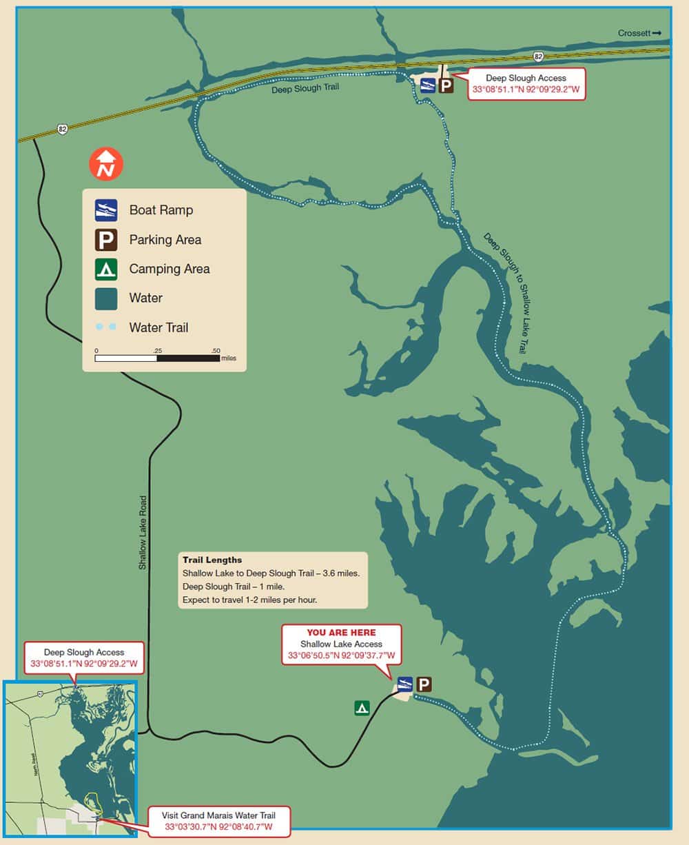

Water Trail Length
The trails have no markers. Download the geo-referenced map to follow trail routes.
Deep Slough Trail – 1 mile
Deep Slough to Shallow Lake Trail – 3.6 miles
Grand Marais Trail -3.7 miles
Float Time
Expect to travel 1-2 miles per hour, depending on water level and rate of paddling.
Felsental Lock and Dam Water Level
Click here to view the most recent gauge reading.
Safety
These trails cover flat water, although the current quickens as the Ouachita River rises. When the river level at Felsenthal Lock and Dam rises above 68 feet, expect flooding, strong current and debris. Check weather forecasts, wind advisories and river conditions before floating. Watch for powerboats.
For Information About the Refuge
There are no entrance fees at Felsenthal National Wildlife Refuge, but visitors do need a Refuge Access Permit, available at the refuge visitor center.
Visit Felsenthal NWR’s website
Emergency Numbers
Ashley County or Union County EMS
911
Ashley County Sheriff
870-853-2040
Union County Sheriff
870-864-1990
Felsenthal National Wildlife Refuge
870-364-3167
Stop Poaching Hotline
833-356-0824
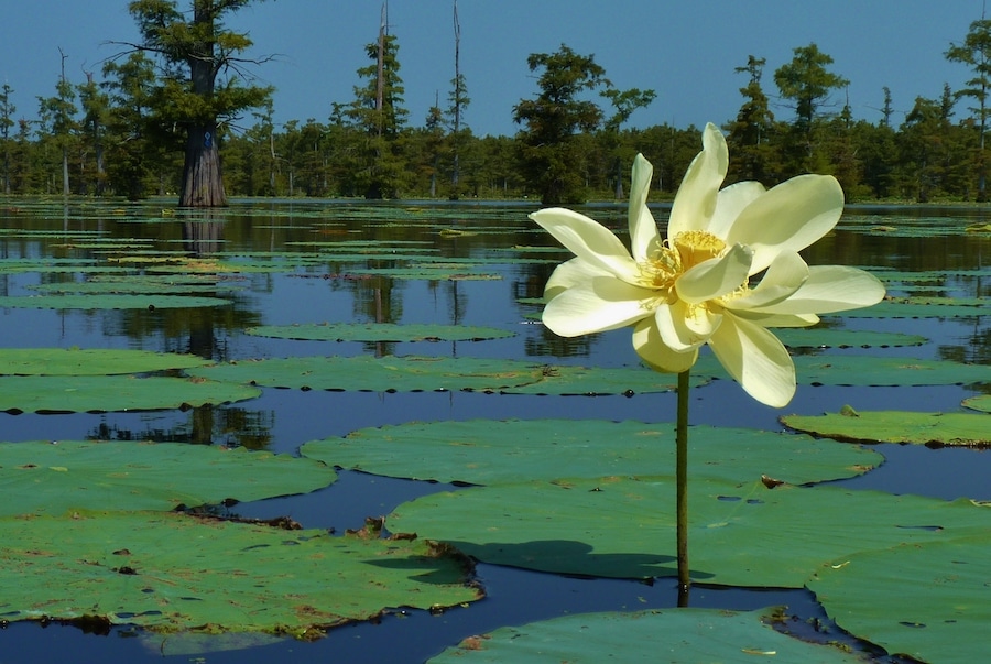
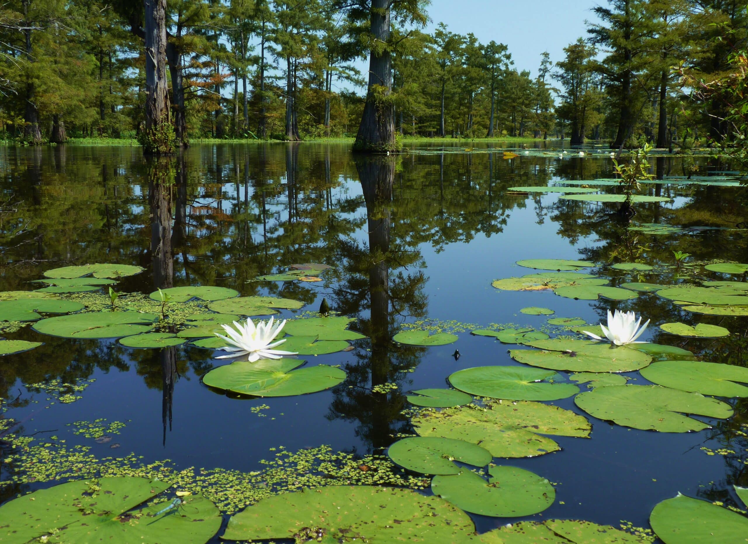
Felsenthal National Wildlife Refuge includes the world’s largest greentree reservoir. At normal level (65 feet), the pool covers 15,000 acres and increases to 36,000 acres at full pool. Bottomland hardwoods include overcup, water, Nuttall, and willow oaks, with water hickory and sweetgum in areas that drain better. Baldcypress, water tupelo and buttonbush thrive in flooded bottoms.
Mallards, wood ducks, teal, coots and hooded mergansers are plentiful in shallow water during winter. Scaup, redheads, bufflehead and loons frequent deeper, open-water areas. Watch for egrets, herons, wood storks and ibis during summer, along with prothonotary warblers and scarlet tanagers in shoreline trees.
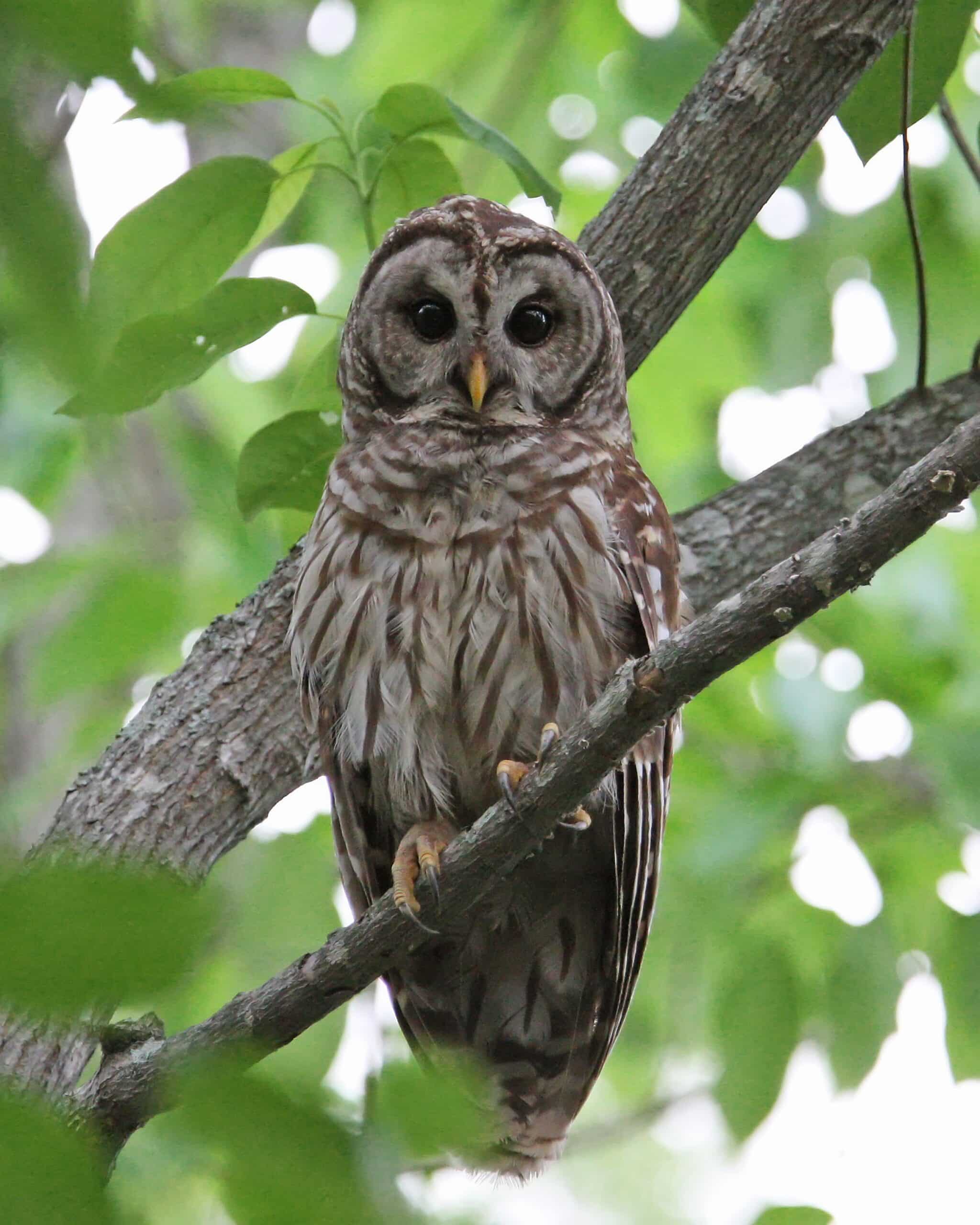
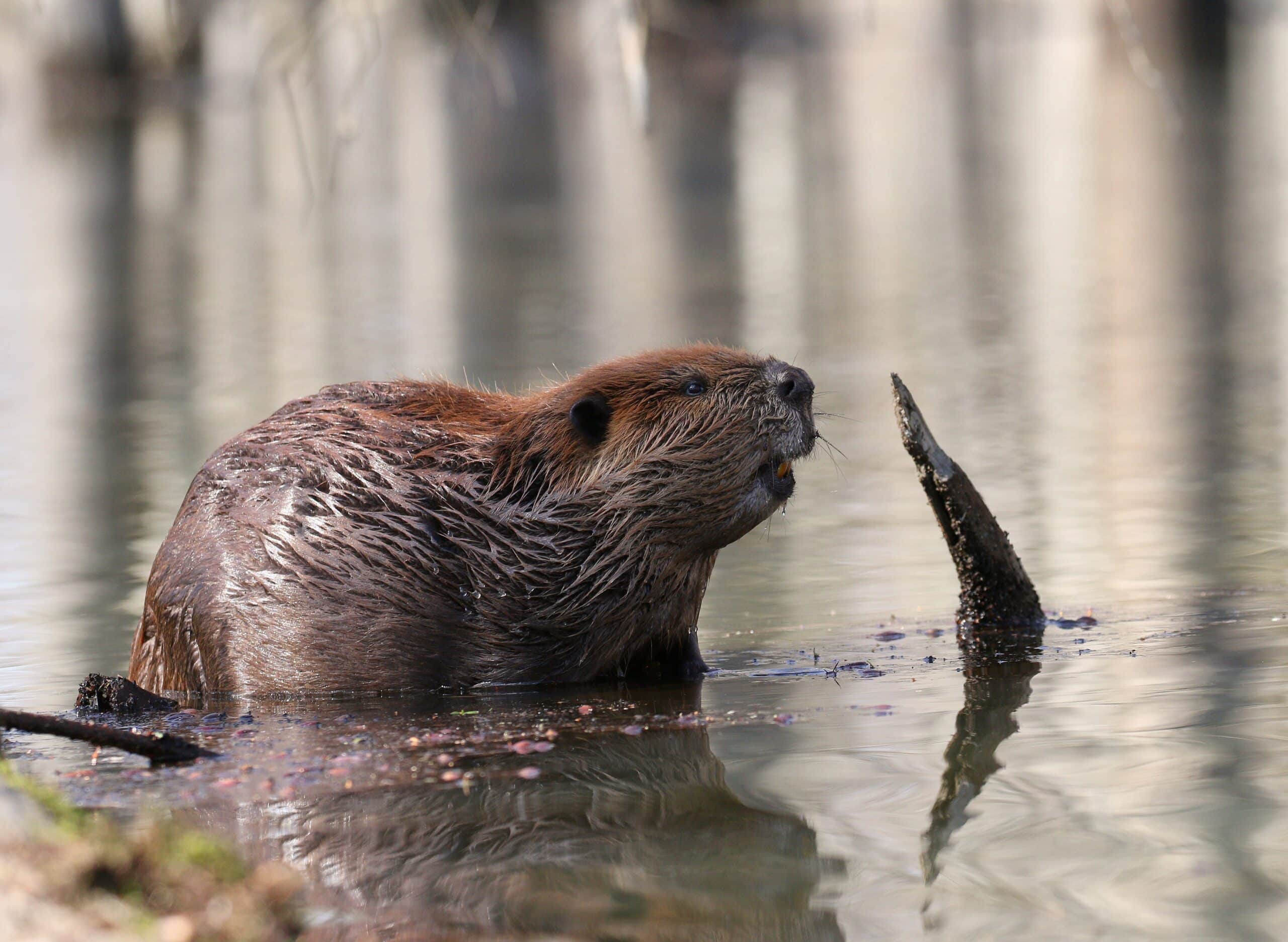
Bald eagles, woodpeckers and osprey may be seen all year. Beavers, otters, mink, diamondback water snakes and alligators are common.
Bluegill, redear and largemouth bass frequent cypress tree trunks, and lily and lotus pads. Flathead and channel catfish hang out in deep holes by day and prowl the shallows at night.
Check https://www.fws.gov/refuge/felsenthal/ for deer, turkey, small game and waterfowl hunting seasons, and wear hunter orange when appropriate. Stick to main channels and avoid paddling during waterfowl season shooting hours. Check seasonal closures of the waterfowl sanctuary. Furbearer trapping is permissible with a Special Use Permit. Leash pets for their safety.
Camping is allowed in primitive, designated sites on the refuge. Crossett Harbor and Grand Marais recreation sites offer improved camping.
According to Arkansas law, children 12 and under must wear a Coast Guard-approved life jacket, and anyone on a boat must have one ready to use. Vessels 16 feet and longer must have a throwable life preserver (type IV) aboard. Glass containers are illegal in boats such as canoes that can be easily swamped. Paddlers must securely fasten cooler lids, use attached litter containers and use floating holders for beverages.