Pulaski County
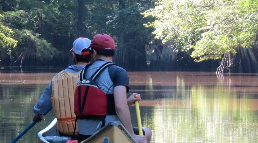
Fourche Creek Urban Water Trail
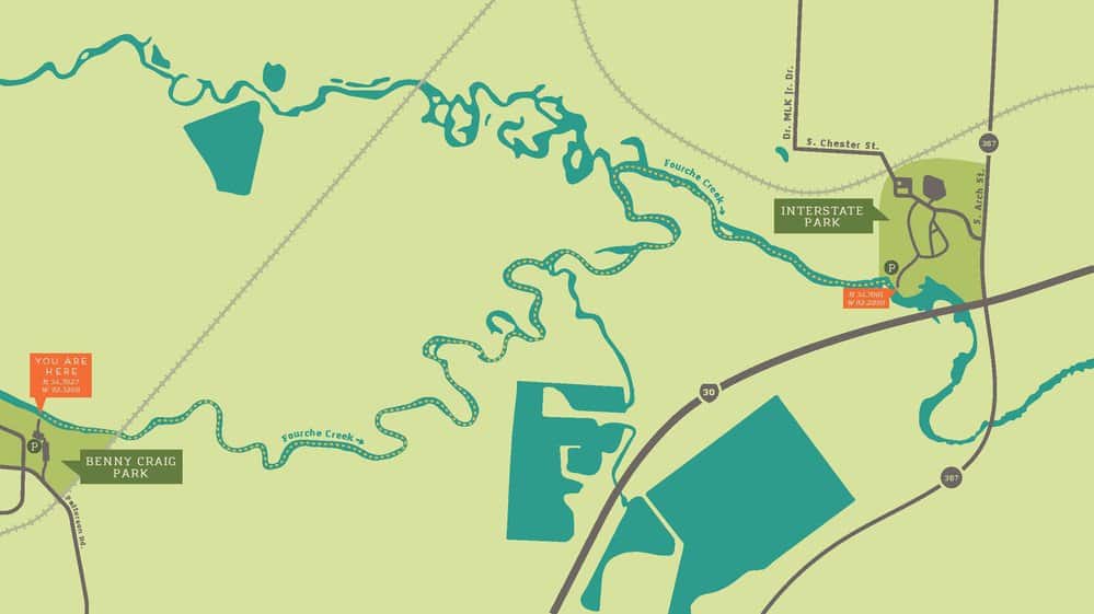
4610 Gum Springs Rd, Little Rock, AR 72209
GPS Coordinates:
Latitude/Longitude – 34.7027 N, 92.3268 W
- From I-60, travel south on University Avenue for 2.3 miles
- Turn left (east) onto W 53rd Street and travel 0.2 miles
- Turn left (east) onto Mabelvale Pike and travel 0.3 miles
- Turn right onto Gum Springs Road and enter Benny Craig Park
3900 S Arch St, Little Rock, AR 72206
GPS Coordinates:
Latitude/Longitude – 34.7081 N, 92.2850 W
- From I-630, take exit 1B and travel south one mile on Broadway Street
- Turn right (west) onto W Roosevelt Road and travel 374 feet
- Turn left (south) onto S Arch Street and travel one mile
- Turn right onto S Chester Street and enter Interstate Park; follow signs to the boat launch
Quick Facts
- Download the free Avenza Map app from the App Store on mobile device.
- Choose a trail and tap on the geo-referenced map.
- Tap on the map again and choose “Open in Avenza Maps” or choose “More” and tap on the Avenza Map icon.
- Map is saved in Avenza Map app.
- A blue dot marks your location on the map.
- The trail map uses the phone’s GPS. If cell reception is poor, put phone on airplane mode to conserve power.
- Download the free Avenza Map app from the App Store on mobile device.
- Choose a trail and tap on the geo-referenced map.
- Tap on the three dots in the upper-right corner.
- Choose “Send File” and tap the Avenza Map icon.
- Map is saved in Avenza Map app.
- A blue dot marks your location on the map.
- The trail map uses the phone’s GPS. If cell reception is poor, put phone on airplane mode to conserve power.
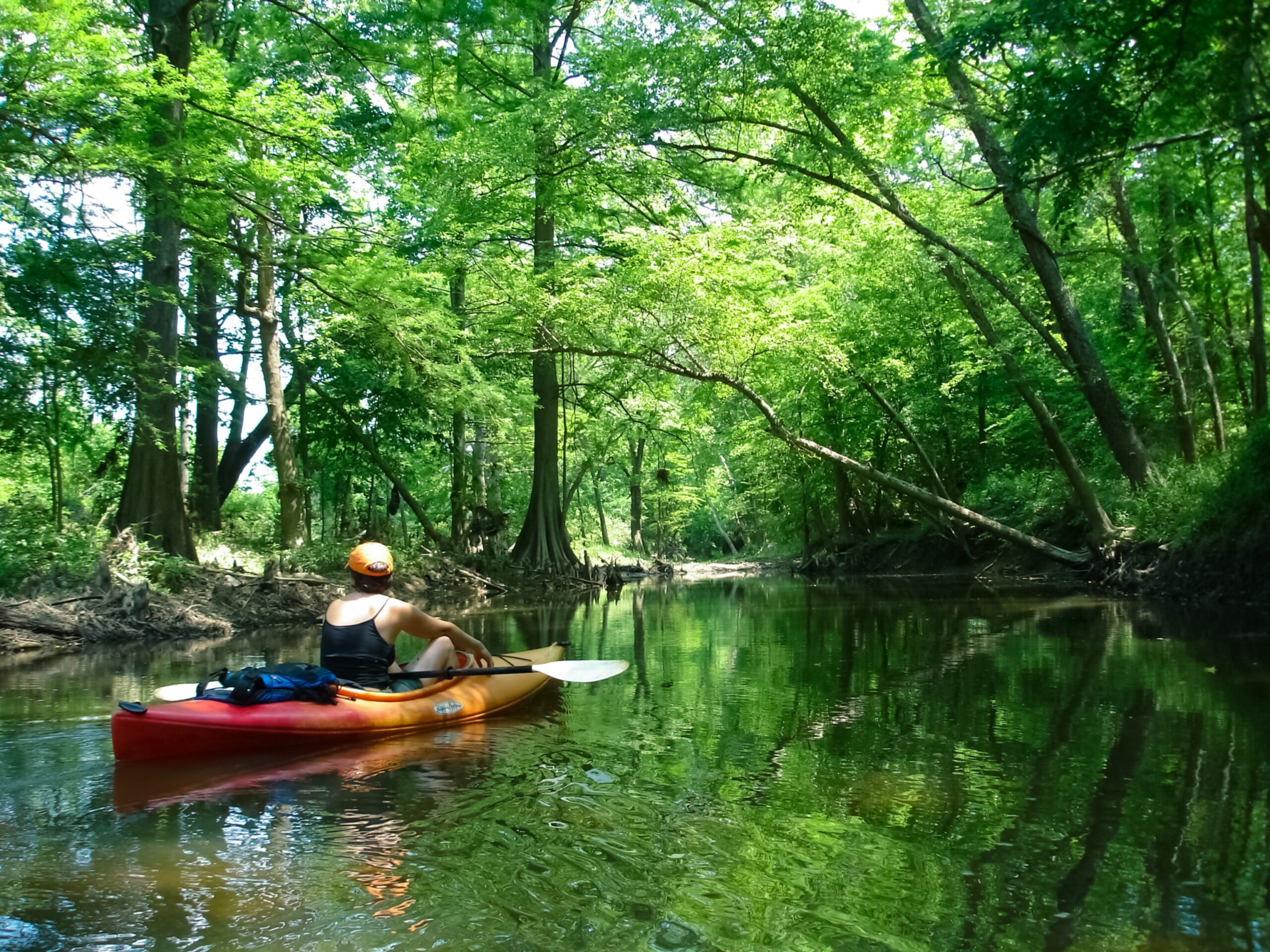
Fourche (rhymes with push) Creek rises in Saline County and winds through Little Rock. It flows more than 20 miles generally eastward and empties into the Arkansas River. The 1,800 acres of bottomland hardwood forest downstream of here is the largest greenspace in the city.
Water Trail Length
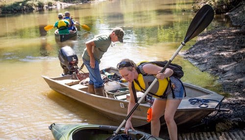
Benny Craig Park to Interstate Park: 4.4 miles. Head upstream from Interstate Park Access for a scenic, out-and-back paddle into Fourche Bottoms.
Urband Environment
Urban streams face special challenges. The creek and its tributaries filter 73 percent of Little Rock’s runoff, and can flood quickly. They catch water from roads, parking lots and buildings that can carry oil, bottles, cigarette butts, Styrofoam and other pollutants. Fecal coliform levels are high two to three days following heavy rain.
Water Level
The U.S. Geological Survey water gauge at University Avenue should read a minimum of 2 feet for comfortable paddling to Interstate Park—3 to 6 feet is ideal. Be prepared to portage around downed trees, and avoid the creek during floods. For current gauge reading, go to waterdata.usgs.gov.
Emergency Numbers
Pulaski County EMS
911
Pulaski County Sheriff
501-340-6600
Little Rock Parks and Recreation
501-371-4770
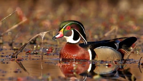
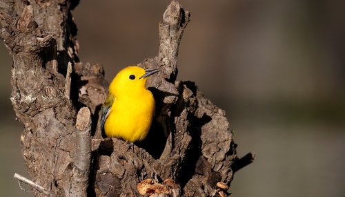
Despite years of abuse and neglect, Fourche Creek continues to support a diverse population of plants and animals. It is lined with baldcypress and water tupelo trees. Look for migratory songbirds such as prothonotary warblers during spring, and wood ducks in fall and winter. Beaver, mink and otter forage in the creek.
As a tributary of the Arkansas River, Fourche Creek hosts a large number of fish species for a waterway its size. Fifty species – 20 percent of species in Arkansas – live here, including catfish, crappie, bream and bass. Check Arkansas Game and Fish Commission fishing regulations.
According to Arkansas law, children 12 and under must wear a Coast Guard-approved life jacket, and anyone on a boat must have one ready to use. Vessels 16 feet and longer must have a throwable life preserver aboard. Glass containers are illegal in canoes and kayaks. Paddlers must securely fasten cooler lids, use attached, closeable trash containers and keep beverages in floating holders.