Pulaski County
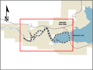
Sleepy Hollow Water Trail
- From I-430 in Little Rock, turn west on Arkansas Highway 10 (Cantrell Road) and travel 19 miles.
- After crossing the causeway over Lake Maumelle, the access is one mile on the left.
Quick Facts
Maps
The trail is only marked in critical locations. To follow the trail route, download a geo-referenced map of the trail in the Avenza App for mobile devices.
Georeferenced Map Instructions
- Download the free Avenza Map app from the App Store on mobile device.
- Choose a trail and tap on the geo-referenced map.
- Tap on the map again and choose “Open in Avenza Maps” or choose “More” and tap on the Avenza Map icon.
- Map is saved in Avenza Map app.
- A blue dot marks your location on the map.
- The trail map uses the phone’s GPS. If cell reception is poor, put phone on airplane mode to conserve power.
- Download the free Avenza Map app from the App Store on mobile device.
- Choose a trail and tap on the geo-referenced map.
- Tap on the three dots in the upper-right corner.
- Choose “Send File” and tap the Avenza Map icon.
- Map is saved in Avenza Map app.
- A blue dot marks your location on the map.
- The trail map uses the phone’s GPS. If cell reception is poor, put phone on airplane mode to conserve power.
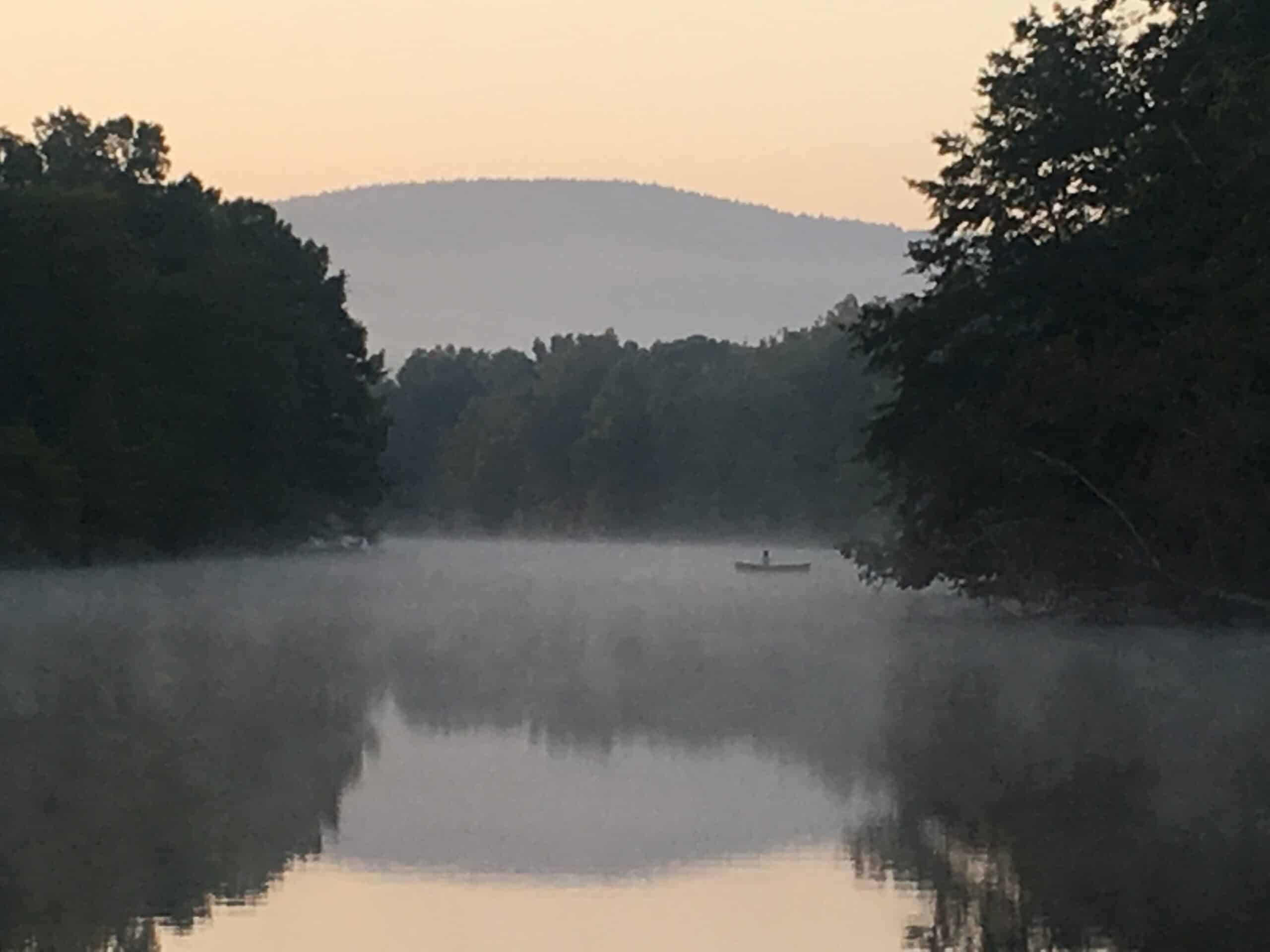
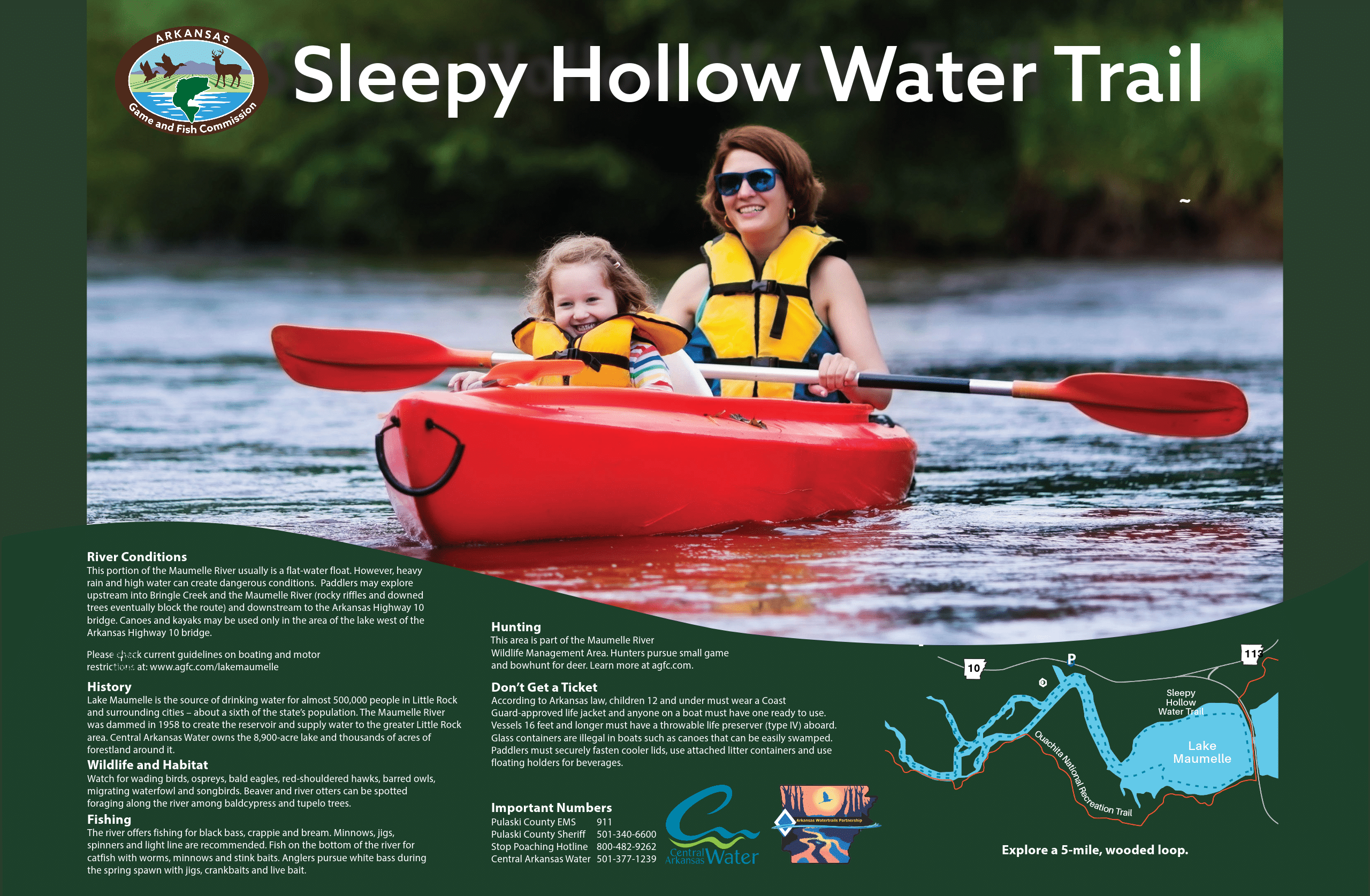
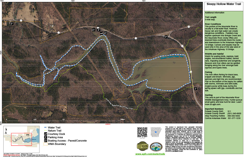
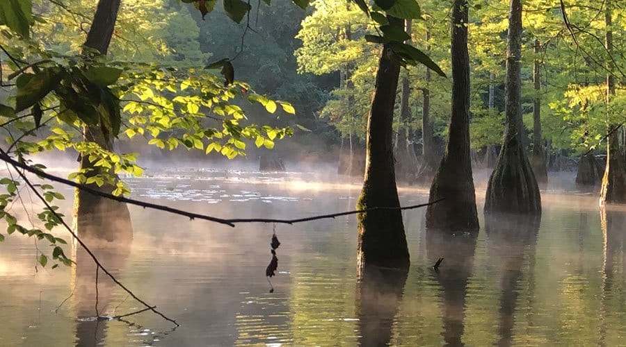
River Conditions
This portion of the Maumelle River usually is a flat-water float. However, heavy rain and high water can create dangerous conditions. Paddlers may explore upstream into Bringle Creek and the Maumelle River (rocky riffles and downed trees eventually block the route) and downstream to the Arkansas Highway 10 bridge. Canoes and kayaks may be used only in the area of the lake west of the Arkansas Highway 10 bridge.
Please check current guidelines on boating and motor restrictions at: www.agfc.com/lakemaumelle.
History
Lake Maumelle is the source of drinking water for almost 500,000 people in Little Rock and surrounding cities – about a sixth of the state’s population. The Maumelle River was dammed in 1958 to create the reservoir and supply water to the greater Little Rock area. Central Arkansas Water owns the 8,900-acre lake and thousands of acres of forestland around it.
Important Numbers
Pulaski County EMS
911
Pulaski County Sheriff’s Office
501-340-6600
Stop Poaching Hotline
833-356-0824
Central Arkansas Water
501-377-1239
Watch for wading birds, ospreys, bald eagles, red-shouldered hawks, barred owls, migrating waterfowl and songbirds. Beaver and river otters can be spotted foraging along the river among baldcypress and tupelo trees.
The river offers fishing for black bass, crappie and bream. Minnows, jigs, spinners and light line are recommended. Fish on the bottom of the river for catfish with worms, minnows and stink baits. Anglers pursue white bass during the spring spawn with jigs, crankbaits and live bait. Find out more about Lake Maumelle and AGFC Fishing Regulations.
This area is part of the Maumelle River Wildlife Management Area. Hunters pursue small game and bowhunt for deer. Check the AGFC Hunting Guidebook for details.