Prairie County
Wattensaw Bayou Water Trail
- From I-40, take Exit 193 and go north on Ark. Highway 11 for 1.6 miles. Turn east into the Mike Freeze Wattensaw WMA.
- Fire Tower road turns to gravel at the 1.0 mile mark. Continue on for 2 more miles and the road comes to a T intersection. Turn left at this junction.
- At mile 6.2, stay to the right and the launch is just around the corner at mile 6.3.
- From 1-40, take Exit 193 and go north on Ark. Highway 11 for 3.1 miles. Turn east on North/Wattensaw Auto Road. This road is not marked, but HW 249 South is on the west side of the road directly across from it.
- Stay to left at mile 2.3. The launch is at mile 2.6.
- From 1-40, take Exit 193 and go north on Ark. Highway 11 for 7.1 miles to Childers Corner.
- Turn east on Letchworth. At mile 4.4, the road takes a sharp left. Continue straight in this curve.
- Stay to the right at mile 4.9.
- At mile 6.9, the road comes to a T intersection. Turn right.
- The boat launch is at mile 8.0.
Quick Facts
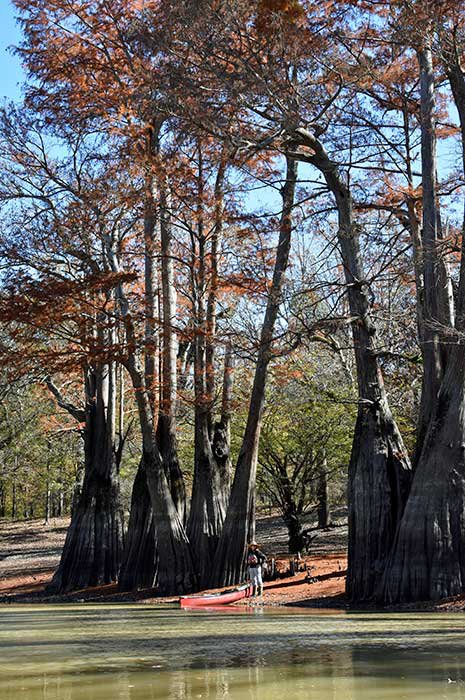
Plenty to Do on the Bayou
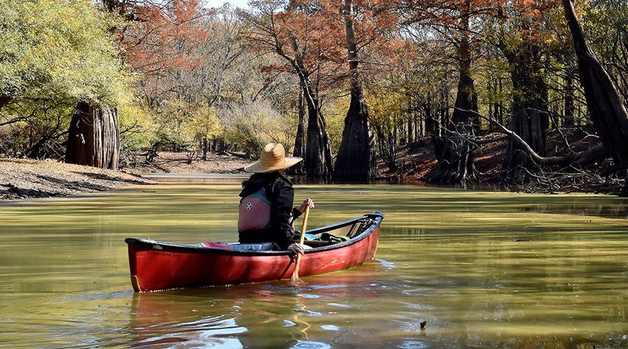
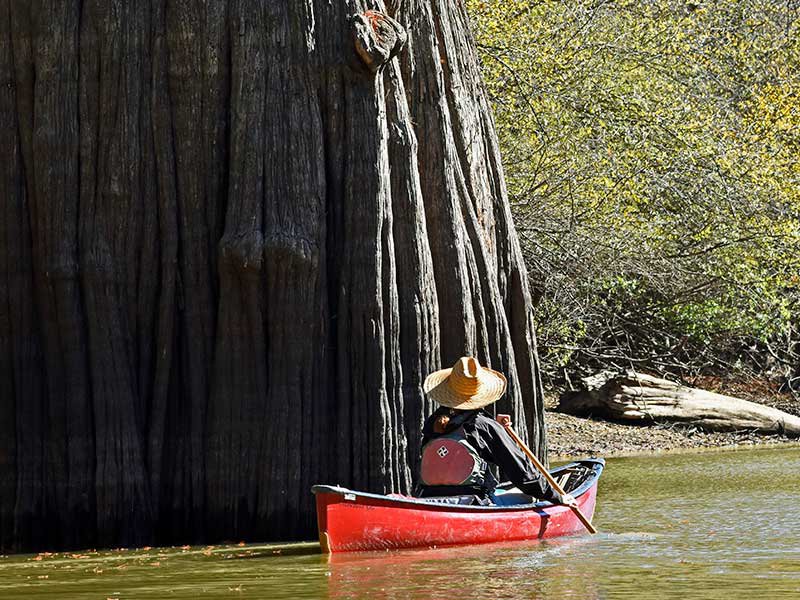
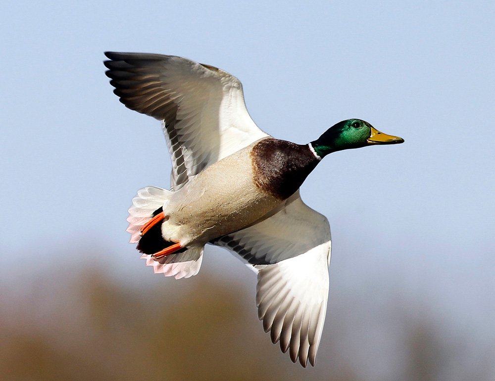
Wattensaw Bayou offers wonderful wildlife-viewing opportunities. Watch for prothonotary warblers, red-headed and pileated woodpeckers, great blue herons, bald eagles and a variety of waterfowl. Beavers, river otters, deer and raccoons travel and feed in and around the bayou. Overcup oak, bald cypress, blackgum and water tupelo trees make up much of the forest.
Maps
Georeferenced Map Instructions
- Download the free Avenza Map app from the App Store on mobile device.
- Choose a trail and tap on the geo-referenced map.
- Tap on the map again and choose “Open in Avenza Maps” or choose “More” and tap on the Avenza Map icon.
- Map is saved in Avenza Map app.
- A blue dot marks your location on the map.
- The trail map uses the phone’s GPS. If cell reception is poor, put phone on airplane mode to conserve power.
- Download the free Avenza Map app from the App Store on mobile device.
- Choose a trail and tap on the geo-referenced map.
- Tap on the three dots in the upper-right corner.
- Choose “Send File” and tap the Avenza Map icon.
- Map is saved in Avenza Map app.
- A blue dot marks your location on the map.
- The trail map uses the phone’s GPS. If cell reception is poor, put phone on airplane mode to conserve power.
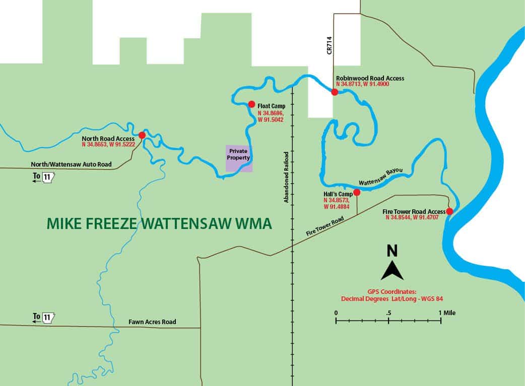
Water Trail Length
7.8 miles
North Road to Robinwood Road – 3.5 miles
Robinwood Road to Fire Tower Road – 4.3 miles
Float Time
Expect to travel 1-2 miles per hour, depending on water level and rate of paddling.
Warning
A train trestle 0.3 miles upstream from the Robinwood Road Access can create a logjam. Approach with caution and portage if necessary.
River Conditions
Wattensaw Bayou usually is a flat-water float. However, heavy rain and high water can create dangerous conditions. Watch for snags and logjams.
At normal water levels, a shuttle vehicle is not needed for this float. Put in at any of the access points and paddle upstream or downstream. Wattensaw Bayou flows east toward the White River.
Emergency Numbers
Prairie County EMS
911
Prairie County Sherrif
870-256-4137
Stop Poaching Hotline
833-356-0824
The bayou offers fishing for crappie and bream. Minnows, jigs, spinners and light line are recommended. Fish on the bottom of the bayou for catfish with worms, minnows and stink baits.
Hunters seek deer, turkey, waterfowl and small game on the area. Avoid the WMA during permits hunts. Furbearer trapping is permissible on the WMA. Check the current Arkansas Hunting Guidebook for details and wear hunter orange when appropriate. Leash pets for their safety.
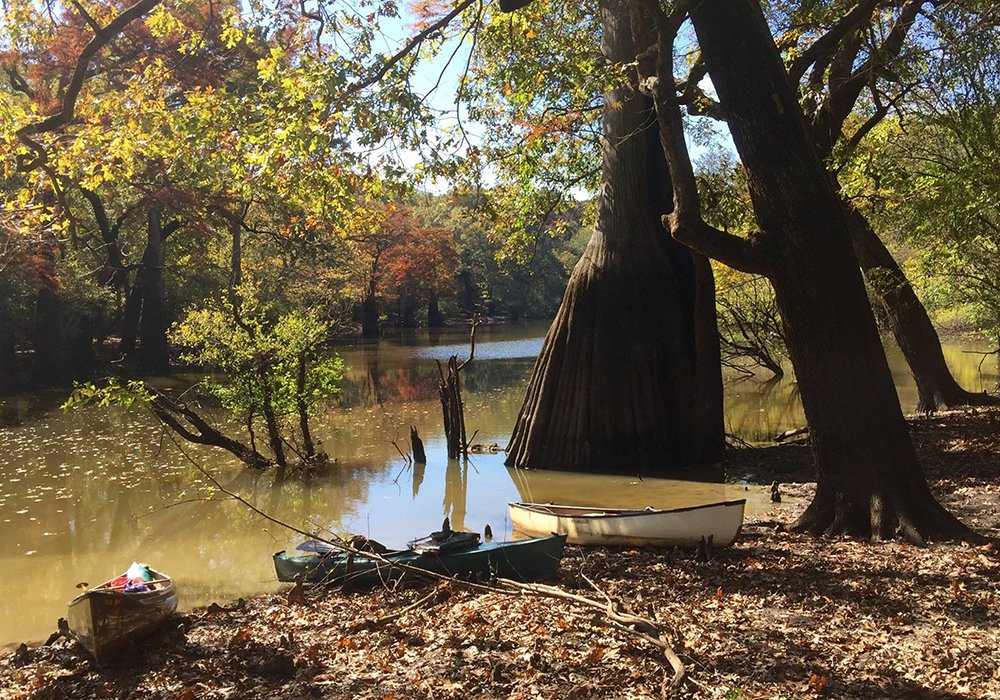
Primitive campsites (no water, sewer or electricity), marked by blue paint, are available at North Road Access, Fire Tower Road Access, Hall’s Camp and Float Camp (accessible by water only). Sites are first-come, first-served.
According to Arkansas law, children 12 and under must wear a Coast Guard-approved life jacket, and anyone on a boat must have one ready to use. Vessels 16 feet and longer must have a throwable life preserver (type IV) aboard. Glass containers are illegal in boats such as canoes that can be easily swamped. Paddlers must securely fasten cooler lids, use attached litter containers and use floating holders for beverages.