Saline County
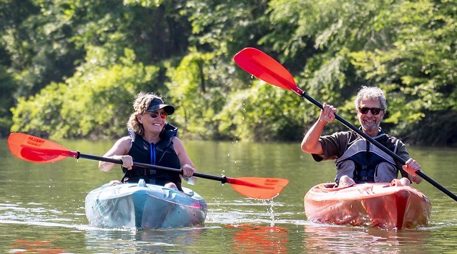
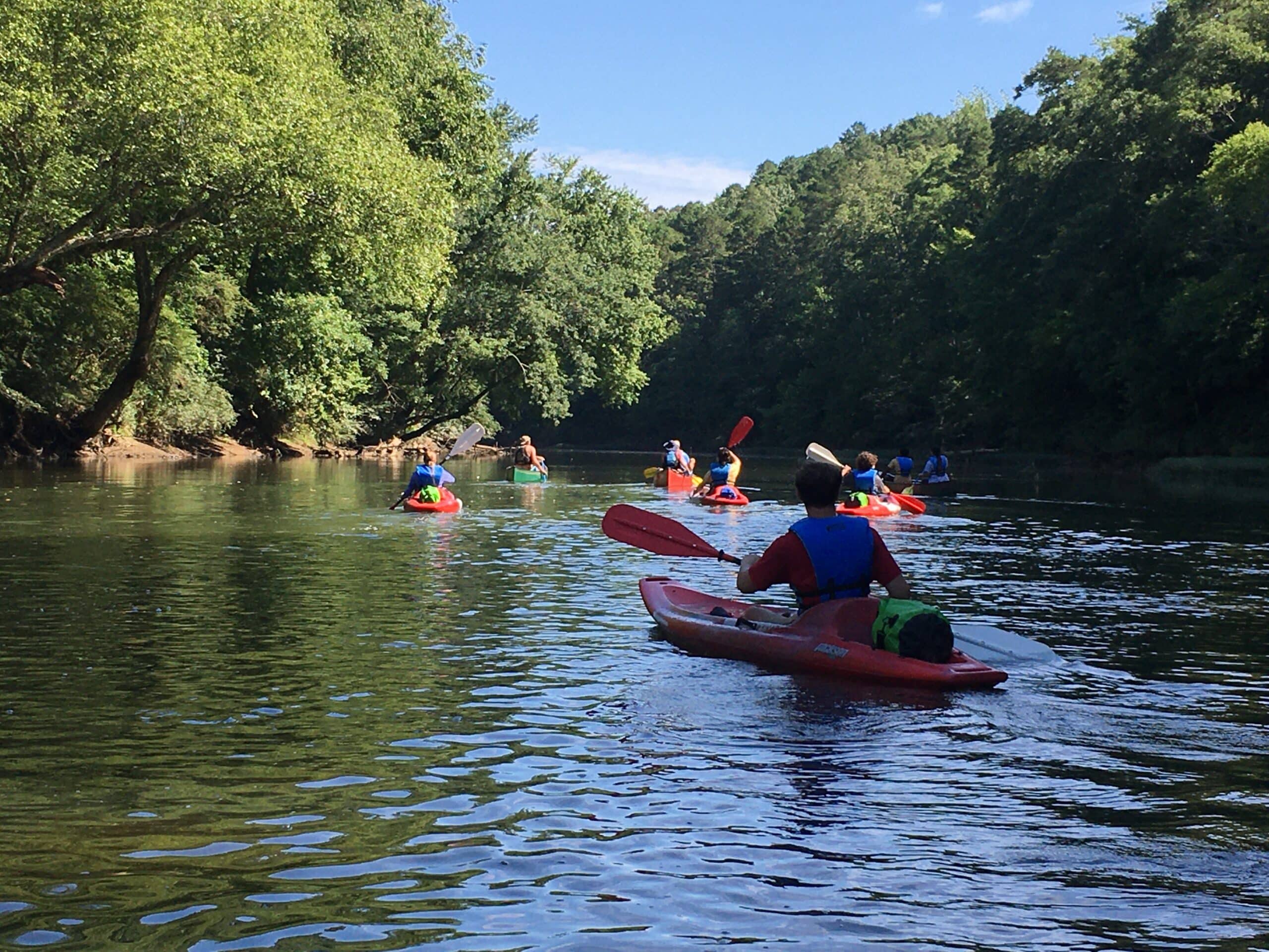
Saline River Water Trail
Gravel road and launch with limited parking. Back down to river or carry boat about 100 yards.
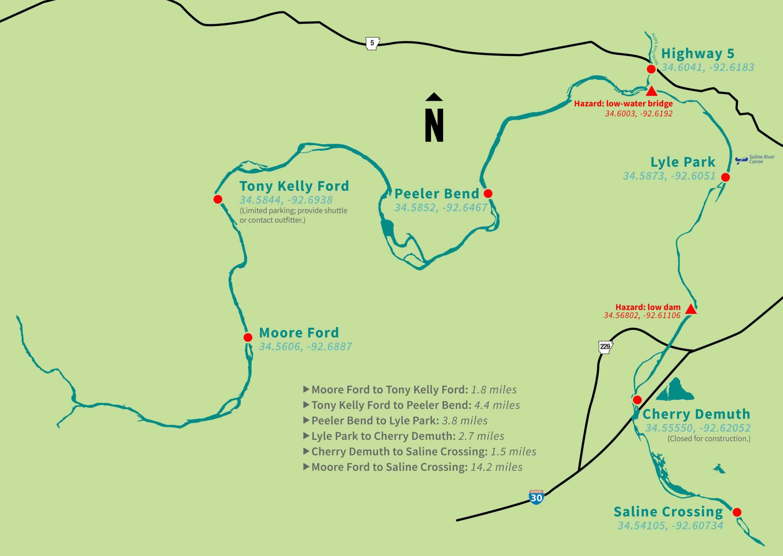
Limited parking. Provide a shuttle or contact outfitter.
Paved road, launch and limited widened-road parking.
Paved parking and launch.
Paved parking and launch.
Gravel road and launch.
Quick Facts
- Download the free Avenza Map app from the App Store on mobile device.
- Choose a trail and tap on the geo-referenced map.
- Tap on the map again and choose “Open in Avenza Maps” or choose “More” and tap on the Avenza Map icon.
- Map is saved in Avenza Map app.
- A blue dot marks your location on the map.
- The trail map uses the phone’s GPS. If cell reception is poor, put phone on airplane mode to conserve power.
- Download the free Avenza Map app from the App Store on mobile device.
- Choose a trail and tap on the geo-referenced map.
- Tap on the three dots in the upper-right corner.
- Choose “Send File” and tap the Avenza Map icon.
- Map is saved in Avenza Map app.
- A blue dot marks your location on the map.
- The trail map uses the phone’s GPS. If cell reception is poor, put phone on airplane mode to conserve power.
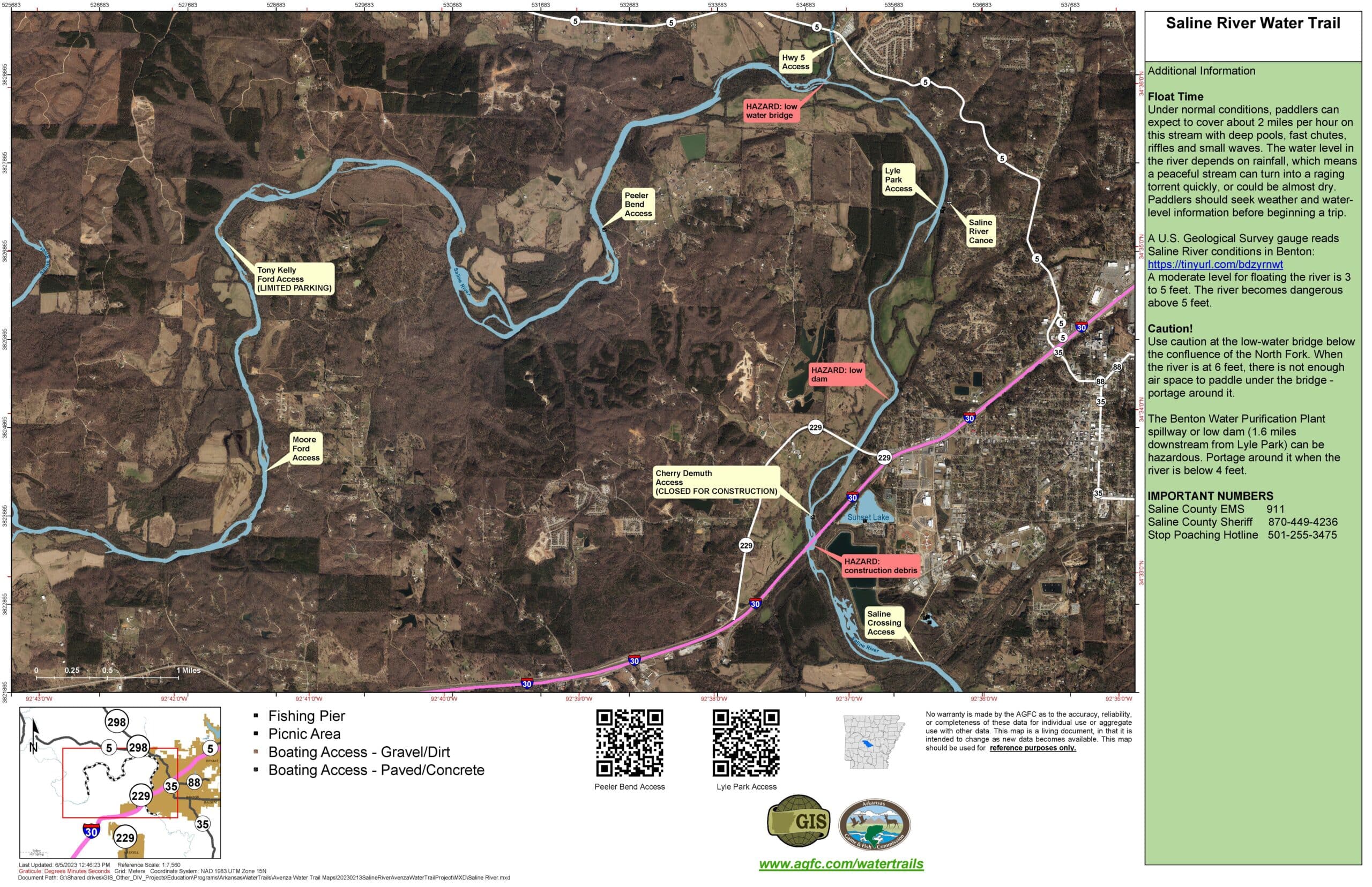
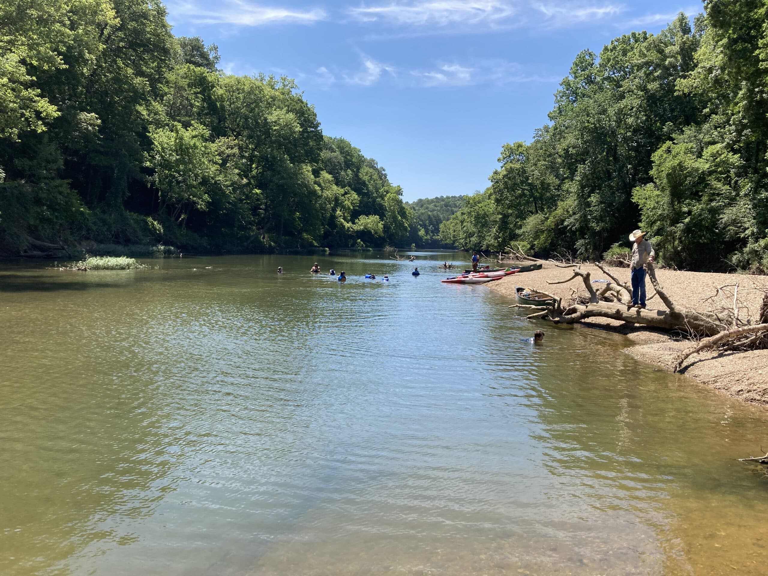
The Saline River flows over 200 miles southeast from Benton before joining the Ouachita River at Felsenthal National Wildlife Refuge near the Louisiana border. It is the last major stream in the Ouachita Mountains that has not been dammed.
The Saline River’s forks are among the state’s healthiest streams. The South, Middle, Alum and North forks flow mostly through forests before joining together just south of Benton.
Map
- Moore Ford to Tony Kelly Ford: 1.8 miles
- Tony Kelly Ford to Peeler Bend: 4.4 miles
- Peeler Bend to Lyle Park: 3.8 miles
- Lyle Park to Cherry Demuth: 2.7 miles
- Cherry Demuth to Saline Crossing: 1.5 miles
- Moore Ford to Saline Crossing: 14.2 miles
Caution!
Use caution at a low water bridge (34.56831, -92.61075), just past the confluence with the North Fork. When the river is at 6 feet, there is not enough air space to go under the bridge and it’s mandatory to portage around it.
The Benton Water Purification Plant spillway or low dam (34.56831, -92.61075) is 1.6 miles downstream from Lyle Park can be hazardous at some water levels. Portage around it when the river is below 4 feet.
Float Time
Under normal conditions, paddlers can expect to cover about 2 miles per hour on this stream with deep pools, fast chutes, riffles and small waves. The water level in the creek depends on rainfall. This peaceful stream can turn into a raging torrent quickly, or could be almost dry. Paddlers should seek weather and water-level information before beginning their trip.
A U.S. Geological Survey gauge reads Saline River conditions in Benton: https://waterdata.usgs.gov/nwis/uv?site_no=07363000.
The river is low. Expect to drag the shoals and paddle the pools.
Peeler Bend to Lyle Park (4 miles/2-3 hours) Lyle Park to Cherry Demuth (Temporarily closed. 4 miles/2-3 hours)
The resting level of the Saline that paddlers can expect much of the year. Dragging is minimal at this level. The water is usually clear and great for fishing, swimming and exploring.
Tony Kelly to Lyle Park (8.2 miles/4-6 hours)
Peeler Bend to Lyle Park (3.8 miles/2-3 hours)
Lyle Park to Saline Crossing (4.2 miles/2-3 hours)
At this level, expect swifter currents and quick turns. Good boat control is important.
Tony Kelly to Lyle Park (8.2 miles/4-6 hours)
Peeler Bend to Lyle Park (3.8 miles/2-3 hours)
Lyle Park to Saline Crossing (4.2 miles/2-3 hours)
Recommended for experienced paddlers only. Paddlers must duck to go under the low water bridge at mile marker 11.6 (34.6003, -92.6192).
Tony Kelly to Lyle Park (8.2 miles/4-6 hours)
Peeler Bend to Lyle Park (3.8 miles/2-3 hours)
Lyle Park to Saline Crossing (4.2 miles/2-3 hours)
Experience and strong boat control is recommended. Expect strong currents and strainers. When the river is at 6 feet, there is not enough air space to go under the low water bridge at mile marker 11.6 (34.6003, -92.6192) and it’s mandatory to portage around it.
Moore Ford to Peeler Bend (6 miles/3-4 hours).
Local outfitter will not rent boats. Not recommended to paddle at this level. Expect very strong, dangerous currents and strainers. There is not enough air space to go under the low water bridge at mile marker 11.6 (34.6003, -92.6192).
Rules of the River
According to Arkansas law, children 12 and under must wear a Coast Guard-approved life jacket and anyone on a boat must have one ready to use. Vessels 16 feet and longer must have a throwable life preserver (type IV) aboard. Glass containers are illegal in boats such as canoes that can be easily swamped. Paddlers must securely fasten cooler lids, use attached litter containers and use floating holders for beverages.
Emergency Numbers
Saline County EMS
911
Saline County Sheriff’s Office
501-303-5609
Stop Poaching Hotline
833-356-0824
Other
River Outfitter
Saline River Canoe
Much of the Saline runs through private property, which may be marked by fences, signs or purple paint. Respect private property.
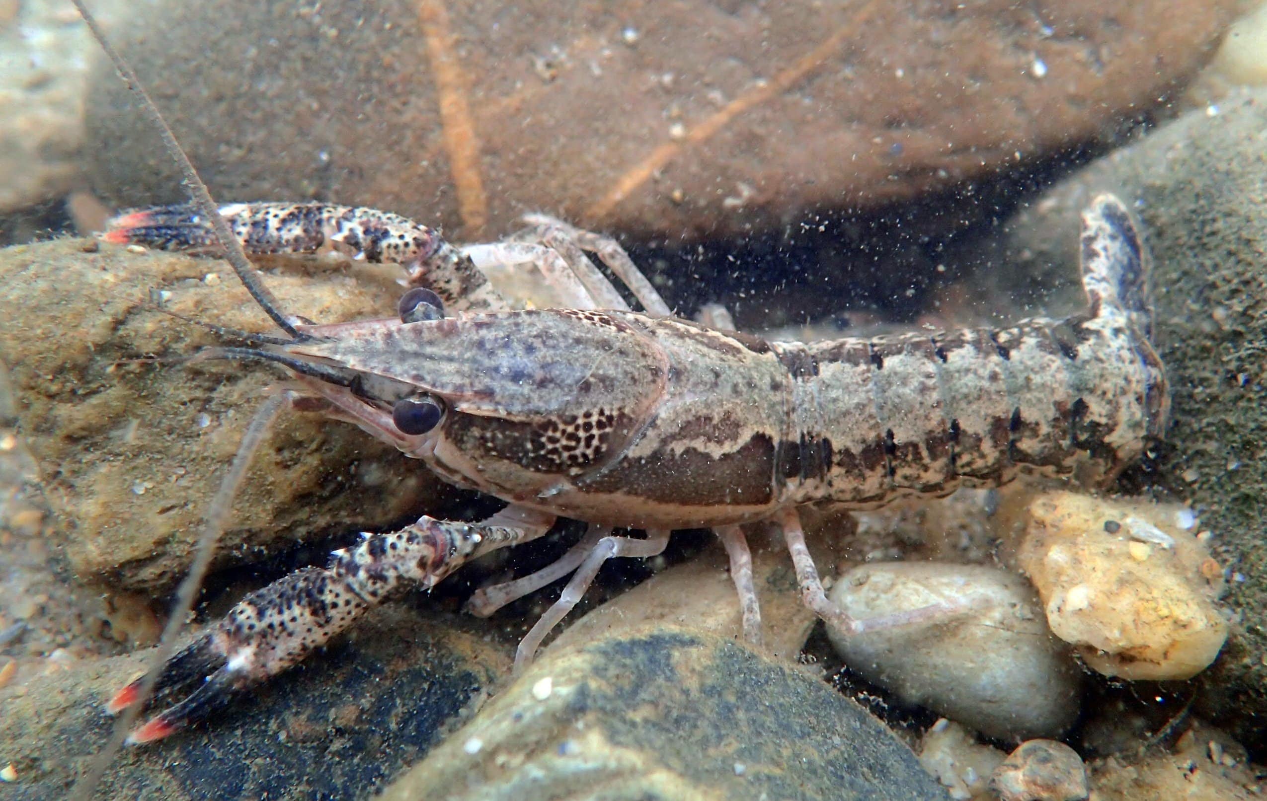
The Saline River – a Ouachita Zone Quality Streams– is known for feisty smallmouth bass. Crank and spinner baits retrieved across riffles or live bait and soft plastic lures worked in deep holes with large rocks and other structure are recommended. Anglers also pursue rock and largemouth bass, longear and green sunfish, and channel catfish. Check agfc.com for fishing regulations and information about mercury contamination.
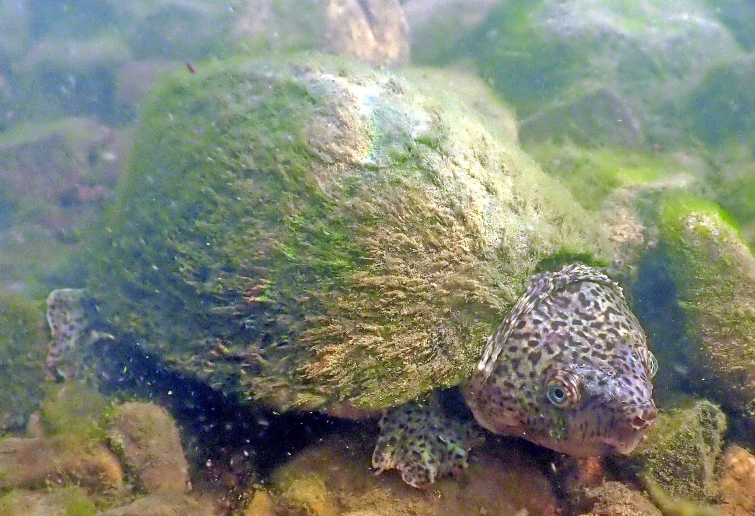
Of the 241 fish species that live in Arkansas, 75 live in the Saline River. Five of the river’s fish are rare and considered species of greatest conservation need, and one, the Ouachita madtom, lives nowhere else. Over half of Arkansas’s 85 mussels live in the Saline River and the Arkansas fatumucket lives nowhere else. Over half of the state’s mussel species are endangered, threatened or are species of special concern.
Water quality on the Saline has declined due to sediment (dirt and what it carries with it), illegal gravel mining, development, and bank erosion. Healthy water quality helps threatened species, game fish, and it ensures a clean source of water for communities along the river. Help protect the Saline by joining an Arkansas Stream Team.