Arkansas Wildlife Weekly Waterfowl Report
BY Jim Harris
ON 11-29-2023
Nov. 29, 2023
Jim Harris
Managing Editor Arkansas Wildlife Magazine
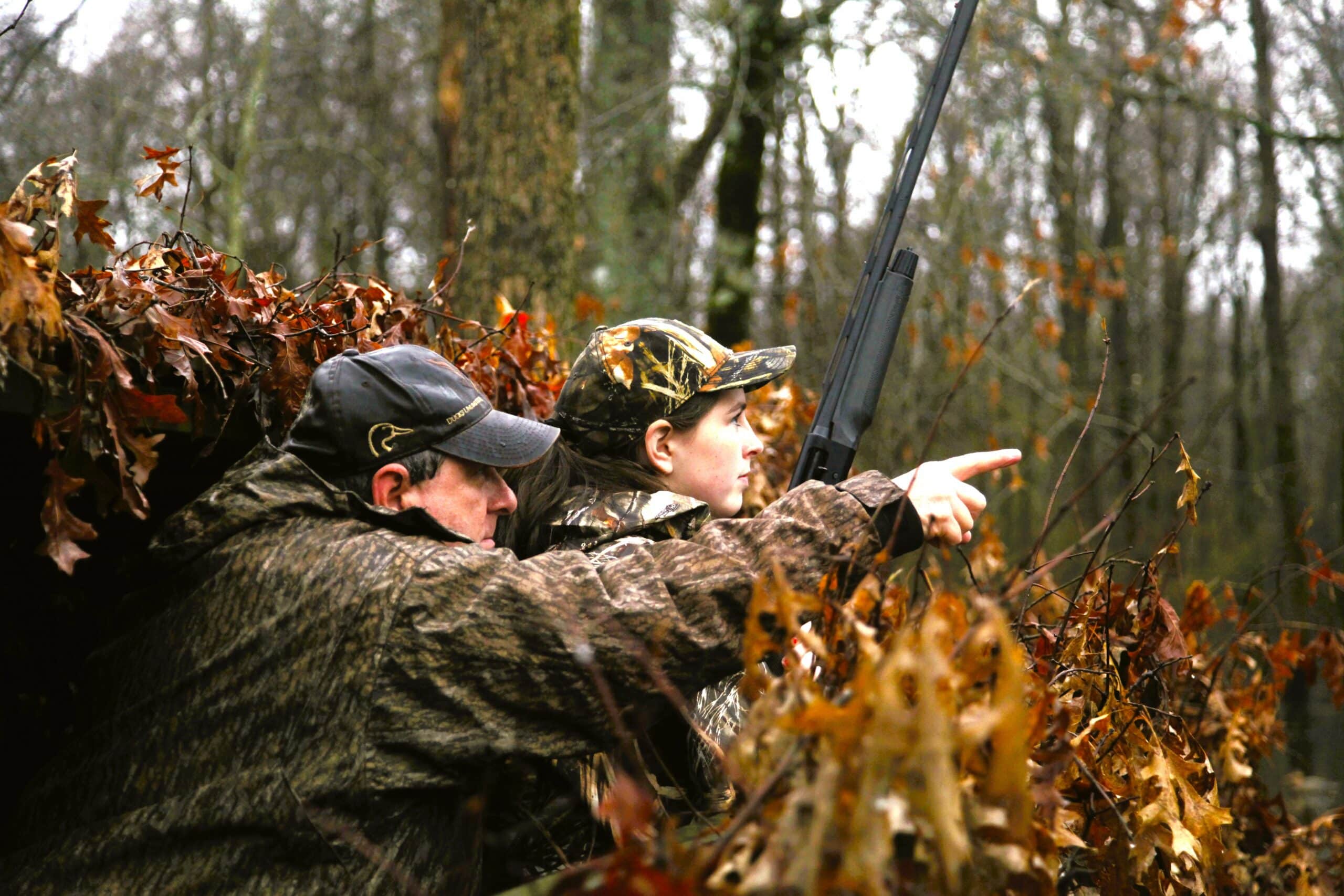
Youth Waterfowl Hunters Have Saturday to Themselves
For the first time in several waterfowl hunting seasons, the first Special Youth Hunt day in Arkansas will be one in which the youths get all the hunting to themselves. Saturday, Dec. 2, is the first of two Special Youth Hunts for the 2023-24 season for youths under 16. The second one, set for Feb. 3 after the close of this 60-day regular waterfowl, will be paired with the annual Veterans and Active Duty Military special hunt day.
The regular duck hunting season remains closed to the rest of the hunting public until Saturday, Dec. 9, one of two splits in Arkansas’s 60-day season. Outside of the youth hunt, waterfowl will be enjoying a respite of 12 days from hunters’ pursuit.
Youths 15 and under were allowed to apply for a Waterfowl Rice Incentive Conservation Enhancement program hunting permit last week to hunt one of about 50 fields available throughout the Delta and west-central regions of the state, as well as the regular youth blinds that are made available by permit for hunting in Steve N. Wilson Raft Creek Bottoms WMA and Sheffield Nelson Dagmar WMA. Without those permits, youths will still have plenty of public land options at all of the AGFC’s WMAs managed for waterfowl (see the habitat conditions and water levels below), including the rest of Raft Creek Bottoms beyond the one permitted youth blind.
The hunting is open from 30 minutes before sunrise Saturday to sunset, and that includes WMAs that typically require hunters off the water by midday. Hunting is open to ducks, geese, mergansers and coots statewide and all applicable daily bag limits apply.
Youths who have not completed the Hunter Education course may take along a mentor 21 and over who may call and help retrieve the ducks but cannot hunt.
While youths have all the hunting to themselves, they may be facing what all hunters have witnessed since opening day: very dry conditions. Several reporting stations around the state indicating water levels were dropping. However, some of the WMAs have improved conditions over the initial nine days of hunting, with what nearby water is available being pumped or diverted into the hunting areas.
More information is available from the state’s regions below.
More Time Off; Plan Ahead on Permits
Hunters planning ahead for next week’s reopening of the season should make sure to apply THIS WEEK for the available WMA permits (including youths seeking youth blinds) at Raft Creek Bottoms WMA, Sheffield Nelson Dagmar WMA and Cypress Bayou’s Red Cut Slough, as well as the dozens of WRICE permits available for full weekend all-day hunting on private land, between Thursday evening and Sunday at midnight.
All applications are $5. Hunters may only apply for one WRICE field per week. Visit the AGFC’s special permit page, which includes more information and a link for WRICE field permit applications and other permit areas, for more information or to apply.
Aerial Survey Next Week
We’ll get a better look at how many ducks have made their way into Arkansas when the AGFC waterfowl biologists take to the skies starting Monday, Dec. 4, for the annual December Waterfowl Survey around The Natural State. Once the flights are completed through the Delta, the Arkansas River Valley and southwestern Arkansas, the information will be compiled, studied and summed up by Brett Leach, the AGFC’s waterfowl program coordinator and released the following week.
For anecdotal reports, and from our own eyes, it appears more mallards were moving into east and southeast Arkansas last weekend. We witnessed groups of mallards (upwards of 14-15 ducks per group) checking out decoy spreads on oxbows and bayous that had water, though where we were specifically hunting, the mallards were skittish to get too close to the decoys despite a nice northeasterly breeze.
Other anecdotal reports from the Cache River area indicated good duck harvests in that area. But overall, the spotty reports continued, and many waterfowlers still lacked enough water.
- Southwest Arkansas
- Central Arkansas
- East-Central Arkansas
- Northwest Arkansas
- Northeast Arkansas
- Southeast Arkansas
Northeast Arkansas
Big Lake WMA
Map | Water Gauge | Weather Report
When the Ditch 81 extension gauge near Manila (upstream of the Big Lake north-end control structure) reads 17.5 feet, water is beginning to come over the north levee degrade on Big Lake WMA. When the Ditch 81 Extension gauge reads 18.0 feet or higher, the water level on the WMA will rise quickly and hunters should exercise caution while on the area. Be aware of underwater logs in boat runs and hangers in trees.
North Woods GTR
Habitat Type: Mast production
Water Level: Gauge reading at BoDoc is 235.2 feet; target level is 235.5 feet; 10% flooded.
South Woods GTR
Habitat Type: Mast production
Water Level: Gauge reading at 7-Mile is 233.6 feet; target level is 234.5 feet; 60% flooded.
Simmons Field
Habitat: Native production is good in the north, middle and south fields.
Water Level: 20% coverage.
Dave Donaldson Black River WMA
Map | Water Gauge | Weather Report
Waterfowl hunters should be aware of hangers and submerged logs within the boat runs and GTRs. Please exercise caution when accessing the area. Please remember to keep boats off the levees so AGFC personnel can access the area. Boats blocking access will be moved. Unattended trailers are not to be left overnight in parking areas. As of Nov. 27, the current Black River level is 1.47 feet and holding.
Upper Island GTR
Habitat Type: Mast crop within the GTRs
Water Level: Current level is 269.45. Target level is 269.5; 95% flooded.
Lower Island GTR
Habitat Type: Mast crop within the GTRs
Water Level: Current level is 268.2 feet msl. Target level is 268.0; 100% flooded.
Upper Reyno GTR
Habitat Type: Mast crop within the GTRs
Water Level: Current level is 266.85 feet msl. Target level is 266.9; 95% flooded.
Lower Reyno GTR
Habitat Type: Mast crop within the GTRs
Water Level: Current level is 266.65 feet msl. Target level is 266.3; 100% flooded.
Winchester GTR
Habitat Type: Mast crop
Water Level: Current level is below readable gauge level.Target level is 263.7; 5% flooded.
Earl Buss Bayou DeView WMA
Map | Water Gauge | Weather Report
Boaters should use caution while using the Thompson Tract boat lane. .
South Oliver GTR
Habitat Type: Bottomland hardwoods
Water Level: Current gauge reading is 0.0 feet 0% flooded.
Thompson Tract GTR
Habitat Type: Bottomland hardwoods
Water Level: Current gauge reading is 0.0 feet. 0% flooded. The Thompson Tract GTR will be allowed to rise and fall naturally without the gates being operated later and partially this season. This action is an effort to help the next generation of forest.
Lake Hogue WRA
Habitat Type: Primarily deep open water
Water Level: Normal pool level
Shirey Bay Rainey Brake WMA
Map | Water Gauge | Weather Report
Waterfowl hunters should be aware of hangers and submerged logs within the boat runs and GTRs. Please exercise caution when accessing the area. In addition, hunters should allow safe passage when parking vehicles along roadsides. Vehicles blocking access will be moved.
Adam Brake GTR
Habitat Type: Mast production
Water Level: Water level is 238.0 feet msl with a target level of 240.0 feet msl. 35% flooded.
Rainey Brake GTR
Habitat Type: Mast production
Water Level: 30% flooded.
Eagle Pond GTR
Habitat Type: Mast production
Water Level: 0% flooded.
Phase III Moist-Soil Unit
Habitat Type: Japanese millet.
Water Level: 0% flooded.
Charles Crisp Moist-Soil Unit
Habitat Type: Japanese millet
Water Level: 0% flooded.
Ward Field Moist-Soil Unit
Habitat Type: Barnyard and panicum grass composition
Water Level: 30% flooded.
River Field Moist-Soil Unit
Habitat Type: Japanese millet
Water Level: 90% flooded.
St. Francis Sunken Lands WMA
Map | Water Gauge | Weather Report
Hunt Area
Habitat Type: Bottomland hardwoods within the hunt area
Water Level: Water levels on St. Francis Sunken Lands for waterfowl season are dependent on flows from the St. Francis River. The target level for providing huntable timber is 212.0 feet msl at the Oak Donnick gauge. Current reading is 211.83 feet msl.
Snowden WRA
Habitat Type: Mixed grasses
Water Level: 10% flooded
Payneway WRA
Habitat Type: A, B, C and D pools have mixed smartweed and barnyard grasses. Moderate hardwoods within pools A, B and C as well.
Water Level: Pool A is at 0% coverage. Pool B is at 0%. Pool C is at 0%. Pool D is at 10%.
East-Central Arkansas
Henry Gray Hurricane Lake WMA
Map | Water Gauge | Weather Report
Hunters should call the Wildlife Hotline at 800-440-1477 for current road closures.
North Unit
Habitat Type: Bottomland timber
Water Level: The White River at Augusta as of Nov. 29 was 13.26 feet and rising. The water level at Glaise Creek is at 186.97 feet msl and falling. All structures on the North GTR will remain open during the 2023-24 season.
South Unit
Habitat Type: Bottomland timber
Water Level: The White River at Augusta is 13.26 feet and rising as of Nov. 29. The water level at Glaise Creek is at 186.97 feet msl and falling. There South Unit nowhas no structures to close; water will flow freely throughout the unit.
Rex Hancock Black Swamp WMA
Map | Water Gauge | Weather Report
Hunters should call the Wildlife Hotline at 800-440-1477 for current road closures.
Gregory GTR
Habitat Type: Bottomland timber
Water Level: Cache River at Patterson was at 3.54 feet and falling on Nov. 29.
Wiville Moist-Soil Unit
Habitat Type: Native vegetation
Water Level: 15% flooded
Sheffield Nelson Dagmar WMA
Map | Water Gauge | Weather Report
The Conway George units are currently available for hunting by applying for online permits. Youths may apply for Saturday and Sunday hunts, with one adult hunter allowed per one youth, up to four hunters in the blind. Wednesday permit hunts are available for adults (up to four hunters per party, three blinds available). Please visit www.agfc.com for maps, special regulations, permit application and draw dates. Hunters should call the Wildlife Hotline at 800-440-1477 for current road closures. The AGFC will not be putting boards in at Dagmar. Water coverage is dependent on river level.
Mud Slough GTR
Habitat Type: Bottomland timber
Water Level: 15% coverage
Apple Lake WRA (no hunting)
Habitat Type: Bottomland timber
Water Level: 25% coverage.
Conway George Waterfowl Unit A
Habitat Type: Native vegetation
Water Level: 90% coverage
Conway George Waterfowl Unit B
Habitat Type: Natural slough area with beneficial native wetland plants
Water Level: 90% coverage
Conway George Waterfowl Unit C
Habitat Type: Native vegetation
Water Level: 0% coverage
Dark Corner Waterfowl Unit 1
Habitat Type: Native vegetation
Water Level: No coverage
Dark Corner Waterfowl Unit 2
Habitat Type: Native vegetation
Water Level: No coverage
Dark Corner Waterfowl Unit 3
Habitat Type: Native vegetation
Water Level: No coverage
Steve N. Wilson Raft Creek Bottoms WMA
Map | Water Gauge | Weather Report
Hunting in Raft Creek Bottoms WMA requires participation on the online draw a week before the following weekend’s hunt. There is no online draw on Tuesdays and Thursdays, and permits are available at the boat accesses. Permits ARE required (via online application) on weekends, Tuesdays and Thursdays for the youth and mobility-impaired blinds and for the Magellan Tract. Visit agfc.com to apply for the online draw. There will be no designated holes this season.
The White River gauge at Georgetown on Monday, Nov. 28, was .08 foot and falling.
Unit A
Habitat Type: Native vegetation
Water Level: 70% coverage.
Unit B
Habitat Type: Native vegetation
Water Level: 25%
Unit C
Habitat Type: Native vegetation
Water Level: 15%
Unit D
Habitat Type: Native vegetation
Water Level: 50%
Unit E
Habitat Type: Native vegetation
Water Level: 80%
Unit F (Youth Area)
Habitat Type: Native vegetation
Water Level: 100%
Unit G
Habitat Type: Habitat conditions are poor.
Water Level: 0%
Unit H (Mobility-impaired blind)
Habitat Type: Native vegetation
Water Level: 100%
Unit I
Habitat Type: Conditions are poor.
Water Level: 0%
Unit J (Cypert Tract)
Habitat Type: Native vegetation
Water Level: 70%
Unit K (Cypert Tract)
Habitat Type: Native vegetation
Water Level: 5%
Unit L (Cypert Tract)
Habitat Type: Native vegetation
Water Level: 0%
Unit M (Magellan Tract)
Habitat Type: Native vegetation
Water Level: 15%
Central Arkansas
Bell Slough WMA
Map | Weather Report
Bell Slough GTR
Flooding of the Bell Slough GTR is rainfall dependent. Gates were lowered in the GTR water control structure on Nov. 17.
Habitat Type: Bottomland hardwood/cypress-tupelo
Water Level: 0%
Palarm Creek WRA
Habitat Type: Native moist-soil vegetation
Water Level: 65%
Craig D. Campbell Lake Conway Reservoir
Map | Weather Report
Due to planned renovation work to Craig D. Campbell Lake Conway Reservoir, water levels are currently 4-4.5 feet below normal pool on both Pierce and Dix creeks.
Cypress Bayou WMA
Map| Weather Report
Hunt Area
Habitat Type: Good mast crop
Water Level: 0% coverage.
Red Cut Slough Tract
Unit 1
Habitat Type: Habitat conditions are good
Water Level: 5%
Unit 2
Habitat Type: Native vegetation.
Water Level: 5%
Unit 3
Habitat Type: Native vegetation
Water Level: 5%
Unit 4
Habitat Type: Native vegetation
Water Level: 20%
Unit 5
Habitat Type: Native vegetation.
Water Level: 70%
Unit 6
Habitat Type: Open water reservoir
Water Level: 65%
Harris Brake WMA
Map | Weather Report
Upper GTR
Habitat Type: Good mast crop
Water Level: 100% coverage
Lower GTR
Habitat Type: Good mast crop.
Water Level: 15% coverage. The Harris Brake Lake valve was opened on Nov. 15 to begin supplemental flooding of both the Lower and Upper GTRs. Damage to one of the Lower GTRs water control structures is allowing water to drain from the Lower GTR and can’t currently be fixed. Sloughs and ditches within the Lower GTR unit will continue to hold water. However, the majority of the Lower GTR unit will stay drained due to the water control structure damage.
Holland Bottoms WMA
Map | Weather Report
Hunt Area
Habitat Type: Mast crop
Water Level: Most of the low lying areas scattered around the WMA have a few inches of water or are completely dry.
Lake Pickthorne WRA (no hunting)
Habitat Type: Native vegetation and millet
Water Level: The East Unit is at 0%, and the West Unit 40% flooded.
Northwest Arkansas
Dardanelle WMA
Map | Weather Report
McKennon Bottoms (half-day hunting)
Habitat Type: Native moist soil
Water Level: 100% coverage
Potter’s Pothole Hartman Waterfowl Unit (half-day hunting)
Habitat Type: Japanese millet and native moist-soil vegetation
Water Level: 100% coverage
Ed Gordon Point Remove WMA
Map | Weather Report
Flooding of waterfowl impoundments on Ed Gordon Point Remove WMA began Oct. 27 and will continue as long as water levels in Point Remove Creek allow.
Little Hole (Unit 1)
Habitat Type: Native moist-soil vegetation
Water Level: 70% flooded
Willow Island (Unit 2)
Habitat Type: Native moist-soil vegetation
Water Level: 10%
Red Gate (Unit 3)
Habitat Type: Native moist-soil vegetation
Water Level: 80%
Pig Trough (Units 4 and 5)
Habitat Type: Native moist-soil vegetation and Japanese millet
Water Level: 65%
Cedar Ridge (Unit 6)
Habitat Type: Native moist-soil vegetation
Water Level: 70%
Unit 7a
Habitat Type: Native moist-soil vegetation
Water Level: 70%
Unit 7b
Habitat Type: Native moist-soil vegetation
Water Level: 0%
Duck Trap (Units 8a, 8b and 8c)
Habitat Type: Native moist-soil vegetation
Water Level: 65%
8b
Habitat Type: Native moist-soil vegetation
Water Level: 50%
8c
Habitat Type: Native moist-soil vegetation
Water Level: 50%
Unit 9
Habitat Type: Native moist-soil vegetation
Water Level: 60%
Controversy Corner (Unit 10)
Habitat Type: Native moist-soil vegetation and Japanese millet
Water Level: 75%
Remmel Marsh
Habitat Type: Native moist-soil vegetation
Water Level: 70%
Mud Pond (Unit 12)
Habitat Type: Native moist-soil vegetation
Water Level: 50%
Turkey Pond (Units 13a, 13b and 13c)
13a
Habitat Type: Native moist-soil vegetation
Water Level: 75%
13b
Habitat Type: Native moist-soil vegetation
Water Level: 0%
13c
Habitat Type: Native moist-soil vegetation
Water Level: 20%
Teeny Pond (Unit 14)
Habitat Type: Native moist-soil vegetation
Water Level: 0%
Salt Lick (Unit 15)
Habitat Type: Native moist-soil vegetation
Water Level: 60%
Bobby’s Pond (Unit 16)
Habitat Type: Native moist-soil vegetation
Water Level: 60%
Race Track (Unit 17)
Habitat Type: Native moist-soil vegetation
Water Level: 70%
Frog Bayou WMA
Map | Weather Report
Unit 1
Habitat Type: Japanese millet and moist soil vegetation
Water Level: 0% coverage. Pumping began Dec. 4.
Unit 2
Habitat Type: Native moist soil vegetation. Unit is rainfall dependent.
Water Level: 25%. Boards were put in Nov. 13.
Unit 3
Habitat Type: Native moist soil vegetation
Water Level: 10%. Pumping began Nov. 27.
Unit 4
Habitat Type: Native moist soil vegetation
Water Level: 100%
Unit 5
Habitat Type: Native moist soil vegetation
Water Level: 25%. Pumping began Dec. 4.
Unit 6
Habitat Type: Native moist soil vegetation
Water Level: 0%. Pumping began Dec. 4.
Unit 7
Habitat Type: Japanese millet and Native moist soil vegetation
Water Level: 0%. Pumping began Nov. 29.
Galla Creek WMA
Map | Weather Report
Galla Creek
Habitat Type: Native moist soil vegetation and Japanese millet. Staged flooding of the waterfowl impoundment began Nov. 7 and will continue throughout waterfowl season with gate next being raised to begin the second stage of flooding on Dec. 1.
Water Level: 35%
Nimrod Lloyd Millwood WMA
Map | Weather Report
Nimrod GTR
Habitat Type: The red oak mast crop is moderate this year as well as the desirable native vegetation growth. The water control structures were closed on Nov. 15.
Water Level: 2% flooded. Flooding of the area is rainfall dependent.
Ozark Lake WMA/Dyer Lake Water Unit
Weather Report
Dyer Lake Cells
Unit 1 Dyer main cell
Habitat Type: Japanese millet
Water Level: 100% coverage for both units
Unit 2 Dyer Road Cell
Habitat Type: Native moist soil
Water Level: 100% coverage
Unit 3 South Cell
Habitat Type: Chiwapa and Japanese millet
Water Level: 5% coverage
Unit 4 West Cell (rainfall dependent)
Habitat Type: Fallow disked
Water Level: 0% coverage
Petit Jean River WMA
Map | Water Gauge | Weather Report
Sorehead Moist-Soil Unit
Habitat Type: This unit was able to grow a stand of desirable native vegetation this year.
Water Level: 100%
Blacklands Moist-Soil Unit
Habitat Type: This summer the units produced a stand of desirable native vegetation. The red oak trees within the unit produced a moderate mast crop this year. Pumping of this unit is dictated by river levels. Due to the constant river level fluctuations, there is not a set date that this unit will be at full pool.
Water Level: 40%.
Slaty Crossing Moist-Soil Unit
Habitat Type: Due to ongoing waterfowl habitat enhancement projects, this unit was not able to grow a desirable native vegetation crop or millet crop this year.
Water Level: 90%
Blacklands Duck Area
Habitat Type: This summer the units produced a stand of desirable native vegetation. The red oak trees within the unit produced a moderate mast crop this year.
Water Level: 100%
Pullen Pond Marsh
Habitat Type: Due to ongoing waterfowl habitat enhancement projects, parts of the central section of this area are bare ground. Most of the area has a stand of desirable native vegetation. The water control structures are closed and already catching water.
Water Level: 5%. Flooding of the area is rainfall dependent.
Pond Creek GTR
Habitat Type: The red oak mast crop is moderate this year as well as the desirable native vegetation growth. The water control structures were closed Nov. 15.
Water Level: 10%. Flooding of this area is rainfall dependent.
Slaty GTR
Habitat Type: The red oak mast crop is moderate this year as well as the desirable native vegetation growth. The water control structures were closed Nov. 15.
Water Level: 10%. Flooding of this area is rainfall dependent.
Santa Fe GTR
Habitat Type: The red oak mast crop is moderate this year as well as the desirable native vegetation growth. The water control structures were closed Nov. 15.
Water Level: 0%. Flooding of this area is rainfall dependent.
Southwest Arkansas
Dr. Lester Sitzes III Bois d’Arc WMA
Map | Weather Report
Bois d’Arc Lake WRA
Habitat Type: Closed to hunting.
Water Level: Normal
Red Slough WRA
Habitat Type: Closed to hunting.
Water Level: 10% coverage.
GTR
Habitat Type: Bottomland timber
Water Level: 5%
Little Grassy
Habitat Type: Native moist-soil vegetation
Water Level: 35%
Millwood Lake
Map | Water Gauge | Weather Report
Habitat Type: Natural vegetation
Water Level: Millwood is at 259.51 feet msl as of Nov. 28.
Ozan WMA
Map | Weather Report
Flooding of all units is rainfall dependent.
Unit 1
Habitat Type: Native moist soil vegetation
Water Level: 50%
Unit 2
Habitat Type: Native moist-soil vegetation
Water Level: 10%
Unit 3
Habitat Type: Native moist-soil vegetation
Water Level: 0%
Unit 4
Habitat Type: Native moist-soil vegetation
Water Level: 0%
Unit 5
Habitat Type: Native moist-soil vegetation
Water Level: 0%
Sulphur River WMA
Map | Weather Report
Mercer Bayou
Habitat Type: Natural vegetation
Water Level: 100%
Henry Moore WRA
Habitat Type: Closed to hunting.
Water Level: 30%
Southeast Arkansas
Beryl Anthony Lower Ouachita WMA
Map | Weather Report
Water Level: No water
Cut-Off Creek WMA
Map | Weather Report
Hunt Area
Habitat Type: Bottomland hardwood habitat
Water Level: No water
Pigeon Creek WRA
Habitat Type: Bottomland hardwood habitat
Water Level: No water.
Freddie Black Choctaw Island WMA Deer Research Area
Map | Water Gauge | Weather Report
Habitat Type: Bottomland hardwood habitat.
Water Level: Flooding is river dependent. Click on the Water Gauge link above for current Mississippi River levels. Use extreme caution when boating in the river.
The Freddie Black Choctaw Island WMA West Unit allows weekend permit hunting for youths (one adult per youth hunter); on Wednesdays, all ages may apply for a permit to hunt the blinds in the West Unit.
George H. Dunklin Jr. Bayou Meto WMA
Map | Water Gauge | Weather Report
The UGSG is reporting real-time water gauge readings at the headwater at each GTR within the George H. Dunklin Bayou Meto WMA. Click the Water Gauge link above for the WMA, and search for the particular GTR as noted.
NOTE: During the 2023-24 wintering period, all intentional flooding will be held at 178.5 feet msl, an elevation that will relieve stress on many trees such as red oaks that are showing signs of distress. Rain and increased flow into the WMA will allow water to rise above that level periodically. A good rule of thumb for comparing water levels to access into Bayou Meto: 176 feet msl – water breaking into sloughs and lower ditches; 177-177.5 feet msl – water beginning to break out of sloughs and lower ditches; 178 feet msl – water in most sloughs and ditches and entering into lower elevations in woods; 178.5 feet msl – most ditches and sloughs deep enough to boat and most boat ramps become serviceable; 179 feet msl or above – water expands to the higher elevations.
Upper Vallier GTR
Habitat Type: Bottomland hardwood habitat
Water Level: See Gauge Link (Upper Vallier Headwater) for updated info.
Lower Vallier GTR
Habitat Type: Bottomland hardwood habitat
Water Level: See Gauge Link (Lower Vallier Headwater) for updated info.
Government Cypress GTR
Habitat Type: Bottomland hardwood habitat
Water Level: See Gauge Link (Government Cypress Headwater) for updated info.
Buckingham Flats GTR
Habitat Type: Bottomland hardwood habitat
Water Level: 175.06 feet and falling as of Nov. 29. See Gauge Link (Buckingham Flats Headwater) for updated info.
Temple Island GTR
Habitat Type: Bottomland hardwood habitat
Water Level: See Gauge Link (Temple Island Headwater) for updated info. Water too low for pumping.
Canon Brake
Habitat Type: Bottomland hardwood
Water Level: See Gauge Link (Canon Brake Headwater) for updated info.
Halowell WRA
Habitat Type: Moist soil
Water Level: Staggered flooding of units.
Wrape Plantation WRA
Habitat Type: Moist soil
Water Level: Staggered flooding of units.
Seven Devils WMA
Map | Weather Report
Hunt Area
Habitat Type: Bottomland hardwood habitat
Water Level: No water.
Trusten Holder WMA
Map | Water Gauge | Weather Report
Habitat Type: Bottomland hardwood habitat.
Water Level: Flooding is river dependent. Click on the Water Gauge link above for current Arkansas River levels.
Recent News

Subscribe to Our Weekly Newsletter E-mails
Don’t miss another issue. Sign up now to receive the AGFC Wildlife Weekly Newsletter in your mailbox every Wednesday afternoon (Waterfowl Reports are published weekly during waterfowl season and periodically outside the season). Fishing Reports arrive on Thursdays. Fill in the following fields and hit submit. Thanks, and welcome!