Arkansas Wildlife Weekly Waterfowl Report
BY Jim Harris
ON 12-28-2022
Dec. 28, 2022
Jim Harris
Managing Editor Arkansas Wildlife Magazine
With Deep Freeze Over, Hunters Have Uninterrupted Hunting
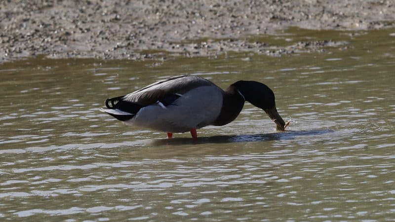
LITTLE ROCK – Arkansas waterfowl hunters endured a deep freeze leading into last weekend, and now temperatures will take an upward trend as the state’s 60-day season has reached its midpoint. There are no more splits left in the season as it runs uninterrupted through Jan. 31.
Long-range weather forecasts indicate temperatures ranging as high as 68 this weekend and staying in the 50s over the next 10 days. But while the temps may be mild, the forecast is also calling for a potential drenching on Monday in the neighborhood of that much-sought-after 4-6 inches that will cover Delta fields and overflow banks and levees, providing ideal duck habitat. Most of Arkansas Game and Fish Commission’s areas managed for waterfowl hunting have plenty of water coverage now, though, after a very dry early season. They, and the ducks, could always use more.
Anecdotal reports surfaced of more mallards arriving as far south as George H. Dunklin Bayou Meto Wildlife Management Area last Wednesday ahead of the cold air blast roared through Arkansas Thursday. There was only minimal landscape coverage of winter precipitation in the state, but states to the north and northwest received a good blanket of snow and ice. Other anectodal reports passed along to the AGFC were from private land hunters, who noted more mallards harvested this year than last for the month of December, which fell in line with results of the AGFC’s December aerial survey.
In the days leading up to that arctic winter front, AGFC waterfowl biologists completed their December aerial survey, noting the biggest concentration of ducks in the Bayou Meto-Lower Arkansas River, Black River-Upper White River and Cache River survey zones. Of the nearly 1.14 million total ducks estimated in the Arkansas Delta during the survey, 75 percent of all ducks were in those zones. The Delta mallard count numbered 480,846 ducks, the most mallards seen in the December survey count since 2018.
Arctic goose population estimates were nearly 1.3 million along with 181,356 greater white-fronted geese.
The big weather blast last week coincided with the last break in the Arkansas waterfowl hunting season Dec. 24-25, but that marks the last stoppage in the season. Ducks, geese, mergansers and coots all can be hunted through January. Also, Arkansas’s second dove season is underway through Jan. 15 (we mention that mainly because we noticed a significant number of doves around the Arkansas River in recent days as the cold front blew through).
Because the inclement flying conditions of earlier December pushed the flights several days later, the survey team of Jason Carbaugh, Buck Jackson, Cameron Tatom and Alex Zachery were scheduled to be back up in the air quicker than usual, with the midwinter survey scheduled for next week beginning Jan. 2.
Looking Northward
The Missouri Department of Conservation completed its waterfowl survey Dec. 12. Since then, hunting at Missouri’s conservation areas (akin to the AGFC’s wildlife management areas) peaked in the south portion of the state by Dec. 22, when most areas recorded average hunter harvest of around 2 ducks. Better hunting was seen at more areas around Dec. 15. In Missouri, hunters sign in at the conservation areas and record their harvest, which is then collected and publicized by the MDC.
Andy Raedeke of the MDC published this report in Dec. 12: “Very little has changed since the last report. Temperatures were 0-5 degrees above average for most of Missouri except for northwest Missouri where they were 0-5 degrees below normal. Precipitation was below normal for much of the state. North Missouri received 0.5 to 1 inches and south Missouri received 1-2 inches over the past two weeks. Good habitat continues to be mainly limited to private and public wetlands with pumping capabilities.
“Managers did not report any significant duck migrations. This week’s tally of 896,051 ducks was similar to the previous survey’s estimate of 917,394 ducks, 12% higher than the previous five-year average of 800,874 ducks, and 26% higher than the previous 20-year average of 713,869 ducks. Our estimate of 680,049 mallards was 7% above the previous five-year average of 634,020 mallards and 15% above the previous 20-year average of 591,989 mallards. Mallards comprised 76% of the total ducks compared to 67% last year, 80% for the previous 5-year average, and 83% for the previous 20-year average. Snow goose numbers declined from 228,760 to 97,762. We also tallied 15,557 white-fronted geese, and 3,376 Canada geese.
Raedeke noted that Missouuri was also seeing cases of Avian Influenza in December.
Continue Vigilance With Avian Flu
Hunters are urged by the AGFC to maintain a vigilant lookout for any birds that might be infected or suffering from Highly Pathogenic Avian Influenza. HPAI has been a concern of wildlife biologists this late fall and winter, especially with much evidence of it seen recently among migrating snow geese and other waterfowl and wintering birds in Arkansas. Hunters, outdoors enthusiasts and wildlife watchers are asked to report instances of dead or sick waterfowl that they encounter in the wild. The risk of humans contracting the disease remains low, but hunters can help further minimize that risk by following a few simple precautions (see below). Anyone who observes concentrations of sick or dead birds should report their sighting by using the AGFC’s Avian Influenza Reporting Form.
More information on avian influenza information is available at AGFC, Ducks Unlimited, and USDA APHIS’s website.
Bag Limits
Remember: Daily bag limits are the same as seen in recent years. Hunters make harvest a bag limit of 6 ducks, which may include no more than 4 mallards (2 hens), 1 scaup, 3 wood ducks, 1 pintail, 2 redheads, 2 canvasbacks, 2 black ducks or 1 mottled duck. Beyond those exceptions, the limit is up to 6 ducks of a species, including teal. The merganser daily bag limit is 5, with only 2 hooded mergansers allowed. The daily bag limit for coots is 15. Non-lead shot must be used for waterfowl hunting in Arkansas. The possession limit for ducks, coots and mergansers is three times the daily bag limit. The daily bag limit for greater white-fronted geese 3, up from last year’s 2 birds per day. The daily limit for snow, blue and Ross’s geese is 20 per day.
Waterfowl season in Arkansas will closes at sunset Jan. 31.
Northeast Arkansas
Big Lake WMA
Map | Water Gauge | Weather Report
When the Ditch 81 extension gauge near Manila (upstream of the Big Lake north-end control structure) reads 17.5 feet, water is beginning to come over the north levee degrade on Big Lake WMA. When the Ditch 81 Extension gauge reads 18.0 feet or higher, the water level on the WMA will rise quickly and hunters should exercise caution while on the area. Be aware of underwater logs in boat runs and hangers in trees.
North Woods GTR
Habitat: Mast production is good.
Water Level: Gauge reading at BoDoc is 237.4 feet msl; target level is 235.5 feet with 100% flooded.
South Woods GTR
Habitat: Mast production is fair.
Water Level: Gauge reading at 7-Mile is 236.2 feet msl; target level is 234.5 feet with 100% flooded.
Simmons Field
Habitat: Native production is good in the middle and south fields.
Water Level: 100% coverage.
Dave Donaldson Black River WMA
Map | Water Gauge | Weather Report
Waterfowl hunters should be aware of hangers and submerged logs within the boat runs and GTRs. Please exercise caution when accessing the area. Please remember to keep boats off the levees so AGFC personnel can access the area. Boats blocking access will be moved. Unattended trailers are not to be left overnight on parking areas. As of Dec. 27, the Black River level is 3.33 feet and falling.
Upper Island GTR
Habitat: Mast crop is moderate within the GTRs.
Water Level: Current level is 269.35 feet msl. Target level is 269.5; 90% flooded.
Lower Island GTR
Habitat: Mast crop is moderate within the GTRs.
Water Level: Current level is 268.3 feet msl. Target level is 268.0; 100% flooded.
Upper Reyno GTR
Habitat: Mast crop is moderate within the GTRs.
Water Level: Current level is 267.15 feet msl. Target level is 266.9; 100% flooded.
Lower Reyno GTR
Habitat: Mast crop is moderate within the GTRs.
Water Level: Current level is 266.8 feet msl. Target level is 266.3; 100% flooded.
Winchester GTR
Habitat: Mast crop is moderate within the GTRs.
Water Level: Current level is 263.7 feet msl. Target level is 263.7; 100% flooded.
Earl Buss Bayou DeView WMA
Map | Water Gauge | Weather Report
Boaters should use caution while using the Thompson Tract boat lane.
South Oliver GTR
Habitat: Mast production is good.
Water Level: Current gauge reading as of Dec. 27 is 1.45 feet. 100% flooded.
Thompson Tract GTR
Habitat: Mast production is good.
Water Level: Current gauge reading as of Dec. 27 is 1.3 feet. 100% flooded. The Thompson Tract GTR will be allowed to rise and fall naturally without the gates being operated later and partially this season. This action in an effort to help the next generation of forest.
Lake Hogue WRA
Habitat: Primarily deep open water habitat.
Water Level: Normal pool level.
Shirey Bay Rainey Brake WMA
Map | Water Gauge | Weather Report
Waterfowl hunters should be aware of hangers and submerged logs within the boat runs and GTRs. Please exercise caution when accessing the area. In addition, hunters should allow safe passage when parking vehicles along roadsides. Vehicles blocking access will be moved.
Adam Brake GTR
Habitat: Mast production is good.
Water Level: Water level is 240 feet msl with a target level of 240.0 feet msl; 100% flooded.
Rainey Brake GTR
Habitat: Mast production is good.
Water Level: 100% flooded.
Eagle Pond GTR
Habitat: Mast production is good.
Water Level: 100% flooded.
Phase III Moist-Soil Unit
Habitat: Fair wetland-type vegetation.
Water Level: 95% flooded.
Charles Crisp Moist-Soil Unit
Habitat: Fair wetland-type vegetation.
Water Level: 100% flooded.
Ward Field Moist-Soil Unit
Habitat: Good wetland-type vegetation.
Water Level: 100% flooded.
River Field Moist-Soil Unit
Habitat: Good wetland-type vegetation.
Water Level: 100% flooded.
St. Francis Sunken Lands WMA
Map | Water Gauge | Weather Report
Hunt Area
Habitat: Good mast production within the hunt area.
Water Level: Water levels on St. Francis Sunken Lands for waterfowl season are dependent on flows from the St. Francis River. The target level for providing huntable timber is 212.0 feet msl at the Oak Donnick gauge. The reading as of Dec. 26 was 212.98 feet msl.
Snowden WRA
Habitat: Mixed grasses.
Water Level: 10% flooded.
Payneway WRA
Habitat: A, B, C and D pools have mixed smartweed and barnyard grasses. Moderate mast is available within pools A, B and C as well.
Water Level: Pool A is at 0% coverage. Pool B is at 10%. Pool C is at 35%. Pool D is at 90%.
East-Central Arkansas
Henry Gray Hurricane Lake WMA
Map | Water Gauge | Weather Report
Hunters should call the Wildlife Hotline at 800-440-1477 for current road closures.
North Unit
Habitat: Good mast crop.
Water Level: The White River at Augusta as of Tuesday, Dec. 27, was 21.55 feet (a drop of almost 5 feet since this time last week). The water level at Glaise Creek is 189.53 feet and falling. All structures on the North GTR will remain open during the 2022-23 season.
South Unit
Habitat: Fair mast crop.
Water Level: The White River at Augusta as of Tuesday, Dec. 27, was 21.55 feet (a drop of almost 5 feet since this time last week). The water level at Glaise Creek is 189.53 feet and falling. All structures on the South Unit are open.
Rex Hancock Black Swamp WMA
Map | Water Gauge | Weather Report
Hunters should call the Wildlife Hotline at 800-440-1477 for current road closures.
Gregory GTR
Habitat: Good mast crop.
Water Level: 40% flooded. The Cache River at Patterson was at 10.48 feet and rising slightly on Dec. 19.
Wiville Moist-Soil Unit
Habitat: Good stand of native vegetation.
Water Level: 90% flooded.
Sheffield Nelson Dagmar WMA
Map | Water Gauge | Weather Report
The Conway George units are currently available for hunting by applying for online permits. Youths may apply for Saturday and Sunday hunts in the Conway George tracts, with one adult hunter allowed per one youth, up to four hunters in the blind. Hunters of any age may apply for Wednesday permit hunts in the Conway George tracts. Please visit www.agfc.com for maps, special regulations, permit application and draw dates. Hunters should call the Wildlife Hotline at 800-440-1477 for current road closures. The AGFC will not be putting boards in at Dagmar. Water coverage is dependent on river level.
Mud Slough GTR
Habitat: Good mast crop.
Water Level: 30% coverage.
Apple Lake WRA (no hunting)
Habitat: Good mast crop.
Water Level: 40% coverage.
Conway George Waterfowl Unit A
Habitat: Good stand of native vegetation.
Water Level: 90% coverage
Conway George Waterfowl Unit B
Habitat: Natural slough area with beneficial native wetland plants.
Water Level: 90% coverage
Conway George Waterfowl Unit C
Habitat: Good stand of native vegetation.
Water Level: 90% coverage
Dark Corner Waterfowl Unit 1
Habitat: Good stand of native vegetation.
Water Level: 95% coverage
Dark Corner Waterfowl Unit 2
Habitat: Good stand of native vegetation.
Water Level: 75% coverage
Dark Corner Waterfowl Unit 3
Habitat: Good stand of native vegetation.
Water Level: 50% coverage
Steve N. Wilson Raft Creek Bottoms WMA
Hunting in Raft Creek Bottoms WMA requires participation on the online draw a week before the following weekend’s hunt. There is no online draw on Tuesdays and Thursdays, and permits are available at the boat accesses. Permits ARE required (via online application) on weekends, Tuesdays and Thursdays for the youth and mobility-impaired blinds and for the Magellan Tract. Visit agfc.com to apply for the online draw. There will be no designated holes this season.
The White River gauge at Georgetown on Tuesday, Dec. 27, was 8.9 feet , going to 8 feet and falling.
Unit A
Habitat: Excellent stand of native vegetation.
Water Level: 100% coverage.
Unit B
Habitat: Excellent stand of millet and native vegetation.
Water Level: 100%
Unit C
Habitat: Good stand of native vegetation.
Water Level: 100%
Unit D
Habitat: Good stand of native vegetation.
Water Level: 100%
Unit E
Habitat: Excellent stand of millet and native vegetation.
Water Level: 90%
Unit F (Youth Area)
Habitat: Good stand of millet and native vegetation.
Water Level: 100%
Unit G
Habitat: Habitat conditions are poor.
Water Level: 30%
Unit H (Mobility-impaired blind)
Habitat: Excellent stand of native vegetation.
Water Level: 100%
Unit I
Habitat: Habitat conditions are poor.
Water Level: 30%
Unit J (Cypert Tract)
Habitat: Excellent stand of native vegetation.
Water Level: 85%
Unit K (Cypert Tract)
Habitat: Excellent stand of native vegetation.
Water Level: 15%
Unit L (Cypert Tract)
Habitat: Fair stand of native vegetation.
Water Level: 10%
Unit M (Magellan Tract)
Habitat: Good stand of native vegetation.
Water Level: 100%
Central Arkansas
Bell Slough WMA
Map | Weather Report
The Bell Slough GTR is primarily rainfall dependent with the exception of a limited amount of water that the AGFC can back in and catch from Palarm Creek.
Bell Slough GTR
Habitat: Fair mast crop.
Water Level: 20%.
Palarm Creek WRA
Habitat: Rest area was heavily disked late this year and millet crop did not take before the early frost.
Water Level: 80%
Craig D. Campbell Lake Conway Reservoir
Map | Weather Report
Habitat and water levels are normal on both Pierce and Dix creeks.
Cypress Bayou WMA
Hunt Area
Habitat:
Good mast crop.
Water Level: 90% coverage.
Red Cut Slough Tract
Unit 1
Habitat:
Habitat conditions are poor.
Water Level: 50%
Unit 2
Habitat:
Excellent stand of millet and native vegetation
Water Level: 50%
Unit 3
Habitat:
Good stand of millet and native vegetation
Water Level: 100%
Unit 4
Habitat: Good stand of millet and native vegetation.
Water Level: 100%
Unit 5
Habitat:
Good stand of native vegetation.
Water Level: 100%
Unit 6
Habitat:
Good stand of native vegetation.
Water Level: 80%
Harris Brake WMA
Upper GTR
Habitat: Good mast crop.
Water Level: 100% coverage.
Lower GTR
Habitat: Good mast crop.
Water Level: 20% coverage. The Harris Brake Lake valve was opened Nov. 15 to begin supplemental flooding of both the Lower and Upper GTRs. Unfortunately, damage to one of the Lower GTR’s water control structures is allowing water to drain from the Lower GTR and can’t currently be fixed. The Lower GTR will mostly likely drain completely unless the Fourche La Fave overtops the levee and floods the GTR.
Holland Bottoms WMA
Hunt Area
Habitat: Good mast crop.
Water Level: Some sloughts on the WMA are starting to be refilled with rainwater.
Lake Pickthorne WRA (no hunting)
Habitat: Excellent crop of native vegetation and millet.
Water Level: The West Unit is 85% flooded.
Northwest Arkansas
Dardanelle WMA
McKennon Bottoms (half-day hunting)
Habitat: Good stand of native moist-soil vegetation.
Water Level: 100% coverage
Potter’s Pothole Hartman Waterfowl Unit (half-day hunting)
Habitat: West cell has a poor stand of moist-soil vegetation. East cell has an average stand of moist-soil vegetation.
Water Level: 100% coverage
Ed Gordon Point Remove WMA
Water levels in most waterfowl impoundments on the WMA are now huntable. Pumping of impoundments began Oct. 31 and will continue as water levels in Point Remove Creek allow. Duck Use on the WMA has been low to moderate.
Little Hole (Unit 1)
Habitat: Japanese millet.
Water Level: 70% flooded.
Willow Island (Unit 2)
Habitat: Japanese millet and natural vegetation.
Water Level: 100%
Red Gate (Unit 3)
Habitat: Natural vegetation
Water Level: 90%
Pig Trough (Units 4 and 5)
Habitat: Natural vegetation.
Water Level: 70%
Cedar Ridge (Unit 6)
Habitat: Japanese millet.
Water Level: 80%
Unit 7a
Habitat: Natural vegetation.
Water Level: 80%
Unit 7b
Habitat: Japanese millet and natural vegetation.
Water Level: 80%
Duck Trap (Units 8a, 8b and 8c)
8a
Habitat: Natural vegetation and Japanese millet.
Water Level: 40%
8b
Habitat: Japanese millett and natural vegetation.
Water Level: 90%
8c
Habitat: Natural vegetation.
Water Level: 75%
Unit 9
Habitat: Natural vegetation.
Water Level: 95%
Controversy Corner (Unit 10)
Habitat: Natural vegetation.
Water Level: 90%
Remmel Marsh
Habitat: Natural vegetation.
Water Level: 90%
Mud Pond (Unit 12)
Habitat: Natural vegetation and Japanese millet.
Water Level: 65%
Turkey Pond (Units 13a, 13b and 13c)
13a
Habitat: Natural vegetation and Japanese millet.
Water Level: 70%
13b
Habitat: Natural vegetation.
Water Level: 75%
13c
Habitat: Natural vegetation and Japanese millet.
Water Level: 75%
Teeny Pond (Unit 14)
Habitat: Natural vegetation.
Water Level: 0%
Salt Lick (Unit 15)
Habitat: Natural vegetation.
Water Level: 70%
Bobby’s Pond (Unit 16)
Habitat: Natural vegetation.
Water Level: 90%
Race Track (Unit 17)
Habitat: Natural vegetation.
Water Level: 100%
Frog Bayou WMA
Due to the dry summer, several units have been fallow-disked in preparation for next season.
Unit 1
Habitat: Good stand of moist-soil vegetation in the upper end, while lower end has been fallow-disked.
Water Level: 100% coverage
Unit 2
Habitat: Has been fallow-disked. Unit is rainfall dependent.
Water Level: 100% flooded.
Unit 3
Habitat: Average stand of moist-soil vegetation on the upper end; lower end has been fallow-disked.
Water Level: 100%
Unit 4
Habitat: Good stand of moist-soil vegetation and planted millet
Water Level: 100%
Unit 5
Habitat: Good stand of moist-soil vegetation on the upper end; lower end has been planted with Japanese millet.
Water Level: 100%
Unit 6
Habitat: Good stand of moist-soil vegetation. Lower end has been fallow-disked.
Water Level: 100%
Unit 7
Habitat: Good stand of moist-soil vegetation.
Water Level: 100%
Galla Creek WMA
Galla Creek
Habitat: Good stands of native vegetation and Japanese millet. Staged flooding of the area will continue throughout the waterfowl season. The gate will be raised for the final time this season by Jan. 1
Water Level: 90% flooded.
Nimrod Lloyd Millwood WMA
Nimrod GTR
Habitat: The red oak mast crop is moderate this year as well as the desirable native vegetation growth. Due to abnormally dry conditions, this area is not expected to fill up as fast as in previous years. The water control structures were closed Nov. 15.
Water Level: 90% flooded. Flooding of the area is rainfall dependent.
Ozark Lake WMA/Dyer Lake Water Unit
Dyer Lake Cells
Unit 1 Dyer main cell
Habitat: Good stand of moist-soil vegetation.
Water Level: 100% coverage for both units
Unit 2 Dyer Road Cell
Habitat: Poor stand of moist-soil vegetation due to dry conditions over the summer.
Water Level: 100% coverage
Unit 3 South Cell
Habitat: Good stand of moist-soil vegetation and volunteer millet.
Water Level: 25% coverage
Unit 4 West Cell (rainfall dependent)
|Habitat: Good stand of moist-soil vegetation and volunteer millet.
Water Level: 5% coverage
Petit Jean River WMA
Map | Water Gauge | Weather Report
Sorehead Moist-Soil Unit
Habitat: This unit was able to grow a great stand of desirable native vegetation this year. The Kingfisher Lake water control structure valve was opened Nov. 15 to help flood this area.
Water Level: 100%
Blacklands Moist-Soil Unit
Habitat: The red oak mast crop is moderate this year as well as the desirable native vegetation growth. Millet planting was attempted this year, but the dry conditions prevented growth. The recent rains have put enough water in the river to start pumping last week.
Water Level: 100%.
Slaty Crossing Moist-Soil Unit
Habitat: Due to ongoing waterfowl habitat enhancement projects, this unit was not able to grow a desirable native vegetation crop or millet crop this year. The recent rains have put enough water in the river to start pumping last week.
Water Level: 100%
Blacklands Duck Area
Habitat: The red oak mast crop is moderate this year as well as the desirable native vegetation growth. Millet planting was attempted this year, but the dry conditions prevented growth. The Kingfisher Lake water control structure valve was to be opened Nov. 15 to help flood the area.
Water Level: 100%
Pullen Pond Marsh
Habitat: Due to ongoing waterfowl habitat enhancement projects, parts of the central section and western section of this area is bare ground. Most of the area has a great stand of desirable native vegetation. The water control structures were closed on Nov. 4.
Water Level: 20%. Flooding of the area is rainfall dependent.
Pond Creek GTR
Habitat: The red oak mast crop is moderate this year as well as the desirable native vegetation growth. Due to abnormally dry conditions, this area is not expected to fill up as fast as in previous years. The water control structures were closed Nov. 15.
Water Level: 5%. Flooding of this area is rainfall dependent.
Slaty GTR
Habitat: The red oak mast crop is moderate this year. Due to abnormally dry conditions, this area is not expected to fill up fast as in previous years. The water control structures were closed Nov. 16.
Water Level: 5%. Flooding of this area is rainfall dependent.
Santa Fe GTR
Habitat: The red oak mast crop is moderate this year as well as the desirable native vegetation growth. Due to abnormally dry conditions, this area is not expected to fill up as fast as in previous years. The water control structures were closed Nov. 15.
Water Level: 90%. Flooding of this area is rainfall dependent.
Southwest Arkansas
Dr. Lester Sitzes III Bois d’Arc WMA
Bois d’Arc Lake WRA
Habitat: Closed to hunting.
Water Level: Normal
Red Slough WRA
Habitat: Closed to hunting.
Water Level: 90% coverage.
GTR
Habitat: Good mast production.
Water Level: 100% coverage.
Little Grassy
Habitat: Good
Water Level: 100% coverage.
Millwood Lake
Map | Water Gauge | Weather Report
Habitat: Habitat conditions are good.
Water Level: Millwood was at 259.86 feet msl as of Dec. 26
Ozan WMA
Flooding of all units is rainfall dependent.
Unit 1
Habitat: Good
Water Level: 0%
Unit 2
Habitat: Good
Water Level: 0%
Unit 3
Habitat: Good
Water Level: 0%
Unit 4
Habitat: Good
Water Level: 0%
Unit 5
Habitat: Good
Water Level: 0%
Sulphur River WMA
Mercer Bayou
Habitat: Fair
Water Level: 90%
Henry Moore WRA
Habitat: Closed to hunting.
Water Level: 60%
Southeast Arkansas
Beryl Anthony Lower Ouachita WMA
Map | Weather Report
Water Level: No duck hunting water. Water is available in the oxbow lakes located in the WMA.
Cut-Off Creek WMA
Map | Weather Report
Hunt Area
Habitat: Habitat conditions are good.
Water Level: Some water in sloughs and lower areas.
Pigeon Creek WRA
Habitat: Habitat conditions are good.
Water Level: Pumping as water conditions allow.
Freddie Black Choctaw Island WMA Deer Research Area
Map | Water Gauge | Weather Report
Habitat conditions are good. Flooding is river dependent. Click on the Water Gauge link above for current Mississippi River levels. Use extreme caution when boating in the river.
The Freddie Black Choctaw Island WMA West Unit allows weekend permit hunting for youths (one adult per youth hunter); on Wednesdays, all ages may apply for a permit to hunt the blinds in the West Unit.
George H. Dunklin Jr. Bayou Meto WMA
Map | Water Gauge | Weather Report
The UGSG is reporting real-time water gauge readings at the headwater at each GTR within the George H. Dunklin Bayou Meto WMA. Click the Water Gauge link above for the WMA, and search for the particular GTR as noted.
NOTE: During the 2022-23 wintering period, all intentional flooding will be held at 178.5 feet msl, an elevation that will relieve stress on many trees such as red oaks that are showing signs of distress. Rain and increased flow into the WMA will allow water to rise above that level periodically. A good rule of thumb for comparing water levels to access into Bayou Meto: 176 feet msl – water breaking into sloughs and lower ditches; 177-177.5 feet msl – water beginning to break out of sloughs and lower ditches; 178 feet msl – water in most sloughs and ditches and entering into lower elevations in woods; 178.5 feet msl – most ditches and sloughs deep enough to boat and most boat ramps become serviceable; 179 feet msl or above – water expands to the higher elevations.
Upper Vallier GTR
Habitat: Good
Water Level: See Gauge Link (Upper Vallier Headwater) for updated info.
Lower Vallier GTR
Habitat: Good
Water Level: See Gauge Link (Lower Vallier Headwater) for updated info.
Government Cypress GTR
Habitat: Good
Water Level: See Gauge Link (Government Cypress Headwater) for updated info.
Buckingham Flats GTR
Habitat: Good
Water Level: See Gauge Link (Buckingham Flats Headwater) for updated info.
Temple Island GTR
Habitat: Good
Water Level: See Gauge Link (Temple Island Headwater) for updated info.
Canon Brake
Habitat: Good
Water Level: See Gauge Link (Canon Brake Headwater) for updated info.
Halowell WRA
Habitat: Excellent
Water Level: Staggered flooding of units.
Wrape Plantation WRA
Habitat: Excellent
Water Level: Staggered flooding of units.
Seven Devils WMA
Hunt Area
Habitat: Habitat conditions are good.
Water Level: Some water in lower sloughs and drainages, boating access is marginal.
Trusten Holder WMA
Map | Water Gauge | Weather Report
Habitat conditions are good. Flooding is river dependent. Click on the Water Gauge link above for current Arkansas River levels.
Recent News

Arkansas Wildlife Weekly Fishing Report
Jul. 10, 2025
Lonoke aquaculturist named to AGFC
Jul. 10, 2025
Subscribe to Our Weekly Newsletter E-mails
Don’t miss another issue. Sign up now to receive the AGFC Wildlife Weekly Newsletter in your mailbox every Wednesday afternoon (Waterfowl Reports are published weekly during waterfowl season and periodically outside the season). Fishing Reports arrive on Thursdays. Fill in the following fields and hit submit. Thanks, and welcome!