Arkansas Wildlife Weekly Waterfowl Report
BY Jim Harris
ON 12-07-2022
Dec. 7, 2022
Jim Harris
Managing Editor Arkansas Wildlife Magazine
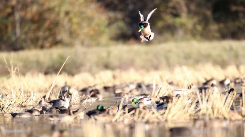
Long Break, More Water Encouraging for Second Portion of Waterfowl Season
Arkansas’s waterfowl hunting season will resume 30 minutes before sunrise Saturday, Dec. 10, and ducks and geese will have had nearly two weeks of mostly quiet on the Arkansas landscape. With this week’s nasty wet weather and ducks perhaps finding more habitat, this 14-day portion of the waterfowl season will open with more promise than the first part did last month.
Public hunting lands are slowly filling up around the state, thanks to some recent weather fronts that have raised water levels, which is typical of the late fall. The big 4- to 6-inch rainfall that waterfowl biologists seek still hasn’t passed our way yet. Weather patterns this week have brought low cloud cover, and at least by Tuesday the Arkansas Game and Fish Commission’s annual December aerial survey had not gotten off the ground. The AGFC’s waterfowl team was scheduled to take to the skies this week to get an estimated statewide count of the waterfowl migration.
The observations from biologist that we spoke with this week have come from the ground. “I’m still hoping to fly one day this week if the weather will just break,” Jason Carbaugh, a waterfowl biologist based in Jonesboro and part of the aerial survey team, said Tuesday. “So far, the clouds are too low.
”I’m not seeing any noteworthy duck concentrations in my daily travels yet. I drove to Earl Buss Bayou DeView WMA (Tuesday) morning. Very little water across the landscape down there and no ducks to speak of yet. I have heard Lake Ashbaugh at Dave Donaldson Black River WMA has a large concentration of ducks, which is usually does this time of year. It usually has more than 20,000 ducks on it this time of year.”
Zach Yancey, an AGFC biologist out of the northeast office with Carbaugh and who checks in on Dave Donaldson WMA, confirmed that “20,000 is probably about right. Lots of pintails, small ducks and a decent amount of mallards.”
Biologist Jessica Homan of the AGFC’s Brinkley Office reported Tuesday seeing about 500 mallards on the Conway George A tract of Sheffield Nelson Dagmar WMA, but that is all she had seen. In the Arkansas River Valley, biologist Alex Zachary said Ed Gordon Point Remove WMA had low to moderate duck use the past week. Water had been low, but now there is at least some water, in George H. Dunklin Bayou Meto WMA, according to Mark Hooks, an AGFC biologist based in Monticello.
Water continues to inches its way up and over moist-soil units in the Steve N. Wilson Raft Creek Bottoms WMA, though it’s still far from easy to navigate the trails to many of the hunting locations. With the White River only at 3.3feet at the Georgetown gauge, there just isn’t a lot of water naturally flowing into the area. The AGFC uses relift pumps to put water into the WMA, and a few areas still have no water. Other favored spots, however, have 100 percent or close water coverage.
For users of Harris Brake WMA in central Arkansas, the upper greentree reservoir has full water coverage, and nearby Harris Brake Lake helps provide the WMA with needed water during waterfowl season. However, the lower GTR’s water control structure recently was damaged, allowing water to drain from the lower greentree reservoir and the structure can’t be fixed at this time. Kevin Lynch, biologist from the Fort Smith office, says that the lower GTR will mostly likely drain completely unless Fourche La Fave overtops the levee and floods the GTR.
So that brings us around to rainfall, and more of it is needed to provide waterfowl with more opportunity to get to the food sources in the moist-soil units and greentree reservoirs, as well as any leftover rice in the fields around the Arkansas Delta.
This portion of the Arkansas waterfowl season will run until sunset Dec. 23. After a two-day closure for the Christmas holiday, the season reopens 30 minutes before sunrise Dec. 26 and continues to its closure of the 60-day full season at sunset Jan. 31.
Permits for Any Hunters Available During the Week in Youth Blinds
The mention above of the Conway George Units in Sheffield Nelson Dagmar WMA reminds us to remind you, the hunter: Last year, the AGFC changed the usage of youth blinds in Sheffield Nelson Dagmar in the three Conway George Units, making them available to ALL HUNTERS not matter the age on Wednesdays each week. They are still permit only and require an application to the permit section of the AGFC website (agfc.com) under “Buy Licenses/Check Game.” And here’s one thing to make sure you avoid confusion. To be able to hunt on Wednesdays, you would have needed to apply like you would for all permits the previous week. Meaning, to hunt at the Conway George Tract on Wednesday, Dec. 21, you need to apply THIS WEEK (3 p.m. Thursday through midnight Sunday). Spots for next Wednesday, Dec. 14, were assigned this past Monday (winners of all permits notified on Monday were told of there plans to WRICE fields, youth blinds and weekend WMA hunts for Saturday and Sunday as well as for any permits into the following week).
We hope this makes sense. In case you need further information, visit the AGFC’s page on all permit hunts.
Permits to hunt the Freddie Black Choctaw Island West Unit WMA youth blinds in southeastern Arkansas also fall under this policy. Weekend youth blind hunting is available at Dagmar, Raft Creek Bottoms and Choctaw Island West Unit.
Hunting on Tuesdays and Thursdays at Raft Creek Bottoms (other than the youth and mobility-impaired blinds and the Magellan Tract, which are online permit only) are available by obtaining a permit onsite at the visitors kiosk. Return your visitors permit to the kiosk before leaving. The area is first-come, first served for hunting locations on those days. On Saturday and Sunday, Raft Creek Bottoms is online permit only.
Red Cut Slough in Cypress Bayou WMA is another permit hunt area, and while most of it has been dry, there are a couple of spots with water. Unit 4 has more than 80 percent coverage.
Avian Flu Cases Call for Continued Hunter Vigilance
Now that hunters will be back in the field starting Saturday with the return of waterfowl season, they are being asked again to maintain a vigilant lookout for any birds that might be infected or suffering from Highly Pathogenic Avian Influenza.
HPAI continues to be a concern for wildlife biologists, especially with much evidence of it seen recently among migrating snow geese and other waterfowl and wintering birds in eastern Arkansas. Hunters, outdoors enthusiasts and wildlife watchers are asked to report instances of dead or sick waterfowl that they encounter in the wild. The risk of humans contracting the disease remains low, but hunters can help further minimize that risk by following a few simple precautions (see below). Anyone who observes concentrations of sick or dead birds should report their sighting by using the AGFC’s Avian Influenza Reporting Form.
More information on avian influenza information is available at AGFC, Ducks Unlimited, and USDA APHIS’s website.
Risk to Humans Is Very Low
The risk for humans to contract HPAI is still very low, and cases where the disease has infected humans came from situations where working conditions caused people to be in close proximity to infected poultry.
As a general precaution, hunters should use good hygiene practices when handling, cleaning and preparing harvested waterfowl.
Safety Guidelines for Hunters:
- Harvest only waterfowl that act and look healthy. Do not handle or eat sick animals.
- Wear disposable gloves when handling and cleaning game and field dress outdoors or in a well-ventilated area. Wash hands thoroughly with soap and water afterward.
- Dispose of unwanted parts in a manner that prevents scavenging by domestic animals and wildlife.
- Thoroughly cook all game to an internal temperature of 165 degrees Fahrenheit before eating it.
- Do not feed pets or domestic animals uncooked portions of waterfowl.
The more concerning risk associated with HPAI is its potential for spillover to domestic poultry.
Agricultural officials urge poultry producers to implement biosecurity measures around their flocks, especially during periods of waterfowl migration, but hunters who have contact with poultry should use extra caution. Avoid contact between poultry and wild birds or their parts. After handling waterfowl, change or clean clothing, shoes and other equipment before coming into contact with poultry, including commercial production facilities and backyard flocks.
Bag Limits
Remember: Daily bag limits are the same as seen in recent years. Hunters make harvest a bag limit of 6 ducks, which may include no more than 4 mallards (2 hens), 1 scaup, 3 wood ducks, 1 pintail, 2 redheads, 2 canvasbacks, 2 black ducks or 1 mottled duck. Beyond those exceptions, the limit is up to 6 ducks of a species, including teal. The merganser daily bag limit is 5, with only 2 hooded mergansers allowed. The daily bag limit for coots is 15. Non-lead shot must be used for waterfowl hunting in Arkansas. The possession limit for ducks, coots and mergansers is three times the daily bag limit. Hunting for geese reopens Dec. 10 as well. The daily bag limit for greater white-fronted geese 3, up from last year’s 2 birds per day. The daily limit for snow, blue and Ross’s geese is 20 per day.
Waterfowl season reopens 30 minutes before sunrise Saturday, Dec. 10. The second closing “split” is for the Christmas holiday, Dec. 24-25, with the final portion of duck season reopening 30 minutes before sunrise Dec. 26. The season closes at sunset Jan. 31.
Northeast Arkansas
Big Lake WMA
Map | Water Gauge | Weather Report
When the Ditch 81 extension gauge near Manila (upstream of the Big Lake north-end control structure) reads 17.5 feet, water is beginning to come over the north levee degrade on Big Lake WMA. When the Ditch 81 Extension gauge reads 18.0 feet or higher, the water level on the WMA will rise quickly and hunters should exercise caution while on the area. Be aware of underwater logs in boat runs and hangers in trees.
North Woods GTR
Habitat: Mast production is good.
Water Level: Gauge reading at BoDoc is 234.8 feet msl; target level is 235.5 feet with 0% flooded.
South Woods GTR
Habitat: Mast production is fair.
Water Level: Gauge reading at 7-Mile is 232.6 feet msl; target level is 234.5 feet with 60% flooded.
Simmons Field
Habitat: Native production is good in the middle and south fields.
Water Level: 0% coverage.
Dave Donaldson Black River WMA
Map | Water Gauge | Weather Report
Waterfowl hunters should be aware of hangers and submerged logs within the boat runs and GTRs. Please exercise caution when accessing the area. Please remember to keep boats off the levees so AGFC personnel can access the area. Boats blocking access will be moved. Unattended trailers are not to be left overnight on parking areas. As of Dec. 5, the current Black River level is 2.8 feet and holding.
Upper Island GTR
Habitat: Mast crop is moderate within the GTRs.
Water Level: Current level is 269.45 feet msl. Target level is 269.5; 95% flooded.
Lower Island GTR
Habitat: Mast crop is moderate within the GTRs.
Water Level: Current level is 268.55. Target level is 268.0; 100% flooded.
Upper Reyno GTR
Habitat: Mast crop is moderate within the GTRs.
Water Level: Current level is 266.95. Target level is 266.9; 100% flooded.
Lower Reyno GTR
Habitat: Mast crop is moderate within the GTRs.
Water Level: Current level is 265.25 feet msl. Target level is 266.3; 95% flooded.
Winchester GTR
Habitat: Mast crop is moderate within the GTRs.
Water Level: Current level is 263.05 ft msl. Target level is 263.7; 40% flooded.
Earl Buss Bayou DeView WMA
Map | Water Gauge | Weather Report
Boaters should use caution while using the Thompson Tract boat run.
South Oliver GTR
Habitat: Mast production is good.
Water Level: 0% flooded.
Thompson Tract GTR
Habitat: Mast production is good.
Water Level: 0% flooded. The Thompson Tract GTR will be allowed to rise and fall naturally without the gates being operated later and partially this season. This action is an effort to help the next generation of forest.
Lake Hogue WRA
Habitat: Primarily deep open water habitat.
Water Level: Normal pool level.
Shirey Bay Rainey Brake WMA
Map | Water Gauge | Weather Report
Waterfowl hunters should be aware of hangers and submerged logs within the boat runs and GTRs. Please exercise caution when accessing the area. In addition, hunters should allow safe passage when parking vehicles along roadsides. Vehicles blocking access will be moved.
Adam Brake GTR
Habitat: Mast production is good.
Water Level: Water level is 238.2 feet msl with a target level of 240.0 feet msl; 45% flooded.
Rainey Brake GTR
Habitat: Mast production is good.
Water Level: 50% flooded.
Eagle Pond GTR
Habitat: Mast production is good.
Water Level: 40% flooded.
Phase III Moist-Soil Unit
Habitat: Fair wetland-type vegetation.
Water Level: 30% flooded.
Charles Crisp Moist-Soil Unit
Habitat: Fair wetland-type vegetation.
Water Level: 0% flooded.
Ward Field Moist-Soil Unit
Habitat: Good wetland-type vegetation.
Water Level: 100% flooded.
River Field Moist-Soil Unit
Habitat: Good wetland-type vegetation.
Water Level: 100% flooded.
St. Francis Sunken Lands WMA
Map | Water Gauge | Weather Report
Hunt Area
Habitat: Good mast production within the hunt area.
Water Level: Water levels on St. Francis Sunken Lands for waterfowl season are dependent on flows from the St. Francis River. The target level for providing huntable timber is 212.0 feet msl at the Oak Donnick gauge. Current reading is 211.80 feet msl.
Snowden WRA
Habitat: Mixed grasses.
Water Level: 0% flooded.
Payneway WRA
Habitat: A, B, C and D pools have mixed smartweed and barnyard grasses. Moderate mast is available within pools A, B and C as well.
Water Level: Pool A is at 0% coverage. Pool B is at 0%. Pool C is at 0%. Pool D is at 0%.
East-Central Arkansas
Henry Gray Hurricane Lake WMA
Map | Water Gauge | Weather Report
Hunters should call the Wildlife Hotline at 800-440-1477 for current road closures.
North Unit
Habitat: Good mast crop.
Water Level: The White River at Augusta as of Tuesday, Dec. 5, was 16.11 feet and falling. The water level at Glaise Creek was not available from the USGS. All structures on the North GTR will remain open during the 2022-23 season.
South Unit
Habitat: Fair mast crop.
Water Level: The White River at Augusta is 16.11 feet and falling. The water level at Glaise Creek was not available from the USGS. All structures on the South Unit are open.
Rex Hancock Black Swamp WMA
Map | Water Gauge | Weather Report
Hunters should call the Wildlife Hotline at 800-440-1477 for current road closures.
Gregory GTR
Habitat: Good mast crop.
Water Level: Little water available (Cache River at Patterson was at 3.23 feet on Dec. 5.)
Wiville Moist-Soil Unit
Habitat: Good stand of native vegetation.
Water Level: 75% flooded.
Sheffield Nelson Dagmar WMA
Map | Water Gauge | Weather Report
The Conway George units are currently available for hunting by applying for online permits. Youths may apply for Saturday and Sunday hunts in the Conway George tracts, with one adult hunter allowed per one youth, up to four hunters in the blind. Hunters of any age may apply for Wednesday permit hunts in the Conway George tracts. Please visit www.agfc.com for maps, special regulations, permit application and draw dates. Hunters should call the Wildlife Hotline at 800-440-1477 for current road closures. The AGFC will not be putting boards in at Dagmar. Water coverage is dependent on river level.
Mud Slough GTR
Habitat: Good mast crop.
Water Level: 10% coverage.
Apple Lake WRA (no hunting)
Habitat: Good mast crop.
Water Level: 10% coverage.
Conway George Waterfowl Unit A
Habitat: Good stand of native vegetation.
Water Level: 90% coverage
Conway George Waterfowl Unit B
Habitat: Natural slough area with beneficial native wetland plants.
Water Level: 60% coverage
Conway George Waterfowl Unit C
Habitat: Good stand of native vegetation.
Water Level: 10% coverage
Dark Corner Waterfowl Unit 1
Habitat: Good stand of native vegetation.
Water Level: 80% coverage
Dark Corner Waterfowl Unit 2
Habitat: Good stand of native vegetation.
Water Level: 50% coverage
Dark Corner Waterfowl Unit 3
Habitat: Good stand of native vegetation.
Water Level: 0% coverage
Steve N. Wilson Raft Creek Bottoms WMA
Hunting in Raft Creek Bottoms WMA requires participation on the online draw a week before the following weekend’s hunt. There is no online draw on Tuesdays and Thursdays, and permits are available at the boat accesses. Permits ARE required (via online application) on weekends, Tuesdays and Thursdays for the youth and mobility-impaired blinds and for the Magellan Tract. Visit agfc.com to apply for the online draw. There will be no designated holes this season.
The White River gauge at Georgetown on Tuesday, Dec. 6, was 3.3 feet and falling.
Unit A
Habitat: Excellent stand of native vegetation.
Water Level: 100% coverage.
Unit B
Habitat: Excellent stand of millet and native vegetation.
Water Level: 75%
Unit C
Habitat: Good stand of native vegetation.
Water Level: 90%
Unit D
Habitat: Good stand of native vegetation.
Water Level: 85%
Unit E
Habitat: Excellent stand of millet and native vegetation.
Water Level: 65%
Unit F (Youth Area)
Habitat: Good stand of millet and native vegetation.
Water Level: 100%
Unit G
Habitat: Habitat conditions are poor.
Water Level: 0%
Unit H (Mobility-impaired blind)
Habitat: Excellent stand of native vegetation.
Water Level: 100%
Unit I
Habitat: Habitat conditions are poor.
Water Level: 0%
Unit J (Cypert Tract)
Habitat: Excellent stand of native vegetation.
Water Level: 50%
Unit K (Cypert Tract)
Habitat: Excellent stand of native vegetation.
Water Level: 3%
Unit L (Cypert Tract)
Habitat: Fair stand of native vegetation.
Water Level: 0%
Unit M (Magellan Tract)
Habitat: Good stand of native vegetation.
Water Level: 100%
Central Arkansas
Bell Slough WMA
Map | Weather Report
The Bell Slough GTR is primarily rainfall dependent with the exception of a limited amount of water that the AGFC can back in and catch from Palarm Creek.
Bell Slough GTR
Habitat: Fair mast crop.
Water Level: 10%.
Palarm Creek WRA
Habitat: Rest area was heavily disked late this year and millet crop did not take before the early frost.
Water Level: 60%
Craig D. Campbell Lake Conway Reservoir
Map | Weather Report
Habitat and water levels are normal on both Pierce and Dix creeks.
Cypress Bayou WMA
Hunt Area
Habitat:
Good mast crop.
Water Level: 5% coverage.
Red Cut Slough Tract
Unit 1
Habitat:
Habitat conditions are poor.
Water Level: 2%
Unit 2
Habitat:
Excellent stand of millet and native vegetation
Water Level: 0%
Unit 3
Habitat:
Good stand of millet and native vegetation
Water Level: 0%
Unit 4
Habitat: Good stand of millet and native vegetation.
Water Level: 80%
Unit 5
Habitat:
Good stand of native vegetation.
Water Level: 0%
Unit 6
Habitat:
Good stand of native vegetation.
Water Level: 80%
Harris Brake WMA
Upper GTR
Habitat: Good mast crop.
Water Level: Full pool.
Lower GTR
Habitat: Good mast crop.
Water Level: 45% coverage. The Harris Brake Lake valve was opened Nov. 15 to begin supplemental flooding of both the Lower and Upper GTRs. Unfortunately, damage to one of the Lower GTR’s water control structure is allowing water to drain from the Lower GTR and can’t currently be fixed. The Lower GTR will mostly likely drain completely unless the Fourche La Fave overtops the levee and floods the GTR.
Holland Bottoms WMA
Hunt Area
Habitat: Good mast crop.
Water Level: Some sloughts on the WMA are starting to be refilled with rainwater.
Lake Pickthorne WRA (no hunting)
Habitat: Excellent crop of native vegetation and millet.
Water Level: The West Unit is 80% flooded.
Northwest Arkansas
Dardanelle WMA
McKennon Bottoms (half-day hunting)
Habitat: Good stand of native moist-soil vegetation.
Water Level: 100% coverage
Potter’s Pothole Hartman Waterfowl Unit (half-day hunting)
Habitat: West cell has a poor stand of moist-soil vegetation. East cell has an average stand of moist-soil vegetation.
Water Level: 190% coverage
Ed Gordon Point Remove WMA
Pumping of waterfowl impoundments began Oct. 31 and will continue as water levels in Point Remove Creek allow. Duck Use on the WMA has been low to moderate.
Little Hole (Unit 1)
Habitat: Japanese millet.
Water Level: 10% flooded.
Willow Island (Unit 2)
Habitat: Japanese millet and natural vegetation.
Water Level: 100%
Red Gate (Unit 3)
Habitat: Natural vegetation
Water Level: 70%
Pig Trough (Units 4 and 5)
Habitat: Natural vegetation.
Water Level: 70%
Cedar Ridge (Unit 6)
Habitat: Japanese millet.
Water Level: 75%
Unit 7a
Habitat: Natural vegetation.
Water Level: 80%
Unit 7b
Habitat: Japanese millet and natural vegetation.
Water Level: 0%
Duck Trap (Units 8a, 8b and 8c)
8a
Habitat: Natural vegetation and Japanese millet.
Water Level: 0%
8b
Habitat: Japanese millett and natural vegetation.
Water Level: 70%
8c
Habitat: Natural vegetation.
Water Level: 25%
Unit 9
Habitat: Natural vegetation.
Water Level: 70%
Controversy Corner (Unit 10)
Habitat: Natural vegetation.
Water Level: 75%
Remmel Marsh
Habitat: Natural vegetation.
Water Level: 80%
Mud Pond (Unit 12)
Habitat: Natural vegetation and Japanese millet.
Water Level: 50%
Turkey Pond (Units 13a, 13b and 13c)
13a
Habitat: Natural vegetation and Japanese millet.
Water Level: 50%
13b
Habitat: Natural vegetation.
Water Level: 0%
13c
Habitat: Natural vegetation and Japanese millet.
Water Level: 70%
Teeny Pond (Unit 14)
Habitat: Natural vegetation.
Water Level: 0%
Salt Lick (Unit 15)
Habitat: Natural vegetation.
Water Level: 60%
Bobby’s Pond (Unit 16)
Habitat: Natural vegetation.
Water Level: 50%
Race Track (Unit 17)
Habitat: Natural vegetation.
Water Level: 80%
Frog Bayou WMA
Due to the dry summer, several units have been fallow-disked in preparation for next season.
Unit 1
Habitat: Good stand of moist-soil vegetation in the upper end, while lower end has been fallow-disked.
Water Level: 100% coverage
Unit 2
Habitat: Has been fallow-disked. Unit is rainfall dependent.
Water Level: 100% flooded.
Unit 3
Habitat: Average stand of moist-soil vegetation on the upper end; lower end has been fallow-disked.
Water Level: 100%
Unit 4
Habitat: Good stand of moist-soil vegetation and planted millet
Water Level: 100%
Unit 5
Habitat: Good stand of moist-soil vegetation on the upper end; lower end has been planted with Japanese millet.
Water Level: 100%
Unit 6
Habitat: Good stand of moist-soil vegetation. Lower end has been fallow-disked.
Water Level: 50% and pumping.
Unit 7
Habitat: Good stand of moist-soil vegetation.
Water Level: 100%
Galla Creek WMA
Galla Creek GTR
Habitat: Good stands of native vegetation and Japanese millet. The area is stage-flooded in thirds, and the gate has been raised during the first third flooding. The gate will be raised again Dec. 1 and the final time around Jan. 1.
Water Level: 40% flooded.
Nimrod Lloyd Millwood WMA
Nimrod GTR
Habitat: The red oak mast crop is moderate this year as well as the desirable native vegetation growth. Due to abnormally dry conditions, this area is not expected to fill up as fast as in previous years. The water control structures were closed Nov. 15.
Water Level: 15% flooded. Flooding of the area is rainfall dependent.
Ozark Lake WMA/Dyer Lake Water Unit
Dyer Lake Cells
Unit 1 Dyer main cell
Habitat: Good stand of moist-soil vegetation.
Water Level: 100% coverage for both units
Unit 2 Dyer Road Cell
Habitat: Poor stand of moist-soil vegetation due to dry conditions over the summer.
Water Level: 100% coverage
Unit 3 South Cell
Habitat: Good stand of moist-soil vegetation and volunteer millet
Water Level: 10% coverage
Unit 4 West Cell (rainfall dependent)
|Habitat: Good stand of moist-soil vegetation and volunteer millet.
Water Level: 5% coverage
Petit Jean River WMA
Map | Water Gauge | Weather Report
Sorehead Moist-Soil Unit
Habitat: This unit was able to grow a great stand of desirable native vegetation this year. The Kingfisher Lake water control structure valve was opened Nov. 15 to help flood this area.
Water Level: 100%
Blacklands Moist-Soil Unit
Habitat: The red oak mast crop is moderate this year as well as the desirable native vegetation growth. Millet planting was attempted this year, but the dry conditions prevented growth. The recent rains have put enough water in the river to start pumping last week.
Water Level: 100%.
Slaty Crossing Moist-Soil Unit
Habitat: Due to ongoing waterfowl habitat enhancement projects, this unit was not able to grow a desirable native vegetation crop or millet crop this year. The recent rains have put enough water in the river to start pumping last week.
Water Level: 100%
Blacklands Duck Area
Habitat: The red oak mast crop is moderate this year as well as the desirable native vegetation growth. Millet planting was attempted this year, but the dry conditions prevented growth. The Kingfisher Lake water control structure valve was to be opened Nov. 15 to help flood the area.
Water Level: 100%
Pullen Pond Marsh
Habitat: Due to ongoing waterfowl habitat enhancement projects, parts of the central section and western section of this area is bare ground. Most of the area has a great stand of desirable native vegetation. Flooding of the area is rainfall dependent. The water control structures were closed on Nov. 4.
Water Level: 10%.
Pond Creek GTR
Habitat: The red oak mast crop is moderate this year as well as the desirable native vegetation growth. Due to abnormally dry conditions, this area is not expected to fill up as fast as in previous years. The water control structures were closed Nov. 15.
Water Level: 5%. Flooding of this area is rainfall dependent.
Slaty GTR
Habitat: The red oak mast crop is moderate this year. Due to abnormally dry conditions, this area is not expected to fill up fast as in previous years. The water control structures were closed Nov. 16.
Water Level: 5%. Flooding of this area is rainfall dependent.
Santa Fe GTR
Habitat: The red oak mast crop is moderate this year as well as the desirable native vegetation growth. Due to abnormally dry conditions, this area is not expected to fill up as fast as in previous years. The water control structures were closed Nov. 15.
Water Level: 5%. Flooding of this area is rainfall dependent.
Southwest Arkansas
Dr. Lester Sitzes III Bois d’Arc WMA
Bois d’Arc Lake WRA
Habitat: Closed to hunting.
Water Level: Normal
Red Slough WRA
Habitat: Closed to hunting.
Water Level: 90% coverage.
GTR
Habitat: Good mast production.
Water Level: 30% (flooding began Dec. 1).
Little Grassy
Habitat: Good
Water Level: 75%
Millwood Lake
Map | Water Gauge | Weather Report
Habitat: Habitat conditions are good.
Water Level: Millwood was at 260.01 feet msl as of Dec. 5.
Ozan WMA
Flooding of all units is rainfall dependent.
Unit 1
Habitat: Good
Water Level: 0%
Unit 2
Habitat: Good
Water Level: 0%
Unit 3
Habitat: Good
Water Level: 0%
Unit 4
Habitat: Good
Water Level: 0%
Unit 5
Habitat: Good
Water Level: 0%
Sulphur River WMA
Mercer Bayou
Habitat: Fair
Water Level: 75%
Henry Moore WRA
Habitat: Closed to hunting.
Water Level: 30%
Southeast Arkansas
Beryl Anthony Lower Ouachita WMA
Map | Weather Report
Water Level: No duck hunting water. Water is available in the oxbow lakes located in the WMA.
Cut-Off Creek WMA
Map | Weather Report
Hunt Area
Habitat: Habitat conditions are good.
Water Level: No huntable water.
Pigeon Creek WRA
Habitat: Habitat conditions are good.
Water Level: Pumping as water conditions allow.
Freddie Black Choctaw Island WMA Deer Research Area
Map | Water Gauge | Weather Report
Habitat conditions are good. Flooding is river dependent. Click on the Water Gauge link above for current Mississippi River levels. Use extreme caution when boating in the river.
The Freddie Black Choctaw Island WMA West Unit allows weekend permit hunting for youths (one adult per youth hunter); on Wednesdays, all ages may apply for a permit to hunt the blinds in the West Unit.
George H. Dunklin Jr. Bayou Meto WMA
Map | Water Gauge | Weather Report
The UGSG is reporting real-time water gauge readings at the headwater at each GTR within the George H. Dunklin Bayou Meto WMA. Click the Water Gauge link above for the WMA, and search for the particular GTR as noted.
NOTE: During the 2022-23 wintering period, all intentional flooding will be held at 178.5 feet msl, an elevation that will relieve stress on many trees such as red oaks that are showing signs of distress. Rain and increased flow into the WMA will allow water to rise above that level periodically. A good rule of thumb for comparing water levels to access into Bayou Meto: 176 feet msl – water breaking into sloughs and lower ditches; 177-177.5 feet msl – water beginning to break out of sloughs and lower ditches; 178 feet msl – water in most sloughs and ditches and entering into lower elevations in woods; 178.5 feet msl – most ditches and sloughs deep enough to boat and most boat ramps become serviceable; 179 feet msl or above – water expands to the higher elevations.
Upper Vallier GTR
Habitat: Good
Water Level: See Gauge Link (Upper Vallier Headwater) for updated info.
Lower Vallier GTR
Habitat: Good
Water Level: See Gauge Link (Lower Vallier Headwater) for updated info.
Government Cypress GTR
Habitat: Good
Water Level: See Gauge Link (Government Cypress Headwater) for updated info.
Buckingham Flats GTR
Habitat: Good
Water Level: See Gauge Link (Buckingham Flats Headwater) for updated info.
Temple Island GTR
Habitat: Good
Water Level: See Gauge Link (Temple Island Headwater) for updated info.
Canon Brake
Habitat: Good
Water Level: See Gauge Link (Canon Brake Headwater) for updated info.
Halowell WRA
Habitat: Excellent
Water Level: Staggered flooding of units.
Wrape Plantation WRA
Habitat: Excellent
Water Level: Staggered flooding of units.
Seven Devils WMA
Hunt Area
Habitat: Habitat conditions are good.
Water Level: No huntable water.
Trusten Holder WMA
Map | Water Gauge | Weather Report
Habitat conditions are good. Flooding is river dependent. Click on the Water Gauge link above for current Arkansas River levels.
Recent News
AGFC Commissioner Meeting Notice
Jul. 15, 2025

Arkansas Wildlife Weekly Fishing Report
Jul. 10, 2025
Subscribe to Our Weekly Newsletter E-mails
Don’t miss another issue. Sign up now to receive the AGFC Wildlife Weekly Newsletter in your mailbox every Wednesday afternoon (Waterfowl Reports are published weekly during waterfowl season and periodically outside the season). Fishing Reports arrive on Thursdays. Fill in the following fields and hit submit. Thanks, and welcome!