Arkansas Wildlife Weekly Waterfowl Report
BY Jim Harris
ON 11-30-2022
Nov. 30, 2022
Jim Harris
Managing Editor Arkansas Wildlife Magazine
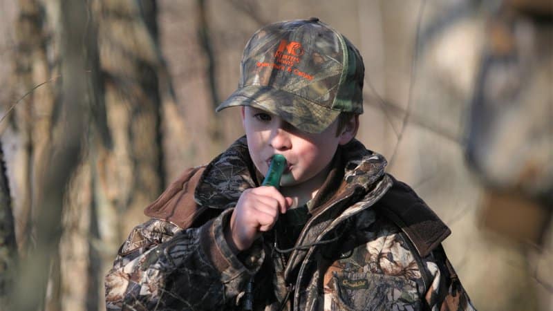
Youth, Veterans and Active Military Have Day to Themselves
Saturday, Dec. 3, is the first of two days this season specifically dedicated to waterfowl hunting for youths, armed forces veterans and active duty military in Arkansas. The regular duck hunting season is closed to the rest of the hunting public until Saturday, Dec. 10, one of two splits in Arkansas’s 60-day season.
Youths 15 and under were allowed to apply for a WRICE hunting permit last week to hunt one of the several dozen fields available throughout the Delta region, as well as the regular youth blinds that are made available by permit for hunting in Steve N. Wilson Raft Creek Bottoms WMA and Sheffield Nelson Dagmar WMA. Without those permits, youths still have plenty of public land options at all of the AGFC’s land managed for waterfowl (see the habitat conditions and water levels below). And just like the youths, veterans and active military can enjoy public or private land hunting all-day Saturday (WMAs typically require hunters off the water by midday, but on Saturday the cutoff is sunset). Hunting is open to ducks, geese, mergansers and coots statewide and all applicable daily bag limits apply.
Youths who have not completed the Hunter Education course may take along a mentor 21 and over who may call and help retrieve the ducks but cannot hunt.
Planning ahead for next week, youths will want to make sure to apply for the available WMA youth blind permits at Raft Creek and Dagmar between Thursday evening and Sunday at midnight. All hunters will want to make their plans for the reopening of the season and apply THIS WEEK for WRICE permits and WMA permits, which are awarded Monday after the application period.
Visit https://www.agfc.com/en/hunting/migratory-birds/waterfowl/special-waterfowl-permit-hunts/ for more information and links to the permit application site. All applications are $5.
The date for the second Special Youth Waterfowl Hunt and Special Active Duty Military and Veterans Hunt is Feb. 4. This will be the last year in the forseeable future for separate special hunt days spread out during the early and late parts of the waterfowl season. With next year’s change in the start of the 60-day season in Arkansas, the special hunt days will move to a Saturday and Sunday following the regular season, Feb. 2-3, 2024.
Members of active duty military and military veterans may harvest ducks, geese, coots and mergansers. Active duty military includes members of the National Guard and Reserves on active duty (other than for training). Veterans must have served in active military, naval, air service or Reserves and National Guard on Title 32 orders in a combat zone and must have been discharged or released under Honorable conditions. Hunters will need to have an active hunting license and stamps and one of the following or copy during the hunt: DD214, Veteran Benefit Card, Retired Military I.D., Veteran Hunting License (VLF, VLH, VLC or VLL) or Military I.D. card. While WMA General Use Permits are not required for youth hunters, veterans and active military must have a WMA permit, available for free on the agfc.com website under “Buy Licenses/Check Game.”
Hunter Viligance Urged as Avian Flu Cases Grow
LITTLE ROCK — Highly Pathogenic Avian Influenza continues to be a concern for wildlife biologists, especially with much evidence of it seen over the past week among migrating snow geese in eastern Arkansas, and hunters are urged to continue to be vigilant and report instances of dead or sick waterfowl that they encounter in the wild. The risk of humans contracting the disease remains low, but hunters can help further minimize that risk by following a few simple precautions (see below).
While the Arkansas waterfowl season is in the first “split” closure for the next week, through Dec. 9, outdoors enthusiasts, landowners and wildlife watchers (and the youth and veteran or active military hunters who are out hunting Saturday) who observe concentrations of sick or dead birds should report their sighting by using the AGFC’s Avian Influenza Reporting Form.
More information on avian influenza information is available at AGFC, Ducks Unlimited, and USDA APHIS’s website.
Risk to Humans Is Very Low
The risk for humans to contract HPAI is still very low, and cases where the disease has infected humans came from situations where working conditions caused people to be in close proximity to infected poultry.
As a general precaution, hunters should use good hygiene practices when handling, cleaning and preparing harvested waterfowl.
Safety Guidelines for Hunters:
- Harvest only waterfowl that act and look healthy. Do not handle or eat sick animals.
- Wear disposable gloves when handling and cleaning game and field dress outdoors or in a well-ventilated area. Wash hands thoroughly with soap and water afterward.
- Dispose of unwanted parts in a manner that prevents scavenging by domestic animals and wildlife.
- Thoroughly cook all game to an internal temperature of 165 degrees Fahrenheit before eating it.
- Do not feed pets or domestic animals uncooked portions of waterfowl.
The more concerning risk associated with HPAI is its potential for spillover to domestic poultry.
Agricultural officials urge poultry producers to implement biosecurity measures around their flocks, especially during periods of waterfowl migration, but hunters who have contact with poultry should use extra caution. Avoid contact between poultry and wild birds or their parts. After handling waterfowl, change or clean clothing, shoes and other equipment before coming into contact with poultry, including commercial production facilities and backyard flocks.
Mississippi Numbers; AGFC Takes to Sky
Total ducks in the state of Mississippi’s Delta waterfowl count were the lowest count in November since 2015. Mississippi’s Delta region has averaged 264,105 ducks in the November survey over the past 15 years, but this November’s survey (Nov. 14-18) showed an abundance of 182,069 total ducks, the lowest figure since the 142,802 estimated in November 2015, according to the Mississippi Department of Fisheries, Wildlife and Parks. This year’s estimate is almost identical to the total counted in November 2010. At this time last year, aerial observers in the Mississippi Delta were seeing 242,344 total ducks., meaning almost a 25 percent dropoff this November.
Arkansas waterfowl hunters anecdotally might concur with those figures on the Arkansas side of the big river. The AGFC’s duck biologists will be out getting a full estimate of the state next week in the annual December Aerial Survey. Results of that survey should be available the week beginning Dec. 12.
Mallards made up just a small fraction of Mississippi’s total Delta count in November, with 33,149 estimated. This was actually up from last year’s 27,462 estimate for November 2021 and better than two of the past four years’ counts. This region’s best estimate in November came in 2017, when a half-million ducks were estimated, including 88,000 mallards. No count has come close since.
Mississippi’s season opened Nov. 25, six days after Arkansas’s opening day.
Houston Havens and Darrin Hardesty, biologists for the MDFWP, prepared the report and said: “Similar to last November, wetland habitat availability was well below average across the Mississippi Delta. Shallow, seasonal water was not widely distributed, which is typical for this time of year in Mississippi However, permanent and semi-permanent wetlands like oxbow lakes and sloughs also held very low water levels. Public lands are currently providing a large proportion of intensively managed waterfowl habitat. As a result, waterfowl were observed responding to these areas, often in high humbers relative to the rest of the Deta …
“As a result of the dry fall, most harvested agricultural fields have been disked, which will result in reduced food availability for waterfowl if the fields are eventually flooded …
“Gadwall and mallards were the two most abundant duck species observed overall … During this survey, mallards and other dabbling ducks were most commonly observed using shallowly flooded agricultural fields, likely due to the below-freezing temperatures creating a need for higher carbohydrate intake for quick energy sources. It should be noted that very few agricultural fields were flooded during this survey, but available flooded fields were highly attractive to ducks … (D)ucks were observed together in relatively large groups, which is typical of early-season behavior in areas with managed complexes of diverse wetland habitat. “
ANRC Seeks More Funding for Water Problems
In news that should be of interest to waterfowl hunters and landowners, and in light of the drought conditions of late and the possibility of similar longterm droughts in coming years, the Arkansas Natural Resources Commission will hold a meeting on Friday (Dec. 2) to approve American Rescue Plan Act funding to help address statewide water needs.
Last year, Gov. Asa Hutchinson created a Water and Other Infrastructure Working Group to assist the Arkansas ARPA Steering Committee in identifying water infrastructure projects. The working group conducted a needs survey that identified more than $5 billion in water, wastewater and stormwater needs across the state. On Sept. 16 the Arkansas Legislative Council approved $270 million in ARPA funding to address water, wastewater and stormwater needs across the state. The application period for funding was Sept 16-Nov. 4. More than 880 applications were submitted and scored by a review committee.
Friday’s meeting will be held at 9:30 a.m. at the Arkansas Department of Agriculture and will be live-streamed myarkansaspbs.org/arcan/home.
Additional information on the grant program can be found at agriculture.arkansas.gov/<wbr></wbr>american-rescue-plan-funding-<wbr></wbr>water-and-wastewater-grant-<wbr></wbr>program/. A list of awarded projects will be available after the commission meeting.
Bag Limits
Remember: Daily bag limits are the same as seen in recent years. Hunters make harvest a bag limit of 6 ducks, which may include no more than 4 mallards (2 hens), 1 scaup, 3 wood ducks, 1 pintail, 2 redheads, 2 canvasbacks, 2 black ducks or 1 mottled duck. Beyond those exceptions, the limit is up to 6 ducks of a species, including teal. The merganser daily bag limit is 5, with only 2 hooded mergansers allowed. The daily bag limit for coots is 15. Non-lead shot must be used for waterfowl hunting in Arkansas. The possession limit for ducks, coots and mergansers is three times the daily bag limit. Hunting for geese reopens Dec. 10 as well. The daily bag limit for greater white-fronted geese 3, up from last year’s 2 birds per day. The daily limit for snow, blue and Ross’s geese is 20 per day.
Waterfowl season reopens 30 minutes before sunrise Saturday, Dec. 10. The second closing “split” is for the Christmas holiday, Dec. 24-25, with the final portion of duck season reopening 30 minutes before sunrise Dec. 26. The season closes at sunset Jan. 31.
Northeast Arkansas
Big Lake WMA
Map | Water Gauge | Weather Report
When the Ditch 81 extension gauge near Manila (upstream of the Big Lake north-end control structure) reads 17.5 feet, water is beginning to come over the north levee degrade on Big Lake WMA. When the Ditch 81 Extension gauge reads 18.0 feet or higher, the water level on the WMA will rise quickly and hunters should exercise caution while on the area. Be aware of underwater logs in boat runs and hangers in trees.
North Woods GTR
Habitat: Mast production is good.
Water Level: Gauge reading at BoDoc is 234.6 feet msl; target level is 235.5 feet with 0% flooded.
South Woods GTR
Habitat: Mast production is fair.
Water Level: Gauge reading at 7-Mile is 232.2 feet msl; target level is 234.5 feet with 0% flooded.
Simmons Field
Habitat: Native production is good in the middle and south fields.
Water Level: 0% coverage.
Dave Donaldson Black River WMA
Map | Water Gauge | Weather Report
Waterfowl hunters should be aware of hangers and submerged logs within the boat runs and GTRs. Please exercise caution when accessing the area. Please remember to keep boats off the levees so AGFC personnel can access the area. Boats blocking access will be moved. Unattended trailers are not to be left overnight on parking areas. As of Nov. 15, the current Black River level is 2.32 feet and falling.
Upper Island GTR
Habitat: Mast crop is moderate within the GTRs.
Water Level: Current level is 269.35 feet msl. Target level is 269.5; 90% flooded.
Lower Island GTR
Habitat: Mast crop is moderate within the GTRs.
Water Level: Water level is below the gauge. Target level is 268.0; 30% flooded.
Upper Reyno GTR
Habitat: Mast crop is moderate within the GTRs.
Water Level: Current level is 265.5. Target level is 266.9; 20% flooded.
Lower Reyno GTR
Habitat: Mast crop is moderate within the GTRs.
Water Level: Current level is 265.1 feet msl. Target level is 266.3; 10% flooded.
Winchester GTR
Habitat: Mast crop is moderate within the GTRs.
Water Level: Water level is below the readable gauge. Target level is 263.7; 0% flooded.
Earl Buss Bayou DeView WMA
Map | Water Gauge | Weather Report
Boaters should use caution while using the Thompson Tract boat run.
South Oliver GTR
Habitat: Mast production is good.
Water Level: 0% flooded.
Thompson Tract GTR
Habitat: Mast production is good.
Water Level: 0% flooded. The Thompson Tract GTR will be allowed to rise and fall naturally without the gates being operated later and partially this season. This action is an effort to help the next generation of forest.
Lake Hogue WRA
Habitat: Primarily deep open water habitat.
Water Level: Normal pool level.
Shirey Bay Rainey Brake WMA
Map | Water Gauge | Weather Report
Waterfowl hunters should be aware of hangers and submerged logs within the boat runs and GTRs. Please exercise caution when accessing the area. In addition, hunters should allow safe passage when parking vehicles along roadsides. Vehicles blocking access will be moved.
Adam Brake GTR
Habitat: Mast production is good.
Water Level: Water level is 238.1 feet msl with a target level of 240.0 feet msl; 35% flooded.
Rainey Brake GTR
Habitat: Mast production is good.
Water Level: 20% flooded.
Eagle Pond GTR
Habitat: Mast production is good.
Water Level: 0% flooded.
Phase III Moist-Soil Unit
Habitat: Fair wetland-type vegetation.
Water Level: 30% flooded.
Charles Crisp Moist-Soil Unit
Habitat: Fair wetland-type vegetation.
Water Level: 0% flooded.
Ward Field Moist-Soil Unit
Habitat: Good wetland-type vegetation.
Water Level: 80% flooded.
River Field Moist-Soil Unit
Habitat: Good wetland-type vegetation.
Water Level: 90% flooded.
St. Francis Sunken Lands WMA
Map | Water Gauge | Weather Report
Hunt Area
Habitat: Good mast production within the hunt area.
Water Level: Water levels on St. Francis Sunken Lands for waterfowl season are dependent on flows from the St. Francis River. The target level for providing huntable timber is 212.0 feet msl at the Oak Donnick gauge. Current reading is 212.11 feet msl.
Snowden WRA
Habitat: Mixed grasses.
Water Level: 0% flooded.
Payneway WRA
Habitat: A, B, C and D pools have mixed smartweed and barnyard grasses. Moderate mast is available within pools A, B and C as well.
Water Level: Pool A is at 0% coverage. Pool B is at 0%. Pool C is at 0%. Pool D is at 0%.
East-Central Arkansas
Henry Gray Hurricane Lake WMA
Map | Water Gauge | Weather Report
Hunters should call the Wildlife Hotline at 800-440-1477 for current road closures.
North Unit
Habitat: Good mast crop.
Water Level: The White River at Augusta as of Wednesday, Nov. 23, was 15.85 feet and falling. The water level at Glaise Creek was not available from the USGS. All structures on the North GTR will remain open during the 2022-23 season.
South Unit
Habitat: Fair mast crop.
Water Level: The White River at Augusta is 15.85 feet and falling. The water level at Glaise Creek was not available from the USGS. All structures on the South Unit are open.
Rex Hancock Black Swamp WMA
Map | Water Gauge | Weather Report
Hunters should call the Wildlife Hotline at 800-440-1477 for current road closures.
Gregory GTR
Habitat: Good mast crop.
Water Level: Little water available (Cache River at Patterson was at 3.11 feet on Nov. 22.)
Wiville Moist-Soil Unit
Habitat: Good stand of native vegetation.
Water Level: Little water available
Sheffield Nelson Dagmar WMA
Map | Water Gauge | Weather Report
The Conway George units are currently available for hunting by applying for online permits. Youths may apply for Saturday and Sunday hunts, with one adult hunter allowed per one youth, up to four hunters in the blind. Please visit www.agfc.com for maps, special regulations, permit application and draw dates. Hunters should call the Wildlife Hotline at 800-440-1477 for current road closures. The AGFC will not be putting boards in at Dagmar. Water coverage is dependent on river level.
Mud Slough GTR
Habitat: Good mast crop.
Water Level: 10% coverage.
Apple Lake WRA (no hunting)
Habitat: Good mast crop.
Water Level: 10% coverage.
Conway George Waterfowl Unit A
Habitat: Good stand of native vegetation.
Water Level: 90% coverage
Conway George Waterfowl Unit B
Habitat: Natural slough area with beneficial native wetland plants.
Water Level: 60% coverage
Conway George Waterfowl Unit C
Habitat: Good stand of native vegetation.
Water Level: 0% coverage
Dark Corner Waterfowl Unit 1
Habitat: Good stand of native vegetation.
Water Level: 80% coverage
Dark Corner Waterfowl Unit 2
Habitat: Good stand of native vegetation.
Water Level: 75% coverage
Dark Corner Waterfowl Unit 3
Habitat: Good stand of native vegetation.
Water Level: 0% coverage
Steve N. Wilson Raft Creek Bottoms WMA
Hunting in Raft Creek Bottoms WMA requires participation on the online draw a week before the following weekend’s hunt. There is no online draw on Tuesdays and Thursdays, and permits are available at the boat accesses. Permits ARE required (via online application) on weekends, Tuesdays and Thursdays for the youth and mobility-impaired blinds and for the Magellan Tract. Visit agfc.com to apply for the online draw. There will be no designated holes this season.
The White River gauge at Georgetown on Wednesday, Nov. 30, was 2.9 feet and holding steady.
Map | Water Gauge | Weather Report
Unit A
Habitat: Excellent stand of native vegetation.
Water Level: 75% coverage.
Unit B
Habitat: Excellent stand of millet and native vegetation.
Water Level: 50%
Unit C
Habitat: Good stand of native vegetation.
Water Level: 20%
Unit D
Habitat: Good stand of native vegetation.
Water Level: 85%
Unit E
Habitat: Excellent stand of millet and native vegetation.
Water Level: 65%
Unit F (Youth Area)
Habitat: Good stand of millet and native vegetation.
Water Level: 100%
Unit G
Habitat: Habitat conditions are poor.
Water Level: 0%
Unit H (Mobility-impaired blind)
Habitat: Excellent stand of native vegetation.
Water Level: 100%
Unit I
Habitat: Habitat conditions are poor.
Water Level: 0%
Unit J (Cypert Tract)
Habitat: Excellent stand of native vegetation.
Water Level: 30%
Unit K (Cypert Tract)
Habitat: Excellent stand of native vegetation.
Water Level: 3%
Unit L (Cypert Tract)
Habitat: Fair stand of native vegetation.
Water Level: 0%
Unit M (Magellan Tract)
Habitat: Good stand of native vegetation.
Water Level: 100%
Central Arkansas
Bell Slough WMA
Map | Weather Report
The Bell Slough GTR is primarily rainfall dependent with the exception of a limited amount of water that the AGFC can back in and catch from Palarm Creek.
Bell Slough GTR
Habitat: Fair mast crop.
Water Level: 5%.
Palarm Creek WRA
Habitat: Rest area was heavily disked late this year and millet crop did not take before the early frost.
Water Level: 40%
Craig D. Campbell Lake Conway Reservoir
Map | Weather Report
Habitat and water levels are normal on both Pierce and Dix creeks.
Cypress Bayou WMA
Hunt Area
Habitat:
Good mast crop.
Water Level: 5% coverage.
Red Cut Slough Tract
Unit 1
Habitat:
Habitat conditions are poor.
Water Level: 2%
Unit 2
Habitat:
Excellent stand of millet and native vegetation
Water Level: 0%
Unit 3
Habitat:
Good stand of millet and native vegetation
Water Level: 0%
Unit 4
Habitat: Good stand of millet and native vegetation.
Water Level: 10%
Unit 5
Habitat:
Good stand of native vegetation.
Water Level: 0%
Unit 6
Habitat:
Good stand of native vegetation.
Water Level: 80%
Harris Brake WMA
Upper GTR
Habitat: Good mast crop.
Water Level: 75%.coverage,
Lower GTR
Habitat: Good mast crop.
Water Level: 40% coverage. The Harris Brake Lake valve was opened Nov. 15 to begin supplemental flooding of both the Lower and Upper GTRs. Water is now going over Steamboat Road.
Holland Bottoms WMA
Hunt Area
Habitat: Good mast crop.
Water Level: NA
Lake Pickthorne WRA (no hunting)
Habitat: Excellent crop of native vegetation and millet.
Water Level: NA
Northwest Arkansas
Dardanelle WMA
McKennon Bottoms (half-day hunting)
Habitat: Good stand of native moist-soil vegetation.
Water Level: 100% coverage
Potter’s Pothole Hartman Waterfowl Unit (half-day hunting)
Habitat: West cell has a poor stand of moist-soil vegetation. East cell has an average stand of moist-soil vegetation.
Water Level: 80% coverage
Ed Gordon Point Remove WMA
Pumping of waterfowl impoundments began Oct. 31 and will continue as water levels in Point Remove Creek allow. Duck Use on the WMA has been moderate.
Little Hole (Unit 1)
Habitat: Japanese millet.
Water Level: 0% flooded.
Willow Island (Unit 2)
Habitat: Japanese millet and natural vegetation.
Water Level: 60%
Red Gate (Unit 3)
Habitat: Natural vegetation
Water Level: 60%
Pig Trough (Units 4 and 5)
Habitat: Natural vegetation.
Water Level: 70%
Cedar Ridge (Unit 6)
Habitat: Japanese millet.
Water Level: 60%
Unit 7a
Habitat: Natural vegetation.
Water Level: 80%
Unit 7b
Habitat: Japanese millet and natural vegetation.
Water Level: 0%
Duck Trap (Units 8a, 8b and 8c)
8a
Habitat: Natural vegetation and Japanese millet.
Water Level: 0%
8b
Habitat: Japanese millett and natural vegetation.
Water Level: 70%
8c
Habitat: Natural vegetation.
Water Level: 10%
Unit 9
Habitat: Natural vegetation.
Water Level: 60%
Controversy Corner (Unit 10)
Habitat: Natural vegetation.
Water Level: 40%
Remmel Marsh
Habitat: Natural vegetation.
Water Level: 60%
Mud Pond (Unit 12)
Habitat: Natural vegetation and Japanese millet.
Water Level: 50%
Turkey Pond (Units 13a, 13b and 13c)
13a
Habitat: Natural vegetation and Japanese millet.
Water Level: 40%
13b
Habitat: Natural vegetation.
Water Level: 0%
13c
Habitat: Natural vegetation and Japanese millet.
Water Level: 0%
Teeny Pond (Unit 14)
Habitat: Natural vegetation.
Water Level: 0%
Salt Lick (Unit 15)
Habitat: Natural vegetation.
Water Level: 40%
Bobby’s Pond (Unit 16)
Habitat: Natural vegetation.
Water Level: 30%
Race Track (Unit 17)
Habitat: Natural vegetation.
Water Level: 80%
Frog Bayou WMA
Due to the dry summer, several units have been fallow-disked in preparation for next season.
Unit 1
Habitat: Good stand of moist-soil vegetation in the upper end, while lower end has been fallow-disked.
Water Level: 100% coverage
Unit 2
Habitat: Has been fallow-disked. Unit is rainfall dependent.
Water Level: 15% flooded.
Unit 3
Habitat: Average stand of moist-soil vegetation on the upper end; lower end has been fallow-disked.
Water Level: 100%
Unit 4
Habitat: Good stand of moist-soil vegetation and planted millet
Water Level: 100%
Unit 5
Habitat: Good stand of moist-soil vegetation on the upper end; lower end has been planted with Japanese millet.
Water Level: 100%
Unit 6
Habitat: Good stand of moist-soil vegetation. Lower end has been fallow-disked.
Water Level: 10% (pumping is dependant on river levels).
Unit 7
Habitat: Good stand of moist-soil vegetation.
Water Level: 20% (pumping will begin Nov. 29).
Galla Creek WMA
Galla Creek GTR
Habitat: Good stands of native vegetation and Japanese millet. The area is stage-flooded in thirds, and the gate has been raised during the first third flooding. The gate will be raised again Dec. 1 and the final time around Jan. 1.
Water Level: About 25% flooded.
Nimrod Lloyd Millwood WMA
Nimrod GTR
Habitat: The red oak mast crop is moderate this year as well as the desirable native vegetation growth. Due to abnormally dry conditions, this area is not expected to fill up as fast as in previous years. The water control structures were closed Nov. 15.
Water Level: 0% flooded. Flooding of the area is rainfall dependent.
Ozark Lake WMA/Dyer Lake Water Unit
Dyer Lake Cells
Unit 1 Dyer main cell
Habitat: Good stand of moist-soil vegetation.
Water Level: 100% coverage for both units
Unit 2 Dyer Road Cell
Habitat: Poor stand of moist-soil vegetation due to dry conditions over the summer.
Water Level: 100% coverage
Unit 3 South Cell
Habitat: Good stand of moist-soil vegetation and volunteer millet
Water Level: 10% coverage
Unit 4 West Cell (rainfall dependent)
|Habitat: Good stand of moist-soil vegetation and volunteer millet.
Water Level: 5% coverage
Petit Jean River WMA
Map | Water Gauge | Weather Report
Sorehead Moist-Soil Unit
Habitat: This unit was able to grow a great stand of desirable native vegetation this year. The Kingfisher Lake water control structure valve was opened Nov. 15 to help flood this area.
Water Level: 100%
Blacklands Moist-Soil Unit
Habitat: The red oak mast crop is moderate this year as well as the desirable native vegetation growth. Millet planting was attempted this year, but the dry conditions prevented growth. The recent rains have put enough water in the river to start pumping last week.
Water Level: 100%.
Slaty Crossing Moist-Soil Unit
Habitat: Due to ongoing waterfowl habitat enhancement projects, this unit was not able to grow a desirable native vegetation crop or millet crop this year. The recent rains have put enough water in the river to start pumping last week.
Water Level: 100%
Blacklands Duck Area
Habitat: The red oak mast crop is moderate this year as well as the desirable native vegetation growth. Millet planting was attempted this year, but the dry conditions prevented growth. The Kingfisher Lake water control structure valve was to be opened Nov. 15 to help flood the area.
Water Level: 100%
Pullen Pond Marsh
Habitat: Due to ongoing waterfowl habitat enhancement projects, parts of the central section and western section of this area is bare ground. Most of the area has a great stand of desirable native vegetation. Flooding of the area is rainfall dependent. The water control structures were closed on Nov. 4.
Water Level: 5%.
Pond Creek GTR
Habitat: The red oak mast crop is moderate this year as well as the desirable native vegetation growth. Due to abnormally dry conditions, this area is not expected to fill up as fast as in previous years. The water control structures were closed Nov. 15.
Water Level: 0%. Flooding of this area is rainfall dependent.
Slaty GTR
Habitat: The red oak mast crop is moderate this year. Due to abnormally dry conditions, this area is not expected to fill up fast as in previous years. The water control structures were closed Nov. 16.
Water Level: 0%. Flooding of this area is rainfall dependent.
Santa Fe GTR
Habitat: The red oak mast crop is moderate this year as well as the desirable native vegetation growth. Due to abnormally dry conditions, this area is not expected to fill up as fast as in previous years. The water control structures were closed Nov. 15.
Water Level: 0%. Flooding of this area is rainfall dependent.
Southwest Arkansas
Dr. Lester Sitzes III Bois d’Arc WMA
Bois d’Arc Lake WRA
Habitat: Closed to hunting.
Water Level: Normal
Red Slough WRA
Habitat: Closed to hunting.
Water Level: 0% coverage.
GTR
Habitat: Good mast production.
Water Level: Flooding will begin Dec. 1.
Little Grassy
Habitat: Good
Water Level: 15%
Millwood Lake
Map | Water Gauge | Weather Report
Habitat: Habitat conditions are good.
Water Level: Millwood was at 259.66 feet msl as of Nov. 21.
Ozan WMA
Flooding of all units is rainfall dependent.
Unit 1
Habitat: Good
Water Level: 0%
Unit 2
Habitat: Good
Water Level: 0%
Unit 3
Habitat: Good
Water Level: 0%
Unit 4
Habitat: Good
Water Level: 0%
Unit 5
Habitat: Good
Water Level: 0%
Sulphur River WMA
Mercer Bayou
Habitat: Fair
Water Level: 75%
Henry Moore WRA
Habitat: Closed to hunting.
Water Level: 5%
Southeast Arkansas
Beryl Anthony Lower Ouachita WMA
Map | Weather Report
Water Level: No duck hunting water. Water is available in the oxbow lakes located in the WMA.
Cut-Off Creek WMA
Map | Weather Report
Hunt Area
Habitat: Habitat conditions are good.
Water Level: No huntable water.
Pigeon Creek WRA
Habitat: Habitat conditions are good.
Water Level: Pumping as water conditions allow.
Freddie Black Choctaw Island WMA Deer Research Area
Map | Water Gauge | Weather Report
Habitat conditions are good. Flooding is river dependent. Click on the Water Gauge link above for current Mississippi River levels. Use extreme caution when boating in the river.
The Freddie Black Choctaw Island WMA West Unit allows weekend permit hunting for youths (one adult per youth hunter); on Wednesdays, all ages may apply for a permit to hunt the blinds in the West Unit.
George H. Dunklin Jr. Bayou Meto WMA
Map | Water Gauge | Weather Report
The UGSG is reporting real-time water gauge readings at the headwater at each GTR within the George H. Dunklin Bayou Meto WMA. Click the Water Gauge link above for the WMA, and search for the particular GTR as noted.
NOTE: During the 2022-23 wintering period, all intentional flooding will be held at 178.5 feet msl, an elevation that will relieve stress on many trees such as red oaks that are showing signs of distress. Rain and increased flow into the WMA will allow water to rise above that level periodically. A good rule of thumb for comparing water levels to access into Bayou Meto: 176 feet msl – water breaking into sloughs and lower ditches; 177-177.5 feet msl – water beginning to break out of sloughs and lower ditches; 178 feet msl – water in most sloughs and ditches and entering into lower elevations in woods; 178.5 feet msl – most ditches and sloughs deep enough to boat and most boat ramps become serviceable; 179 feet msl or above – water expands to the higher elevations.
Upper Vallier GTR
Habitat: Good
Water Level: See Gauge Link (Upper Vallier Headwater) for updated info.
Lower Vallier GTR
Habitat: Good
Water Level: See Gauge Link (Lower Vallier Headwater) for updated info.
Government Cypress GTR
Habitat: Good
Water Level: See Gauge Link (Government Cypress Headwater) for updated info.
Buckingham Flats GTR
Habitat: Good
Water Level: No huntable water. See Gauge Link (Buckingham Flats Headwater) for updated info.
Temple Island GTR
Habitat: Good
Water Level: No huntable water. See Gauge Link (Temple Island Headwater) for updated info.
Canon Brake
Habitat: Good
Water Level: See Gauge Link (Canon Brake Headwater) for updated info.
Halowell WRA
Habitat: Excellent
Water Level: Staggered flooding of units.
Wrape Plantation WRA
Habitat: Excellent
Water Level: Staggered flooding of units.
Seven Devils WMA
Hunt Area
Habitat: Habitat conditions are good.
Water Level: No huntable water.
Trusten Holder WMA
Map | Water Gauge | Weather Report
Habitat conditions are good. Flooding is river dependent. Click on the Water Gauge link above for current Arkansas River levels.
Recent News
Subscribe to Our Weekly Newsletter E-mails
Don’t miss another issue. Sign up now to receive the AGFC Wildlife Weekly Newsletter in your mailbox every Wednesday afternoon (Waterfowl Reports are published weekly during waterfowl season and periodically outside the season). Fishing Reports arrive on Thursdays. Fill in the following fields and hit submit. Thanks, and welcome!