Arkansas Wildlife Waterfowl Report
BY Jim Harris
ON 11-14-2018
Nov. 14, 2018
Jim Harris
Managing Editor Arkansas Wildlife Magazine
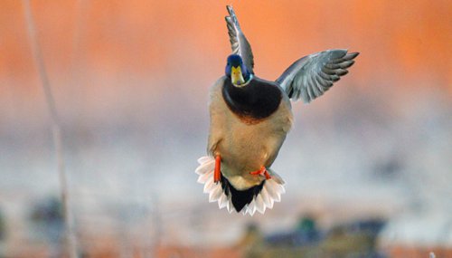
Waterfowl Season Opens Saturday
LITTLE ROCK – What a difference a year makes! Arkansas waterfowl hunters will be greeted with far wetter conditions this year than they have experienced in recent years, as the state’s waterfowl hunting season opens Saturday, Nov. 17, at 30 minutes before sunrise.
Last year, much of the public hunting grounds were like most of the state – in the midst of a fall drought that wasn’t abated until mid-December, well into duck hunting season. This year, though, hunters should find water and good habitat conditions for ducks throughout the Arkansas Game and Fish Commission’s WMA system. And, not only that, Mother Nature has contributed some extra colder weather in the run-up to waterfowl season than Arkansas has seen in recent years.
Boards were to be put in place where structure is required on WMAs on Nov. 15 to hold water on the grounds. The exception is the south unit green tree reservoir area of Henry Gray Hurricane Lake WMA, which will not use boards this year after a significant die-off of green timber within the unit, according to Luke Naylor, the AGFC’s waterfowl program coordinator. The north unit boards will be in place Nov. 15.
A new addition to the AGFC’s WMA system for waterfowl hunting in 2018-19 is the management of nearly 1,000 acres newly purchased for Cypress Bayou WMA, situated between Ward and Beebe a short distance off U.S. Highway 67-167 and near state Highway 31. The addition of Cypress Bayou WMA waterfowl-managed acreage offers central Arkansas hunters a much closer alternative than having to travel some distance to WMAs in southeast or northeast Arkansas.
Biologists surveys of duck breeding populations in the northern regions in the spring indicated somewhat fewer mallards are forecast for this year, though the figures are still above long-term averages. According to the U.S. Fish and Wildlife Service, estimates for total mallards this year are 9.3 million, which is 12 percent lower than 2017 estimates but 17 percent above the long-term average. Gadwalls are expected to be 31 percent lower than 2017 numbers, but 43 percent above their long-term average, at 2.9 million. The American widgeon was the only species that saw a rise in estimate over 2017, at 2.8 million, or 2 percent above the previous spring’s estimate. The overall drop in prairie-breeding puddle ducks was attributed to drier than normal conditions in the prairie breeding grounds.
The Weekly Waterfowl Report highlights all WMAs managed for waterfowl hunting in Arkansas, with water levels and weather trends noted along with waterfowl habitat conditions. WMA managers provide information on a weekly basis to help hunters find possible locations for hunting. Food sources that were planted, like millet, and food sources prepared through extensive manipulation of native vegetation are listed as well as a snapshot of what sort of hunting conditions hunters may expect. Flooding conditions also are noted. For example, you may see “100% flooded” or “35% flooded” listed with a unit inside a particular WMA.
Naylor says the term “flooded” may mean something different than what the typical duck hunter might expect, though.
“When an area is deemed flooded, that means water is covering the ground,” Naylor said. “It doesn’t necessarily mean there’s enough water to float a boat or run a motor through the area.
“Dabbling ducks like mallards are most attracted to water less than 18 inches deep, because they can easily reach the food at the bottom in that depth. If you want to attract ducks and provide the energy they need for migration, the food has to be accessible. It may mean getting out of the boat and walking occasionally, but shallow habitat makes for fantastic hunts and can even prevent people from setting up on top of you if you’ll take the time to walk a little to get to your location.”
An area listed as “100% flooded” means that the unit is completed covered in water. A unit listed as, say, “35% flooded” means that there is 35 percent coverage of water on the particular unit, and 65 percent of it has no water on it.
- Central Arkansas
- East Central Arkansas
- Northwest Arkansas
- Northeast Arkansas
- Southeast Arkansas
- Southwest Arkansas
Northeast Arkansas
Big Lake WMA
When the Ditch 81 extension gauge near Manila (upstream of the Big Lake north-end control structure) reads 17.5 feet, water is beginning to come over the north levee degrade on Big Lake WMA. When the Ditch 81 Extension gauge reads 18.0 feet or higher, the water level on the WMA will rise quickly and hunters should exercise caution while on the area. Be aware of underwater logs in boat runs and hangers in trees.
A few ducks and geese have been seen flying around the area.
North Woods GTR
Habitat: Mast production is fair.
Water Level: Bo Dock gauge currently reads 235.3 feet, Target level is 235.5 feet with 95% flooded.
South Woods GTR
Habitat: Mast production is fair.
Water Level: The 7-Mile gauge is currently at 234.2 feet. Target level is 234.5 feet with 90% flooded.
Simmons Field
Habitat: A good amount of millet, smartweed and sedge is present. Seed production is very good in north unit; middle field was planted in Chawapa millet, coverage is fair; south field was stripped in Chawapa millet with fair production, with strips of smartweed that did extremely well.
Water Level: 10% coverage
Dave Donaldson Black River WMA
Map | Water Gauge | Weather Report
Waterfowl hunters should be aware of hangers and submerged logs within the boat runs and GTRs. Please exercise caution when accessing the area. Please remember to keep boats off the levees so AGFC personnel can access the area. Boats blocking access will be moved. Unattended trailers are not to be left overnight on parking areas.
Upper Island GTR
Habitat: Average abundance of mast crop within the GTRs.
Water Level: Water level is below readable gauge levels. Target level is 269.5 feet msl. 25% flooded.
Lower Island GTR
Habitat: Average abundance of mast crop within the GTRs.
Water Level: Water level is below readable gauge levels. Target level is 268.0 feet msl. 40% flooded.
Upper Reyno GTR
Habitat: Average abundance of mast crop within the GTRs.
Water Level: Water level is 265.2 feet msl. Target level is 266.9 feet msl. 30% flooded.
Lower Reyno GTR
Habitat: Average abundance of mast crop within the GTRs.
Water Level: Water level is 265.1 feet msl. Target level is 266.3 feet msl. 50% flooded.
Winchester GTR
Habitat: Average abundance of mast crop within the GTRs.
Water Level: Water level is 263.6 feet msl. Target level is 263.7 feet msl. 90% flooded.
Earl Buss Bayou DeView WMA
Map | Water Gauge | Weather Report
Boaters should use caution while using the Thompson Tract boat run. A few ducks and geese are slowing moving through the area.
South Oliver GTR
Habitat: Mast production has been good.
Water Level: 75% flooded with a current gauge reading of 1.0 feet.
Thompson Tract GTR
Habitat: Mast production has been good.
Water Level: 50% flooded with a current gauge reading of 0.6 feet.
Lake Hogue WRA
Habitat: Primarily deep open water habitat.
Water Level: Normal pool level.
Shirey Bay Rainey Brake WMA
Map | Water Gauge | Weather Report
Waterfowl hunters should be aware of hangers and submerged logs within the boat runs and GTRs. Please exercise caution when accessing the area. In addition, hunters should allow safe passage when parking vehicles along roadsides. Vehicles blocking access will be moved.
Adam Brake GTR
Habitat: Good abundance of mast crop within the GTR.
Water Level: Water level is 235.0 feet msl with a target level of 240.0 msl. 5% flooded.
Rainey Brake GTR
Habitat: Good abundance of mast crop within the GTR.
Water Level: 5% flooded.
Eagle Pond GTR
Habitat: Good abundance of mast crop within the GTR.
Water Level: 0% flooded.
Phase III Moist-Soil Unit
Habitat: Good wetland-type vegetation.
Water Level: 70% flooded.
Charles Crisp Moist-Soil Unit
Habitat: Good wetland-type vegetation.
Water Level: 65% flooded.
Ward Field Moist-Soil Unit
Habitat: Good wetland-type vegetation.
Water Level: 60% flooded.
River Field Moist-Soil Unit
Habitat: Good wetland-type vegetation.
Water Level: 70% flooded.
St. Francis Sunken Lands WMA
Map | Water Gauge | Weather Report
Hunt Area
Habitat: Mast production is average within the hunt area.
Water Level: Water levels on St. Francis Sunken Lands for waterfowl season are dependent on flows from the St. Francis River. The target level for providing huntable timber is 212.0 feel msl reading from the Oak Donnick gauge. As of Nov. 12, levels were 2.8 feet ablove target at 214.83 feet msl. The number of birds using the area is still low.
Snowden WRA
Habitat: There was a small green-up response of wetland plants after the growing season burns throughout the unit.
Water Level: 15% flooded, mostly in the low-lying areas due to rain and the barrows.
Payneway WRA
Habitat: Pool D has 14 acres of Buckwheat providing good bugging areas when water becomes available. A, B, C pools have sunflowers left standing with some smartweed response underneath. Barrows have been mowed for open water use.
Water Level: Pool A is at 0%. Pool B is at 0% coverage. Pool C is at 10%. Pool D is at 20%.
East-Central Arkansas
Henry Gray Hurricane Lake WMA
Map | Water Gauge | Weather Report
Hunters should call the Wildlife Hotline at 800-440-1477 for current road closures.
North GTR
Habitat: Good mast crop.
Water Level: The current Glaise Creek reading is 189.97 feet msl. NOTE: All water control structures for the North GTR will be closed on Nov. 15.
South GTR
Habitat: Good mast crop.
Water Level: The current Glaise Creek reading is 189.97 feet msl.
Rex Hancock Black Swamp WMA
Map | Water Gauge | Weather Report
Hunters should call the Wildlife Hotline at 800-440-1477 for current road closures.
Main WMA
Habitat: Good mast crop.
Water Level: 100%.
Wyeville Unit
Habitat: Good stand of millet and native vegetation.
Water Level: 75% coverage.
Sheffield Nelson Dagmar WMA
Map | Water Gauge | Weather Report
The Conway George units are available by applying for online permits. Please visit www.agfc.com for maps, special regulations, permit application and draw dates. Hunters should call the Wildlife Hotline at 800-440-1477 for current road closures.
Mud Slough GTR
Habitat: Good mast crop.
Water Level: 100%
Apple Lake WRA
Habitat: Good mast crop.
Water Level: 100%
Conway George Waterfowl Unit A
Habitat: Good stand of millet and native vegetation.
Water Level: 100%
Conway George Waterfowl Unit B
Habitat: Natural slough area with beneficial wetland plants.
Water Level: 100%
Conway George Waterfowl Unit C
Habitat: Good stand of millet and native vegetation.
Water Level: 100%
Steve N. Wilson Raft Creek Bottoms WMA
Map | Water Gauge | Weather Report
Unit A
Habitat: Excellent stand of millet and native vegetation.
Water Level: 100% coverage.
Unit B
Habitat: Excellent stand of millet and native vegetation.
Water Level: 100%
Unit C
Habitat: Good stand of native vegetation.
Water Level: 100%
Unit D (Youth Area)
Habitat: Good stand of millet and native vegetation.
Water Level: 100%
Unit E
Habitat: Good stand of millet and native vegetation.
Water Level: 100%
Unit F
Habitat: Good stand of millet and native vegetation.
Water Level: 100%
Unit G
Habitat: Fair stand of millet and native vegetation.
Water Level: 100%
Unit H (Mobility-impaired blind)
Habitat: Excellent stand of millet and native vegetation.
Water Level: 100%
Unit I
Habitat: Habitat conditions are poor.
Water Level: 100%
Unit J (Cypert Tract)
Habitat: Excellent stand of millet and native vegetation.
Water Level: 100%
Unit K (Cypert Tract)
Habitat: Excellent stand of native vegetation.
Water Level: 15%
Unit L (Cypert Tract)
Habitat: Good stand of native vegetation.
Water Level: 0%
Central Arkansas
Bell Slough WMA
Map | Weather Report
The Bell Slough GTR is primarily rainfall dependent with the exception of a limited amount of water that the AGFC can back in and catch from Palarm Creek.
Bell Slough GTR
Habitat: Poor mast crop.
Water Level: 100%.
Palarm Creek WRA
Habitat: Millet was planted as a cover crop this year following disking within the moist-soil units.
Water Level: 90%
Craig D. Campbell Lake Conway Reservoir
Map | Weather Report
Habitat and water levels are normal on both Pierce and Dix creeks.
(NEW) Cypress Bayou WMA
Hunt Area
Habitat: Good mast crop.
Water Level: 80%
Red Cut Slough Tract
Unit 1
Habitat: Good stand of millet and native vegetation.
Water Level: 80%
Unit 2
Habitat: Excellent stand of millet and native vegetation.
Water Level: 0%
Unit 3
Habitat: Good stand of millet and native vegetation.
Water Level: 0%
Unit 4
Habitat: Good stand of millet and native vegetation.
Water Level: 0%
Unit 5
Habitat: Good stand of native vegetation.
Water Level: 0%
Unit 6
Habitat: Good stand of native vegetation.
Water Level: 0%
Harris Brake WMA
Harris Brake Upper Unit
Habitat: Fair mast crop mixed in with native vegetation.
Water Level: 30%
Harris Brake Lower Unit
Habitat: Fair mast crop mixed in with native vegetation.
Water Level: 70%
Notes: Flooding in each unit is from overflow from the lake. The structures are open; personnel will attempt to close the structures Nov. 15.
Holland Bottoms WMA
Hunt Area
Habitat: Good mast crop.
Water Level: 30% coverage.
Lake Pickthorne WRA
Habitat: Excellent.
Water Level: East cell is 70%. West cell is 20%.
Northwest Arkansas
Dardanelle WMA
McKennon Bottoms (half-day hunting)
Habitat: Good stand of native moist-soil vegetation.
Water Level: 100%.
Potter’s Pothole Hartman Waterfowl Unit (half-day hunting)
Habitat: Excellent stand of millet.
Water Level: 45%
Frog Bayou WMA
County Roads are muddy and rough; exercise caution upon entry/exit.
Unit 1
Habitat: Sprangle Top Crabgrass, wild millet and smartweed.
Water Level: 100%
Unit 2
Habitat: Poor moist-soil response due to August flood.
Water Level: 100%
Unit 3
Habitat: Smartweed, tooth cup, wild millet and Sprangle top.
Water Level: 100%
Unit 4
Habitat: Wild millet, sprangle top, smartweed, nut sedge and crabgrass.
Water Level: 100%
Unit 5
Habitat: Sprangle top, wild millet, smartweed.
Water Level: 100%
Unit 6
Habitat: Wild millet, smartweed, crabgrass.
Water Level: 100%
Unit 7
Habitat: Smartweed, wild millet, sprangle top.
Water Level: 100%
Nimrod Lloyd Millwood WMA
Nimrod GTR
Fair mast crop mixed in with native vegetation.
Water Level: 50% and falling quickly.
Ozark Lake WMA/Dyer Lake Water Unit
Dyer Lake Cells (half-day hunting)
Habitat: Awaiting soybean harvest.
Water Level: Dry.
Petit Jean River WMA
Water levels are falling on GTRs
Map | Water Gauge | Weather Report
Santa Fe GTR
Habitat: Faor mast crop mixed in with native vegetation.
Water Level: 70%
Olin Cain/Sore Head Moist-Soil Unit
Habitat: Good stand of native vegetation.
Water Level: 100%
Black Lands Moist-Soil Unit
Habitat: Good stand of native vegetation.
Water Level: 100%
Slaty Crossing Moist-Soil Unit
Habitat: Fair stand of native vegetation.
Water Level: 85%
Pullen Pond
Habitat: Half of area has a fair stand of native vegetation, other half of area has 100 acres of Japanese millet.
Water Level: 30%
Pond Creek GTR
Habitat: Fair mast crop mixed in with native vegetation.
Water Level: 10%
Slaty Pond GTR
Habitat: Fair mast crop mixed in with native vegetation.
Water Level: 10%
Black Lands Duck Area
Habitat: Millet mixed in with native vegetation.
Water Level: 0%
Ed Gordon Point Remove WMA
Map | Weather Report
Due to recent heavy rainfall, most waterfowl impoundments on Ed Gordon Point Remove WMA are at full pool at this time. Duck use on the WMA has been fair to moderate.
Little Hole (Unit 1)
Habitat: Natural vegetation.
Water Level: 100%
Willow Island (Unit 2)
Habitat: Natural vegetation.
Water Level: 100%
Red Gate (Unit 3)
Habitat: Natural vegetation.
Water Level: 100%
Pig Trough (Units 4 and 5)
Habitat: Natural vegetation.
Water Level: 100%
Cedar Ridge (Unit 6)
Habitat: Natural vegetation and Japanese and Chiwappa Millet.
Water Level: 100%
Unit 7a
Habitat: Japanese and Chiwappa Millet.
Water Level: 100%
Unit 7b
Habitat: Natural vegetation.
Water Level: 100%
Duck Trap (Units 8a, 8b, 8c)
8a
Habitat: Natural vegetation and Japanese and Chiwappa Millet.
Water Level: 100%
8b
Habitat: Natural vegetation and Japanese and Chiwappa Millet.
Water Level: 100%
8c
Habitat: Natural vegetation and Japanese and Chiwappa Millet.
Water Level: 100%
Unit 9
Habitat: Natural vegetation and Japanese and Chiwappa Millet.
Water Level: 100%
Controversy Corner (Unit 10)
Habitat: Natural vegetation and Japanese and Chiwappa Millet.
Water Level: 100%
Remmel Marsh (Unit 11)
Habitat: Natural vegetation and Japanese and Chiwappa Millet.
Water Level: 100%
Mud Pond (Unit 12)
Habitat: Natural vegetation.
Water Level: 100%
Turkey Pond (Units 13a, 13b, 13c)
13a
Habitat: Natural vegetation and Japanese and Chiwappa Millet.
Water Level: 100%
13b
Habitat: Natural vegetation.
Water Level: 100%
13c
Habitat: Natural vegetation and Japanese and Chiwappa Millet.
Water Level: 100%
Teeny Pond (Unit 14)
Habitat: Natural vegetation.
Water Level: 100%
Salt Lick (Unit 15)
Habitat: Natural vegetation.
Water Level: 100%
Bobby’s Pond (Unit 16)
Habitat: Natural vegetation.
Water Level: 100%
Race Track (Unit 17)
Habitat: Natural vegetation.
Water Level: 100%
Galla Creek WMA
Galla Creek GTR
Habitat: Excellent stand of natural vegetation, including a mixture of barnyard and smartweed.
Water Level: 15% coverage, staged flooding of the impoundment will begin on Nov. 19.
Southwest Arkansas
Dr. Lester Sitzes III Bois d’Arc WMA
Bois d’Arc Lake WRA
Habitat: Closed to hunting.
Water Level: Normal
Red Slough WRA
Habitat: Closed to hunting.
Water Level: 10%
GTR
Habitat: Good mast production.
Water Level: 100%.
Little Grassy
Habitat: Good.
Water Level: 60%
Millwood Lake
Habitat: Habitat conditions are good.
Water Level: 260.72 feet msl.
Ozan WMA
Unit 1
Habitat: Good
Water Level: 40%
Unit 2
Habitat: Good
Water Level: 10%
Unit 3
Habitat: Good
Water Level: 5%
Unit 4
Habitat: Good
Water Level: 5%
Unit 5
Habitat: Good
Water Level: 5%
Sulphur River WMA
Map | Weather Report
The Henry Moore WRA is not flooded due to pump problems.
Mercer Bayou
Habitat: Fair.
Water Level: Drawn down for restoration project, boat ramps are closed.
Henry Moore WRA
Habitat: Closed to hunting.
Water Level: 20%
Southeast Arkansas
Beryl Anthony Lower Ouachita WMA
Map | Weather Report
Habitat: The WMA has a good hard mast production.
Water Level: The sloughs and oxbow lakes on the WMA are beginning to overflow their banks, putting additional water onto the WMA. The WMA is less than 10% flooded.
Cut-Off Creek WMA
Hunt Area
Habitat: Habitat conditions are good.
Water Level: 0% flooded.
Pigeon Creek WRA
Habitat: Habitat conditions are good.
Water Level: 0% flooded.
Freddie Black Choctaw Island WMA Deer Research Area
Map | Weather Report
Habitat conditions are good. Flooding is river dependent. Click on the Water Gauge link above for current Mississippi River levels. Use extreme caution when boating in river.
George H. Dunklin Jr. Bayou Meto WMA
Upper Vallier GTR
Habitat: Good
Water Level: 178.2 feet msl, full pool at 180 feet msl.
Lower Vallier GTR
Habitat: Good
Water Level: 178.2 feet msl, full pool at 179 feet msl.
Government Cypress GTR
Habitat: Good
Water Level: 178.2 feet msl, full pool at 179 feet msl.
Buckingham Flats GTR
Habitat: Good
Water Level: 0% flooded.
Temple Island GTR
Habitat: Good
Water Level: 0% flooded.
Canon Brake
Habitat: Good
Water Level: 50% flooded.
Halowell WRA
Habitat: Excellent
Water Level: Staggered flooding of units.
Wrape Plantation WRA
Habitat: Excellent
Water Level: Staggered flooding of units.
Seven Devils WMA
Hunt Area
Habitat: Habitat conditions are good.
Water Level: 129.5 feet msl. Water levels are variable depending on Cut-Off Creek levels.
Trusten Holder WMA
Map | Water Gauge | Weather Report
Habitat conditions are good. Flooding is river dependent. Click on the Water Gauge link above for current Arkansas River levels.
Recent News
Arkansas Wildlife Weekly Fishing Report
Jul. 3, 2025
Subscribe to Our Weekly Newsletter E-mails
Don’t miss another issue. Sign up now to receive the AGFC Wildlife Weekly Newsletter in your mailbox every Wednesday afternoon (Waterfowl Reports are published weekly during waterfowl season and periodically outside the season). Fishing Reports arrive on Thursdays. Fill in the following fields and hit submit. Thanks, and welcome!