Arkansas Wildlife Waterfowl Report
BY Jim Harris
ON 11-18-2020
Nov. 18, 2020
Jim Harris
Managing Editor Arkansas Wildlife Magazine
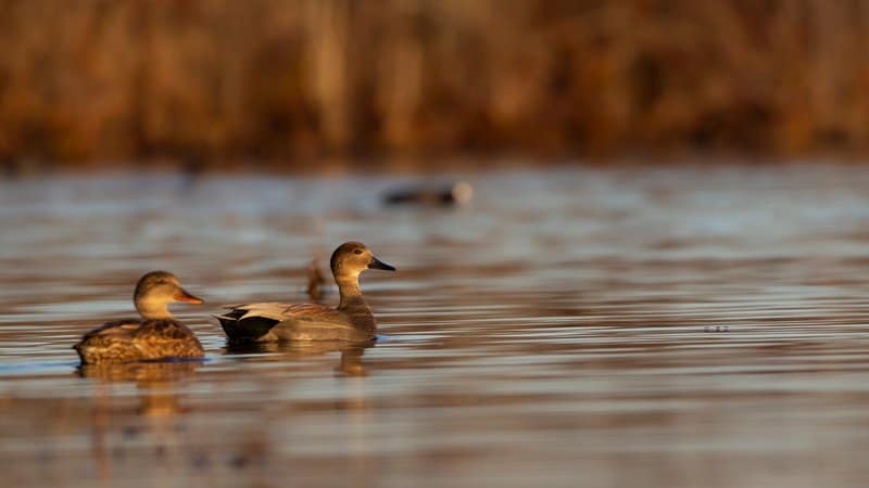
60-day Duck Season Kicks Off Saturday; Habitat Limited by Recent Dry Weather
LITTLE ROCK – Waterfowl season in Arkansas officially opens 30 minutes before sunrise Saturday. In what has become standard in the state for more than two decades, Arkansans will enjoy a 60-day duck season with two splits scheduled during the season. Also, as with last year, this year’s 60-day season will run until the end of January, meaning that there will be a few more days of rest in early December for the migrating waterfowl.
This weekend’s outlook appears to indicate slower hunting for those looking to harvest mallards. That’s not all that unusual for November in Arkansas anyway, AGFC waterfowl coordinator Luke Naylor says, but habitat conditions aren’t ideal at this time for migrating ducks. Areas that are rain-dependent for water are dry now.
“For this first weekend, I have low expectations. Very low,” Naylor said, though he added that hunters throughout Arkansas should still see ducks, especially the usual gadwalls, shovelers and teal that frequent the state before the big move of mallards. “Overall over the past month, habitat availability has largely declined, with the exception of the helpful efforts of landowners to flood harvested rice fields ands with what we can do in our moist-soil units. We closed the boards on our (greentree reservoirs) on Monday. A lot of areas, like Dave Donaldson (Black River WMA) will have a quick response in terms of holding water, and much of that area should be flooded for this weekend.”
But, as Naylor noted, some other popular areas such as Ed Gordon Point Remove WMA in west-central Arkansas are drier than they’ve been the past two years. Wetter weather in the runup to duck season in 2018 and 2019 had Point Remove Creek running over its banks and helping flood units in the WMA. This year, following a six-year project on the WMA, there is ability to pump water but the creek is not running high. George H. Dunklin Bayou Meto WMA, even with the boards put in place to hold water, has no water in Temple Island or Buckingham Flats.
However, other favorite public hunting grounds are beginning to see some water where it can be pumped. Read the listing below of all the AGFC’s WMAs and GTRs and the current habitat conditions.
Arkansas seemed to be in good shape for wetter duck habitat in October with rains from gulf hurricanes that moved through the area, and an early cold front also pushed down from Canada to drop temperatures last month. Naylor said he’d heard that “a decent amount of mallards had come in” early with such good habitat available.
“Most of it, by in large, is gone now,” he said. All of that habitat that was there has dried up. It’s stagnant now. There are a few places with some ducks. There’s not a high percentage of mallards, but that isn’t abnormal for this time of year. About 25 percent of the total duck count at this time is usually mallards. That will change in the coming weeks.” Privately owned fields and private greentree timber holdings will be flooding, and ducks will find those spots. However, this weekend also calls for high temperatures in some places of the state in the 70s, much higher than several days last month.
The daily bag limit for ducks remains 6, 4 of which can be mallards (only 2 of those may be hens). Canvasback and black duck limits remain 2 per day, a change made last year. The daily bag limit for pintails remains 1 per day. Other daily bag limits: 1 scaup, 3 wood ducks, 2 redheads, 1 mottled duck. Ducks not listed among these, hunters may harvest up to 6 ducks of a species (including teal) daily.
The Youth and Veterans/Active Military special hunts are scheduled for Dec. 5 and Feb. 6. Both active duty military and veterans may hunt on those days, which are not part of the 60-day scheduled season. Youths under 16 may hunt on those days as well, as long as they are accompanied by a mentor — youths who have not completed the Hunter Education course must be accompanied by a mentor 21 or older; those who have completed the course can be accompanied by a mentor 18 or older. The mentor cannot hunt but can call the ducks, set decoys, help retrieve game and such.
On those same days, members of active duty military and military veterans may harvest ducks, geese, coots and mergansers. Active duty military includes members of the National Guard and Reserves on active duty (other than for training). Veterans must have served in active military, naval, air service or Reserves and National Guard on Title 32 orders in a combat zone and must have been discharged or released under honorable conditions. Hunters will need to have one of the following or copy during the hunt: DD214, Veteran Benefit Card, Retired Active Military I.D., Veteran Hunting License (VLF, VLH, VLC or VLL) or Active Duty I.D. card. Shooting hours and bag limits are the same as regular duck and goose seasons. Hunters may hunt on wildlife management areas from 30 minutes before sunrise until sunset these two days. WMA General Use permits are required for active military and veterans; they are NOT required for youth hunters.
Changes from last year that are still in place this year: The nonresident 5-day WMA waterfowl hunting permit is now good for any WMA during the 5-day hunt period. Also, nonresidents have been lmited to only being able to hunt on WMAs on certain dates this season.
Also, remember that while all stamp, license, HIP and WMA General Use permit purchases are shown online, hunters will still need to have their federal duck stamp on their possession and signed across the front, if the stamp was purchases more than 45 days ago. There is a 45-day grace period for having the federal stamp in the hunter’s possession.
Along with ducks, coots and mergansers, hunters in Arkansas beginning Saturday may also take snow, blue and Ross’s geese, as well as greater white-fronted geese (specklebellies) and Canada geese during the 60-day season. Refer to the AGFC’s Waterfowl Hunting Guidebook for daily bag limits and restrictions, which differ substantially from hunting geese during the Light Goose Conservation Order. The conservation order will resume after duck season and run through April 25. Greater white-fronted geese are not part of the order. The limit on “specks” this year is 2, down from 3 in recent years.
Naylor said the AGFC will conduct three aerial surveys this duck season, down from four in recent years when weather conditions permitted. The first aerial survey will be staged during the first split of the duck season, between Dec. 1-10. Two surveys will be conducted in January, he said.
Northeast Arkansas
Big Lake WMA
Map | Water Gauge | Weather Report
When the Ditch 81 extension gauge near Manila (upstream of the Big Lake north-end control structure) reads 17.5 feet, water is beginning to come over the north levee degrade on Big Lake WMA. When the Ditch 81 Extension gauge reads 18.0 feet or higher, the water level on the WMA will rise quickly and hunters should exercise caution while on the area. Be aware of underwater logs in boat runs and hangers in trees.
A few ducks are moving through the area.
North Woods GTR
Habitat: Mast production is good.
Water Level: Bo Dock guage currently reads 233.6 feet msl; target level is 235.5 feet with 0% flooded.
South Woods GTR
Habitat: Mast production is fair.
Water Level: The 7-Mile gauge is currently at 232.6 feet msl; target level is 234.5 feet with 20% flooded.
Simmons Field
Habitat: Good production of millet and sedge. Native production is very good in the north, middle and south fields with 5 acres of millet planted in the north field. All fields were rolled with a cleated roller in April.
Water Level: 80% coverage.
Dave Donaldson Black River WMA
Map | Water Gauge | Weather Report
Waterfowl hunters should be aware of hangers and submerged logs within the boat runs and GTRs. Please exercise caution when accessing the area. Please remember to keep boats off the levees so AGFC personnel can access the area. Boats blocking access will be moved. Unattended trailers are not to be left overnight on parking areas. River level is 4.17 feet msl and holding.
Upper Island GTR
Habitat: Mast crop is moderate within the GTRs.
Water Level: Gauge is below readable level. Target level is 269.5 feet msl. 15% flooded.
Lower Island GTR
Habitat: Mast crop is moderate within the GTRs.
Water Level: Gauge is below readable level. Target level is 268.0 feet msl. 15% flooded.
Upper Reyno GTR
Habitat: Mast crop is moderate within the GTRs.
Water Level: Gauge is below readable level. Target level is 266.9 feet msl. 10% flooded.
Lower Reyno GTR
Habitat: Mast crop is moderate within the GTRs.
Water Level: Gauge is below readable level. Target level is 266.3 feet msl. 10% flooded.
Winchester GTR
Habitat: Mast crop is moderate within the GTRs.
Water Level: Water level is 263.0 feet msl; target level is 263.7 feet msl. 15% flooded.
Earl Buss Bayou DeView WMA
Map | Water Gauge | Weather Report
Boaters should use caution while using the Thompson Tract boat run. A few ducks and geese are moving through the area.
South Oliver GTR
Habitat: Mast production has been good.
Water Level: 10% flooded with a current gauge reading of 0.0 foot. Water is located within the natural sloughs.
Thompson Tract GTR
Habitat: Mast production is good.
Water Level: 0% flooded with a current gauge reading of 0.0 foot.
Lake Hogue WRA
Habitat: Primarily deep open water habitat.
Water Level: Normal pool level.
Shirey Bay Rainey Brake WMA
Map | Water Gauge | Weather Report
Waterfowl hunters should be aware of hangers and submerged logs within the boat runs and GTRs. Please exercise caution when accessing the area. In addition, hunters should allow safe passage when parking vehicles along roadsides. Vehicles blocking access will be moved.
Adam Brake GTR
Habitat: Mast production is good.
Water Level: Water level is 238.0 feet msl with a target level of 240.0 msl. 15% flooded.
Rainey Brake GTR
Habitat: Mast production is good.
Water Level: 30% flooded.
Eagle Pond GTR
Habitat: Mast production is good.
Water Level: 20% flooded.
Phase III Moist-Soil Unit
Habitat: Good wetland-type vegetation.
Water Level: 20% flooded.
Charles Crisp Moist-Soil Unit
Habitat: Good wetland-type vegetation.
Water Level: 60% flooded.
Ward Field Moist-Soil Unit
Habitat: Good wetland-type vegetation.
Water Level: 75% flooded.
River Field Moist-Soil Unit
Habitat: Good wetland-type vegetation.
Water Level: 55% flooded.
St. Francis Sunken Lands WMA
Map | Water Gauge | Weather Report
Hunt Area
Habitat: Good mast production this year within the hunt area.
Water Level: Water levels on St. Francis Sunken Lands for waterfowl season are dependent on flows from the St. Francis River. The target level for providing huntable timber is 212.0 feet msl at the Oak Donnick gauge. As of Nov. 17, levels were 211.47 feet msl.
Snowden WRA
Habitat: Mixed grasses.
Water Level: 0% flooded, mostly in the low-lying areas due to rain.
Payneway WRA
Habitat: A, B, C D pools have mixed smartweed and barnyard grasses. Moderate mast is available within pools A, B and C as well.
Water Level: Pool A is at 0% coverage. Pool B is at 0%. Pool C is at 0%. Pool D is at 0%.
East-Central Arkansas
Henry Gray Hurricane Lake WMA
Map | Water Gauge | Weather Report
Hunters should call the Wildlife Hotline at 800-440-1477 for current road closures.
North GTR
Habitat: Good mast crop.
Water Level: The Glaise Creek reading as of Nov. 17 was 191.07 feet msl; full pool is 192 feet msl.
Note: All structures on the North GTR are closed.
South GTR
Habitat: Fair mast crop.
Water Level: The Glaise Creek reading as of Nov. 17 was 191.07 feet msl; full pool is 192 feet msl.
Note: All structures on the South GTR are open.
Rex Hancock Black Swamp WMA
Map | Water Gauge | Weather Report
Hunters should call the Wildlife Hotline at 800-440-1477 for current road closures.
Gregory GTR
Habitat: Good mast crop.
Water Level: 35% (as of Nov. 17 the Cache River level is 6.2 feet and falling on the Patterson Gauge).
Wyeville Moist-Soil Unit
Habitat: Good stand of millet and native vegetation.
Water Level: 100% coverage.
Sheffield Nelson Dagmar WMA
Map | Water Gauge | Weather Report
The Conway George units are currently available for hunting by applying for online permits. Please visit www.agfc.com for maps, special regulations, permit application and draw dates. Hunters should call the Wildlife Hotline at 800-440-1477 for current road closures.
Mud Slough GTR
Habitat: Good mast crop.
Water Level: 65% coverage.
Apple Lake WRA
Habitat: Good mast crop.
Water Level: 90%.
Conway George Waterfowl Unit A
Habitat: Good stand of millet and native vegetation.
Water Level: 100%
Conway George Waterfowl Unit B
Habitat: Natural slough area with beneficial wetland plants.
Water Level: 100%
Conway George Waterfowl Unit C
Habitat: Good stand of millet and native vegetation.
Water Level: 100%
Steve N. Wilson Raft Creek Bottoms WMA
Map | Water Gauge | Weather Report
Raft Creek Bottoms WMA is open to waterfowl hunting Tuesday, Thursday, Saturday and Sunday only. Saturday and Sunday hunting has both in-person draws and an online permit draw via www.agfc.com. On Tuesday and Thursday, permits need to be picked up before hunting and returned to the work center off Jones Island Road after the hunt. Waterfowl hunting is closed Monday, Wednesday and Friday. The Youth blind and Mobility-Impaired blind are available Tuesday, Thursday, Saturday and Sunday by online draw. The Magellan Tract is available to online drawing. Online draws are held the Thursday-Sunday before the week of hunt.
Unit A
Habitat: Excellent stand of native vegetation.
Water Level: 45% coverage.
Unit B
Habitat: Excellent stand of millet and native vegetation.
Water Level: 45%
Unit C
Habitat: Good stand of native vegetation.
Water Level: 35%
Unit D (Youth Area)
Habitat: Good stand of millet and native vegetation.
Water Level: 100%
Unit E
Habitat: Excellent stand of millet and native vegetation.
Water Level: 45%
Unit F
Habitat: Good stand of millet and native vegetation.
Water Level: 45%
Unit G
Habitat: Fair stand of millet and native vegetation.
Water Level: 50%
Unit H (Mobility-impaired blind)
Habitat: Excellent stand of native vegetation.
Water Level: 100%
Unit I
Habitat: Habitat conditions are poor.
Water Level: 100%
Unit J (Cypert Tract)
Habitat: Excellent stand of native vegetation.
Water Level: 25%
Unit K (Cypert Tract)
Habitat: Excellent stand of native vegetation.
Water Level: 40%
Unit L (Cypert Tract)
Habitat: Fair stand of native vegetation.
Water Level: 15%
Central Arkansas
Bell Slough WMA
Map | Weather Report
The Bell Slough GTR is primarily rainfall dependent with the exception of a limited amount of water that the AGFC can back in and catch from Palarm Creek.
Bell Slough GTR
Habitat: Poor to moderate mast crop.
Water Level: 30% flooded.
Palarm Creek WRA Units 1&2
Habitat: Natural vegetation and planted millet.
Water Level: 30% flooded.
Craig D. Campbell Lake Conway Reservoir
Map | Weather Report
Habitat and water levels are normal on both Pierce and Dix creeks.
Cypress Bayou WMA
Hunt Area
Habitat:
Good mast crop.
Water Level: 100% coverage.
Red Cut Slough Tract
The six units of Cypress Bayou Red Cut Slough are available for permit-only hunting on Tuesday, Thursday, Saturday and Sunday. Weekend hunts are available only via online draw for permits through the website, www.agfc.com. On Tuesday and Thursday, hunters need to pick up a permit at the parking lot and return it after the hunt.
Unit 1
Habitat:
Good stand of millet and native vegetation.
Water Level: 25%
Unit 2
Habitat:
Excellent stand of millet and native vegatation
Water Level: 15%
Unit 3
Habitat:
Good stand of millet and native vegatation
Water Level: 5%
Unit 4
Habitat: Good stand of millet and native vegetation.
Water Level: 5%
Unit 5
Habitat:
Good stand of native vegetation.
Water Level: 15%
Unit 6
Habitat:
Good stand of native vegetation.
Water Level: 15%
Harris Brake WMA
Upper GTR
Habitat: Average mast crop this year.
Water Level: 2%
Lower GTR
Habitat: Average mast crop this year.
Water Level: 0% flooded.
NOTES: The water control structures on both the Lower and Upper GTRs were closed on Monday, Nov. 16. The Harris Brake Lake valve was opened on Nov. 16 to begin supplemental flooding of both the Lower and Upper GTRs.
Holland Bottoms WMA
WRA Moist-Soil Unit (East/West)
Habitat: Good mast crop.
Water Level: 50% coverage.
Lake Pickthorne WRA
Habitat: Excellent.
Water Level: East cell is 100%, West cell is 100%.
Northwest Arkansas
Dardanelle WMA
McKennon Bottoms (half-day hunting)
Habitat: 8 acres of native millet, 24 acres of fallow ground.
Water Level: 25% and pumping.
Potter’s Pothole Hartman Waterfowl Unit (half-day hunting)
Habitat: Good stand of native vegetation.
Water Level: 0%, pumping will begin this week.
Ed Gordon Point Remove WMA
Due to lack of rainfall, conditions on Ed Gordon Point Remove WMA are fairly dry. Pumping of waterfowl impoundments began on Nov. 4 and staggered flooding of units will continue as water levels in Point Remove Creek allow. Most waterfowl impoundments are between 20%-80% flooded at this time. Duck use on the WMA has been low.
Little Hole (Unit 1)
Habitat: Natural vegetation.
Water Level: 70% flooded.
Willow Island (Unit 2)
Habitat: Natural vegetation.
Water Level: 90%
Red Gate (Unit 3)
Habitat: Natural vegetation and Japanese millet.
Water Level: 75%
Pig Trough (Units 4 and 5)
Habitat: Natural vegetation.
Water Level: 60%
Cedar Ridge (Unit 6)
Habitat: Natural vegetation.
Water Level: 50%
Unit 7a
Habitat: Japanese millet.
Water Level: 80%
Unit 7b
Habitat: Natural vegetation.
Water Level: 10%
Duck Trap (Units 8a, 8b and 8c)
8a
Habitat: Natural vegetation.
Water Level: 50%
8b
Habitat: Natural vegetation.
Water Level: 50%
8c
Habitat: Natural vegetation.
Water Level: 75%
Unit 9
Habitat: Natural vegetation.
Water Level: 90%
Controversy Corner (Unit 10)
Habitat: Natural vegetation and Japanese millet.
Water Level: 40%
Remmel Marsh
Habitat: Natural vegetation and Japanese millet.
Water Level: 40%
Mud Pond (Unit 12)
Habitat: Natural vegetation.
Water Level: 90%
Turkey Pond (Units 13a, 13b and 13c)
13a
Habitat: Natural vegetation and Japanese millet.
Water Level: 10%
13b
Habitat: Natural vegetation.
Water Level: 10%
13c
Habitat: Japanese millet.
Water Level: 15%
Teeny Pond (Unit 15)
Habitat: Natural vegetation and Japanese millet
Water Level: 0%
Salt Lick (Unit 15)
Habitat: Japanese millet.
Water Level: 60%
Bobby’s Pond (Unit 16)
Habitat: Japanese millet.
Water Level: 60%
Race Track (Unit 17)
Habitat: Japanese millet.
Water Level: 50%
Frog Bayou WMA (half-day hunting)
Unit 1
Habitat: Sprangletop, wild millet, smartweed, nutsedge, Japanese millet planted in the northwest corner.
Water Level: 100%
Unit 2
Habitat: Good stand of barnyard grass and nutsedge.
Water Level: 100%
Unit 3
Habitat: Smartweed, toothcup, nutsedge, barnyard grass, sprangletop and duck potato and Japanese millet planted in northwest corner.
Water Level: 60%, pumping underway.
Unit 4
Habitat: Barnyard grass, sprangletop, annual smartweed, nutsedge and crabgrass.
Water Level: 100%
Unit 5
Habitat: Sprangletop, wild millet, smartweed, knotgrass, nutsedge and duck potato..
Water Level: 50%, pumping underway.
Unit 6
Habitat: Barnyard grass, smartweed, crabgrass and sprangletop.
Water Level: 50%, pumping will begin Dec. 2.
Unit 7
Habitat: Excellent stand of barnyard grass, sprangletop and smartweed.
Water Level: 50%, pumping will begin Dec. 2.
Galla Creek WMA
Galla Creek GTR
Habitat: Moderate stand of planted millet and natural vegetation, including a mixture of barnyard grass and sprangletop.
Water Level: 15% flooded.Staged flooding of the impoundment began on Nov. 12.
Nimrod Lloyd Millwood WMA
Nimrod GTR
Habitat: The red oak mast crop and desirable native vegetation growth this year was far less substantial than in previous years. One reason for the lack of desirable forage has a lot ot do with the above-average rainfall and flooding this year.
Water Level: 0% flooded.
NOTES: The water control structures were closed Monday, Nov. 16. Flooding of this area is rainfall dependent.
Ozark Lake WMA/Dyer Lake Water Unit
Dyer Lake Cells (half-day hunting)
Habitat: Excellent stand of barnyard grass, toothcup, smartweed and sprangletop.
Water Level: Units 1 and 2, 100%. Units 3 south cell (rainfall dependent), 100%, planted with millet.
Petit Jean River WMA
Map | Water Gauge | Weather Report
Sore Head Moist-Soil Unit
Habitat: The unit contains a mix of moderate to great stands of desirable native vegetation throughout.
Water Level: 0%. Flooding of the unit began on Nov. 16.
Blacklands Moist-Soil Unit
Habitat: This unit this year contains one of the best stands of desirable native vegetation in recent years. The wooded areas inside the unit produced a below-average red oak mast crop this year.
Water Level: 100%. The area was fully flooded on Nov. 6.
Slaty Crossing Moist-Soil Unit
Habitat: Due to ongoing waterfowl habitat enhancement projects, this unit was not able to grow a desirable native vegetation crop this year. The area was seeded with Japanese millet after the project was completed. Only about half of the unit produced a crop of millet, but the areas that did produce look amazing.
Water Level: 0%
NOTES: The ongoing work within this unit has increased the overall floodable ground by cutting down the high spots that normally stayed dry. The dirt from these high spots was used to fill in the ditches. This area will not be flooded until the first week of December to allow the millet stand to fully mature.
Blacklands Duck Area
Habitat: The wooded sections of this area produced a below-average red oak mast crop this year. This area also contains a mix of moderate to great stands of desirable native vegetation mixed throughout.
Water Level: 0%, flooding began on Nov. 16.
Pullen Pond Marsh
Habitat: Due to ongoing waterfowl habitat enhancement projects, parts of the northeastern sections of this area are bare ground. Other parts of this area have spotted sections of great desirable native vegetation. The desirable native vegetation has started to become more and more prevalent with each year of ongoing management work.
Water Level: 15%. The water control structures were closed at the end of October. Flooding of this area is rainfall dependent.
Pond Creek GTR
Habitat: This area produced a less-than-desirable red oak mast crop this year with good stands of desirable native vegetation in the open lands within this area.
Water Level: 0%. The water control structures were closed on Monday, Nov. 16. Flooding of this area is rainfall dependent.
Slaty GTR
Habitat: This area produced a less-than-desirable red oak mast crop this year.
Water Level: 5%. The water control structures were closed on Monday, Nov. 16. Flooding of this area is rainfall dependent.
Santa Fe GTR
Habitat: This area produced a less-than-desirable red oak mast crop this year.
Water Level: 0%. Closing of the water control structures is planned for Thursday, Nov. 19. Ongoing water control structure maintenance work has pushed the closing date to later in the week. Flooding of this area is rainfall dependent.
Southwest Arkansas
Dr. Lester Sitzes III Bois d’Arc WMA
Dr. Lester Sitzes III Bois d’Arc Lake WRA
Habitat: Closed to hunting.
Water Level: Normal
Red Slough WRA
Habitat: Closed to hunting.
Water Level: 0%
GTR
Habitat: Good mast production.
Water Level: 0%
Little Grassy
Habitat: Good
Water Level: 0%
Millwood Lake
Map | Water Gauge | Weather Report
Habitat: Habitat conditions are good.
Water Level: 259.40 feet msl.
Ozan WMA
Unit 1
Habitat: Good
Water Level: 0%
Unit 2
Habitat: Good
Water Level: 0%
Unit 3
Habitat: Good
Water Level: 0%
Unit 4
Habitat: Good
Water Level: 0%
Unit 5
Habitat: Good
Water Level: 0%
Sulphur River WMA
Mercer Bayou
Habitat: Fair
Water Level: Low, no boat access.
Henry Moore WRA
Habitat: Closed to hunting.
Water Level: 0%
Southeast Arkansas
Beryl Anthony Lower Ouachita WMA
Map | Weather Report
Water Level: No duck hunting water. Water is available in the oxbow lakes located in the WMA.
Cut-Off Creek WMA
Hunt Area
Habitat: Habitat conditions are good.
Water Level: No water.
Pigeon Creek WRA
Habitat: Habitat conditions are good.
Water Level: No water.
Freddie Black Choctaw Island WMA Deer Research Area
Map | Water Gauge | Weather Report
Habitat conditions are good. Flooding is river dependent. Click on the Water Gauge link above for current Mississippi River levels. Use extreme caution when boating in river.
George H. Dunklin Jr. Bayou Meto WMA
Map | Water Gauge | Weather Report
The UGSG is now reporting real-time water gauge readings at the headwater at each GTR within the George H. Dunklin Bayou Meto WMA. Click the Water Gauge link above for the WMA, and search for the particular GTR as noted.
Upper Vallier GTR
Habitat: Good
Water Level: See Gauge Link (Upper Vallier Headwater)
NOTE: The Jefferson County Road portion of the Mulberry Access has a bridge closed to public access. For more information, contact the Jefferson County Road Dept.
Lower Vallier GTR
Habitat: Good
Water Level: See Gauge Link (Lower Vallier Headwater). Use caution around water control structures.
Government Cypress GTR
Habitat: Good
Water Level: See Gauge Link (Government Cypress Headwater)
Buckingham Flats GTR
Habitat: Good
Water Level: No water. See Gauge Link (Buckingham Flats Headwater).
Temple Island GTR
Habitat: Good
Water Level: No water. See Gauge Link (Temple Island Headwater).
Canon Brake
Habitat: Good
Water Level: See Gauge Link (Canon Brake Headwater). Use caution around water control structures.
Halowell WRA
Habitat: Excellent
Water Level: Staggered flooding of units.
Wrape Plantation WRA
Habitat: Excellent
Water Level: Staggered flooding of units.
Seven Devils WMA
Hunt Area
Habitat: Habitat conditions are good.
Water Level: No water.
Trusten Holder WMA
Map | Water Gauge | Weather Report
Habitat conditions are good. Flooding is river dependent. Click on the Water Gauge link above for current Arkansas River levels.
Recent News

Arkansas Wildlife Weekly Fishing Report
Jul. 10, 2025
Lonoke aquaculturist named to AGFC
Jul. 10, 2025
Subscribe to Our Weekly Newsletter E-mails
Don’t miss another issue. Sign up now to receive the AGFC Wildlife Weekly Newsletter in your mailbox every Wednesday afternoon (Waterfowl Reports are published weekly during waterfowl season and periodically outside the season). Fishing Reports arrive on Thursdays. Fill in the following fields and hit submit. Thanks, and welcome!