Arkansas Wildlife Waterfowl Report
BY Jim Harris
ON 12-18-2019
Dec. 18, 2019
Jim Harris
Managing Editor Arkansas Wildlife Magazine
Cold Front, Heavy Rain Timely for Bringing New Ducks
LITTLE ROCK – A cold front that not only pushed temperatures in Arkansas down below 32 at night, but dumped heavy frozen precipitation on areas north of Arkansas, combined with heavy rain in the state that promised potentially better waterfowl hunting through the second split of the 60-day season.
“While our areas have had good water on them, there hasn’t been a lot of sheet water out there unless people were holding it,” Trey Reid, assistant chief for communications, said earlier this week. “It rained hard throughout the Delta from north to south Sunday and especially Monday. That ought to create some areas for new duck habitat. Probably temporarily flooded some of the bottoms.
“Another good thing was the timing of it as far as our water management plans for our areas. Bayou Meto put its last set of boards in Dec. 15. So that should put some water on some near areas as well.”
As far as just how many ducks might have moved into the state will be answered later, as the AGFC’s waterfowl biologists were taking to the skies again this week for the annual December aerial waterfowl survey. Results of the survey will be posted on the website as soon as they are made available.
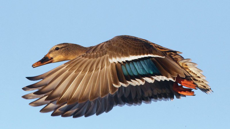
Anecdotally, hunters who were in George H. Dunklin Bayou Meto Wildlife Management Area noted a difficult hunting day in dreary, overcast conditions last Friday, but with the sun out and mild temperatures on Saturday, mallards began to fly.
AGFC Biologist Jason Carbaugh, who was on the aerial survey this week, reported Monday night that in his base area of northeast Arkansas “I did see a few more ducks in the Bayou DeView area while driving down there (Monday) morning. I can’t say we have picked up a bunch of ducks just yet.”
The question may be, just how many ducks are there above Arkansas to push down. Last year, Missouri’s waterfowl biologists reported counts that included around 900,000 mallards at one point in December. However, in the Missouri Conservation Department’s early December duck counts at its public conservation areas, numbers in the state were well down from peak totals. Estimates were about a half-million ducks in the state in early December. The public conservation areas in southeast Missouri that might provide ducks that move into northeast Arkansas were decent, but not overwhelming. Coon Island Conservation Area reported a ground count of 25,000 ducks (18,750 mallards) on Dec. 3; Little River CA had 6,750 ducks; and Ten Mile Bond CA of 33,294 ducks (13,755 mallards), 7,500 snow geese and 8,500 white-fronted geese.
Interestingly, where observers and other biologists were reported better migration and increasing numbers were through Nebraska and down through Oklahoma, with Texas biologists expecting a large Central Flyway migration. Also, there were impressive counts of birds in the Mississippi Flyway in Tennessee in proximity of the Mississippi River in their managed areas.
Reid, in speaking with Luke Naylor, the AGFC’s waterfowl program coordinator, said that Naylor “said it to me, ‘We need a good rain.’ Some water just to stir things up, and we got it. Besides really early in the season, we haven’t had any real storm systems until the past few days. A big rain like we had Monday puts water in the fields, sheet water, creates new habitat. There’s a lot more water on the landscape and that usually equates to more ducks for us.”
So, Reid said, the welcome cold front with snow through the Ohio Valley and the Central Plains, and more water in Arkansas, “typically that’s a scenario that bodes well for Arkansas duck hunters.”
Also of note: Reports from the Morrilton area on the Arkansas River was favorable over the weekend, according to Charley’s Hidden Harbor in Oppelo.
Regular waterfowl season runs through Dec. 23, with a brief break for the Christmas holiday, resuming on Dec. 26 and ending at sunset Jan. 31, 2020. The daily duck bag limit is 6, which may include no more than 4 mallards (2 hens), 3 scaup, 3 wood ducks, 1 pintail (a change from last year’s limit of 2), 2 redheads, 2 canvasbacks (a chance from last year’s limit of 1), 2 black ducks and 1 mottled duck. Coot daily bag limit is 15. Merganser daily bag limit is 5, of which only 2 may be hooded mergansers. Daily bag limit for snow, blue and Ross’s geese is 20; daily limit for white-fronted geese is 3 and for Canada geese the limit is 2.
Check out the current habitat conditions for the AGFC’s managed areas for waterfowl:
Northeast Arkansas
Big Lake WMA
Map | Water Gauge | Weather Report
When the Ditch 81 extension gauge near Manila (upstream of the Big Lake north-end control structure) reads 17.5 feet, water is beginning to come over the north levee degrade on Big Lake WMA. When the Ditch 81 Extension gauge reads 18.0 feet or higher, the water level on the WMA will rise quickly and hunters should exercise caution while on the area. Be aware of underwater logs in boat runs and hangers in trees.
North Woods GTR
Habitat: Mast production is good.
Water Level: Bo Dock guage currently reads 236.5 feet msl; target level is 235.5 feet with 100% flooded.
South Woods GTR
Habitat: Mast production is fair.
Water Level: The 7-Mile gauge is currently at 235.8 feet msl; target level is 234.5 feet with 100% flooded.
Simmons Field
Habitat: Good production of millet and sedge. Native vegetation production is very good in north unit middle fields with 5 acres of millet planted in the north field. The south field was strip planted in Japanese millet leaving strips of wild millet and sedge that did extremely well. On Nov. 22, one-third of the north field and one-third of the middle field were stripped-rolled with a cleated roller.
Water Level: 100% coverage.
Dave Donaldson Black River WMA
Map | Water Gauge | Weather Report
Waterfowl hunters should be aware of hangers and submerged logs within the boat runs and GTRs. Please exercise caution when accessing the area. Please remember to keep boats off the levees so AGFC personnel can access the area. Boats blocking access will be moved. Unattended trailers are not to be left overnight on parking areas. River level is 7.34 feet.
Upper Island GTR
Habitat: Mast crop is moderate within the GTRs.
Water Level: Current level is 270.05 feet msl. Target level is 269.5, 100% flooded.
Lower Island GTR
Habitat: Mast crop is moderate within the GTRs.
Water Level: Current level is 267.25 feet msl. Target level is 268.0. 100% flooded.
Upper Reyno GTR
Habitat: Mast crop is moderate within the GTRs.
Water Level: Current level is 267.85 feet msl. Target level is 266.9. 100% flooded.
Lower Reyno GTR
Habitat: Mast crop is moderate within the GTRs.
Water Level: Current level is 267.2 feet msl. Target level is 266.3 feet msl. 100% flooded.
Winchester GTR
Habitat: Mast crop is moderate within the GTRs.
Water Level: Current level is 264.6 feet msl. Target level is 263.7. 100% flooded.
Earl Buss Bayou DeView WMA
Map | Water Gauge | Weather Report
Boaters should use caution while using the Thompson Tract boat run.
South Oliver GTR
Habitat: Mast production has been good.
Water Level: 100% flooded with a current gauge reading of 1.0 foot.
Thompson Tract GTR
Habitat: Mast production has been good.
Water Level: 100% flooded with a current gauge reading of 1.3 feet.
Lake Hogue WRA
Habitat: Primarily deep open water habitat.
Water Level: Normal pool level.
Shirey Bay Rainey Brake WMA
Map | Water Gauge | Weather Report
Waterfowl hunters should be aware of hangers and submerged logs within the boat runs and GTRs. Please exercise caution when accessing the area. In addition, hunters should allow safe passage when parking vehicles along roadsides. Vehicles blocking access will be moved.
Adam Brake GTR
Habitat: Mast production is good.
Water Level: Water level is 240.0 feet msl with a target level of 240.0 msl. 100% flooded.
Rainey Brake GTR
Habitat: Mast production is good.
Water Level: 100% flooded.
Eagle Pond GTR
Habitat: Mast production is good.
Water Level: 100% flooded.
Phase III Moist-Soil Unit
Habitat: Good wetland-type vegetation.
Water Level: 45% flooded.
Charles Crisp Moist-Soil Unit
Habitat: Good wetland-type vegetation.
Water Level: 75% flooded.
Ward Field Moist-Soil Unit
Habitat: Good wetland-type vegetation.
Water Level: 90% flooded.
River Field Moist-Soil Unit
Habitat: Good wetland-type vegetation.
Water Level: 80% flooded.
St. Francis Sunken Lands WMA
Map | Water Gauge | Weather Report
Hunt Area
Habitat: Mast production is good within the hunt area.
Water Level: Water levels on St. Francis Sunken Lands for waterfowl season are dependent on flows from St. Francis River. The target level for providing huntable timber is 212.0 feet msl reading from the Oak Donnick gauge. Current level is 212.54 feet msl.
Snowden WRA
Habitat: Mixed grasses.
Water Level: 15% flooded, mostly in the low-lying areas due to rain.
Payneway WRA
Habitat: A, B, C D pools have mixed smartweed and barnyard grasses. Mowing was completed for waterfowl use in pools B and C. Moderate mast is available within pools A, B and C as well.
Water Level: Pool A is at 0% coverage. Pool B is at 0%. Pool C is at 15%. Pool D is at 30%.
bar
East-Central Arkansas
Henry Gray Hurricane Lake WMA
Map | Water Gauge | Weather Report
Hunters should call the Wildlife Hotline at 800-440-1477 for current road closures.
North GTR
Habitat: Good mast crop.
Water Level: The current Glaise Creek reading is 194.44 feet msl.
Note: All structures on the North GTR are closed.
South GTR
Habitat: Fair mast crop.
Water Level: The current Glaise Creek reading is 194.44 feet msl.
Note: All structures on the South GTR are open.
Rex Hancock Black Swamp WMA
Map | Water Gauge | Weather Report
Hunters should call the Wildlife Hotline at 800-440-1477 for current road closures.
Main WMA
Habitat: Good mast crop.
Water Level: 40% flooded (currently, the Cache River level is 6.2 feet on the Patterson Gauge).
Wyeville Unit
Habitat: Good stand of millet and native vegetation,
Water Level: 100% coverage.
Sheffield Nelson Dagmar WMA
Map | Water Gauge | Weather Report
The Conway George units are available by applying for online permits. Please visit www.agfc.com for maps, special regulations, permit application and draw dates. Hunters should call the Wildlife Hotline at 800-440-1477 for current road closures.
Mud Slough GTR
Habitat: Good mast crop.
Water Level: 65% coverage.
Apple Lake WRA
Habitat: Good mast crop.
Water Level: 70%
Conway George Waterfowl Unit A
Habitat: Good stand of millet and native vegetation.
Water Level: 100%
Conway George Waterfowl Unit B
Habitat: Natural slough area with beneficial wetland palnts.
Water Level: 100%
Conway George Waterfowl Unit C
Habitat: Good stand of millet and native vegetation.
Water Level: 100%
Steve N. Wilson Raft Creek Bottoms WMA
Map | Water Gauge | Weather Report
NOTE: The White River has reached 19 feet at the Georgetown gauge . All on-site draws for Saturdays and Sundays are suspended until the river recedes to 17.5 feet on the Georgetown gauge. Hunters will still need a permit to hunt waterfowl; they can be picked up at the kiosks located at the Cypert Tract access on Jones Island Road and south of the headquarters at the end of Cypert Road.
Unit A
Habitat: Excellent stand of native vegetation.
Water Level: 100% coverage.
Unit B
Habitat: Excellent stand of millet and native vegetation.
Water Level: 100%
Unit C
Habitat: Good stand of native vegetation.
Water Level: 100%
Unit D (Youth Area)
Habitat: Good stand of native vegetation.
Water Level: 100%
Unit E
Habitat: Excellent stand of millet and native vegetation.
Water Level: 100%
Unit F
Habitat: Good stand of millet and native vegetation.
Water Level: 100%
Unit G
Habitat: Fair stand of millet and native vegetation.
Water Level: 90%
Unit H (Mobility-impaired blind)
Habitat: Excellent stand of native vegetation.
Water Level: 100%
Unit I
Habitat: Habitat conditions are poor.
Water Level: 90%
Unit J (Cypert Tract)
Habitat: Excellent stand of native vegetation.
Water Level: 100%
Unit K (Cypert Tract)
Habitat: Excellent stand of native vegetation.
Water Level: 100%
Unit L (Cypert Tract)
Habitat: Fair stand of native vegetation.
Water Level: 55%
Central Arkansas
Bell Slough WMA
Map | Weather Report
The Bell Slough GTR is primarily rainfall dependent with the exception of a limited amount of water that the AGFC can back in and catch from Palarm Creek.
Bell Slough GTR
Habitat: Moderate mast crop.
Water Level: 100% flooded.
Palarm Creek WRA
Habitat: Millet was planted as a cover crop this year following disking within the moist-soil units.
Water Level: 100% flooded.
Craig D. Campbell Lake Conway Reservoir
Map | Weather Report
Habitat and water levels are normal on both Pierce and Dix creeks.
Cypress Bayou WMA
Hunt Area
Habitat:
Good mast crop
Water Level: 85% coverage.
Red Cut Slough Tract
Unit 1
Habitat: Good stand of millet and native vegetation.
Water Level: 55%
Unit 2
Habitat:
Excellent stand of millet and native vegatation.
Water Level: 100%
Unit 3
Habitat:
Good stand of millet and native vegetation.
Water Level: 100%
Unit 4
Habitat:
Good stand of millet and native vegetation.
Water Level: 100%
Unit 5
Habitat:
Good stand of native vegetation.
Water Level: 45%
Unit 6
Habitat:
Good stand native vegetation.
Water Level: 45%
Harris Brake WMA
Harris Brake Upper Unit
Habitat: Good hard mast production within the GTR.
Water Level: 85%
Harris Brake Lower Unit
Habitat: Good hard mast production within the GTR.
Water Level:
100% flooded.
Holland Bottoms WMA
Hunt Area
Habitat: Good mast crop.
Water Level: 30%
Lake Pickthorne WRA
Habitat: Excellent.
Water Level: East cell is 100% coverage. West cell is 75%.
Northwest Arkansas
Dardanelle WMA
McKennon Bottoms (half-day hunting)
Habitat: Heavy stand of perennial vegetation due for disking next spring.
Water Level: 100%
Potter’s Pothole Hartman Waterfowl Unit (half-day hunting)
Habitat: Some planted millet, good stand of native millet, sprangletop, panic grasses.
Water Level: 100%
Ed Gordon Point Remove WMA
Due to continued rainfall events, all waterfowl impoundments on Ed Gordon Point Remove WMA are at full pool. Duck use on the WMA has been low to moderate.
Little Hole (Unit 1)
Habitat: Naive vegetation.
Water Level: 100% coverage.
Willow Island (Unit 2)
Habitat: Japanese millet.
Water Level: 100%
Red Gate (Unit 3)
Habitat: Naive vegetation.
Water Level: 100%
Pig Trough (Units 4 and 5)
Habitat: Native vegetation and Japanese and Chiwappa millet.
Water Level: 100%
Cedar Ridge (Unit 6)
Habitat: Japanese and Chiwappa millet, native vegetation.
Water Level: 100%
Unit 7a
Habitat: Japanese millet, native vegetation.
Water Level: 100%
Unit 7b
Habitat: Native vegetation.
Water Level: 100%
Duck Trap (Units 8a, 8b and 8c)
8a
Habitat: Native vegetation.
Water Level: 100%
8b
Habitat: Japanese and Chiwappa millet, native vegetation.
Water Level: 100%
8c
Habitat: Japanese millet.
Water Level: 100%
Unit 9
Habitat: Japanese millet.
Water Level: 100%
Controversy Corner (Unit 10)
Habitat: Native vegetation.
Water Level: 100%
Remmel Marsh
Habitat: Planted Japanese millet, native vegetation.
Water Level: 100%
Mud Pond (Unit 12)
Habitat: Native vegetation.
Water Level: 100%
Turkey Pond (Units 13a, 13b and 13c)
13a
Habitat: Native vegetation and Japanese millet.
Water Level: 100%
13b
Habitat: Native vegetation.
Water Level: 100%
13c
Habitat: Japanese and Chiwappa millet, native vegetation.
Water Level: 100%
Teeny Pond (Unit 14)
Habitat: Native vegetation.
Water Level: 100%
Salt Lick (Unit 15)
Habitat: Native vegetation.
Water Level: 100%
Bobby’s Pond (Unit 16)
Habitat: Japanese millet.
Water Level: 100%
Race Track (Unit 17)
Habitat: Native vegetation.
Water Level: 100%
Frog Bayou WMA (half-day hunting)
Unit 1
Habitat: Sprangletop, wild millet, smartweed and nutsedge
Water Level: 100%
Unit 2
Habitat: Good stand of barnyard grass and nutsedge.
Water Level: 50%
Unit 3
Habitat: Smartweed, toothcup, nutsedge, barnyard grass, sprangle top and duck potato.
Water Level: 100%
Unit 4
Habitat: Barnyard grass, sprangletop, annual smartweed, nutsedge and crabgrass.
Water Level: 100%
Unit 5
Habitat: Sprangletop, wild millet, smartweed, knotgrass, nutsedge and duck potato..
Water Level: 100%
Unit 6
Habitat: Barnyard grass, smartweed, crabgrass and sprangletop.
Water Level: 100%
Unit 7
Habitat: Lower end of unit planted with millet, upper end with barnyard grass, sprangle top and smartweed.
Water Level: 100%
bar
Galla Creek WMA
Galla Creek GTR
Habitat: Moderate stand of native vegetation, including a mixture of barnyard grass and sprangletop. Duck use and hunter success on the WMA has been low to moderate.
Water Level: 95%, staged flooding of the impoundment began on Nov. 12.
Nimrod Lloyd Millwood WMA
Nimrod GTR
Habitat: This area produced a great mast crop this year with a mix of moderate to good stands of desirable native vegetation throughout the open lands.
Water Level: 100% flooded.
Ozark Lake WMA/Dyer Lake Water Unit
Dyer Lake Cells (half-day hunting)
Habitat: Fair stand of nutsedge, toothcup, smartweed and sprangletop. Unit 3 was impacted by summer flooding and is in need of disturbance, which is scheduled for next year.
Water Level: Units 1 and 2, 100%. Units 3 (rainfall dependent) 100%.
Petit Jean River WMA
Map | Water Gauge | Weather Report
Sorehead Moist-Soil Unit
Habitat: This unit contains a mix of moderate to good stands of desirable native vegetation throughout..
Water Level: 100%
Blacklands Moist-Soil Unit
Habitat: This area contains a mix of poor to great stands of desirable native vegetation throughout. The wooded areas inside the unit produced a great mast crop this year.
Water Level: 100%
Slaty Crossing Moist-Soil Unit
Habitat: Due to ongoing waterfowl habitat enhancement projects, this unit has only small stands of native vegetation. The majority of this unit is bare ground.
Water Level: 90%
Blacklands Duck Area
Habitat: The wooded sections of this area produced a great mast crop this year. This area also contains a mix of moderate to great stands of desirable native vegetation mixed throughout.
Water Level: 100%
Pullen Pond Marsh
Habitat: Due to ongoing waterfowl habitat enhancement projects, parts of the southern and western sections of this area are bare ground. The western section of this area has spotted sections of great desirable native vegetation. The northern section of the area only produced poor stands of native vegetation.
Water Level: 100%
Pond Creek GTR
Habitat: This area produced a great mast crop this year with great stands of desirable mative vegetation in the open lands within this area,
Water Level: 90%
Slaty GTR
Habitat: This area produced a great mast crop this year.
Water Level: 10%
Santa Fe GTR
Habitat: This area produced a great mast crop this year.
Water Level: 100%
Southwest Arkansas
Dr. Lester Sitzes III Bois d’Arc WMA
Bois d’Arc Lake WRA
Habitat: Closed to hunting.
Water Level: Normal
Red Slough WRA
Habitat: Closed to hunting.
Water Level: 40%
GTR
Habitat: Good mast production.
Water Level: 50%.
Little Grassy
Habitat: Good
Water Level: 75%
Millwood Lake
Map | Water Gauge | Weather Report
Habitat: Habitat conditions are good.
Water Level: 259.5 feet msl.
Ozan WMA
Unit 1
Habitat: Good
Water Level: 0%
Unit 2
Habitat: Good
Water Level: 0%
Unit 3
Habitat: Good
Water Level: 0%
Unit 4
Habitat: Good
Water Level: 0%
Unit 5
Habitat: Good
Water Level: 0%
Sulphur River WMA
Mercer Bayou
Habitat: Fair
Water Level: Low, no boat access.
Henry Moore WRA
Habitat: Closed to hunting.
Water Level: 10%
Southeast Arkansas
Beryl Anthony Lower Ouachita WMA
Map | Weather Report
Habitat: The WMA has a good hard mast production.
Water Level: The only water on the WMA currently is in the sloughs and in the oxbow lakes.
Cut-Off Creek WMA
Hunt Area
Habitat: Habitat conditions are good.
Water Level: Some water in sloughs and low areas.
Pigeon Creek WRA
Habitat: Habitat conditions are good.
Water Level: Pumping is ongoing, near complete.
Freddie Black Choctaw Island WMA Deer Research Area
Map | Water Gauge | Weather Report
Habitat conditions are good. Flooding is river dependent. Click on the Water Gauge link above for current Mississippi River levels. Use extreme caution when boating in river.
George H. Dunklin Jr. Bayou Meto WMA
Map | Water Gauge | Weather Report
The UGSG is now reporting real-time water gauge readings at the headwater at each GTR within the George H. Dunklin Bayou Meto WMA. Click the Water Gauge link above, and search for the particular GTR as noted. As of Monday, Dec. 9, all gauges in all GTRs were at full pool.
Upper Vallier GTR
Habitat: Good
Water Level: See Gauge Link (Upper Vallier Headwater)
Lower Vallier GTR
Habitat: Good
Water Level: See Gauge Link (Lower Vallier Headwater)
Government Cypress GTR
Habitat: Good
Water Level: See Gauge Link (Government Cypress Headwater)
Buckingham Flats GTR
Habitat: Good
Water Level: Pumping complete. See Gauge Link (Buckingham Flats Headwater).
Temple Island GTR
Habitat: Good
Water Level: Pumping complete. See Gauge Link (Temple Island Headwater).
Canon Brake
Habitat: Good
Water Level: See Gauge Link (Canon Brake Headwater).
Halowell WRA
Habitat: Excellent
Water Level: Staggered flooding of units, 60% flooded.
Wrape Plantation WRA
Habitat: Excellent
Water Level: Staggered flooding of units.
Seven Devils WMA
Hunt Area
Habitat: Habitat conditions are good.
Water Level: Water levels are at flood pool.
Trusten Holder WMA
Map | Water Gauge | Weather Report
Habitat conditions are good. Flooding is river dependent. Click on the Water Gauge link above for current Arkansas River levels.
Recent News
AGFC Commissioner Meeting Notice
Jul. 15, 2025

Arkansas Wildlife Weekly Fishing Report
Jul. 10, 2025
Subscribe to Our Weekly Newsletter E-mails
Don’t miss another issue. Sign up now to receive the AGFC Wildlife Weekly Newsletter in your mailbox every Wednesday afternoon (Waterfowl Reports are published weekly during waterfowl season and periodically outside the season). Fishing Reports arrive on Thursdays. Fill in the following fields and hit submit. Thanks, and welcome!