Arkansas Wildlife Waterfowl Report
BY Jim Harris
ON 11-28-2018
Nov. 28, 2018
Jim Harris
Managing Editor Arkansas Wildlife Magazine
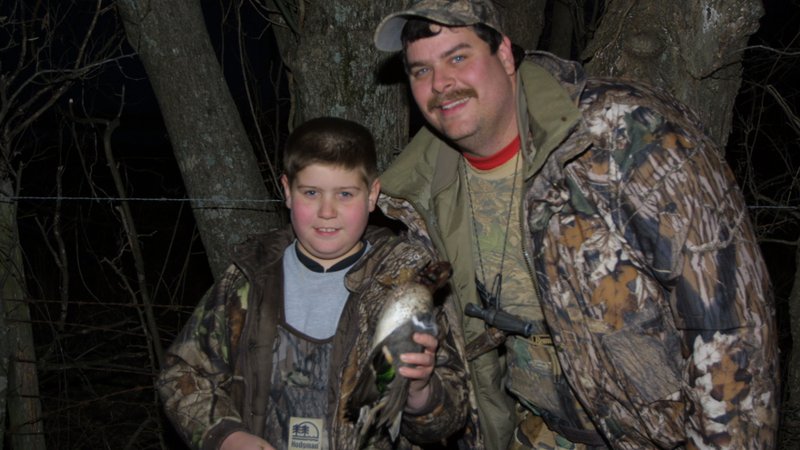
First of two youth waterfowl hunts is Saturday, Dec. 1; regular season reopens Dec. 6
LITTLE ROCK – Arkansas duck hunters are in the split between the first and second hunting periods of the 2018-19, 60-day season, with the second portion opening on Thursday, Dec. 6. In the meantime, Saturday (Dec. 1) offers the first of two opportunities for youths to take to the duck woods and fields for hunting with a supervising mentor.
Only hunters age 15 and younger may hunt ducks, geese, coots and mergansers, allowing their mentors to focus solely on teaching the next generation how to set up, call and have a successful waterfowl hunt. It also serves as a great opportunity for a hunting mentor to instill the unwritten rules of hunting to the youngsters, showing them that duck or goose hunting isn’t about bagging a limit the quickest or who can amass the biggest pile of birds for photos. The best part about Arkansas waterfowl hunting is the shared experience.
Youths will also have their own day to hunt waterfowl on Saturday, Feb. 2, 2019, following the close of the regular season the previous Sunday.
The hunting times for youth hunts are the same as regular hunting, with shooting time starting 30 minutes before sunrise and ending at sunset.
Youths who have completed a hunter education course may hunt on their own if their parent or legal guardian feels comfortable allowing them to. Youths who have not completed the hunter education course must be accompanied by a mentor who is 21 years or older. The members may set up the decoys, retrieve downed game and call ducks, but cannot shoot.
Another opportunity for youths is the ability to hunt all day on the WMA system. Regulations during the regular season call for all hunters to be done hunting at noon and off the water by 1 p.m., but on Saturday and on Feb. 2, youths may hunt until sunset even on the WMAs. Also, youths are not limited to the number of shotgun shells they may carry on the WMAs. However, mentors can take this opportunity as well to point out ethical rules about when a hunter should or should not take a shot.
The second split of duck season will run from Dec. 6 to Dec. 23. The season picks up again for the third time on Dec. 26, running through Jan. 27.
Northeast Arkansas
Earl Buss Bayou DeView WMA
Map | Water Gauge | Weather Report
Boaters should use caution while using the Thompson Tract boat run. A few ducks and geese are moving through the area.
South Oliver GTR
Habitat: Mast production has been good.
Water Level: 10% flooded with a current gauge reading of 0.0 feet. Most available water is within the natural slough.
Thompson Tract GTR
Habitat: Mast production has been good.
Water Level: 80% flooded with a current gauge reading of 0.9 feet.
Lake Hogue WRA
Habitat: Primarily deep open water habitat.
Water Level: Normal pool level.
Big Lake WMA
Map | Water Gauge | Weather Report
When the Ditch 81 extension gauge near Manila (upstream of the Big Lake north-end control structure) reads 17.5 feet, water is beginning to come over the north levee degrade on Big Lake WMA. When the Ditch 81 Extension gauge reads 18.0 feet or higher, the water level on the WMA will rise quickly and hunters should exercise caution while on the area. Be aware of underwater logs in boat runs and hangers in trees.
A few ducks and greese are seen flying around the area.
North Woods GTR
Habitat: Mast production is fair.
Water Level: Bo Dock gauge currently reads 235.3 feet msl. Target level is 235.5 feet with 95% flooded.
South Woods GTR
Habitat: Mast production is fair.
Water Level: The 7-Mile gauge is currently at 234.4 feet msl. Target level is 234.5 feet with 98% flooded.
Simmons Field
Habitat: A good amount of millet, smartweed and sedge is present. Seed production is very good in north unit, middle field was planted in Chawapa millet coverage is fair, south field was stripped in Chawapa millet fair with strips of smartweed that did extremely well.
Water Level: 100% coverage
St. Francis Sunken Lands WMA
Map | Water Gauge | Weather Report
Hunt Area
Habitat: Mast production is average within the hunt area.
Water Level: Water levels on St. Francis Sunken Lands for waterfowl season are dependent on flows from St. Francis River. The target level for providing huntable timber is 212.0 feet msl read from the Oak Donnick gauge. As of Nov. 26, levels were at 212.34 feet msl. Birds are in the area; however, numbers are still low.
Snowden WRA
Habitat: There was a small green up response of wetland plants after the growing season burns throughout the unit.
Water Level: 10% flooded, mostly in the low-lying areas due to rain.
Payneway WRA
Habitat: Pool D has 14 acres of buckwheat providing good bugging areas when water becomes available. A,B,C pools have sunflowers left standing with some smartweed response underneath. Barrows have been mowed for open-water use.
Water Level: Pool A is at 0%. Pool B is at 5% coverage. Pool C is at 10%. Pool D is at 30%.
Shirey Bay Rainey Brake WMA
Map | Water Gauge | Weather Report
Waterfowl hunters should be aware of hangers and submerged logs within the boat runs and GTRs. Please exercise caution when accessing the area. In addition, hunters should allow safe passage when parking vehicles along roadsides. Vehicles blocking access will be moved.
Adam Brake GTR
Habitat: Good abundance of mast crop within the GTR.
Water Level: Water level is 238.4 feet msl with a target level of 240.0 msl. 50% flooded.
Rainey Brake GTR
Habitat: Good abundance of mast crop within the GTR.
Water Level: 90% flooded.
Eagle Pond GTR
Habitat: Good abundance of mast crop within the GTR.
Water Level: 40% flooded.
Phase III Moist-Soil Unit
Habitat: Good wetland-type vegetation.
Water Level: 80% flooded.
Charles Crisp Moist-Soil Unit
Habitat: Good wetland-type vegetation.
Water Level: 70% flooded.
Ward Field Moist-Soil Unit
Habitat: Good wetland-type vegetation.
Water Level: 60% flooded.
River Field Moist-Soil Unit
Habitat: Good wetland-type vegetation..
Water Level: 70% flooded.
Dave Donaldson Black River WMA
Map | Water Gauge | Weather Report
Waterfowl hunters should be aware of hangers and submerged logs within the boat runs and GTRs. Please exercise caution when accessing the area. Please remember to keep boats off the levees so AGFC personnel can access the area. Boats blocking access will be moved. Unattended trailers are not to be left overnight on parking areas.
Upper Island GTR
Habitat: Below-average abundance of mast crop within the GTRs.
Water Level: Water level is 269.65 feet msl. Target level is 269.5 feet msl. 100% flooded.
Lower Island GTR
Habitat: Below-average abundance of mast crop within the GTRs.
Water Level: Water level is 268.25 feet msl. Target level is 268.0 feet msl. 100% flooded.
Upper Reyno GTR
Habitat: Below-average abundance of mast crop within the GTRs.
Water Level: Water level is 267.0 feet msl. Target level is 266.9 feet msl. 100% flooded.
Lower Reyno GTR
Habitat: Below-average abundance of mast crop within the GTRs.
Water Level: Water level is 266.0 feet msl. Target level is 266.3 feet msl. 85% flooded.
Winchester GTR
Habitat: Below-average abundance of mast crop within the GTRs.
Water Level: Water level is 263.25 feet msl. Target level is 263.7 feet msl. 80% flooded.
East-Central Arkansas
Sheffield Nelson Dagmar WMA
Map | Water Gauge | Weather Report
The Conway George units are available by applying for online permits. Please visit www.agfc.com for maps, special regulations, permit application and draw dates. Hunters should call the Wildlife Hotline at 800-440-1477 for current road closures.
Mud Slough GTR
Habitat: Good mast crop.
Water Level: 100%.
Apple Lake WRA
Habitat: Good mast crop.
Water Level: 100%.
Conway George Waterfowl Unit A
Habitat: Good stand of millet and native vegetation.
Water Level: 100%
Conway George Waterfowl Unit B
Habitat: Natural slough area with beneficial wetland plants
Water Level: 100%
Conway George Waterfowl Unit C
Habitat: Good stand of millet and native vegetation.
Water Level: 100%
Rex Hancock Black Swamp WMA
Map | Water Gauge | Weather Report
Hunters should call the Wildlife Hotline at 800-440-1477 for current road closures.
Main WMA
Habitat: Good mast crop.
Water Level: 75%.
Wyeville Unit
Habitat: Good stand of millet and native vegetation.
Water Level: 75% coverage.
Steve N. Wilson Raft Creek Bottoms WMA
Map | Water Gauge | Weather Report
Unit A
Habitat: Excellent stand of millet and native vegetation.
Water Level: 100% coverage.
Unit B
Habitat: Excellent stand of millet and native vegetation.
Water Level: 100%
Unit C
Habitat: Good stand of native vegetation.
Water Level: 100%
Unit D (Youth Area)
Habitat: Good stand of millet and native vegetation.
Water Level: 100%
Unit E
Habitat: Excellent stand of millet and native vegetation.
Water Level: 100%
Unit F
Habitat: Good stand of millet and native vegetation.
Water Level: 100%
Unit G
Habitat: Fair stand of millet and native vegetation.
Water Level: 100%
Unit H (Mobility-impaired blind)
Habitat: Excellent stand of millet and native vegetation.
Water Level: 100%
Unit I
Habitat: Habitat conditions are poor.
Water Level: 100%
Unit J (Cypert Tract)
Habitat: Excellent stand of millet and native vegetation.
Water Level: 100%
Unit K (Cypert Tract)
Habitat: Excellent stand of native vegetation.
Water Level: 15%
Unit L (Cypert Tract)
Habitat: Good stand of native vegetation.
Water Level: 0%
Henry Gray Hurricane Lake WMA
Map | Water Gauge | Weather Report
Hunters should call the Wildlife Hotline at 800-440-1477 for current road closures.
North GTR
Habitat: Good mast crop.
Water Level: The current Glaise Creek reading is 191.11 feet msl.
Note: All structures on the North GTR are closed.
South GTR
Habitat: Fair mast crop.
Water Level: The current Glaise Creek reading is 191.11 feet msl.
Note: All structures on the South GTR are open.
Central Arkansas
Craig D. Campbell Lake Conway Reservoir
Map | Weather Report
Habitat and water levels are normal on both Pierce and Dix creeks.
Bell Slough WMA
Map | Weather Report
The Bell Slough GTR is primarily rainfall dependent with the exception of a limited amount of water that the AGFC can back in and catch from Palarm Creek.
Bell Slough GTR
Habitat: Poor mast crop.
Water Level: 100%.
Palarm Creek WRA
Habitat: Millet was planted as a cover crop this year following disking within the moist-soil units.
Water Level: 90%
Cypress Bayou WMA
Hunt Area
Habitat: Good mast crop.
Water Level: 80% coverage.
Red Cut Slough Tract
Unit 1
Habitat: Good stand of millet and native vegetation.
Water Level: 80%
Unit 2
Habitat: Excellet stand of millet and native vegetation.
Water Level: 0%
Unit 3
Habitat: Good stand of millet and native vegetation.
Water Level: 0%
Unit 4
Habitat: Good stand of millet and native vegetation.
Water Level: 0%
Unit 5
Habitat: Good stand of millet and native vegetation.
Water Level: 0%
Unit 6
Habitat: Good stand of millet and native vegetation.
Water Level: 0%
Holland Bottoms WMA
Hunt Area
Habitat: Good mast crop.
Water Level: 30% coverage.
Lake Pickthorne WRA
Habitat: Excellent.
Water Level: East cell is 70% coverage. West cell is 20%.
Harris Brake WMA
Harris Brake Upper Unit
Habitat: Fair mast crop mixed in with native vegetation.
Water Level: 95%
Harris Brake Lower Unit
Habitat: Fair mast crop mixed in with native vegetation.
Water Level: 60%
Northwest Arkansas
Dardanelle WMA
McKennon Bottoms (half-day hunting)
Habitat: Good stand of native moist-soil vegetation.
Water Level: 100%.
Potter’s Pothole Hartman Waterfowl Unit (half-day hunting)
Habitat: Excellent stand of millet.
Water Level: 100%
Ozark Lake WMA/Dyer Lake Water Unit
Dyer Lake Cells (half-day hunting)
Habitat: Awaiting soybean harvest.
Water Level: Began pumping Monday, Nov. 19.
Nimrod Lloyd Millwood WMA
Nimrod GTR
Habitat: Fair mast crop mixed in with native vegetation.
Water Level: 5% and falling.
Frog Bayou WMA
Unit 1
Habitat: Sprangle top crabgrass, wild millet and smartweed.
Water Level: 100%
Unit 2
Habitat: Poor moist-soil response due to August flood.
Water Level: 100%
Unit 3
Habitat: Smartweed, toothcup, wild millet and sprangle top.
Water Level: 100%
Unit 4
Habitat: Wild millet, sprangle top, smartweed, nut sedge and crabgrass.
Water Level: 100%
Unit 5
Habitat: Sprangle top, wild millet and smartweed.
Water Level: 100%
Unit 6
Habitat: Wild millet, smartweed and crabgrass.
Water Level: 100%
Unit 7
Habitat: Smartweed, wild millet and sprangle top.
Water Level: 100%
Petit Jean River WMA
Map | Water Gauge | Weather Report
Santa Fe GTR
Habitat: Fair mast crop mixed in with native vegetation.
Water Level: 100%
Note: Both water control structure/gates had debris under them, preventing them from fully closing when the area was full of water. Once water levels go down enough to safely close these gates, they will be closed and the area will be allowed to refill once rains return.
Olin Cain/Sore Head Moist-Soil Unit
Habitat: Good stand of native vegetation.
Water Level: 90%
Black Lands Moist-Soil Unit
Habitat: Good stand of native vegetation.
Water Level: 90%
Slaty Crossing Moist-Soil Unit
Habitat: Fair stand of native vegetation.
Water Level: 90%
Pullen Pond
Habitat: Half of area has a fair stand of native vegetation, other half of area has 100 acres of Japanese millet.
Water Level: 30%
Pond Creek GTR
Habitat: Fair mast crop mixed in with native vegetation.
Water Level: 0%
Note: Both water control structures/gates had debris under them, preventing them from fully closing when the area was full of water. Once water levels go down enough to safely close these gates, they will be closed and the area will be allowed to refill once rains return.
Slaty Pond GTR
Habitat: Fair mast crop mixed in with native vegetation.
Water Level: 10%
Black Lands Duck Area
Habitat: Millet mixed in with good native vegetation.
Water Level: 35%
Note: Water levels will continue to rise due to the Kingfisher Lake valve being opened.
Galla Creek WMA
Galla Creek GTR
Habitat: Excellent stand of natural vegetation including a mixture of barnyard and smartweed.
Water Level: 50%, staged flooding of the impoundment began on Nov. 15.
Ed Gordon Point Remove WMA
Map | Weather Report
Most waterfowl impoundments on Ed Gordon Point Remove WMA are at full pool at this time. Duck use on hte WMA has decreased and hunter access on the WMA has been poor to moderate.
Little Hole (Unit 1)
Habitat: Natural vegetation.
Water Level: 100%
Willow Island (Unit 2)
Habitat: Natural vegetation.
Water Level: 100%
Red Gate (Unit 3)
Habitat: Natural vegetation.
Water Level: 100%
Pig Trough (Units 4 and 5)
Habitat: Natural vegetation.
Water Level: 100%
Cedar Ridge (Unit 6)
Habitat: Natural vegetation and Japanese and Chiwappa millet.
Water Level: 100%
Unit 7a
Habitat: Japanese and Chiwappa millet.
Water Level:100%
Unit 7b
Habitat: Natural vegetation.
Water Level: 100%
Duck Trap (Units 8a, 8b and 8c)
8a
Habitat: Natural vegetation and Japanese and Chiwappa millet.
Water Level: 100%
8b
Habitat: Natural vegetation and Japanese and Chiwappa millet.
Water Level: 100%
8c
Habitat: Natural vegetation and Japanese and Chiwappa millet.
Water Level: 100%
Unit 9
Habitat: Natural vegetation and Japanese and Chiwappa Millet.
Water Level: 100%
Controversy Corner (Unit 10)
Habitat: Natural vegetation and Japanese and Chiwappa millet.
Water Level: 100%
Remmel Marsh
Habitat: Natural vegetation and Japanese and Chiwappa millet.
Water Level: 100%
Mud Pond (Unit 12)
Habitat: Natural vegetation.
Water Level: 100%
Turkey Pond (Units 13a, 13b and 13c)
13a
Habitat: Natural vegetation and Japanese and Chiwappa millet.
Water Level: 100%
13b
Habitat: Natural vegetation.
Water Level: 100%
13c
Habitat: Natural vegetation and Japanese and Chiwappa millet.
Water Level: 100%
Teeny Pond (Unit 14)
Habitat: Natural vegetation.
Water Level: 100%
Salt Lick (Unit 15)
Habitat: Natural vegetation.
Water Level: 100%
Bobby’s Pond (Unit 16)
Habitat: Natural vegetation.
Water Level: 100%
Race Track (Unit 17)
Habitat: Natural vegetation.
Water Level: 100%
Southwest Arkansas
Sulphur River WMA
Mercer Bayou
Habitat: Fair.
Water Level: 100%. Drawn down for restoration project, boat ramps are open as water levels allow.
Henry Moore WRA
Habitat: Closed to hunting.
Water Level: 20%.
Millwood Lake
Map | Water Gauge | Weather Report
Habitat: Habitat conditions are good.
Water Level: 260.32 feet msl.
Dr. Lester Sitzes III Bois d’Arc WMA
Bois d’Arc Lake WRA
Habitat: Closed to hunting.
Water Level: Normal
Red Slough WRA
Habitat: Closed to hunting.
Water Level: 10%
GTR
Habitat: Good mast production.
Water Level: 15%.
Little Grassy
Habitat: Good.
Water Level: 70%
Ozan WMA
Unit 1
Habitat: Good
Water Level: 50%
Unit 2
Habitat: Good
Water Level: 0%
Unit 3
Habitat: Good
Water Level: 5%
Unit 4
Habitat: Good
Water Level: 70%
Unit 5
Habitat: Good
Water Level: 0%
Southeast Arkansas
Beryl Anthony Lower Ouachita WMA
Map | Weather Report
Habitat: The WMA has a good hard mast production.
Water Level: The Ouachita River is receding back into its banks below the Felsenthal Lock and Dam. The WMA is less than 10% flooded.
Freddie Black Choctaw Island WMA Deer Research Area
Map | Water Gauge | Weather Report
Habitat conditions are good. Flooding is river dependent. Click on the Water Gauge link above for current Mississippi River levels. Use extreme caution when boating in river.
Trusten Holder WMA
Map | Water Gauge | Weather Report
Habitat conditions are good. Flooding is river dependent. Click on the Water Gauge link above for current Arkansas River levels.
Seven Devils WMA
Hunt Area
Habitat: Habitat conditions are good
Water Level: 12.8 feet msl. Water levels are variable and too low for boat access.
Cut-Off Creek WMA
Hunt Area
Habitat: Habitat conditions are good.
Water Level: 0% flooded.
Pigeon Creek WRA
Habitat: Habitat conditions are good.
Water Level: 0% flooded.
George H. Dunklin Jr. Bayou Meto WMA
Upper Vallier GTR
Habitat: Good
Water Level: 178.5 feet msl, full pool at 180 feet msl.
Lower Vallier GTR
Habitat: Good
Water Level: 178.5 feet msl, full pool at 179 feet msl.
Government Cypress GTR
Habitat: Good
Water Level: 178.5 feet msl, full pool at 179 feet msl.
Buckingham Flats GTR
Habitat: Good
Water Level: 0% flooded. First phase of pumping ongoing.
Temple Island GTR
Habitat: Good
Water Level: 0% flooded. First phase of pumping ongoing.
Canon Brake
Habitat: Good
Water Level: 100% flooded.
Halowell WRA
Habitat: Excellent
Water Level: Staggered flooding of units. 75% flooded, good duck usage on west units.
Wrape Plantation WRA
Habitat: Excellent
Water Level: Staggered flooding of units.
Ducks return, geese remain prevalent for last week of season
LITTLE ROCK – Warmer temperatures last weekend and some much needed rainfall seemed to spark a significant return of waterfowl throughout Arkansas, but reports of success depended on choosing the right spot at the right time.
Geese were found in great numbers in the Delta again starting late Friday, particularly in areas of Lonoke, Prairie and Arkansas counties. Duck movement was noticed as well as thawing set in around many previously locked up areas of water last week. Hunters in various areas of the state that the AFGC contacted reported anywhere from peak numbers of mallards seen and limits harvested, to few ducks seen in what typically were dependable holes. Some AGFC personnel reported hunting in George H. Dunklin Bayou Meto Wildlife Management Area in the Upper Vallier portion and seeing few ducks on Sunday, but just two days later noted lots of shooting in the Upper Vallier and Government Cypress areas of the WMA.
Reports from the Grand Prairie area in and around Stuttgart were strong numbers of ducks being seen early this week. Everything from mallards to large flights of pintails to ringnecks were reported from hunters in fields.
“We still have just not had enough rain this season, but the little bit we got seemed to put enough puddles in the fields that ducks are finding them,” said Luke Naylor, the AGFC’s waterfowl program coordinator.
The Light Goose Conservation Order goes into effect for Arkansas hunters beginning Monday, Jan. 29, through 30 minutes after sunset Friday, Feb. 2, then resumes 30 minutes before sunrise Sunday, Feb. 4, and runs through a half-hour after sunset April 25. During the Conservation Order, all daily bag limits and possession limits are waived on Snow, Blue and Ross’s geese. Shotguns do not have to be plugged, electronic calls are allowed, and hunters 16 and older do not need a Migratory Bird Hunting and Conservation Stamp, Arkansas Waterfowl Stamp or HIP registration. A valid hunting license (from any state) is required, however. Youth 15 and younger do not need a license. Shooting hours during the Order are 30 minutes before sunrise until 30 minutes after sunset. The Light Goose Conservation Order only covers Snow, Blue and Ross’s geese. White-front geese (specklebellies) and Canada Geese are not part of the Order.
Northeast Arkansas
Earl Buss Bayou DeView WMA
Map | Water Gauge | Weather Report
Boaters should use caution while using the Thompson Tract boat run.
South Oliver GTR
Habitat: Mast production has been good.
Water Level: 70% flooded with a current gauge reading of 0.7 feet. There is a small amount of available water present within the natural slough on the north end of this GTR and south end of the North Oliver Tract.
Thompson Tract GTR
Habitat: Mast production has been good.
Water Level: 50% flooded with a current gauge reading of 0.6 feet.
Lake Hogue WRA
Habitat: A small amount of beneficial wetland plants is located along the east side of the lake.
Water Level: Normal pool level.
Big Lake WMA
Map | Water Gauge | Weather Report
When the Ditch 81 extension gauge near Manila (upstream of the Big Lake north-end control structure) reads 17.5 feet, water is beginning to come over the north levee degrade on Big Lake WMA. When the Ditch 81 Extension gauge reads 18.0 feet or higher, the water level on the WMA will rise quickly and hunters should exercise caution while on the area. Be aware of underwater logs in boat runs and hangers in trees.
North Woods GTR
Habitat: Mast production is good.
Water Level: Bo Dock gauge currently reads 236.4 feet, Target level is 235.5 feet with 100% flooded.
South Woods GTR
Habitat: Mast production is good.
Water Level: The 7-Mile gauge is currently at 235.4 feet. Target level is 234.5 feet with 100% flooded.
Simmons Field
Habitat: A good amount of millet, smartweed and sedge is present. Seed production is very good.
Water Level: 100% coverage
St. Francis Sunken Lands WMA
Map | Water Gauge | Weather Report
Hunt Area
Habitat: Mast production is considered above average within the timber and floodways.
Water Level: Water levels in the huntable areas are dependent on St. Francis River flows. The water level at Oak Donnick is 212.42 feet, and approximately 100% of the huntable area is flooded.
Snowden WRA
Habitat: There is a small amount of beneficial wetland plants within the borrow areas.
Water Level: 10% flooded
Payneway WRA
Habitat: There are 70 acres of corn and millet planted throughout the WRA
Water Level: Pool A is at 0%. Pool B is at 5% coverage. Pool C is at 10%. Pool D is at 20%.
Shirey Bay Rainey Brake WMA
Map | Water Gauge | Weather Report
Waterfowl hunters should be aware of hangers and submerged logs within the boat runs and GTRs. Please exercise caution when accessing the area. In addition, hunters should allow safe passage when parking vehicles along roadsides. Vehicles blocking access will be moved.
Adam Brake GTR
Habitat: High abundance of mast crop within the GTR.
Water Level: Water level is 240.0 feet msl with a target level of 240.0 msl. 100% flooded.
Rainey Brake GTR
Habitat: High abundance of mast crop within the GTR.
Water Level: 90% flooded.
Eagle Pond GTR
Habitat: High abundance of mast crop within the GTR.
Water Level: 100% flooded.
Phase III Moist-Soil Unit
Habitat: Fair wetland-type vegetation.
Water Level: 60% flooded.
Charles Crisp Moist-Soil Unit
Habitat: Fair wetland-type vegetation.
Water Level: 70% flooded.
Ward Field Moist-Soil Unit
Habitat: Good wetland-type vegetation.
Water Level: 100% flooded.
River Field Moist-Soil Unit
Habitat: High abundance of native wetland vegetation..
Water Level: 0% flooded.
Dave Donaldson Black River WMA
Map | Water Gauge | Weather Report
Waterfowl hunters should be aware of hangers and submerged logs within the boat runs and GTRs. Please exercise caution when accessing the area. Please remember to keep boats off the levees so AGFC personnel can access the area. Boats blocking access will be moved. Unattended trailers are not to be left overnight on parking areas.
Upper Island GTR
Habitat: Average abundance of mast crop within the GTRs.
Water Level: Water level is 269.35 feet msl. Target level is 269.5 feet msl. 95% flooded.
Lower Island GTR
Habitat: Average abundance of mast crop within the GTRs.
Water Level: Water level is 268.3 feet msl. Target level is 268.0 feet msl. 100% flooded.
Upper Reyno GTR
Habitat: Average abundance of mast crop within the GTRs.
Water Level: Water level is 267.24 feet msl. Target level is 266.9 feet msl. 100% flooded.
Lower Reyno GTR
Habitat: Average abundance of mast crop within the GTRs.
Water Level: Water level is 265.8 feet msl. Target level is 266.3 feet msl. 80% flooded.
Winchester GTR
Habitat: Average abundance of mast crop within the GTRs.
Water Level: Water level is 263.4 feet msl. Target level is 263.7 feet msl. 90% flooded.
East Central Arkansas
Sheffield Nelson Dagmar WMA
Map | Water Gauge | Weather Report
The Conway George units are available by applying for online permits. Permit hunts are on Saturday and Sunday. Please visit www.agfc.com for maps, special regulations, permit application and draw dates. Hunters should call the Wildlife Hotline at 800-440-1477 for current road closures.
Mud Slough GTR
Habitat: Good mast crop.
Water Level: 100%.
Apple Lake WRA
Habitat: Good mast crop.
Water Level: 100%.
Conway George Waterfowl Unit A
Habitat: Good stand of millet and native vegetation.
Water Level: 100%
Conway George Waterfowl Unit B
Habitat: Natural slough area with beneficial wetland plants
Water Level: 100%
Conway George Waterfowl Unit C
Habitat: Good stand of millet and native vegetation.
Water Level: 100%
Rex Hancock Black Swamp WMA
Map | Water Gauge | Weather Report
Hunters should call the Wildlife Hotline at 800-440-1477 for current road closures.
Main WMA
Habitat: Good mast crop.
Water Level: 10%.
Wyeville Unit
Habitat: Good stand of millet and native vegetation.
Water Level: 100% coverage.
Steve N. Wilson Raft Creek Bottoms WMA
Map | Water Gauge | Weather Report
Unit A
Habitat: Excellent stand of millet and native vegetation.
Water Level: 100% coverage.
Unit B
Habitat: Excellent stand of millet and native vegetation.
Water Level: 100%
Unit C
Habitat: Good stand of native vegetation.
Water Level: 100%
Unit D (Youth Area)
Habitat: Good stand of millet and native vegetation.
Water Level: 100%
Unit E
Habitat: Good stand of millet and native vegetation.
Water Level: 100%
Unit F
Habitat: Good stand of millet and native vegetation.
Water Level: 60%
Unit G
Habitat: Fair stand of millet and native vegetation.
Water Level: 85%
Unit H (Mobility-impaired blind)
Habitat: Excellent stand of millet and native vegetation.
Water Level: 100%
Unit I
Habitat: Habitat conditions are poor.
Water Level: 80%
Unit J (Cypert Tract)
Habitat: Fair stand of native vegetation.
Water Level: 70%
Unit K (Cypert Tract)
Habitat: Excellent stand of millet and native vegetation.
Water Level: 75%
Unit L (Cypert Tract)
Habitat: Good stand of millet.
Water Level: 100%
Henry Gray Hurricane Lake WMA
Map | Water Gauge | Weather Report
Hunters should call the Wildlife Hotline at 800-440-1477 for current road closures.
North GTR
Habitat: Good mast crop.
Water Level: 90% coverage
South GTR
Habitat: Good mast crop.
Water Level: 45% coverage
Central Arkansas
Craig D. Campbell Lake Conway Reservoir
Map | Weather Report
Habitat and water levels are normal on both Pierce and Dix creeks.
Bell Slough WMA
Map | Weather Report
The Bell Slough GTR is primarily rainfall dependent with the exception of a limited amount of water that the AGFC can back in and catch from Palarm Creek.
Bell Slough GTR
Habitat: Moderate mast crop.
Water Level: 85%.
Palarm Creek WRA
Habitat: Millet was planted as a cover crop this year following disking within the moist-soil units.
Water Level: 100%
Holland Bottoms WMA
Hunt Area
Habitat: Good mast crop.
Water Level: 20% coverage.
Lake Pickthorne WRA
Habitat: Excellent.
Water Level: East cell is 100%. West cell is 100%.
Harris Brake WMA
Harris Brake Upper Unit
Habitat: Good mast crop mixed in with native vegetation.
Water Level: 100%
Harris Brake Lower Unit
Habitat: Good mast crop mixed in with native vegetation.
Water Level: 100%
Northwest Arkansas
Dardanelle WMA
McKennon Bottoms (half-day hunting)
Habitat: Good stand of native moist-soil vegetation.
Water Level: 100%.
Potter’s Pothole Hartman Waterfowl Unit (half-day hunting)
Habitat: Good stand of native moist-soil vegetation.
Water Level: 100%
Ozark Pool
Dyer Lake Cells (half-day hunting)
Habitat: Native vegetation.
Water Level: Dry.
Nimrod Lloyd Millwood WMA
Nimrod GTR
Good mast crop mixed in with native vegetation.
Water Level: 5%
Frog Bayou WMA
Unit 1
Habitat: Planted millet and native moist-soil vegetation.
Water Level: 95%
Unit 2
Habitat: Poor moist-soil response.
Water Level: 0% – rainfall dependent
Unit 3
Habitat: Primarily perennial vegetation.
Water Level: 95%
Unit 4
Habitat: Planted millet and native moist-soil vegetation.
Water Level: 95%
Unit 5
Habitat: Good moist-soil vegetation.
Water Level: 95%
Unit 6
Habitat: Good moist-soil response.
Water Level: 90%
Unit 7
Habitat: Some annual and perennial moist-soil vegetation.
Water Level: 90%
Petit Jean River WMA
Map | Water Gauge | Weather Report
Santa Fe GTR
Habitat: Good mast crop mixed in with native vegetation.
Water Level: 5%
Olin Cain Moist-Soil Unit
Habitat: 25% native vegetation with 75% bare ground due to ongoing waterfowl habitat enhancement projects.
Water Level: 35%
Black Lands Moist-Soil Unit
Habitat: 25% native vegetation with 75% bare ground due to ongoing waterfowl habitat enhancement projects.
Water Level: 20%
Slaty Crossing Moist-Soil Unit
Habitat: 25% native vegetation with 75% bare ground due to ongoing waterfowl habitat enhancement projects.
Water Level: 15%
Pullen Pond
Habitat: Native vegetation.
Water Level: 20%
Pond Creek GTR
Habitat: Good mast crop mixed in with native vegetation.
Water Level: 5%
Slaty Pond GTR
Habitat: Good mast crop mixed in with native vegetation.
Water Level: 5%
Black Lands Duck Area
Habitat: Good mast crop mixed in with native vegetation.
Water Level: 90%
Galla Creek WMA
Galla Creek GTR
Habitat: Natural vegetation, including a mixture of barnyard and smartweed.
Water Level: 100% – Staged flooding of the impoundment began on Nov. 27 and the waterfowl impoundment is flooded to full pool at this time.
Ed Gordon Point Remove WMA
Map | Weather Report
Most waterfowl impoundments on Ed Gordon Point Remove WMA have some degree of water at this time, and all units that can be artificially flooded are at or near full capacity. Duck use on the WMA has continued to be low, and hunter success has been generally poor.
Willow Island
Habitat: Natural vegetation.
Water Level: 100%
Little Hole
Habitat: Natural vegetation.
Water Level: 95%
Red Gate
Habitat: Natural vegetation.
Water Level: 95%
Pig Trough
Habitat: Natural vegetation.
Water Level: 80%
Cedar Ridge
Habitat: Natural vegetation.
Water Level: 100%
Duck Trap
Habitat: Natural vegetation.
Water Level: 30%
Salt Lick
Habitat: Natural vegetation.
Water Level: 80%
Bobby’s Pond
Habitat: Natural vegetation.
Water Level: 75%
Race Track
Habitat: Natural vegetation.
Water Level: 100%
Controversy Corner
Habitat: Natural vegetation.
Water Level: 90%
Remmel Marsh
Habitat: Natural vegetation.
Water Level: 90%
Mud Pond
Habitat: Natural vegetation.
Water Level: 10%
Turkey Pond
Habitat: Natural vegetation.
Water Level: 15%
Teeny Pond
Habitat: Natural vegetation.
Water Level: 0%
Southwest Arkansas
Sulphur River WMA
Map | Weather Report
The Henry Moore WRA is not flooded due to pump problems.
Mercer Bayou
Habitat: Fair.
Water Level: Drawn down for restoration project, boat ramps are closed.
Henry Moore WRA
Habitat: Closed to hunting.
Water Level: 0%.
Millwood Lake
Map | Water Gauge | Weather Report
Habitat: Habitat conditions are good.
Water Level: 259.52 feet msl.
Dr. Lester Sitzes III Bois d’Arc WMA
Bois d’Arc Lake WRA
Habitat: Closed to hunting.
Water Level: Normal
Red Slough WRA
Habitat: Closed to hunting.
Water Level: 40%
GTR
Habitat: Good mast production.
Water Level: 100%.
Little Grassy
Habitat: Habitat is fair.
Water Level: 60%
Ozan WMA
Habitat: Good
Water Level: 10%
Southeast Arkansas
Beryl Anthony Lower Ouachita WMA
Map | Weather Report
The WMA has fair hard mast production. Water is available in the oxbow lakes located in the WMA.
Freddie Black Choctaw Island WMA Deer Research Area
Map | Water Gauge | Weather Report
Habitat conditions are good. Flooding is river dependent. Click on the Water Gauge link above for current Mississippi River levels. Use extreme caution when boating in river.
Trusten Holder WMA
Map | Water Gauge | Weather Report
Habitat conditions are good. Flooding is river dependent. Click on the Water Gauge link above for current Arkansas River levels.
Seven Devils WMA
Hunt Area
Habitat: Habitat conditions are good, with an excellent acorn crop.
Water Level: This area is in a dry rotation year for flooding but some overbank flooding is occurring from Cut-Off Creek. Water level on 1-22-2018 was 130.2 feet msl.
Cut-Off Creek WMA
Hunt Area
Habitat: Habitat conditions are good, with an excellent acorn crop.
Water Level: 100% flooded.
Pigeon Creek WRA
Habitat: Habitat conditions are good, excellent acorn crop.
Water Level: 100% flooded.
George H. Dunklin Jr. Bayou Meto WMA
Upper Vallier GTR
Habitat: Good
Water Level: 180 feet msl, full pool at 180 feet msl.
Lower Vallier GTR
Habitat: Good
Water Level: 179.8 feet msl, full pool at 179 feet msl. Use extreme caution when operating boats near water control structures.
Government Cypress GTR
Habitat: Good
Water Level: 179.8 feet msl, full pool at 179 feet msl.
Buckingham Flats GTR
Habitat: Good
Water Level: 100% flooded.
Temple Island GTR
Habitat: Good
Water Level: 100% flooded.
Canon Brake
Habitat: Good
Water Level: 100% flooded. Use extreme caution when operating boats near water control structures.
Halowell WRA
Habitat: Excellent
Water Level: Staggered flooding of units.
Wrape Plantation WRA
Habitat: Excellent
Water Level: Staggered flooding of units.
Recent News

Arkansas Wildlife Weekly Fishing Report
Jul. 10, 2025
Lonoke aquaculturist named to AGFC
Jul. 10, 2025
Subscribe to Our Weekly Newsletter E-mails
Don’t miss another issue. Sign up now to receive the AGFC Wildlife Weekly Newsletter in your mailbox every Wednesday afternoon (Waterfowl Reports are published weekly during waterfowl season and periodically outside the season). Fishing Reports arrive on Thursdays. Fill in the following fields and hit submit. Thanks, and welcome!