Arkansas Wildlife Waterfowl Report
BY Jim Harris
ON 12-20-2017
Dec. 20, 2017
Jim Harris
Managing Editor Arkansas Wildlife Magazine
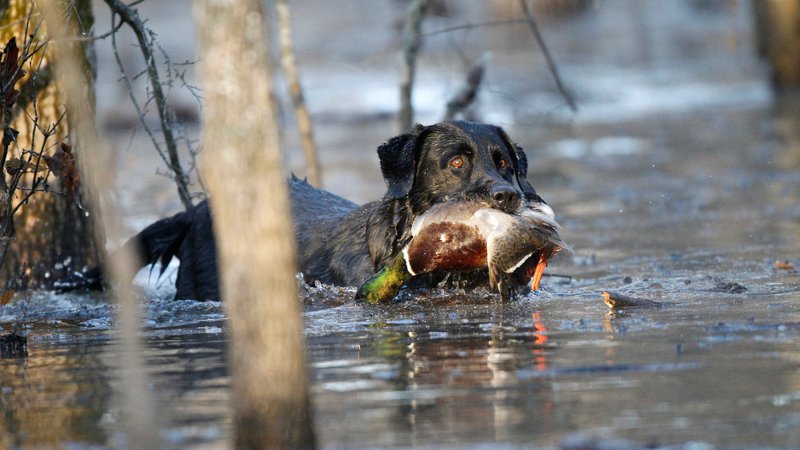
Heavy Rain, Likely Runoff Should Open Up Habitat for Ducks
LITTLE ROCK – The heavy rainfall that Arkansas waterfowl hunters have been waiting for all season finally arrived Tuesday, at least for the southern portion of the state, and with it comes hopes for better habitat conditions to spread out the duck migration into the state.
A large area in east-central Arkansas received up to 6 inches of rainfall in a 24-hour period Tuesday-Wednesday, according to the National Weather Service, and a large swath of the state from the southwestern tip to West Memphis appeared to receive anywhere from 3 to 5 inches of rainfall in that period. All but the northernmost reaches +of Arkansas received at least an inch. Before Tuesday, the state was enduring record drought conditions in many areas, and the Arkansas Game and Fish Commission’s greentree reservoirs and other wildlife management areas were battling dry conditions and little chance finding ducks. Aerial surveys conducted Dec. 4-7 showed that while the mallard numbers mirrored totals for the past six Decembers, nearly half the mallard population in Arkansas was in flooded ricefields, and the remainder were scrounging for the limited water available – much of that artificially flooded on private land – outside of the major tributaries in the state.
“It’s raining, and that’s good,” Luke Naylor, the AGFC’s waterfowl program coordinator, said Tuesday afternoon. “Maybe we’ll start getting a little runoff after this rain and that should help us for sure. We’re still not sure it will be enough to make a whole lot more habitat available for ducks, but we’ll start to get some runoff in some areas and then see what that ends up doing.
“There are ducks around. Our waterfowl count was about average for a December, and there are places that have a bunch of ducks in them. We just need more surface water. We have fairly typical mallard numbers, so with more water coming in, hopefully more habitat will be available to them. There have been fairly cold conditions to the north of here and we’ve seen some ducks move our way.”
Forecasts for the coming weeks show possible lower temperatures through the new year. “That will move ducks in now that we have the habitat,” Naylor said. “After this system, at the end of the week, it’s just shaky past that as far as more water. It’s just kind of unknown. We could settle into a pattern where we’re getting rain every week. It’s just hard to know at this point. We had a little bit of rain last week so the grown should be fully saturated and with a lot of rain, that could become runoff and start filling up some places. Some of the bayous and sloughs are starting to stack water. Some places that would normally be flooded now that aren’t, those might be stackng up some water after this week’s system.”
NOTE (UPDATE 12-22-2017): Most water levels listed in the Waterfowl Report were taken on Monday, before the rain system that moved into Arkansas on Tuesday. Updated water levels since the rains began are noted, and water levels are changing throughout the state with the second system passing through Friday, Dec. 22.
Northeast Arkansas
Earl Buss Bayou DeView WMA
Map | Water Gauge | Weather Report
Boaters should use caution while using the Thompson Tract boat run.
South Oliver GTR
Habitat: Mast production has been good.
Water Level: 0% flooded with a current gauge reading of 0.0 feet. There is a small amount of available water present within the natural slough on the north end of this GTR and south end of the North Oliver Tract.
Thompson Tract GTR
Habitat: Mast production has been good.
Water Level: 0% flooded with a current gauge reading of 0.0 feet.
Lake Hogue WRA
Habitat: A small amount of beneficial wetland plants is located along the east side of the lake.
Water Level: Normal pool level.
Big Lake WMA
Map | Water Gauge | Weather Report
When the Ditch 81 extension gauge near Manila (upstream of the Big Lake north-end control structure) reads 17.5 feet, water is beginning to come over the north levee degrade on Big Lake WMA. When the Ditch 81 Extension gauge reads 18.0 feet or higher, the water level on the WMA will rise quickly and hunters should exercise caution while on the area. Be aware of underwater logs in boat runs and hangers in trees.
North Woods GTR
Habitat: Mast production is good.
Water Level: Bo Dock gauge currently reads 234.2 feet, Target level is 235.5 feet with 0% flooded.
South Woods GTR
Habitat: Mast production is good.
Water Level: The 7-Mile gauge is currently at 233.2 feet. Target level is 234.5 feet with 20% flooded.
Simmons Field
Habitat: A good amount of millet, smartweed and sedge is present. Seed production is very good.
Water Level: 15%
St. Francis Sunken Lands WMA
Map | Water Gauge | Weather Report
Hunt Area
Habitat: Mast production is considered above average within the timber and floodways.
Water Level: Water levels in the huntable areas are dependent on St. Francis River flows. The water level at Oak Donnick is 211.22 feet, and approximately 85% of the huntable area is flooded.
Snowden WRA
Habitat: There is a small amount of beneficial wetland plants within the borrow areas.
Water Level: 0% flooded
Payneway WRA
Habitat: There are 70 acres of corn and millet planted throughout the WRA
Water Level: Pool A is at 0%. Pool B is at 0%. Pool C is at 0%. Pool D is at 0%.
Shirey Bay Rainey Brake WMA
Map | Water Gauge | Weather Report
Waterfowl hunters should be aware of hangers and submerged logs within the boat runs and GTRs. Please exercise caution when accessing the area. In addition, hunters should allow safe passage when parking vehicles along roadsides. Vehicles blocking access will be moved.
Adam Brake GTR
Habitat: High abundance of mast crop within the GTR.
Water Level: Water level is 238.5 feet msl with a target level of 240.0 msl. 65% flooded.
Rainey Brake GTR
Habitat: High abundance of mast crop within the GTR.
Water Level: 90% flooded.
Eagle Pond GTR
Habitat: High abundance of mast crop within the GTR.
Water Level: 80% flooded.
Phase III Moist-Soil Unit
Habitat: Fair wetland-type vegetation.
Water Level: 20% flooded.
Charles Crisp Moist-Soil Unit
Habitat: Fair wetland-type vegetation.
Water Level: 70% flooded.
Ward Field Moist-Soil Unit
Habitat: Good wetland-type vegetation.
Water Level: 100% flooded.
River Field Moist-Soil Unit
Habitat: High abundance of native wetland vegetation..
Water Level: 0% flooded.
Dave Donaldson Black River WMA
Map | Water Gauge | Weather Report
Waterfowl hunters should be aware of hangers and submerged logs within the boat runs and GTRs. Please exercise caution when accessing the area. Please remember to keep boats off the levees so AGFC personnel can access the area. Boats blocking access will be moved. Unattended trailers are not to be left overnight on parking areas.
Upper Island GTR
Habitat: Average abundance of mast crop within the GTRs.
Water Level: Water level is 269.28 feet msl. Target level is 269.5 feet msl. 90% flooded.
Lower Island GTR
Habitat: Average abundance of mast crop within the GTRs.
Water Level: Water level is 268.25 feet msl. Target level is 268.0 feet msl. 100% flooded.
Upper Reyno GTR
Habitat: Average abundance of mast crop within the GTRs.
Water Level: Water level is 266.85 feet msl. Target level is 266.9 feet msl. 95% flooded.
Lower Reyno GTR
Habitat: Average abundance of mast crop within the GTRs.
Water Level: Water level is 265.85 feet msl. Target level is 266.3 feet msl. 75% flooded.
Winchester GTR
Habitat: Average abundance of mast crop within the GTRs.
Water Level: Water level is 263.42 feet msl. Target level is 263.7 feet msl. 90% flooded.
East Central Arkansas
Sheffield Nelson Dagmar WMA
Map | Water Gauge | Weather Report
The Conway George units are available by applying for online permits. Permit hunts are on Saturday and Sunday. Please visit www.agfc.com for maps, special regulations, permit application and draw dates. Hunters should call the Wildlife Hotline at 800-440-1477 for current road closures.
Mud Slough GTR
Habitat: Good mast crop.
Water Level: 0%.
Apple Lake WRA
Habitat: Good mast crop.
Water Level: 90%.
Conway George Waterfowl Unit A
Habitat: Good stand of millet and native vegetation.
Water Level: 100%
Conway George Waterfowl Unit B
Habitat: Natural slough area with beneficial wetland plants
Water Level: 100%
Conway George Waterfowl Unit C
Habitat: Good stand of millet and native vegetation.
Water Level: 100%
Rex Hancock Black Swamp WMA
Map | Water Gauge | Weather Report
Hunters should call the Wildlife Hotline at 800-440-1477 for current road closures.
Main WMA
Habitat: Good mast crop.
Water Level: 0%
Wyeville Unit
Habitat: Good stand of millet and native vegetation.
Water Level: 90%
Steve N. Wilson Raft Creek Bottoms WMA
*Due to low water conditions, no permit draw will be conducted this Saturday (the second split ends Dec. 23 at sunset, with season reopening Dec. 26). The Mobility Impaired and Youth Blind are available for the online draw only. The WMA is open for waterfowl hunting and hunters will need to pick up a permit from the kiosks located in the parking areas. Water levels should improve throughout the week with the forecasted rain and AGFC pumping efforts.
Map | Water Gauge | Weather Report
Unit A
Habitat: Excellent stand of millet and native vegetation.
Water Level: 70%
Unit B
Habitat: Excellent stand of millet and native vegetation.
Water Level: 55%
Unit C
Habitat: Good stand of native vegetation.
Water Level: 5%
Unit D (Youth Area)
Habitat: Good stand of millet and native vegetation.
Water Level: 50%
Unit E
Habitat: Good stand of millet and native vegetation.
Water Level: 15%
Unit F
Habitat: Good stand of millet and native vegetation.
Water Level: 5%
Unit G
Habitat: Fair stand of millet and native vegetation.
Water Level: 20%
Unit H (Mobility-impaired blind)
Habitat: Excellent stand of millet and native vegetation.
Water Level: 100%
Unit I
Habitat: Habitat conditions are poor.
Water Level: 30%
Unit J (Cypert Tract)
Habitat: Fair stand of native vegetation.
Water Level: 5%
Unit K (Cypert Tract)
Habitat: Excellent stand of millet and native vegetation.
Water Level: 5%
Unit L (Cypert Tract)
Habitat: Good stand of millet.
Water Level: 5%
Henry Gray Hurricane Lake WMA
Map | Water Gauge | Weather Report
Hunters should call the Wildlife Hotline at 800-440-1477 for current road closures.
North GTR
Habitat: Good mast crop.
Water Level: 0%
South GTR
Habitat: Good mast crop.
Water Level: 0%
Central Arkansas
Craig D. Campbell Lake Conway Reservoir
Map | Weather Report
Habitat and water levels are normal on both Pierce and Dix creeks.
Bell Slough WMA
Map | Weather Report
The Bell Slough GTR is primarily rainfall dependent with the exception of a limited amount of water that the AGFC can back in and catch from Palarm Creek.
Bell Slough GTR
Habitat: Moderate mast crop.
Water Level: 25%.
Palarm Creek WRA
Habitat: Millet was planted as a cover crop this year following disking within the moist-soil units.
Water Level: 45%
Holland Bottoms WMA
Hunt Area
Habitat: Good mast crop.
Water Level: 0%
Lake Pickthorne WRA
Habitat: Excellent.
Water Level: East cell is 10%. West cell is 30%.
Harris Brake WMA
Harris Brake Upper Unit
Habitat: Good mast crop mixed in with native vegetation.
Water Level: 100%
Harris Brake Lower Unit
Habitat: Good mast crop mixed in with native vegetation.
Water Level: 100%
Northwest Arkansas
Dardanelle WMA
McKennon Bottoms (half-day hunting)
Habitat: Good stand of native moist-soil vegetation.
Water Level: 100%.
Potter’s Pothole Hartman Waterfowl Unit (half-day hunting)
Habitat: Good stand of native moist-soil vegetation.
Water Level: 100%
Ozark Pool
Dyer Lake Cells (half-day hunting)
Habitat: Native vegetation.
Water Level: Dry.
Nimrod Lloyd Millwood WMA
Nimrod GTR
Good mast crop mixed in with native vegetation.
Water Level: 0%
Frog Bayou WMA
Unit 1
Habitat: Planted millet and native moist-soil vegetation.
Water Level: 95%
Unit 2
Habitat: Poor moist-soil response.
Water Level: 0% – rainfall dependent
Unit 3
Habitat: Primarily perennial vegetation.
Water Level: 95%
Unit 4
Habitat: Planted millet and native moist-soil vegetation.
Water Level: 95%
Unit 5
Habitat: Good moist-soil vegetation.
Water Level: 95%
Unit 6
Habitat: Good moist-soil response.
Water Level: 90%
Unit 7
Habitat: Some annual and perennial moist-soil vegetation.
Water Level: 90%
Petit Jean River WMA
Map | Water Gauge | Weather Report
Santa Fe GTR
Habitat: Good mast crop mixed in with native vegetation.
Water Level: 0%
Olin Cain Moist-Soil Unit
Habitat: 25% native vegetation with 75% bare ground due to ongoing waterfowl habitat enhancement projects.
Water Level: 10%
Black Lands Moist-Soil Unit
Habitat: 25% native vegetation with 75% bare ground due to ongoing waterfowl habitat enhancement projects.
Water Level: 0%
Slaty Crossing Moist-Soil Unit
Habitat: 25% native vegetation with 75% bare ground due to ongoing waterfowl habitat enhancement projects.
Water Level: 0%
Pullen Pond
Habitat: Native vegetation.
Water Level: 0%
Pond Creek GTR
Habitat: Good mast crop mixed in with native vegetation.
Water Level: 0%
Slaty Pond GTR
Habitat: Good mast crop mixed in with native vegetation.
Water Level: 0%
Black Lands Duck Area
Habitat: Good mast crop mixed in with native vegetation.
Water Level: 40%
Galla Creek WMA
Galla Creek GTR
Habitat: Natural vegetation, including a mixture of barnyard and smartweed.
Water Level: 100% – Staged flooding of the impoundment began on Nov. 27 and the waterfowl impoundment is flooded to full pool at this time.
Ed Gordon Point Remove WMA
Map | Weather Report
While water levels have improved slightly, most waterfowl impoundments on Ed Gordon Point Remove WMA still remain dry or have very little water at this time. Due to inadequate rainfall, water levels in Point Remove Creek are too low to allow for pumping in most units; however, limited pumping has been possible, and impoundments will continue to be flooded as water levels in the creek allow. Duck use on the WMA has been minimal and hunter success has been poor.
Willow Island
Habitat: Natural vegetation.
Water Level: 0%
Little Hole
Habitat: Natural vegetation.
Water Level: 0%
Red Gate
Habitat: Natural vegetation.
Water Level: 60%
Pig Trough
Habitat: Natural vegetation.
Water Level: 0%
Cedar Ridge
Habitat: Natural vegetation.
Water Level: 10%
Duck Trap
Habitat: Natural vegetation.
Water Level: 10%
Salt Lick
Habitat: Natural vegetation.
Water Level: 0%
Bobby’s Pond
Habitat: Natural vegetation.
Water Level: 60%
Race Track
Habitat: Natural vegetation.
Water Level: 70%
Controversy Corner
Habitat: Natural vegetation.
Water Level: 80%
Remmel Marsh
Habitat: Natural vegetation.
Water Level: 90%
Mud Pond
Habitat: Natural vegetation.
Water Level: 0%
Turkey Pond
Habitat: Natural vegetation.
Water Level: 0%
Teeny Pond
Habitat: Natural vegetation.
Water Level: 0%
Southwest Arkansas
Sulphur River WMA
Map | Weather Report
The Henry Moore WRA is not flooded due to pump problems.
Mercer Bayou
Habitat: Fair.
Water Level: Drawn down for restoration project, boat ramps are closed.
Henry Moore WRA
Habitat: Closed to hunting.
Water Level: 0%.
Millwood Lake
Map | Water Gauge | Weather Report
Habitat: Habitat conditions are good.
Water Level: 258.67 feet msl
Dr. Lester Sitzes III Bois d’Arc WMA
Bois d’Arc Lake WRA
Habitat: Closed to hunting.
Water Level: 10%
Red Slough WRA
Habitat: Closed to hunting.
Water Level: 5%
GTR
Habitat: Good mast production.
Water Level: 25%. Boat t ravel is possible from the boat launch to the cross levee. Water is currently running north over the cross levee. As of Dec. 18, boat travel is possible north of the cross levee but you will have to drag your boat over the cross levee to boatable water.. The sloughs within the GTR are swelling.
Little Grassy
Habitat: Habitat is fair.
Water Level: 10%
Ozan WMA
Habitat: Good
Water Level: 0%
Southeast Arkansas
NOTE: UPDATED 12-22-2017)
Beryl Anthony Lower Ouachita WMA
Map | Weather Report
There has been fair hard mast production. There is minor flooding in the area, mostly in sloughs and oxbow lakes.
Freddie Black Choctaw Island WMA Deer Research Area
Map | Water Gauge | Weather Report
Habitat conditions are good. Flooding is river dependent. Click on the Water Gauge link above for current Mississippi River levels. Use extreme caution when boating in river.
Trusten Holder WMA
Map | Water Gauge | Weather Report
Habitat conditions are good. Flooding is river dependent. Click on the Water Gauge link above for current Arkansas River levels.
Seven Devils WMA
Hunt Area
Habitat: Habitat conditions are good, with an excellent acorn crop.
Water Level: This area is in a dry rotation year for flooding but some overbank flooding is occurring from Cut Off Creek.
Cut-Off Creek WMA
Hunt Area
Habitat: Habitat conditions are good, with an excellent acorn crop.
Water Level: Recent rains have water rising.
Pigeon Creek WRA
Habitat: Habitat conditions are good, excellent acorn crop.
Water Level: Pumping from Cut Off Creek has begun.
George H. Dunklin Jr. Bayou Meto WMA
Upper Vallier GTR
Habitat: Good
Water Level: 178 feet msl, full pool at 180 feet msl..
Lower Vallier GTR
Habitat: Good
Water Level: 179 feet msl, full pool at 179 feet msl.
Government Cypress GTR
Habitat: Good
Water Level: 178 feet msl, full pool at 179 feet msl.
Buckingham Flats GTR
Habitat: Good
Water Level: 100% flooded.
Temple Island GTR
Habitat: Good
Water Level: Pumping from Salt Bayou Ditch is delayed due to excessive road flooding.
Canon Brake
Habitat: Good
Water Level: Water levels rising, likely reach full pool in 24 hours.
Halowell WRA
Habitat: Excellent
Water Level: Staggered flooding of units.
Wrape Plantation WRA
Habitat: Excellent
Water Level: Staggered flooding of units.
Recent News

Arkansas Wildlife Weekly Fishing Report
Jul. 10, 2025
Lonoke aquaculturist named to AGFC
Jul. 10, 2025
Subscribe to Our Weekly Newsletter E-mails
Don’t miss another issue. Sign up now to receive the AGFC Wildlife Weekly Newsletter in your mailbox every Wednesday afternoon (Waterfowl Reports are published weekly during waterfowl season and periodically outside the season). Fishing Reports arrive on Thursdays. Fill in the following fields and hit submit. Thanks, and welcome!