Find your next fishing hot spot free on agfc.com
ON 06-30-2021
June 30, 2021
Randy Zellers
Assistant Chief of Communications
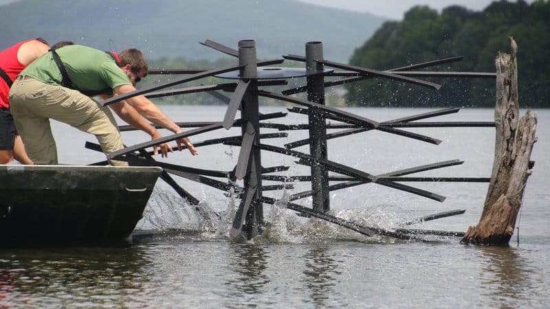
LITTLE ROCK — Each year, AGFC biologists sink hundreds of fish attractors made from natural brush or environmentally friendly inert materials in water bodies ranging from community ponds to large U.S. Corps of Engineers reservoirs spanning tens of thousands of surface acres. Adding this sort of cover can help baitfish and young-of-the-year sport fish hide from predators. It also provides sport fish such as bass and crappie ambush points to conserve energy and increase their growth rate.
Perhaps the most important aspect of a fish attractor is its ability to concentrate sportfish in a known location for anglers looking for an enjoyable day on the water. During spring, when many species move shallow to feed and spawn, practically any flooded bush or grassline has the potential to hold fish. Changes in depth along points and creek channels can increase the odds of finding a willing target, but fish can be found fairly easily with enough casting to potential targets. During summer, when many fish move to deeper water to avoid the summer heat, fish attractors shine. As the water gets deeper, less cover is available, increasing the chances a fish will take up residence in whatever they can find. Sunken trees, brush, PVC structures and other manmade cover can be the difference between fun and frustration. But finding this cover often requires using electronic sonar to probe the depths and reveal what lies beneath. Even with the investment of electronics, anglers can spend hours scanning their favorite lake for likely spots.
AGFC fish attractors can shorten your search time to minutes.
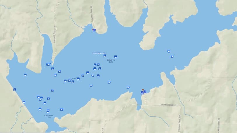
Fish attractor locations as well as fishing access points to most lakes and rivers in the state can be found through the AGFC’s interactive map at www.agfc.com/maps. Click on the Interactive Map tab to start this free software and zoom in to the areas that pique your interest. Fish attractors are labeled with a symbol of a white fish inside a blue square. Zooming in closer may reveal multiple attractors within the location. Clicking or tapping on the fish icon will open a box that describes the attractor’s location and construction materials. The latitude and longitude may be copied and pasted to your GPS device or Google Maps on your phone to take you to the attractor you are interested in. If you have a good cellular data signal where you fish, you can also click the “locate me” pin button in the upper left portion of the screen to place a blue dot where you are on the map.
For people who have a GPS-enabled fishfinder, the entire list of all fish attractors for each lake the AGFC manages also is available for downloading and easy navigation. Visit www.agfc.com/fishattractors from your home computer and you will be able to download data files compatible with most major fishfinder and GPS units. A list of videos on the AGFC’s YouTube page can walk you step-by-step through the download process to help you get on the fish faster than ever before.
Recent News
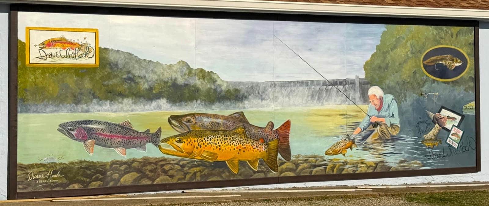
Bull Shoals Mural Honors Dave Whitlock
Apr. 1, 2026

Subscribe to Our Weekly Newsletter E-mails
Don’t miss another issue. Sign up now to receive the AGFC Wildlife Weekly Newsletter in your mailbox every Wednesday afternoon (Waterfowl Reports are published weekly during waterfowl season and periodically outside the season). Fishing Reports arrive on Thursdays. Fill in the following fields and hit submit. Thanks, and welcome!