Overview

Conservation Incentive Program

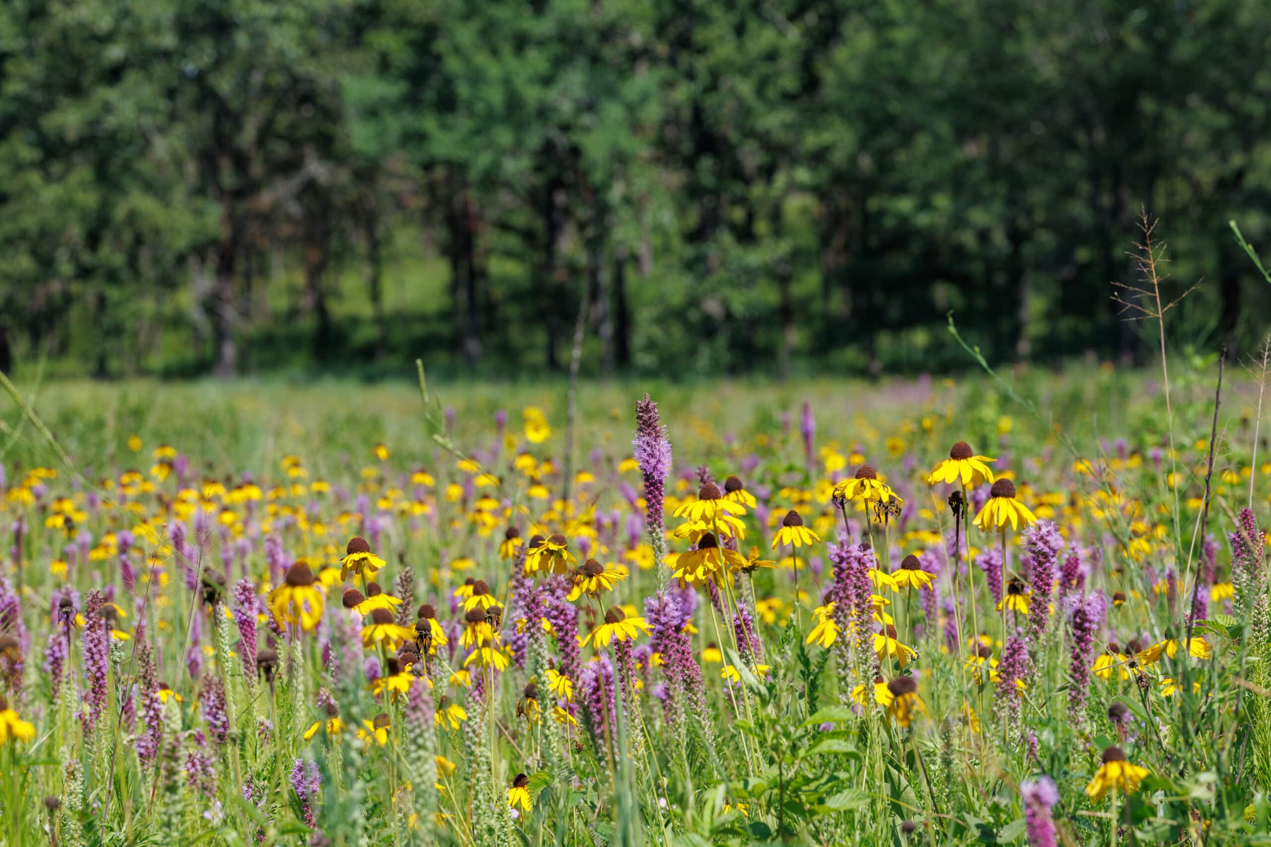
At the Arkansas Game and Fish Commission, our mission is to conserve and enhance our state’s wildlife and their habitats. It’s a job we take to heart and one we never take for granted. But our state is vast and only 10% of it is public land that we can manage. We need partners. People who are part of this natural wonder every day of their lives. Landowners who appreciate the unique resources that few have, and who take the responsibility of their land seriously.

Landowners are, and always have been, the cornerstone to conservation efforts and wildlife management in our state. If you’re willing to put in the effort and do the hard work with us, we’re willing to reward you for it.

We have numerous programs that will make your land more valuable to the fish and wildlife on your property, that reflect our shared values and will help keep The Natural State, natural.

These programs include ways to benefit migrating waterfowl, provide additional cover and food on your forestland, improve your streams, provide fishing opportunities for the public, and control feral hogs and invasive plant species. 

AGFC would also like to express appreciation of our partners in the Arkansas General Assembly and Arkansas Legislative Council for their support for this program.

The Conservation Incentive Program is now open for applications. If you’d like to learn more on a practice below, or if you’re interested in bringing any of these practices to your land, contact conservationincentiveprogram@agfc.ar.gov

Click here to find a Private Lands Biologist in your area. 


Click below to watch a video about the 2024 Conservation Incentive Program.


Purpose
Winter-flooded rice fields and managed seasonal wetlands can provide many of the same functions for waterfowl and other wetland-dependent birds as natural wetlands. Harvested rice fields provide a variety of food resources for foraging waterfowl, shorebirds and wading birds, including rice seeds, moist-soil seeds, green vegetation and invertebrates. Greater wildlife benefits occur when rice fields are flooded during fall and winter, and not tilled prior to flooding. These practices help ensure that resources for migrating and wintering waterfowl remain above ground and accessible. This will help producers hold water and provide food for migratory birds during spring and fall migrations, and the wintering period.

Practice
Eligible lands are layout fields, harvested, harvested and ratooned, or harvested and planted with small grain crop rice fields that have been farmed in rice two of the last three growing seasons. Harvested fields must forgo tilling/disking/ripping until Feb. 15 of the year following the growing season of enrollment. Patchy burning or rolling is encouraged. All levees must be maintained and boards installed in water-control structures to intentionally hold water for at least 90 days between Sept. 1 and Feb. 15. Land must have a surface-water supply (no groundwater pumping is allowed) that can be used to maintain water levels between 1 and 18 inches over 90 percent of the field during the inundation period. Drying agents will not be allowed for ratoon rice. Ratoon rice fields may not be manipulated after seed set. There are no hunting restrictions for this property during any open hunting seasons. Layout fields can’t be filed for insurance claims under prevented planting, and landowners will have to submit a 578 form to be eligible. Fields eligible for ratoon rice should be harvested by Aug. 31 so seeds can fully mature.

Landowner Payment Rate:
Maximum of $10,000 per landowner

Active Flooding
$92/acre

Layout, Ratooned or Small Grain Crop
$120/acre

Two payments will be made for this practice. The first payment will be made once the management practices and flooding are complete. The second payment will be made before Feb. 1, 2025.

Monitoring
Landowners will be required to send a georeferenced photo of the field flooded twice per month during the contract period. Arkansas Game and Fish Commission staff or its agents will conduct monitoring checks twice during the contract period to ensure habitat requirements are being met.

Required Documentation

  • Deed
  • Property Boundary Map
  • FSA Map (to determine surface water source for flooding)
  • 578 Form (if applying for layout field)  **Req before contract execution**

Click here to apply for the Conservation Incentive Program.

Purpose:
Hardwood management improves forest health conditions and forest composition to improve waterfowl habitat. These bottomland hardwood forested tracts are vitally important during waterfowl migrations in the Mississippi Alluvial Valley. Water management during the last five decades has focused mainly on waterfowl season dates, which has caused a shift in these forests to become more water tolerant and less desirable for waterfowl. Through proper forest- and water management techniques, forest health and composition can be improved to provide high-quality habitat for future generations.

Practice:
Eligible lands are bottomland hardwood tracts that are leveed and flooded at least two out of every five years for waterfowl habitat. Timber harvest and timber-stand improvement activities often are used to meet desired forest conditions appropriate for the soil, elevation and forest species composition of the site. Forest management objectives must be outlined in a forest management plan written or approved by an Arkansas Registered Forester with bottomland hardwood management knowledge before implementation. Herbicide applicators must follow specific product label recommendations for the hack-and-squirt method of tree injection. If new water control structures are needed to improve proper drainage during the growing season, landowners need to apply to receive 404 Permits.

Landowner Payment Rate:
Maximum of $10,000 per Landowner

Timber Stand Improvement
Above 60 Basal Area
$142/acre (mulching)
$150/acre (hack-and-squirt)
$219/acre (chainsaw)

Water-Control Structure

  • 75% of actual cost of structure
  • Applicants must provide actual receipts to the AGFC

One payment will be made to the landowner once practice is completed as prescribed in the approved management plan.

Monitoring
AGFC staff or its agents will conduct one monitoring check following the completion of the practice to ensure adequate coverage and kill for undesired trees.

Required Documentation

  • Deed
  • Property Boundary Map
  • Approved management plan with map and documentation of author
  • 404 permit (if applying for water control structure)

Click here to apply for the Conservation Incentive Program.

Purpose
Shallow-water wetland habitats support migratory bird populations in Arkansas. Managed shallow-water wetland habitats provide an abundance of plant species that produce high seed numbers. Adding these plant species to shallow-water wetlands leads to an increase in available duck energy days (a measure of the number of ducks that can be supported based on daily energy needs) across the landscape. This practice helps producers hold water and provide food sources for migratory birds, including waterfowl and shorebirds during spring and fall migrations, and the wintering period.

Practice
Eligible lands include wetlands that have been managed for native wetland plants by appropriately timed drawdowns, flooding, soil disturbances, soil amendments and chemical application following an approved moist-soil management plan. Land must have a surface water supply that can be used to maintain water levels between 1 and 30 inches over 90 percent of the area during the inundation period. Fall flooding should be done over a four-month period. The acceptable flooding schedule is Sept. 1-Feb. 15.

Landowner Payment Rate:
Maximum of $10,000 per Landowner

Heavy Disking/Grinding
$310/acre

Mechanical Bush Hogging/Light Disk/Light Open Field Ripping
$40/acre

Active Flooding
$92/acre

Payment will be made once land management practice is completed. A second payment will be made if surface-water flooding is contracted. This payment will be made before Feb. 1, 2025.

Monitoring
Landowners will be required to send a georeferenced photo of the moist soil unit(s) flooded twice per month during the contract period. Arkansas Game and Fish Commission staff or its agents will conduct monitoring checks twice during the contract period to ensure habitat requirements are being met.

Required Documentation

  • Property Boundary Map
  • Approved management plan with map and documentation of author
  • FSA Map (to determine surface water source for flooding)

Click here to apply for the Conservation Incentive Program.

Purpose
Forest management practices improve the habitat conditions in hardwood and pine forests to achieve ecological benefits for ground-nesting birds such as northern bobwhite and eastern wild turkey.

Practice
Eligible lands are upland hardwood or pine forest with a current basal area greater than 80 square feet per acre that would benefit from management-promoting understory plants for nesting, brood rearing and feeding resources for ground-nesting birds. Treatment must reduce forest density by a minimum of 30% and will target primarily trees 8 inch diameter at breast height (dbh) and smaller. Forested stands with a current basal area greater than 120 square feet per acre are also eligible but will not be reduced to more than 50% basal area. Management options include timber stand improvement using herbicide.

Herbicide applicators must follow specific product label recommendations for the hack-and-squirt method of tree injection. All eastern red cedar should be targeted for treatment.

An acceptable alternative treatment method for individual eastern red cedar stems is to completely sever the tree below the lowest limb or to double girdle with chainsaw by cutting two intersecting rings along the entire circumference of the tree deep enough to penetrate the cambium layer of tissue. Timber stand improvement shall be performed in conjunction with prescribed burning to maximize wildlife benefits.

Downed tree structures can be built using cut trees (cedar is preferable) in open field areas to provide escape cover. Qualifying fields must be lacking adequate escape cover, according to a private lands biologist. Escape cover can be on field edges, in drains or dispersed in the field. Structures are created by placing large (at least 6 inches in diameter at breast height) cut trees laid down in the field horizontally, tip to butt, to cover 1,500 square ft. (30 feet x 50 feet). Spacing between downed tree structures should be 200-500 square feet. These downed tree structures offer temporary cover and they typically grow up in desirable shrubs over time.

Landowner Payment Rate:
Maximum of $10,000 per Landowner

Firebreaks
Disked Lines – $.05 per linear foot
Hand Lines – $.15 per linear foot
Dozer Lines – $1.68 per linear foot

Prescribed Burning
$50/acre

Timber Stand Improvement
(Below 60 basal area)
$213/acre

30’x 50’ Downed Tree Structures
$120/structure

Monitoring
AGFC staff or its agents will conduct at least one monitoring check to confirm completion of listed management practices, objectives were met and to ensure best management practices were followed.

Required Documentation

  • Property boundary map 
  • Approved management plan with map and documentation of author

Click here to apply for the Conservation Incentive Program.


Purpose
Prescribed burns improve forest, woodland, savanna and native grassland habitats for wildlife. Outcomes will enhance habitat diversity by increasing native plant quality, quantity and vigor for wildlife use throughout their life cycles.

Practice
Qualifying firebreaks must be established using best management practices and designed as part of a prescribed burn plan written by a prescribed fire professional. Qualifying prescribed burns are restricted to predominantly native vegetation or as an approved project to restore native vegetation. Prescribed burning of agricultural stubble or pastures/hay meadows with introduced grasses does not qualify.

Landowner Payment Rate:
Maximum of $10,000 per Landowner

Firebreaks
Disked Lines – $.05 per linear foot
Hand Lines – $.15 per linear foot
Dozer Lines – $1.68 per linear foot

Prescribed Burning
$50/acre

Payment will be made once practice is completed.

Monitoring
AGFC staff or its agents will conduct one monitoring check following the completion of firebreak installation to ensure best management practices were followed and lines were installed  correctly. AGFC staff or its agents will conduct one monitoring postburn to ensure the approved burn plan objectives were met.

Required Documentation

  • Property Boundary Map
  • Approved management plan with map and documentation of author

Click here to apply for the Conservation Incentive Program.

Purpose
This incentive will increase access to sections of streams or rivers that have limited public access and will open new access to large bodies of water that are privately owned such as oxbow lakes and flood-control reservoirs. This will not only increase public fishing opportunities but also allow the public, through a limited permit system, to help private landowners manage fish populations by removing overabundant fish.

Practice
Eligible lands will be those that allow walk-in or vehicle access to bodies of water with a minimum surface area of 10 acres. Private landowners will allow public access and the AGFC will provide signs and trash pickup to ensure land remains in good condition. Creel and length limits will be set for each body of water based on an approved management plan.

Landowner Payment Rate

Monitoring
AGFC staff or its agents will conduct monthly monitoring checks to ensure access is open, signs are in place and trash is picked up.

Required Documentation

  • Deed
  • Property boundary map 
  • Pictures of Water Body
  • Pictures of Access

Click here to apply for the Conservation Incentive Program.

Purpose
Reducing sediment in our state’s waterbodies, especially those with flowing waters, improves stream water quality. Sediment reduction will be accomplished by implementation of streambank restoration and stabilization projects or other approved best management practices on private land. These practices reduce the deposition of fine sediment in streambeds, resulting in cleaner water and healthier streams, both of which are important to the economy of the state and contribute to the sustainability of Arkansas’s fish and wildlife populations.

Practice
Eligible activities include implementation of stream improvement projects and sediment-reducing best management practices on private land with the specific goals of sediment reduction in aquatic conservation opportunity areas identified in the Arkansas Wildlife Action Plan or nonpoint source priority watersheds.

Landowner Payment Rate:

Maximum of $10,000 per Landowner

  • 75% reimbursement of actual cost of practice, up to a maximum of $10,000 per year
  • Applicants must provide actual receipts to the AGFC. Payment will be made once practice is completed and AGFC staff or its agents/partners inspect the project and confirm that it will meet the objectives of the approved design plan.

Monitoring
AGFC staff or its agents will conduct two monitoring checks during the project to ensure design plans and best management practices were followed. AGFC staff or its agents will conduct one inspection upon project completion to ensure the completed project will meet objectives described in the approved design plan.

Required Documentation

  • Property Boundary Map
  • Deed
  • Approved project design plan
  • STAA and 404  and 401 Permit (proof of application (email from COE and DEQ or actual permit)

Click here to apply for the Conservation Incentive Program.

Purpose
Feral swine eradication is a component of an area-wide effort of assessment, control and monitoring to document and reduce resource damage caused by feral swine. Damages include impacts to native wildlife, soil health, destruction of natural areas, water bodies and wetlands, vegetative diversity, and pasture and rangeland.

Practice
Landowners from across the state would be eligible to apply for this program granted they own at least 100 acres or submit an application as a cooperative that includes at least 100 acres. Cooperatives must include properties within the same county. While applicants may apply to purchase multiple traps there is a maximum of one allotted trap per 100 acres until the $10,000 cap is reached. The second requirement to qualify for the program is to provide photo evidence (pictures of hogs or damage with GPS information) that feral hogs have been documented on one of the properties included within the application within the last six months.

Landowner Payment Rate:
Maximum of $10,000 per Landowner

  • 75% of the actual cost reimbursement for eligible traps and control system up to $10,000

Eligible Traps
Game Changer (GC) JR
GC Skid Trap 2×6
GC Skid Trap 4×4
Pig Brig
Boar Buster
Jager Pro
Big Pig Panel Trap

Applicants must provide actual receipts to the AGFC feral hog program coordinator. Funds will cover all components of the trap and one year’s worth of data for the live feed cameras. Funds will cover the purchase of a cellular game camera if the applicant indicates they want to purchase the Pig Brig trap. Landowners will receive two payments. The first 45% as demonstrated by actual receipts or paid invoices. Landowners will receive their second payment to cover the additional 30% after the first successfully documented trap event of feral hogs on any of the properties included within the application.

Applicants must agree to record and report the number of feral hogs caught and dispatched with the trap(s). All applicants will be required to complete an online technical training course. To view the trapping training video you will be quizzed on, click here. 

Monitoring
Removal numbers will be tracked by implementation of the Arkansas Feral Hog Control Survey. Everyone participating in the program will be required to record and submit removals on this survey. Landowner surveys can help us gain a better understanding of the perceptions of participating landowners pertaining to the amount of hogs and damage before and after the project.

Water samples will be collected from properties that have access to first- and second-order streams. This stream sampling effort will assess the concentration of swine bactericides within these various streams. This swine-specific marker (PIG-2-BAC) has been identified as having extremely high specificity to swine fecal waste and, as such, is used in surface water testing for studies of surface water contamination.

Required Documentation

  • Landowners will be required to send a georeferenced photo of feral hog damage.
  • Property boundary map

Click here to apply for the Conservation Incentive Program.

Purpose
Incentivizing invasive plant control encourages landowners to help reduce the threats and impacts of invasive plant species to Arkansas’s native fish, wildlife and plant communities, and the habitats in which they occur.

Practice
Integrated vegetation management is the management or removal of invasive or noxious herbaceous or woody (nonherbaceous or succulent) plants as outlined in an approved management plan. Invasive species are listed in the Arkansas Invasive Species Management Plan. This practice is intended to restore the desired plant community consistent with the ecological site. Herbicides must be used according to the product label and align with an approved habitat management plan.

Landowner Payment Rate:
Maximum of $10,000 per Landowner

10 Acres Minimum (Terrestrial)
1 Acre Minimum (Aquatic)

75% reimbursement for actual herbicide and application costs up to $10,000 per landowner. Applicants must provide actual receipts to the AGFC.

Monitoring
AGFC staff or its agents will conduct one monitoring check following herbicide applications. Proof of payment by the land/lake owner to a certified applicator that includes treatment acres may substitute for an onsite monitoring check.

Click here for more information about Arkansas’s Aquatic Nuisance Species.

Click here for more information about Arkansas’s terrestrial invasive plants.

Aquatic Required Documentation

  • Property boundary map 
  • Map identifying area to be treated

Terrestrial Required Documentation

  • Property boundary map
  • Approved management plan with map and documentation of author

Click here to apply for the Conservation Incentive Program.

AGFC Conservation Incentive Program

Program Coordinator

Phone 833-345-0325