Arkansas Wildlife Waterfowl Report
BY Jim Harris
ON 01-27-2021
Jan. 27, 2021
Jim Harris
Managing Editor Arkansas Wildlife Magazine
Regular Season Ends Sunday; Latest Winter Storm Pushes Hopes
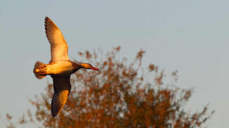
LITTLE ROCK – As the Arkansas waterfowl season winds down, hunters are eyeing this latest midweek winter storm over the midwest and what it might bring in terms of late migration to The Natural State.
Reports earlier this week from Arkansas Game and Fish Commission biologists were that the overall duck numbers appeared to be down in the huntable areas, and that it appeared ducks were “moving out,” according to one biologist observing east-central Arkansas. More pintails, shovelers and green-winged teal observed en masse in last week’s AGFC late-January aerial survey indicated that ducks were beginning their move back north.
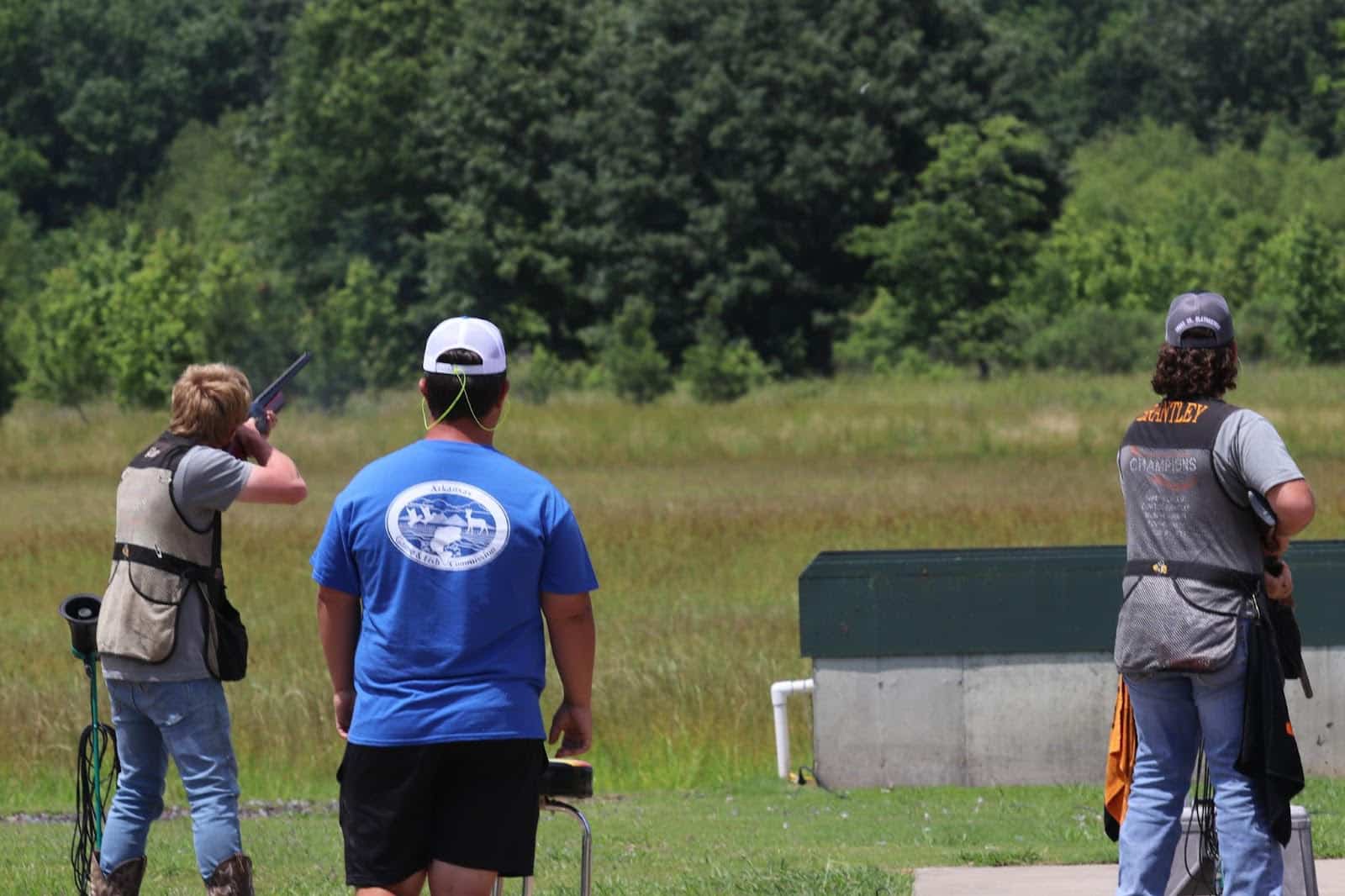
Hunters, though, were not detered and were still filling the public lands and wildlife management area parking lots on weekdays, such as Steve N. Wilson Raft Creek Bottoms WMA and George H. Dunklin Bayou Meto WMA. Then, early Wednesday, a major winter storm moved across the midwest and dipped into Arkansas. While the ice and snow in Arkansas was mostly confined to the northern reaches and mountainous hills of Arkansas, a blanket of snow apparently fell over all over Missouri and portions of Iowa and was moving eastward into Illinois. The hopeful waterfowl hunter here must be thinking, “Here’s the weather system we’ve been waiting for, one that covers up the food sources to the north of us.”
Well, we shall see. The regular 60-day season comes to a close at sunset Sunday, Jan. 31. There still remains one special hunt day on Feb. 6 for youth, veterans and active military statewide. Also, the Light Goose Conservation Order takes effect on Feb. 1 and, with the exception of no hunting on Feb. 6 outside of the special youth/veterans day Feb. 6, runs continuously through April 25. Special regulations allow for liberal hunting of lesser snows and Ross’s geese, including no daily bag limit and the allowed use of electronic calling devices, among other rules that would normally be prohibited during regular waterfowl season. The season for greater white-fronted geese, though, ends with ducks on Jan. 31. For more information on the Light Goose Conservation Order, please click here.
The AGFC’s second aerial survey of January, conducted Jan. 17-20 across the state by four waterfowl observers, noted a slight uptick in overall duck numbers and in mallards from the midwinter survey that was conducted Jan. 4-7. The last of three surveys of the year showed an estimate of 1.2 million ducks and 527,920 mallards in Arkansas’s Delta region, up from 1.078 million total ducks and 458,000 mallards in the survey from two weeks earlier. The mallard numbers were about 200,000 birds below the 2010-2021 long-term average, but were in line with late-January mallard counts in recent years. The total duck population was slightly below the long-term average. The late January survey for the past decade typically shows a decline from the midwinter numbers, according to Luke Naylor, AGFC waterfowl program coordinator. Mallards typically account for 59 percent of all ducks during the late January county, but this year made up 44 percent of all ducks.
Dabbling ducks other than mallards (including northern pintail, northern shovelers and American green-winged teal) accounted for the overwhelming majority of other ducks in the Delta region survey.
Though the survey is designed for ducks and not geared toward counting geese, observers did estimate about a half-million light geese (lesser snow and Ross’s) in the Delta, with about 260,000 greater white-fronted geese.
* * *
The Arkansas River Valley count in the survey showed a big increase over what had been seen in the previous aerial surveys, but Naylor said the estimate of 79 percent of the total ducks in that region being mallards “was driven almost entirely by high mallard counts in the Ed Gordon Point Remove Waterfowl Rest Area (Point Remove-Plumerville survey zone) and should be interpreted as questionable, given the high degree of uncertainty around the point estimate. The large standard error around the mallard estimate indicates this particular sample estimate is less likely to represent the actual population present at the time of the survey.” The estimate numbers, though, showed a jump from 9,400 mallards and 21,000 total ducks in the area to more than 55,000 mallards and 69,000 total ducks.
Southwest Arkansas had just slightly less than 6,000 mallards estimated, but total duck numbers 9,100 in the midwinter survey to more than 49,000. Typically around this year, Millwood Lake sees a large number of gadwalls and other non-mallards congregating about.
Outside of what was seen in the Ed Gordon Rest Area, the survey indicated the highest mallard estimate in the Arkansas River Valley was in the West Dardanelle Reservoir survey zone.
In the Delta, the Lower White survey zone had the highest mallard count by a substantial margin, while the Lower St. Francis and Bayou Meto-Lower Arkansas survey zones also had fair numbers of mallards. Mallard counts were relatively lower in all other survey zones. Duck distribution maps in the Delta showed several hotspots for all ducks but only a few noticeable concentrations of mallards.
“Although some regions of the state had decent amounts of flooded fields, the widespread habitat availability driven by large rain events and overbank flooding remained absent through the end of this survey,” Naylor said, before the midweek push of rainfall across the region.
“Precipitation since around Thanksgiving remains several inches below normal across much of the state, including northern parts of Arkansas that help feed the upper reaches of major waterways important for providing duck habitat and hunting opportunity.”
* * *
Naylor’s report alsonoted that temperatures in Arkansas throughout the 2020-21 wintering period have been about average, given that averages can, at times, mask important deviations. Nonetheless, overwinter temperatures in Arkansas have varied little from long-term averages. What has jumped out to him throughout this season has been the temperature various above the norm in the far north states, particularly in the duck breeding grounds of the Dakotas.
He said, “In other words, we have not had an unusually warm winter, but we have not had an unusually cold winter, either. In stark contrast, temperatures throughout much of the midcontinent mallard range have been above normal since last fall.”
The bottom line for the last survey of the year, Naylor said, is that ducks in Arkansas continued to seek out undisturbed habitat as they have throughout much of the 2020-21 wintering period. “Flooded fields, for example, were often devoid of ducks during this survey, while purposeful sanctuary habitat or simply lightly hunted, harder-to-reach areas supported noticeable concentrations of ducks. Odd areas dominated by moist-soil plants appeared to host lots of ducks, including the nearly 27 percent of all mallards observed in this habitat type. Observers noted over 31 percent of mallards in oxbow lakes, buttonbush (buckbrush) habitat and agricultural reservoirs. Many of these areas showed little evidence of hunting activity and were off the beaten path.
“Other dabbling ducks were also found in these habitats, but were more commonly observed in agricultural fields, primarily rice. The increase in dabbling ducks such as northern pintails and northern shovelers likely resulted from movement of birds into the state from south as winter transitions to spring migration.”
* * *
One special note for regular WMA duck hunters who are used to rules in place in past years and might be confused about the regulation for this season: This year there is just ONE all-day hunt allowed the final weekend in WMAs for duck season. Hunters may hunt until sunset on the last day, Sunday, Jan. 31. Friday and Saturday hours are the same for WMAs as any other day during the season.
Northeast Arkansas
Big Lake WMA
Map | Water Gauge | Weather Report
When the Ditch 81 extension gauge near Manila (upstream of the Big Lake north-end control structure) reads 17.5 feet, water is beginning to come over the north levee degrade on Big Lake WMA. When the Ditch 81 Extension gauge reads 18.0 feet or higher, the water level on the WMA will rise quickly and hunters should exercise caution while on the area. Be aware of underwater logs in boat runs and hangers in trees.
A few ducks are moving through the area.
North Woods GTR
Habitat: Mast production is good.
Water Level: 100% flooded, Bo Dock gauge reading is 236.6 feet msl with a target level of 235.5 feet msl.
South Woods GTR
Habitat: Mast production is fair.
Water Level: 100% flooded. The 7-mile gauge is reading 235.8 feet msl; target level is 234.5 feet.
Simmons Field
Habitat: Good production of millet and sedge. Native production is very good in the north, middle and south fields with 5 acres of millet planted in the north field. All fields were rolled with a cleated roller in April.
Water Level: 100% coverage.
Dave Donaldson Black River WMA
Map | Water Gauge | Weather Report
Waterfowl hunters should be aware of hangers and submerged logs within the boat runs and GTRs. Please exercise caution when accessing the area. Please remember to keep boats off the levees so AGFC personnel can access the area. Boats blocking access will be moved. Unattended trailers are not to be left overnight on parking areas. River level is 4.08 feet and rising.
Upper Island GTR
Habitat: Mast crop is moderate within the GTRs.
Water Level: Current level is 269.65 feet msl. Target level is 269.5 feet msl. 100% flooded.
Lower Island GTR
Habitat: Mast crop is moderate within the GTRs.
Water Level: Current level is 268.8 feet msl. Target level is 268.0 feet msl. 100% flooded.
Upper Reyno GTR
Habitat: Mast crop is moderate within the GTRs.
Water Level: Current level is 267.4 feet msl. Target level is 266.9 feet msl. 100% flooded.
Lower Reyno GTR
Habitat: Mast crop is moderate within the GTRs.
Water Level: Current level is 266.4 feet msl Target level is 266.3 feet msl. 100% flooded.
Winchester GTR
Habitat: Mast crop is moderate within the GTRs.
Water Level: Current level is 263.5 feet msl. Target level is 263.7 feet msl. 90% flooded.
Earl Buss Bayou DeView WMA
Map | Water Gauge | Weather Report
Boaters should use caution while using the Thompson Tract boat run. A few ducks and geese are moving through the area.
South Oliver GTR
Habitat: Mast production has been good.
Water Level: 100% flooded with a current gauge reading of 1.65 feet.
Thompson Tract GTR
Habitat: Mast production is good.
Water Level: 100% flooded with a current gauge reading of 1.35 feet.
Lake Hogue WRA
Habitat: Primarily deep open water habitat.
Water Level: Normal pool level.
Shirey Bay Rainey Brake WMA
Map | Water Gauge | Weather Report
Waterfowl hunters should be aware of hangers and submerged logs within the boat runs and GTRs. Please exercise caution when accessing the area. In addition, hunters should allow safe passage when parking vehicles along roadsides. Vehicles blocking access will be moved.
Adam Brake GTR
Habitat: Mast production is good.
Water Level: Water level is 240.1 feet msl with a target level of 240.0 msl. 100% flooded.
Rainey Brake GTR
Habitat: Mast production is good.
Water Level: 100% flooded.
Eagle Pond GTR
Habitat: Mast production is good.
Water Level: 100% flooded.
Phase III Moist-Soil Unit
Habitat: Good wetland-type vegetation.
Water Level: 95% flooded.
Charles Crisp Moist-Soil Unit
Habitat: Good wetland-type vegetation.
Water Level: 100% flooded.
Ward Field Moist-Soil Unit
Habitat: Good wetland-type vegetation.
Water Level: 100% flooded.
River Field Moist-Soil Unit
Habitat: Good wetland-type vegetation.
Water Level: 100% flooded.
St. Francis Sunken Lands WMA
Map | Water Gauge | Weather Report
Hunt Area
Habitat: Good mast production within the hunt area.
Water Level: Water levels on St. Francis Sunken Lands for waterfowl season are dependent on flows from the St. Francis River. The target level for providing huntable timber is 212.0 feet msl at the Oak Donnick gauge. As of Jan. 19, the reading was 212.67 feet msl.
Snowden WRA
Habitat: Mixed grasses.
Water Level: 10% flooded, mostly in the low-lying areas due to rain.
Payneway WRA
Habitat: A, B, C and D pools have mixed smartweed and barnyard grasses. Moderate mast is available within pools A, B and C as well.
Water Level: Pool A is at 0% coverage. Pool B is at 5%. Pool C is at 5%. Pool D is at 20%.
East-Central Arkansas
Henry Gray Hurricane Lake WMA
Map | Water Gauge | Weather Report
Hunters should call the Wildlife Hotline at 800-440-1477 for current road closures.
North GTR
Habitat: Good mast crop.
Water Level: The Glaise Creek reading on Jan. 26 was 192.63 feet msl; the North GRT is at full pool. All structures on the North GTR are closed.
South GTR
Habitat: Fair mast crop.
Water Level: The Glaise Creek reading is 192.63 feet msl; full pool is 192 feet msl.
Note: All structures on the South GTR are open.
Rex Hancock Black Swamp WMA
Map | Water Gauge | Weather Report
Hunters should call the Wildlife Hotline at 800-440-1477 for current road closures.
Gregory GTR
Habitat: Good mast crop.
Water Level: 65% (the Cache River level on Monday, Jan. 26, was at 7.66 feet and rising on the Patterson Gauge).
Wyeville Moist-Soil Unit
Habitat: Good stand of millet and native vegetation.
Water Level: 100% coverage.
Sheffield Nelson Dagmar WMA
Map | Water Gauge | Weather Report
The Conway George units are currently available for hunting by applying for online permits. Please visit www.agfc.com for maps, special regulations, permit application and draw dates. Hunters should call the Wildlife Hotline at 800-440-1477 for current road closures.
Mud Slough GTR
Habitat: Good mast crop.
Water Level: 35% coverage.
Apple Lake WRA
Habitat: Good mast crop.
Water Level: 70%.
Conway George Waterfowl Unit A
Habitat: Good stand of millet and native vegetation.
Water Level: 100%
Conway George Waterfowl Unit B
Habitat: Natural slough area with beneficial wetland plants.
Water Level: 100%
Conway George Waterfowl Unit C
Habitat: Good stand of millet and native vegetation.
Water Level: 100%
Steve N. Wilson Raft Creek Bottoms WMA
Map | Water Gauge | Weather Report
Raft Creek Bottoms WMA is open to waterfowl hunting Tuesday, Thursday, Saturday and Sunday only. Saturday and Sunday hunting has both in-person draws and an online permit draw via www.agfc.com. On Tuesday and Thursday, permits need to be picked up before hunting and returned to the permit box kiosk after the hunt. Waterfowl hunting is closed Monday, Wednesday and Friday. The Youth blind, Mobility-Impaired blind and teh Magellan Tract are available Tuesday, Thursday, Saturday and Sunday by online draw. Online draws for other weekend duck holes are held the Thursday-Sunday before the week of hunt.
Unit A
Habitat: Excellent stand of native vegetation.
Water Level: 100% coverage.
Unit B
Habitat: Excellent stand of millet and native vegetation.
Water Level: 100%
Unit C
Habitat: Good stand of native vegetation.
Water Level: 100%
Unit D (Youth Area)
Habitat: Good stand of native vegetation.
Water Level: 100%
Unit E
Habitat: Excellent stand of millet and native vegetation.
Water Level: 100%
Unit F
Habitat: Good stand of millet and native vegetation.
Water Level: 100%
Unit G
Habitat: Fair stand of millet and native vegetation.
Water Level: 100%
Unit H (Mobility-impaired blind)
Habitat: Excellent stand of native vegetation.
Water Level: 100%
Unit I
Habitat: Habitat conditions are poor.
Water Level: 100%
Unit J (Cypert Tract)
Habitat: Excellent stand of native vegetation.
Water Level: 100%
Unit K (Cypert Tract)
Habitat: Excellent stand of native vegetation.
Water Level: 90%
Unit L (Cypert Tract)
Habitat: Fair stand of native vegetation.
Water Level: 50%
Unit M (Magellan Tract)
Habitat: Fair stand of native vegetation.
Water Level: 100%
Central Arkansas
Bell Slough WMA
Map | Weather Report
The Bell Slough GTR is primarily rainfall dependent with the exception of a limited amount of water that the AGFC can back in and catch from Palarm Creek.
Bell Slough GTR
Habitat: Poor to moderate mast crop.
Water Level: 100% flooded.
Palarm Creek WRA
Habitat: Natural vegetation and planted millet.
Water Level: 85% flooded.
Craig D. Campbell Lake Conway Reservoir
Map | Weather Report
Habitat and water levels are normal on both Pierce and Dix creeks.
Cypress Bayou WMA
Hunt Area
Habitat:
Good mast crop.
Water Level: 100% coverage.
Red Cut Slough Tract
The six units of Cypress Bayou Red Cut Slough are available for permit-only hunting on Tuesday, Thursday, Saturday and Sunday. Weekend hunts are available only via online draw for permits through the website, www.agfc.com. On Tuesday and Thursday, hunters need to pick up a permit at the parking lot and return it after the hunt.
Unit 1
Habitat:
Good stand of millet and native vegetation.
Water Level: 75%
Unit 2
Habitat:
Excellent stand of millet and native vegatation
Water Level: 100%
Unit 3
Habitat:
Good stand of millet and native vegatation
Water Level: 100%
Unit 4
Habitat: Good stand of millet and native vegetation.
Water Level: 100%
Unit 5
Habitat:
Good stand of native vegetation.
Water Level: 40%
Unit 6
Habitat:
Good stand of native vegetation.
Water Level: 30%
Harris Brake WMA
Upper GTR
Habitat: Average mast crop.
Water Level: 100% full.
Lower GTR
Habitat: Average mast crop.
Water Level: 100% flooded.
Holland Bottoms WMA
WRA Moist-Soil Unit (East/West)
Habitat: Good mast crop.
Water Level: 50% coverage.
Lake Pickthorne WRA
Habitat: Excellent.
Water Level: East cell is 100%, West cell is 100%.
Northwest Arkansas
Dardanelle WMA
McKennon Bottoms (half-day hunting)
Habitat: 8 acres of native millet, 24 acres of fallow ground.
Water Level: 100%
Potter’s Pothole Hartman Waterfowl Unit (half-day hunting)
Habitat: Good stand of native vegetation.
Water Level: 100%
Ed Gordon Point Remove WMA
All waterfowl impoundments on Ed Gordon Point Remove WMA should be at or near full pool at this time. Duck use on the WMA has continued to been low, and hunter success has remained generally poor.
Little Hole (Unit 1)
Habitat: Natural vegetation.
Water Level: 100% flooded.
Willow Island (Unit 2)
Habitat: Natural vegetation.
Water Level: 100%
Red Gate (Unit 3)
Habitat: Natural vegetation and Japanese millet.
Water Level: 100%
Pig Trough (Units 4 and 5)
Habitat: Natural vegetation.
Water Level: 95%
Cedar Ridge (Unit 6)
Habitat: Natural vegetation.
Water Level: 95%
Unit 7a
Habitat: Japanese millet.
Water Level: 100%
Unit 7b
Habitat: Natural vegetation.
Water Level: 100%
Duck Trap (Units 8a, 8b and 8c)
8a
Habitat: Natural vegetation.
Water Level: 100%
8b
Habitat: Natural vegetation.
Water Level: 100%
8c
Habitat: Natural vegetation.
Water Level: 100%
Unit 9
Habitat: Natural vegetation.
Water Level: 100%
Controversy Corner (Unit 10)
Habitat: Natural vegetation and Japanese millet.
Water Level: 100%
Remmel Marsh
Habitat: Natural vegetation and Japanese millet.
Water Level: 100%
Mud Pond (Unit 12)
Habitat: Natural vegetation.
Water Level: 100%
Turkey Pond (Units 13a, 13b and 13c)
13a
Habitat: Natural vegetation and Japanese millet.
Water Level: 100%
13b
Habitat: Natural vegetation.
Water Level: 90%
13c
Habitat: Japanese millet.
Water Level: 100%
Teeny Pond (Unit 15)
Habitat: Natural vegetation and Japanese millet
Water Level: 90%
Salt Lick (Unit 15)
Habitat: Japanese millet.
Water Level: 100%
Bobby’s Pond (Unit 16)
Habitat: Japanese millet.
Water Level: 100%
Race Track (Unit 17)
Habitat: Japanese millet.
Water Level: 100%
Frog Bayou WMA (half-day hunting)
Unit 1
Habitat: Sprangletop, wild millet, smartweed, nutsedge, Japanese millet planted in the northwest corner.
Water Level: 100%
Unit 2
Habitat: Good stand of barnyard grass and nutsedge.
Water Level: 100%
Unit 3
Habitat: Smartweed, toothcup, nutsedge, barnyard grass, sprangletop and duck potato and Japanese millet planted in northwest corner.
Water Level: 80%
Unit 4
Habitat: Barnyard grass, sprangletop, annual smartweed, nutsedge and crabgrass.
Water Level: 100%
Unit 5
Habitat: Sprangletop, wild millet, smartweed, knotgrass, nutsedge and duck potato.
Water Level: 100%
Unit 6
Habitat: Barnyard grass, smartweed, crabgrass and sprangletop.
Water Level: 90%
Unit 7
Habitat: Excellent stand of barnyard grass, sprangletop and smartweed.
Water Level: 100%
Galla Creek WMA
Galla Creek GTR
Habitat: Moderate stand of planted millet and natural vegetation, including a mixture of barnyard grass and sprangletop.
Water Level: 100% flooded.
Nimrod Lloyd Millwood WMA
Nimrod GTR
Habitat: The red oak mast crop and desirable native vegetation growth this year was far less substantial than in previous years.
Water Level: 100% flooded.
Ozark Lake WMA/Dyer Lake Water Unit
Dyer Lake Cells (half-day hunting)
Habitat: Excellent stand of barnyard grass, toothcup, smartweed and sprangletop.
Water Level: Units 1 and 2, 100%.
Unit 3 South Cell: 75% (rainfall dependent), planted with millet.
Dyer West Cell: 100% coverage, planted with Japanese millet and chipwapa.
Petit Jean River WMA
Map | Water Gauge | Weather Report
Sorehead Moist-Soil Unit
Habitat: The unit contains a mix of moderate to great stands of desirable native vegetation throughout.
Water Level: 100%
Blacklands Moist-Soil Unit
Habitat: This unit this year contains one of the best stands of desirable native vegetation in recent years. The wooded areas inside the unit produced a below-average red oak mast crop this year.
Water Level: 100%.
Slaty Crossing Moist-Soil Unit
Habitat: Due to ongoing waterfowl habitat enhancement projects, this unit was not able to grow a desirable native vegetation crop this year. The area was seeded with Japanese millet after the project was completed. Only about half of the unit produced a crop of millet, but the areas that did produce look amazing.
Water Level: 100%
Blacklands Duck Area
Habitat: The wooded sections of this area produced a below-average red oak mast crop this year. This area also contains a mix of moderate to great stands of desirable native vegetation mixed throughout.
Water Level: 100%
Pullen Pond Marsh
Habitat: Due to ongoing waterfowl habitat enhancement projects, parts of the northeastern sections of this area are bare ground. Other parts of this area have spotted sections of great desirable native vegetation. The desirable native vegetation has started to become more and more prevalent with each year of ongoing management work.
Water Level: 100%.
Pond Creek GTR
Habitat: This area produced a less-than-desirable red oak mast crop this year with good stands of desirable native vegetation in the open lands within this area.
Water Level: 100%. Flooding of this area is rainfall dependent.
Slaty GTR
Habitat: This area produced a less-than-desirable red oak mast crop this year.
Water Level: 20%. Flooding of this area is rainfall dependent.
Santa Fe GTR
Habitat: This area produced a less-than-desirable red oak mast crop this year.
Water Level: 100%. Flooding of this area is rainfall dependent.
Southwest Arkansas
Dr. Lester Sitzes III Bois d’Arc WMA
Bois d’Arc Lake WRA
Habitat: Closed to hunting.
Water Level: Normal
Red Slough WRA
Habitat: Closed to hunting.
Water Level: 90%
GTR
Habitat: Good mast production.
Water Level: 100%
Little Grassy
Habitat: Good
Water Level: 100%
Millwood Lake
Map | Water Gauge | Weather Report
Habitat: Habitat conditions are good.
Water Level: 261.51 feet msl.
Ozan WMA
Unit 1
Habitat: Good
Water Level: 70%
Unit 2
Habitat: Good
Water Level: 60%
Unit 3
Habitat: Good
Water Level: 60%
Unit 4
Habitat: Good
Water Level: 75%
Unit 5
Habitat: Good
Water Level: 90%
Sulphur River WMA
Mercer Bayou
Habitat: Fair
Water Level: 100%
Henry Moore WRA
Habitat: Closed to hunting.
Water Level: 100%
Southeast Arkansas
Beryl Anthony Lower Ouachita WMA
Map | Weather Report
Water Level: Water is only available in the oxbow lakes located on the WMA and some river backwater is available. Clear Lake Road is closed to all vehicular access, including ATVs.
Cut-Off Creek WMA
Hunt Area
Habitat: Habitat conditions are good.
Water Level: Water levels are high; but road is accessible.
Pigeon Creek WRA
Habitat: Habitat conditions are good.
Water Level: Fully flooded.
Freddie Black Choctaw Island WMA Deer Research Area
Map | Water Gauge | Weather Report
Habitat conditions are good. Flooding is river dependent. Click on the Water Gauge link above for current Mississippi River levels. Use extreme caution when boating in river.
George H. Dunklin Jr. Bayou Meto WMA
Map | Water Gauge | Weather Report
The UGSG is now reporting real-time water gauge readings at the headwater at each GTR within the George H. Dunklin Bayou Meto WMA. Click the Water Gauge link above for the WMA, and search for the particular GTR as noted.
A good rule of thumb for comparing water levels to access into Bayou Meto: 176 feet msl – water breaking into sloughs and lower ditches; 177-177.5 feet msl – water beginning to break out of sloughs and lower ditches; 178 feet msl – water in most sloughs and ditches and entering into lower elevations in woods; 178.5 feet msl – most ditches and sloughs deep enough to boat and most boat ramps become serviceable; 179 feet msl or above – good duck hunting waters.
Upper Vallier GTR
Habitat: Good
Water Level: See Gauge Link (Upper Vallier Headwater)
Lower Vallier GTR
Habitat: Good
Water Level: See Gauge Link (Lower Vallier Headwater). Use caution operating boats near water control structures.
Government Cypress GTR
Habitat: Good
Water Level: See Gauge Link (Government Cypress Headwater)
Buckingham Flats GTR
Habitat: Good
Water Level: Pumping complete, 100% flooded. See Gauge Link (Buckingham Flats Headwater).
Temple Island GTR
Habitat: Good
Water Level: Pumping complete, 100% flooded. See Gauge Link (Temple Island Headwater).
Canon Brake
Habitat: Good
Water Level: See Gauge Link (Canon Brake Headwater). Use caution operating boats near water control structures.
Halowell WRA
Habitat: Excellent
Water Level: Flooding complete.
Wrape Plantation WRA
Habitat: Excellent
Water Level: Flooding complete.
Seven Devils WMA
Hunt Area
Habitat: Habitat conditions are good.
Water Level: Water levels are high; but road is accessible.
Trusten Holder WMA
Map | Water Gauge | Weather Report
Habitat conditions are good. Flooding is river dependent. Click on the Water Gauge link above for current Arkansas River levels.
Recent News

Subscribe to Our Weekly Newsletter E-mails
Don’t miss another issue. Sign up now to receive the AGFC Wildlife Weekly Newsletter in your mailbox every Wednesday afternoon (Waterfowl Reports are published weekly during waterfowl season and periodically outside the season). Fishing Reports arrive on Thursdays. Fill in the following fields and hit submit. Thanks, and welcome!