Arkansas Wildlife Waterfowl Report
BY Jim Harris
ON 12-23-2020
Dec. 23, 2020
Jim Harris
Managing Editor Arkansas Wildlife Magazine
More Ducks Still North; Levee Washout Fixed in Dave Donaldson Black River WMA
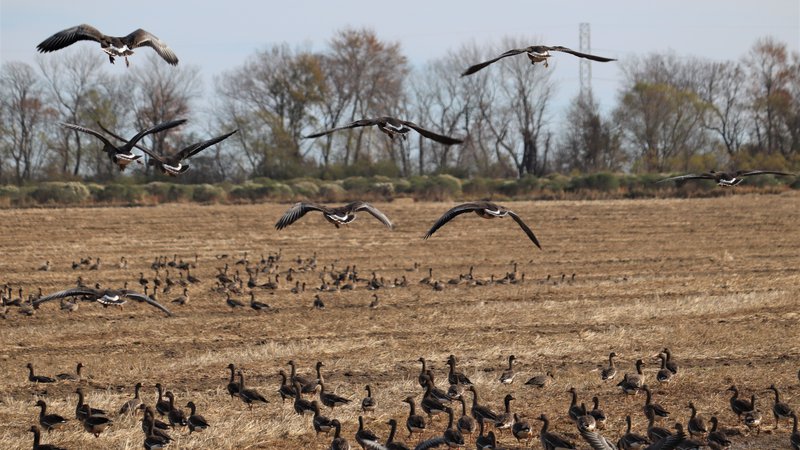
LITTLE ROCK – At the same time Arkansas’s December duck population estimates were about half what is typically expected for that time of the year, Illinois aerial surveys of its usual spots of duck habitat, such as the central Mississippi River region, went the other direction: about 50 percent more birds counted in their estimate than what is usually seen.
Missouri biologists and the Missouri Department of Conservation duck counts for December also showed pockets in the southeast in proximity to Arkansas that contained fair numbers, though nothing to forecast a wave there waiting to move south.
From those observations, can we hunters extrapolate that there are numbers of ducks still “out there,” they just haven’t made it to The Natural State in the usual numbers yet?
Luke Naylor, the Arkansas Game and Fish Commission’s waterfowl program coordinator, said he’s not sure. “Maybe some ducks are still as far north as South Dakota. Weather has been mild. Yes, numbers are higher along the Mississippi River in portions of Illinois, but numbers in Missouri aren’t really through the roof. So I don’t think we should expect ducks to be coming from Missouri. We’ve had normal to below-normal temperatures here lately, maybe lulling people into thinking ducks should be on the move. Much of the midcontinent mallard range has experienced above average temperatures.”
It should be noted, too, that in both Missouri and Illinois, according to their conservation agencies, blogs and in reports carried in other duck-centric publications, hunter satisfaction with duck season in terms of harvest has been low, even though biologists are noting more ducks on the landscape in the river that separates those states, as well as further in Illinois. Like what was noted by Arkansas biologists in their aerial survey Dec. 7-10, when the state’s 60-day season was in a 10-day hiatus, many ducks were seen in sanctuary areas where they would not have been hunted anyway. In Arkansas, even with no hunting for a few days with the exception of the Dec. 5 youth, veterans and active military special hunt, ducks weren’t venturing out far from the sanctuary areas, though the lack of usual December habitat was limiting those other areas anyway.
With a major ice and snow buildup in the northern United States and colder temperatures there, and perhaps with more late-year rainfall arriving here, the hope is that Arkansas’s duck numbers, particularly mallards, will begin to swell as typical for January. The AGFC aerial survey team will be back in the skies the week of Jan. 4 to check.
“We need rain,” Naylor said. “We have precious little habitat for a duck to find if they did move this way. Extensive habitat created by flooding is what drives duck numbers here. We haven’t had the rain necessary to create that flooding.”
This office did receive anecdotal reports of more ducks seen in the southeastern Delta region than had been noted during the first segment of the season. Lack of duck habitat (water) continues to be a problem in some of the public lands that depend on river rises, overbank flooding and the like, however. Geese numbers continue to be good in the Delta. The aerial survey by AGFC biologists indicated more greater white-fronted geese (300,000 estimated) than mallards in early December, though lesser geese (snows, blues and Ross’s) were less than expected for the period, at 542,231, bringing total geese estimates to more than 800,000.
One positive of the aerial survey seemed to be the numbers seen in southwest Arkansas; we were struck with how much those estimates outdistanced Arkansas River Valley in ducks counted for early December in spite of habitat problems in both areas. Observers conducting transect-based surveys estimated 16,958 ducks in the Arkansas River Valley, including only 7,416 mallards. Cruise surveys in southwest Arkansas showed a total of 45,832 ducks, of which 12,367 were mallards.
The highest concentrations of mallards in Arkansas in the survey were seen in the Bayou Macon, Cache River and Lower St. Francis River survey zones. “Duck density maps show several areas of relatively higher duck and mallard abundance across the Delta, but bright red hot spots are rare,” according to Luke Naylor, AGFC waterfowl program coordinator. Biologists canvassing the Arkansas Delta, the Arkansas River Valley and southwest Arkansas estimated 632,977 total ducks, of which 255,052 were mallards. The AGFC has been conducting aerial surveys of waterfowl since 2009 and the 2020 mallard estimate was the lowest since the formal surveys began.
The Delta mallard population was less than half the 2009-2020 long-term December average of over 624,000. Similarly, total duck population estimates were about half the long-term average of over 1.17 million ducks. Naylor noted that ducks were not widely scattered across the landscape during the survey period, particularly through the Delta, because of dry conditions, limited overbank flooding and relatively low amounts of flooded agricultural fields statewide.
Illinois has been conducting aerial surveys steadily since 1949. The 330,000 or so ducks counted in the central Mississippi River in the first half of December were decidedly more than the long-term (2010-2019) average of 220,000 ducks.
Arkansas’s regular waterfowl season has its last break Dec. 24-25 before resuming Dec. 26 and continuing uninterrupted to its close at sunset Jan. 31.
* * *
A levee washout this week in the Dave Donaldson Black River Wildlife Management Area required repairs that were completed Wednesday. The Winchester greentree reservoir experienced a major levee washout and a couple of minor ones, according to the AGFC Wildlife Management Division. Contractor Levi Pillow was able to repair the levee Wednesday. The GTR water level should improve now with the repair.
* * *
During the week of Christmas, the special permit draws application period that is usually scheduled to start each week on Thursday will be shifted to allow application beginning at noon Wednesday, Dec. 23, because Christmas Eve and Christmas Day fall on Thursday-Friday. Visit the Special Permit Page on the agfc.com website for information on all the available permits for waterfowl hunting and a link to apply. For the weekend of Jan. 2-3, the WRICE program adds another huntable area to the program in Drew County, the furthest south for the program. The area is listed as the Collins Field under Drew County. There are about 40 available fields to hunt in the WRICE program statewide, which offer a group of up to hunters a full weekend of rice field hunting at each location (some areas have multiple fields, so when applying realize that each field is separate in the location with multiple fields).
Northeast Arkansas
Big Lake WMA
Map | Water Gauge | Weather Report
When the Ditch 81 extension gauge near Manila (upstream of the Big Lake north-end control structure) reads 17.5 feet, water is beginning to come over the north levee degrade on Big Lake WMA. When the Ditch 81 Extension gauge reads 18.0 feet or higher, the water level on the WMA will rise quickly and hunters should exercise caution while on the area. Be aware of underwater logs in boat runs and hangers in trees.
Some ducks are moving through the area.
North Woods GTR
Habitat: Mast production is good.
Water Level: 100% flooded, Bo Dock gauge reading is 235.7 feet msl.
South Woods GTR
Habitat: Mast production is fair.
Water Level: 100% flooded. The 7-mile gauge is reading 235.2 feet msl; target level is 234.5 feet.
Simmons Field
Habitat: Good production of millet and sedge. Native production is very good in the north, middle and south fields with 5 acres of millet planted in the north field. All fields were rolled with a cleated roller in April.
Water Level: 100% coverage.
Dave Donaldson Black River WMA
Map | Water Gauge | Weather Report
Waterfowl hunters should be aware of hangers and submerged logs within the boat runs and GTRs. Please exercise caution when accessing the area. Please remember to keep boats off the levees so AGFC personnel can access the area. Boats blocking access will be moved. Unattended trailers are not to be left overnight on parking areas. River level is 5.03 feet msl and rising.
Upper Island GTR
Habitat: Mast crop is moderate within the GTRs.
Water Level: Current level is 269.64 feet msl. Target level is 269.5 feet msl. 100% flooded.
Lower Island GTR
Habitat: Mast crop is moderate within the GTRs.
Water Level: Current level is 268.58 feet msl. Target level is 268.0 feet msl. 100% flooded.
Upper Reyno GTR
Habitat: Mast crop is moderate within the GTRs.
Water Level: Current level is 267.56 feet msl. Target level is 266.9 feet msl. 100% flooded.
Lower Reyno GTR
Habitat: Mast crop is moderate within the GTRs.
Water Level: Current level is 266.28 feet msl Target level is 266.3 feet msl. 100% flooded.
Winchester GTR
Habitat: Mast crop is moderate within the GTRs.
Water Level: A levee broke in the Winchester GTR in recent days, but it has been repaired. Water levels should improve now in this GTR.
Earl Buss Bayou DeView WMA
Map | Water Gauge | Weather Report
Boaters should use caution while using the Thompson Tract boat run. A few ducks are moving through the area.
South Oliver GTR
Habitat: Mast production has been good.
Water Level: 15% flooded with a current gauge reading of 0.2 foot. Water is located within the natural sloughs.
Thompson Tract GTR
Habitat: Mast production is good.
Water Level: 35% flooded with a current gauge reading of 0.85 foot.
Lake Hogue WRA
Habitat: Primarily deep open water habitat.
Water Level: Normal pool level.
Shirey Bay Rainey Brake WMA
Map | Water Gauge | Weather Report
Waterfowl hunters should be aware of hangers and submerged logs within the boat runs and GTRs. Please exercise caution when accessing the area. In addition, hunters should allow safe passage when parking vehicles along roadsides. Vehicles blocking access will be moved.
Adam Brake GTR
Habitat: Mast production is good.
Water Level: Water level is 240.1 feet msl with a target level of 240.0 msl. 90% flooded.
Rainey Brake GTR
Habitat: Mast production is good.
Water Level: 100% flooded.
Eagle Pond GTR
Habitat: Mast production is good.
Water Level: 100% flooded.
Phase III Moist-Soil Unit
Habitat: Good wetland-type vegetation.
Water Level: 75% flooded.
Charles Crisp Moist-Soil Unit
Habitat: Good wetland-type vegetation.
Water Level: 70% flooded.
Ward Field Moist-Soil Unit
Habitat: Good wetland-type vegetation.
Water Level: 100% flooded.
River Field Moist-Soil Unit
Habitat: Good wetland-type vegetation.
Water Level: 10% flooded.
St. Francis Sunken Lands WMA
Map | Water Gauge | Weather Report
Hunt Area
Habitat: Good mast production within the hunt area.
Water Level: Water levels on St. Francis Sunken Lands for waterfowl season are dependent on flows from the St. Francis River. The target level for providing huntable timber is 212.0 feet msl at the Oak Donnick gauge. As of Dec. 8, levels were 213.13 feet msl.
Snowden WRA
Habitat: Mixed grasses.
Water Level: 5% flooded, mostly in the low-lying areas due to rain.
Payneway WRA
Habitat: A, B, C and D pools have mixed smartweed and barnyard grasses. Moderate mast is available within pools A, B and C as well.
Water Level: Pool A is at 0% coverage. Pool B is at 0%. Pool C is at 0%. Pool D is at 5%.
East-Central Arkansas
Henry Gray Hurricane Lake WMA
Map | Water Gauge | Weather Report
Hunters should call the Wildlife Hotline at 800-440-1477 for current road closures.
North GTR
Habitat: Good mast crop.
Water Level: The Glaise Creek reading on Dec. 23 is 192.28 feet msl and on a slight fall since Dec. 19; the North GRT is at full pool. All structures on the North GTR are closed.
South GTR
Habitat: Fair mast crop.
Water Level: The Glaise Creek reading is 192.28 feet msl; full pool is 192 feet msl.
Note: All structures on the South GTR are open.
Rex Hancock Black Swamp WMA
Map | Water Gauge | Weather Report
Hunters should call the Wildlife Hotline at 800-440-1477 for current road closures.
Gregory GTR
Habitat: Good mast crop.
Water Level: 30% (the Cache River level as of Wednesday is 6.2 feet msl on the Patterson Gauge).
Wyeville Moist-Soil Unit
Habitat: Good stand of millet and native vegetation.
Water Level: 100% coverage.
Sheffield Nelson Dagmar WMA
Map | Water Gauge | Weather Report
The Conway George units are currently available for hunting by applying for online permits. Please visit www.agfc.com for maps, special regulations, permit application and draw dates. Hunters should call the Wildlife Hotline at 800-440-1477 for current road closures.
Mud Slough GTR
Habitat: Good mast crop.
Water Level: 15% coverage.
Apple Lake WRA
Habitat: Good mast crop.
Water Level: 50%.
Conway George Waterfowl Unit A
Habitat: Good stand of millet and native vegetation.
Water Level: 100%
Conway George Waterfowl Unit B
Habitat: Natural slough area with beneficial wetland plants.
Water Level: 100%
Conway George Waterfowl Unit C
Habitat: Good stand of millet and native vegetation.
Water Level: 100%
Steve N. Wilson Raft Creek Bottoms WMA
Map | Water Gauge | Weather Report
Raft Creek Bottoms WMA is open to waterfowl hunting Tuesday, Thursday, Saturday and Sunday only. Saturday and Sunday hunting has both in-person draws and an online permit draw via www.agfc.com. On Tuesday and Thursday, permits need to be picked up before hunting and returned to the permit box kiosk after the hunt. Waterfowl hunting is closed Monday, Wednesday and Friday. The Youth blind, Mobility-Impaired blind and teh Magellan Tract are available Tuesday, Thursday, Saturday and Sunday by online draw. Online draws for other weekend duck holes are held the Thursday-Sunday before the week of hunt.
Unit A
Habitat: Excellent stand of native vegetation.
Water Level: 100% coverage.
Unit B
Habitat: Excellent stand of millet and native vegetation.
Water Level: 95%
Unit C
Habitat: Good stand of native vegetation.
Water Level: 100%
Unit D (Youth Area)
Habitat: Good stand of native vegetation.
Water Level: 100%
Unit E
Habitat: Excellent stand of millet and native vegetation.
Water Level: 100%
Unit F
Habitat: Good stand of millet and native vegetation.
Water Level: 100%
Unit G
Habitat: Fair stand of millet and native vegetation.
Water Level: 100%
Unit H (Mobility-impaired blind)
Habitat: Excellent stand of native vegetation.
Water Level: 100%
Unit I
Habitat: Habitat conditions are poor.
Water Level: 85%
Unit J (Cypert Tract)
Habitat: Excellent stand of native vegetation.
Water Level: 65%
Unit K (Cypert Tract)
Habitat: Excellent stand of native vegetation.
Water Level: 60%
Unit L (Cypert Tract)
Habitat: Fair stand of native vegetation.
Water Level: 15%
Unit M (Magellan Tract)
Habitat: Fair stand of native vegetation.
Water Level: 90%
Central Arkansas
Bell Slough WMA
Map | Weather Report
The Bell Slough GTR is primarily rainfall dependent with the exception of a limited amount of water that the AGFC can back in and catch from Palarm Creek.
Bell Slough GTR
Habitat: Poor to moderate mast crop.
Water Level: 70% flooded.
Palarm Creek WRA Units 1 and 2
Habitat: Natural vegetation and planted millet.
Water Level: 60% flooded.
Craig D. Campbell Lake Conway Reservoir
Map | Weather Report
Habitat and water levels are normal on both Pierce and Dix creeks.
Cypress Bayou WMA
Hunt Area
Habitat:
Good mast crop.
Water Level: 90% coverage.
Red Cut Slough Tract
The six units of Cypress Bayou Red Cut Slough are available for permit-only hunting on Tuesday, Thursday, Saturday and Sunday. Weekend hunts are available only via online draw for permits through the website, www.agfc.com. On Tuesday and Thursday, hunters need to pick up a permit at the parking lot and return it after the hunt.
Unit 1
Habitat:
Good stand of millet and native vegetation.
Water Level: 55%
Unit 2
Habitat:
Excellent stand of millet and native vegatation
Water Level: 100%
Unit 3
Habitat:
Good stand of millet and native vegatation
Water Level: 100%
Unit 4
Habitat: Good stand of millet and native vegetation.
Water Level: 100%
Unit 5
Habitat:
Good stand of native vegetation.
Water Level: 30%
Unit 6
Habitat:
Good stand of native vegetation.
Water Level: 20%
Harris Brake WMA
Upper GTR
Habitat: Average mast crop this year.
Water Level: 100% full.
Lower GTR
Habitat: Average mast crop this year.
Water Level: 100% flooded.
Holland Bottoms WMA
WRA Moist-Soil Unit (East/West)
Habitat: Good mast crop.
Water Level: 35% coverage.
Lake Pickthorne WRA
Habitat: Excellent.
Water Level: East cell is 25%, West cell is 75%.
Northwest Arkansas
Dardanelle WMA
McKennon Bottoms (half-day hunting)
Habitat: 8 acres of native millet, 24 acres of fallow ground.
Water Level: 100%
Potter’s Pothole Hartman Waterfowl Unit (half-day hunting)
Habitat: Good stand of native vegetation.
Water Level: 100%
Ed Gordon Point Remove WMA
Pumping of waterfowl impoundments began on Nov. 4 and staggered flooding of units will continue throughout the remainder of duck season. Most waterfowl impoundments are between 80-85% flooded now. Duck use on the WMA has been low to moderate.
Little Hole (Unit 1)
Habitat: Natural vegetation.
Water Level: 100% flooded.
Willow Island (Unit 2)
Habitat: Natural vegetation.
Water Level: 95%
Red Gate (Unit 3)
Habitat: Natural vegetation and Japanese millet.
Water Level: 85%
Pig Trough (Units 4 and 5)
Habitat: Natural vegetation.
Water Level: 85%
Cedar Ridge (Unit 6)
Habitat: Natural vegetation.
Water Level: 85%
Unit 7a
Habitat: Japanese millet.
Water Level: 85%
Unit 7b
Habitat: Natural vegetation.
Water Level: 20%
Duck Trap (Units 8a, 8b and 8c)
8a
Habitat: Natural vegetation.
Water Level: 85%
8b
Habitat: Natural vegetation.
Water Level: 90%
8c
Habitat: Natural vegetation.
Water Level: 95%
Unit 9
Habitat: Natural vegetation.
Water Level: 100%
Controversy Corner (Unit 10)
Habitat: Natural vegetation and Japanese millet.
Water Level: 95%
Remmel Marsh
Habitat: Natural vegetation and Japanese millet.
Water Level: 80%
Mud Pond (Unit 12)
Habitat: Natural vegetation.
Water Level: 95%
Turkey Pond (Units 13a, 13b and 13c)
13a
Habitat: Natural vegetation and Japanese millet.
Water Level: 90%
13b
Habitat: Natural vegetation.
Water Level: 55%
13c
Habitat: Japanese millet.
Water Level: 75%
Teeny Pond (Unit 15)
Habitat: Natural vegetation and Japanese millet
Water Level: 10%
Salt Lick (Unit 15)
Habitat: Japanese millet.
Water Level: 60%
Bobby’s Pond (Unit 16)
Habitat: Japanese millet.
Water Level: 80%
Race Track (Unit 17)
Habitat: Japanese millet.
Water Level: 60%
Frog Bayou WMA (half-day hunting)
Unit 1
Habitat: Sprangletop, wild millet, smartweed, nutsedge, Japanese millet planted in the northwest corner.
Water Level: 100%
Unit 2
Habitat: Good stand of barnyard grass and nutsedge.
Water Level: 100%
Unit 3
Habitat: Smartweed, toothcup, nutsedge, barnyard grass, sprangletop and duck potato and Japanese millet planted in northwest corner.
Water Level: 80%
Unit 4
Habitat: Barnyard grass, sprangletop, annual smartweed, nutsedge and crabgrass.
Water Level: 100%
Unit 5
Habitat: Sprangletop, wild millet, smartweed, knotgrass, nutsedge and duck potato..
Water Level: 60%
Unit 6
Habitat: Barnyard grass, smartweed, crabgrass and sprangletop.
Water Level: 90%
Unit 7
Habitat: Excellent stand of barnyard grass, sprangletop and smartweed.
Water Level: 100%
Galla Creek WMA
Galla Creek GTR
Habitat: Moderate stand of planted millet and natural vegetation, including a mixture of barnyard grass and sprangletop.
Water Level: 80% flooded.Staged flooding of the impoundment began Nov. 12.
Nimrod Lloyd Millwood WMA
Nimrod GTR
Habitat: The red oak mast crop and desirable native vegetation growth this year was far less substantial than in previous years.
Water Level: 50% flooded.
NOTES: The water control structures were closed Monday, Nov. 16. Flooding of this area is rainfall dependent.
Ozark Lake WMA/Dyer Lake Water Unit
Dyer Lake Cells (half-day hunting)
Habitat: Excellent stand of barnyard grass, toothcup, smartweed and sprangletop.
Water Level: Units 1 and 2, 100%. Units 3 south cell (rainfall dependent), 75%, planted with millet. West cell, 0% coverage, had structure issues, planted with Japanese millet and chipwapa.
Petit Jean River WMA
Map | Water Gauge | Weather Report
Sorehead Moist-Soil Unit
Habitat: The unit contains a mix of moderate to great stands of desirable native vegetation throughout.
Water Level: 100%
Blacklands Moist-Soil Unit
Habitat: This unit this year contains one of the best stands of desirable native vegetation in recent years. The wooded areas inside the unit produced a below-average red oak mast crop this year.
Water Level: 100%.
Slaty Crossing Moist-Soil Unit
Habitat: Due to ongoing waterfowl habitat enhancement projects, this unit was not able to grow a desirable native vegetation crop this year. The area was seeded with Japanese millet after the project was completed. Only about half of the unit produced a crop of millet, but the areas that did produce look amazing.
Water Level: 80%
Blacklands Duck Area
Habitat: The wooded sections of this area produced a below-average red oak mast crop this year. This area also contains a mix of moderate to great stands of desirable native vegetation mixed throughout.
Water Level: 100%
Pullen Pond Marsh
Habitat: Due to ongoing waterfowl habitat enhancement projects, parts of the northeastern sections of this area are bare ground. Other parts of this area have spotted sections of great desirable native vegetation. The desirable native vegetation has started to become more and more prevalent with each year of ongoing management work.
Water Level: 70%. The water control structures were closed at the end of October. Flooding of this area is rainfall dependent.
Pond Creek GTR
Habitat: This area produced a less-than-desirable red oak mast crop this year with good stands of desirable native vegetation in the open lands within this area.
Water Level: 5%. Flooding of this area is rainfall dependent.
Slaty GTR
Habitat: This area produced a less-than-desirable red oak mast crop this year.
Water Level: 5%. Flooding of this area is rainfall dependent.
Santa Fe GTR
Habitat: This area produced a less-than-desirable red oak mast crop this year.
Water Level: 10%. Flooding of this area is rainfall dependent.
Southwest Arkansas
Dr. Lester Sitzes III Bois d’Arc WMA
Bois d’Arc Lake WRA
Habitat: Closed to hunting.
Water Level: Normal
Red Slough WRA
Habitat: Closed to hunting.
Water Level: 80%
GTR
Habitat: Good mast production.
Water Level: 90%
Little Grassy
Habitat: Good
Water Level: 85%
Millwood Lake
Map | Water Gauge | Weather Report
Habitat: Habitat conditions are good.
Water Level: 259.87 feet msl.
Ozan WMA
Unit 1
Habitat: Good
Water Level: 5%
Unit 2
Habitat: Good
Water Level: 55%
Unit 3
Habitat: Good
Water Level: 5%
Unit 4
Habitat: Good
Water Level: 5%
Unit 5
Habitat: Good
Water Level: 5%
Sulphur River WMA
Mercer Bayou
Habitat: Fair
Water Level: 70%
Henry Moore WRA
Habitat: Closed to hunting.
Water Level: 80%
Southeast Arkansas
Beryl Anthony Lower Ouachita WMA
Map | Weather Report
Water Level: Water is only available in the oxbow lakes located in the WMA.
Cut-Off Creek WMA
Hunt Area
Habitat: Habitat conditions are good.
Water Level: Some water in sloughs and lower areas.
Pigeon Creek WRA
Habitat: Habitat conditions are good.
Water Level: Some water, pumping ongoing based on creek levels.
Freddie Black Choctaw Island WMA Deer Research Area
Map | Water Gauge | Weather Report
Habitat conditions are good. Flooding is river dependent. Click on the Water Gauge link above for current Mississippi River levels. Use extreme caution when boating in river.
George H. Dunklin Jr. Bayou Meto WMA
Map | Water Gauge | Weather Report
The UGSG is now reporting real-time water gauge readings at the headwater at each GTR within the George H. Dunklin Bayou Meto WMA. Click the Water Gauge link above for the WMA, and search for the particular GTR as noted.
A good rule of thumb for comparing water levels to access into Bayou Meto: 176 feet msl – water breaking into sloughs and lower ditches; 177-177.5 feet msl – water beginning to break out of sloughs and lower ditches; 178 feet msl – water in most sloughs and ditches and entering into lower elevations in woods; 178.5 feet msl – most ditches and sloughs deep enough to boat and most boat ramps become serviceable; 179 feet msl or above – good duck hunting waters.
Upper Vallier GTR
Habitat: Good
Water Level: See Gauge Link (Upper Vallier Headwater)
Lower Vallier GTR
Habitat: Good
Water Level: See Gauge Link (Lower Vallier Headwater). Use caution around water control structures.
Government Cypress GTR
Habitat: Good
Water Level: See Gauge Link (Government Cypress Headwater)
Buckingham Flats GTR
Habitat: Good
Water Level: Initial first 10 days of pumping complete. See Gauge Link (Buckingham Flats Headwater).
Temple Island GTR
Habitat: Good
Water Level: Initial first 10 days of pumping complete. See Gauge Link (Temple Island Headwater).
Canon Brake
Habitat: Good
Water Level: See Gauge Link (Canon Brake Headwater).
Halowell WRA
Habitat: Excellent
Water Level: Staggered flooding of units.
Wrape Plantation WRA
Habitat: Excellent
Water Level: Staggered flooding of units.
Seven Devils WMA
Hunt Area
Habitat: Habitat conditions are good.
Water Level: Water at 129.8 feet msl, fair water for hunting.
Trusten Holder WMA
Map | Water Gauge | Weather Report
Habitat conditions are good. Flooding is river dependent. Click on the Water Gauge link above for current Arkansas River levels.
Recent News
Arkansas Wildlife Weekly Fishing Report
Apr. 18, 2024
Subscribe to Our Weekly Newsletter E-mails
Don’t miss another issue. Sign up now to receive the AGFC Wildlife Weekly Newsletter in your mailbox every Wednesday afternoon (Waterfowl Reports are published weekly during waterfowl season and periodically outside the season). Fishing Reports arrive on Thursdays. Fill in the following fields and hit submit. Thanks, and welcome!