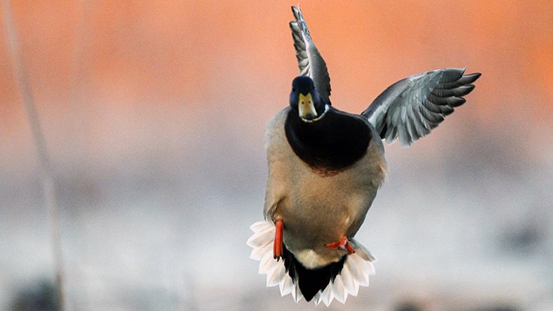
Arkansas Wildlife Waterfowl Report
BY Jim Harris
ON 11-15-2017
Nov. 15, 2017
Jim Harris
Managing Editor Arkansas Wildlife Magazine
The Season Is Here
Duck season in Arkansas will open 30 minutes before sunrise Saturday, Nov. 18, with 60 days of hunting. With near-record numbers of ducks from the northern breeding grounds for yet another year, Arkansas hunters will enjoy 60 days of hunting for the 21st season in a row.
Arkansas should see the typical number of ducks for this time of the year, but the biggest concern for hunting on public grounds is the lack of water, according to Luke Naylor, the AGFC’s waterfowl program coordinator.
Wet conditions in the prairie pothole region, which ranges from Canada and Montana through the Dakotas and into Iowa, have offset a recent loss of duck habitat in those areas, Naylor said, and the results are continued outstanding breeding numbers. Those wet conditions aren’t carrying over down south, though, and these early birds passing through on their migration won’t find much water here. Naylor says this is typical for Arkansas.
“It sounds like a broken record but it’s kind of consistent for us,” Naylor said. “Artificially flooded habitat is where it’s at, but that’s really normal for now. That’s what the climate history is here. September, October and November are dry, the rain and the water build up in late November a little, and in December it changes real quickly.”
“If you have water, you have ducks. That’s pretty much the story. As soon as we get a 3-, 5- or 6-inch rain, be ready.”
Northeast Arkansas
Earl Buss Bayou DeView WMA
Map | Water Gauge | Weather Report
Boaters should use caution while using the Thompson Tract boat run.
South Oliver GTR
Habitat: Mast production has been good.
Water Level: 0% flooded with a current gauge reading of 0.0 feet. There is a small amount of available water present within the natural slough on the north end of this GTR and south end of the North Oliver Tract.
Thompson Tract GTR
Habitat: Mast production has been good.
Water Level: 0% flooded with a current gauge reading of 0.0 feet.
Lake Hogue WRA
Habitat: A small amount of beneficial wetland plants is located along the east side of the lake.
Water Level: Normal pool level.
Big Lake WMA
Map | Water Gauge | Weather Report
When the Ditch 81 extension gauge near Manilla (upstream of the Big Lake north-end control structure) reads 17.5 feet, water is beginning to come over the north levee degrade on Big Lake WMA. When the Ditch 81 Extension gauge reads 18.0 feet or higher, the water level on the WMA will rise quickly and hunters should exercise caution while on the area. Be aware of underwater logs in boat runs and hangers in trees.
North Woods GTR
Habitat: Mast production is good.
Water Level: Bo Dock gauge currently reads 0.0 feet, Target level is 235.5 feet with 0% flooded.
South Woods GTR
Habitat: Mast production is good.
Water Level: The 7-Mile gauge is currently at 0.0 feet. Target level is 234.5 feet with 0% flooded. There is a small amount of water available in the bar pits on the west side of the area between the 7 and 8 mile laterals.
Simmons Field
Habitat: A good amount of millet, smartweed and sedge is present. Seed production is good.
Water Level: 0%
St. Francis Sunken Lands WMA
Map | Water Gauge | Weather Report
Hunt Area
Habitat: Mast production is considered above average within the timber and floodways.
Water Level: Water levels in the huntable areas are dependent on St. Francis River flows. The water level at Oak Donnick is 210.48 ft., and approximately 70% of the huntable area is flooded.
Snowden WRA
Habitat: There is a small amount of beneficial wetland plants within the borrow areas.
Water Level: 0% flooded
Payneway WRA
Habitat: There are 70 acres of corn and millet planted throughout the WRA
Water Level: Pool A is at 0%. Pool B is at 0%. Pool C is at 0%. Pool D is at 0%.
Shirey Bay Rainey Brake WMA
Map | Water Gauge | Weather Report
Waterfowl hunters should be aware of hangers and submerged logs within the boat runs and GTRs. Please exercise caution when accessing the area. In addition, hunters should allow safe passage when parking vehicles along roadsides. Vehicles blocking access will be moved.
Adam’s Brake GTR
Habitat: High abundance of mast crop within the GTR.
Water Level: Water level is 236.0 MSL with a target level of 240.0 MSL. 0% flooded.
Rainey Brake GTR
Habitat: High abundance of mast crop within the GTR.
Water Level: 0% flooded.
Eagle Pond GTR
Habitat: High abundance of mast crop within the GTR.
Water Level: 0% flooded.
Phase III Moist-soil Unit
Habitat: Fair wetland type vegetation.
Water Level: 0% flooded.
Charles Crisp Moist-soil Unit
Habitat: Fair wetland type vegetation.
Water Level: 0% flooded.
Ward Field Moist-soil Unit
Habitat: Good wetland type vegetation.
Water Level: 0% flooded.
River Field Moist-soil Unit
Habitat: High abundance of native wetland vegetation..
Water Level: 0% flooded.
Dave Donaldson Black River WMA
Map | Water Gauge | Weather Report
Waterfowl hunters should be aware of hangers and submerged logs within the boat runs and GTRs. Please exercise caution when accessing the area. Please remember to keep boats off the levees so AGFC personnel can access the area. Boats blocking access will be moved. Unattended trailers are not to be left overnight on parking areas.
Upper Island GTR
Habitat: Average abundance of mast crop within the GTRs.
Water Level: Water level is Below Readable Level. Target level is 269.5 MSL. 0% flooded.
Lower Island GTR
Habitat: Average abundance of mast crop within the GTRs.
Water Level: Water level is Below Readable Level. Target level is 268.0 MSL. 0% flooded.
Upper Reyno GTR
Habitat: Average abundance of mast crop within the GTRs.
Water Level: Water level is Below Readable Level. Target level is 266.9 MSL. 0% flooded.
Lower Reyno GTR
Habitat: Average abundance of mast crop within the GTRs.
Water Level: Water level is Below Readable Level. Target level is 266.3 MSL. 0% flooded.
Winchester GTR
Habitat: Average abundance of mast crop within the GTRs.
Water Level: Water level is Below Readable Level. Target level is 263.7 MSL. 0% flooded.
East Central Arkansas
Sheffield Nelson Dagmar WMA
Map | Water Gauge | Weather Report
The Conway George units are available by applying for online permits. Permit hunts are on Saturday and Sunday. Please visit www.agfc.com for maps, special regulations, permit application and draw dates. Hunters should call the Wildlife Hotline at 800-440-1477 for current road closures.
Mud Slough GTR
Habitat: Good mast crop.
Water Level: 0%.
Apple Lake WRA
Habitat: Good mast crop.
Water Level: 90%.
Conway George Waterfowl Unit A
Habitat: Good stand of millet and native vegetation.
Water Level: 100%
Conway George Waterfowl Unit B
Habitat: Natural slough area with beneficial wetland plants
Water Level: 100%
Conway George Waterfowl Unit C
Habitat: Good stand of millet and native vegetation.
Water Level: 40%
Rex Hancock Black Swamp WMA
Map | Water Gauge | Weather Report
Hunters should call the Wildlife Hotline at 800-440-1477 for current road closures.
Main WMA
Habitat: Good mast crop.
Water Level: 0%
Wyeville Unit
Habitat: Good stand of millet and native vegetation.
Water Level: 0%
Steve N. Wilson Raft Creek Bottoms WMA
Map | Water Gauge | Weather Report
Due to low water conditions no permit draw will be conducted this weekend, the WMA is open for waterfowl hunting.
Unit A
Habitat: Excellent stand of millet and native vegetation.
Water Level: 25%
Unit B
Habitat: Excellent stand of millet and native vegetation.
Water Level: 20%
Unit C
Habitat: Good stand of native vegetation.
Water Level: 10%
Unit D (Youth area)
Habitat: Good stand of millet and native vegetation.
Water Level: 50%
Unit E
Habitat: Good stand of millet and native vegetation.
Water Level: 5%
Unit F
Habitat: Good stand of millet and native vegetation.
Water Level: 5%
Unit G
Habitat: Fair stand of millet and native vegetation.
Water Level: 20%
Unit H (Mobility-impaired blind)
Habitat: Excellent stand of millet and native vegetation.
Water Level: 80%
Unit I
Habitat: Habitat conditions are poor.
Water Level: 30%
Unit J (Cypert Tract)
Habitat: Fair stand of native vegetation.
Water Level: 50%
Unit K (Cypert Tract)
Habitat: Excellent stand of millet and native vegetation.
Water Level: 30%
Unit L (Cypert Tract)
Habitat: Good stand of millet.
Water Level: 5%
Henry Gray Hurricane Lake WMA
Map | Water Gauge | Weather Report
Hunters should call the Wildlife Hotline at 800-440-1477 for current road closures.
North GTR
Habitat: Good mast crop.
Water Level: 0%
South GTR
Habitat: Good mast crop.
Water Level: 0%
Central Arkansas
Craig D. Campbell Lake Conway Reservoir
Map | Weather Report
Habitat and water levels are normal on both Pierce and Dix Creeks.
Bell Slough WMA
Map | Weather Report
The Bell Slough GTR is primarily rainfall dependent with the exception of a limited amount of water that we can back in and catch from Palarm Creek.
Bell Slough GTR
Habitat: Moderate mast crop.
Water Level: Expected to be at 25% on opening day.
Palarm Creek WRA
Habitat: Millet was planted as a cover crop this year following disking within the moist-soil units.
Water Level: 33%
Holland Bottoms WMA
Hunt Area
Habitat: Good mast crop.
Water Level: 0%
Lake Pickthorne WRA
Habitat: Excellent.
Water Level: East cell is 10%. West cell is 30%.
Harris Brake WMA
Harris Brake Upper Unit
Habitat: Good mast crop with mixed in with native vegetation.
Water Level: 0%
Harris Brake Lower Unit
Habitat: Good mast crop with mixed in with native vegetation.
Water Level: 0%
Northwest Arkansas
Dardanelle WMA
McKennon Bottoms
Habitat: Good stand of Native moist soil vegetation.
Water Level: Currently pumping, should reach 100% by week’s end.
Potter’s Pothole Hartman Waterfowl Unit
Habitat: Good stand of Native moist soil vegetation.
Water Level: 100%
Ozark Pool
Dyer Lake Cells (half day hunting)
Habitat: Native vegetation.
Water Level: Dry.
Nimrod Lloyd Millwood WMA
Nimrod GTR
Good mast crop with mixed in with native vegetationGood mast crop.
Water Level: 0%
Frog Bayou WMA
Unit 1
Habitat: Planted millet and native moist soil vegetation.
Water Level: 80%
Unit 2
Habitat: Poor moist soil response.
Water Level: 0% – rainfall dependent
Unit 3
Habitat: Primarily perennial vegetation.
Water Level: 70%
Unit 4
Habitat: Planted millet and native moist soil vegetation.
Water Level: 80%
Unit 5
Habitat: Good moist soil vegetation.
Water Level: 75%
Unit 6
Habitat: Good Moist soil response.
Water Level: 65%
Unit 7
Habitat: Some annual and perennial moist soil vegetation.
Water Level: 90%
Petit Jean River WMA
Map | Water Gauge | Weather Report
Santa Fe GTR
Habitat: Good mast crop with mixed in native vegetation.
Water Level: 0%
Olin Cain Moist-soil Unit
Habitat: 25% native vegetation with 75% bare ground due to ongoing waterfowl habitat enhancement projects.
Water Level: 0%
Black Lands Moist-soil Unit
Habitat: 25% native vegetation with 75% bare ground due to ongoing waterfowl habitat enhancement projects.
Water Level: 0%
Slaty Crossing Moist-soil Unit
Habitat: 25% native vegetation with 75% bare ground due to ongoing waterfowl habitat enhancement projects.
Water Level: 0%
Pullen Pond
Habitat: Good mast crop with mixed in with native vegetation.
Water Level: 0%
Pond Creek GTR
Habitat: Good mast crop.
Water Level: 0%
Slaty Pond GTR
Habitat: Good mast crop with mixed in with native vegetation.
Water Level: 0%
Black Lands Duck Area
Habitat: Good mast crop with mixed in with native vegetation.
Water Level: 0%
Galla Creek WMA
Galla Creek GTR
Habitat: Natural vegetation including a mixture of barnyard and smartweed.
Water Level: 0% – Gates on the weir for the waterfowl impoundment have been closed, but water flow in the creek is minimal at this time. Staged flooding of the impoundment is scheduled to begin on Monday November 27, 2017.
Ed Gordon Point Remove WMA
Map | Weather Report
Nearly all waterfowl impoundments on Ed Gordon Point Remove WMA remain dry at this time. Due to inadequate rainfall, water levels in Point Remove Creek are currently too low to allow for pumping most in most units. Pumping did begin in Remmel Marsh on Nov. 13, and other impoundments will be flooded as water levels in the creek allow. Duck use on the WMA has been minimal.
Willow Island
Habitat: Natural vegetation.
Water Level: 0%
Little Hole
Habitat: Natural vegetation.
Water Level: 0%
Red Gate
Habitat: Natural vegetation.
Water Level: 0%
Pig Trough
Habitat: Natural vegetation.
Water Level: 0%
Cedar Ridge
Habitat: Natural vegetation.
Water Level: 0%
Duck Trap
Habitat: Natural vegetation.
Water Level: 0%
Salt Lick
Habitat: Natural vegetation.
Water Level: 0%
Bobby’s Pond
Habitat: Natural vegetation.
Water Level: 0%
Race Track
Habitat: Natural vegetation.
Water Level: 0%
Controversy Corner
Habitat: Natural vegetation.
Water Level: 0%
Remmel Marsh
Habitat: Natural vegetation.
Water Level: 25%
Mud Pond
Habitat: Natural vegetation.
Water Level: 0%
Turkey Pond
Habitat: Natural vegetation.
Water Level: 0%
Teeny Pond
Habitat: Natural vegetation.
Water Level: 0%
Southwest Arkansas
Sulphur River WMA
Map | Weather Report
The Henry Moore WRA is not flooded due to pump problems.
Mercer Bayou
Habitat: Fair.
Water Level: Drawn down for restoration project, boat ramps are closed.
Henry Moore WRA
Habitat: Closed to hunting.
Water Level: 0%.
Millwood Lake
Map | Water Gauge | Weather Report
Habitat: Habitat conditions are good.
Water Level: 258.13 MSL
Dr. Lester Sitzes III Bois d’Arc WMA
Map | Weather Report
The water level in the GTR is still increasing.
Bois d’Arc Lake WRA
Habitat: Closed to hunting.
Water Level: Normal water level.
Red Slough WRA
Habitat: Closed to hunting.
Water Level: 0%
GTR
Habitat: Good mast production.
Water Level: 0%
Little Grassy
Habitat: Habitat is fair.
Water Level: 5%
Southeast Arkansas
Beryl Anthony Lower Ouachita WMA
Map | Weather Report
There has been fair soft and hard mast crop production on the WMA. There is minor flooding on the area, mostly in sloughs and oxbow lakes.
Freddie Black Choctaw Island WMA Deer Research Area
Map | Water Gauge | Weather Report
Habitat conditions are good. Flooding is river dependent. Click on the Water Gauge link above for current Mississippi River levels. Use extreme caution when boating in river.
Trusten Holder WMA
Map | Water Gauge | Weather Report
Habitat conditions are good. Flooding is river dependent. Click on the Water Gauge link above for current Arkansas River levels.
Seven Devils WMA
Hunt Area
Habitat: Habitat conditions are good, with an excellent acorn crop.
Water Level: 0% flooded.
Cut-Off Creek WMA
Hunt Area
Habitat: Habitat conditions are good, with an excellent acorn crop.
Water Level: 0%
Pigeon Creek WRA
Habitat: Habitat conditions are good, with an excellent acorn crop.
Water Level: 0%
George H. Dunklin Jr. Bayou Meto WMA
Upper Vallier GTR
Habitat: Good
Water Level: 0% flooded.
Lower Vallier GTR
Habitat: Good
Water Level: 0% flooded.
Government Cypress GTR
Habitat: Good
Water Level: 0% flooded.
Buckingham Flats GTR
Habitat: Good
Water Level: 0% flooded
Temple Island GTR
Habitat: Good
Water Level: 0% flooded.
Canon Brake
Habitat: Good
Water Level: 0% flooded.
Halowell WRA
Habitat: Excellent
Water Level: Staggered flooding of units.
Wrape Plantation WRA
Habitat: Excellent
Water Level: Staggered flooding of units.
Recent News
AGFC Commissioner Meeting Notice
Apr. 16, 2024
Subscribe to Our Weekly Newsletter E-mails
Don’t miss another issue. Sign up now to receive the AGFC Wildlife Weekly Newsletter in your mailbox every Wednesday afternoon (Waterfowl Reports are published weekly during waterfowl season and periodically outside the season). Fishing Reports arrive on Thursdays. Fill in the following fields and hit submit. Thanks, and welcome!